720 x 480
JPEG
Deforestation in Malaysian Borneo
Published September 10, 2009
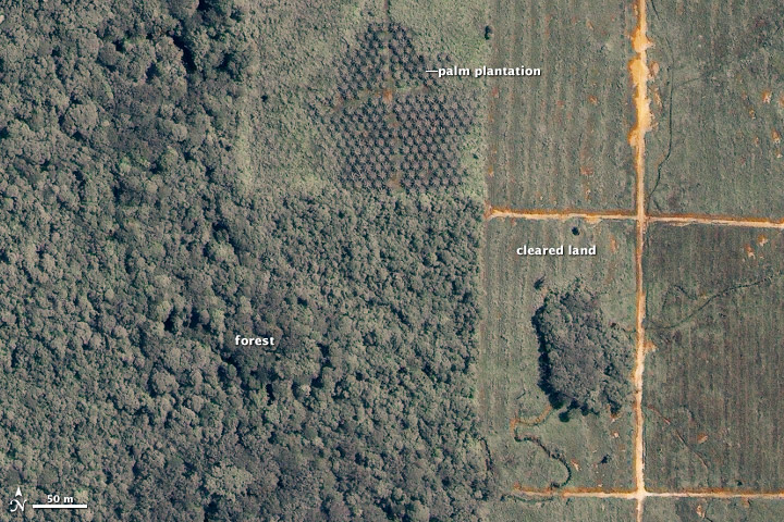
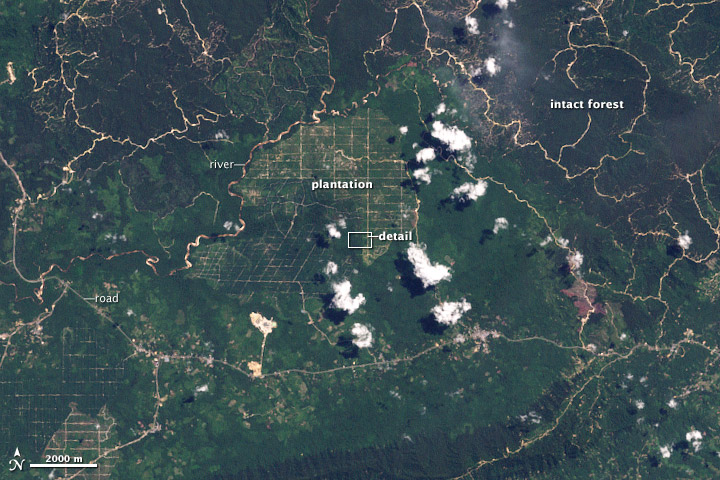
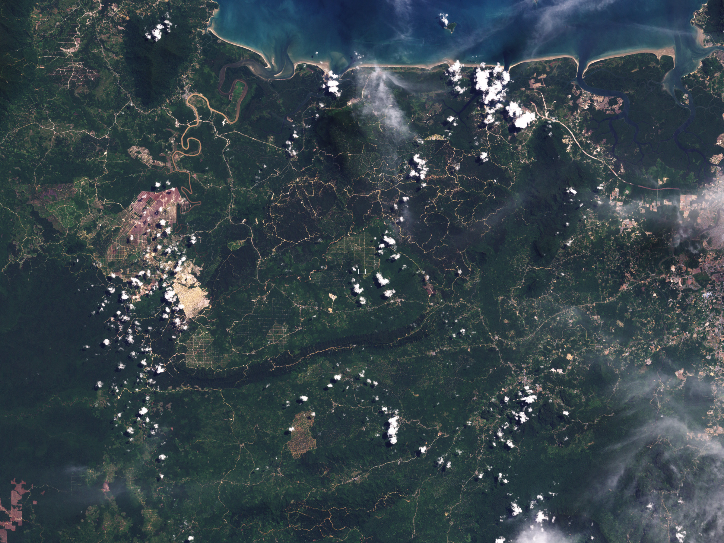
Acquired May 27, 2003, this true-color Landsat ETM image shows part of a plantation in Malaysian Borneo, along the edge of the forest. The area outlined in white in the ETM image appears in greater detail in the image acquired on June 18, 2002, by the commercial satellite Ikonos. The images show the differences between forest, cleared land, and palm plantation.
Related images:
720 x 480
JPEG
2400 x 1800
1 MB - JPEG
8101 x 7041
68 MB - GeoTIFF

30 KB - KML/KMZ
2400 x 1800
2 MB - JPEG

10516 x 10448
240 MB - GeoTIFF
57 KB - KML/KMZ

10516 x 10448
240 MB - GeoTIFF
Deforestation in Malaysian Borneo
Published September 10, 2009
Acquired May 27, 2003, this true-color Landsat ETM image shows part of a plantation in Malaysian Borneo, along the edge of the forest. The area outlined in white in the ETM image appears in greater detail in the image acquired on June 18, 2002, by the commercial satellite Ikonos. The images show the differences between forest, cleared land, and palm plantation.
Related images:
720 x 480
JPEG
2400 x 1800
1 MB - JPEG
8101 x 7041
68 MB - GeoTIFF
30 KB - KML/KMZ
720 x 480
JPEG
2400 x 1800
2 MB - JPEG
57 KB - KML/KMZ
720 x 480
JPEG
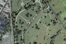
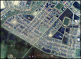
Gettysburg National Military Park
Published February 12, 2009
Soldiers’ National Cemetery, where U.S. President Abraham Lincoln delivered the “Gettysburg Address” in November 1863, appears in this Ikonos satellite image from June 25, 2003.
Related images:
2500 x 2000
5 MB - JPEG
720 x 480
JPEG
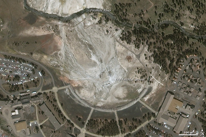
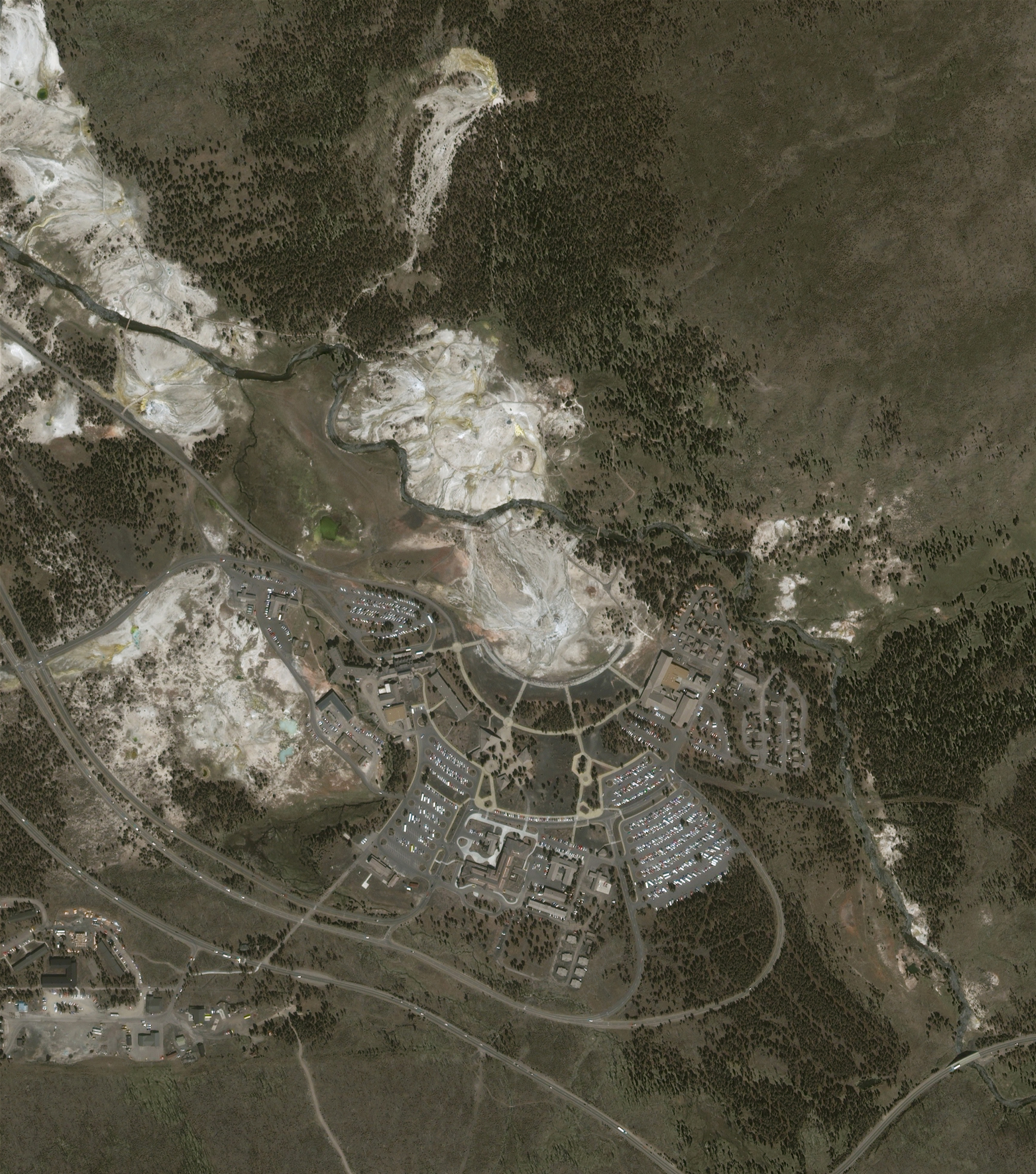
Old Faithful
Published November 30, 2008
Yellowstone National Park’s Old Faithful Geyser erupts so reliably—every hour on the hour—you can set your watch by it. So goes the legend, but it’s not true.
Related images:
3000 x 3400
4 MB - JPEG
720 x 480
JPEG
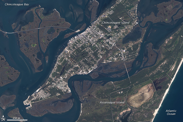
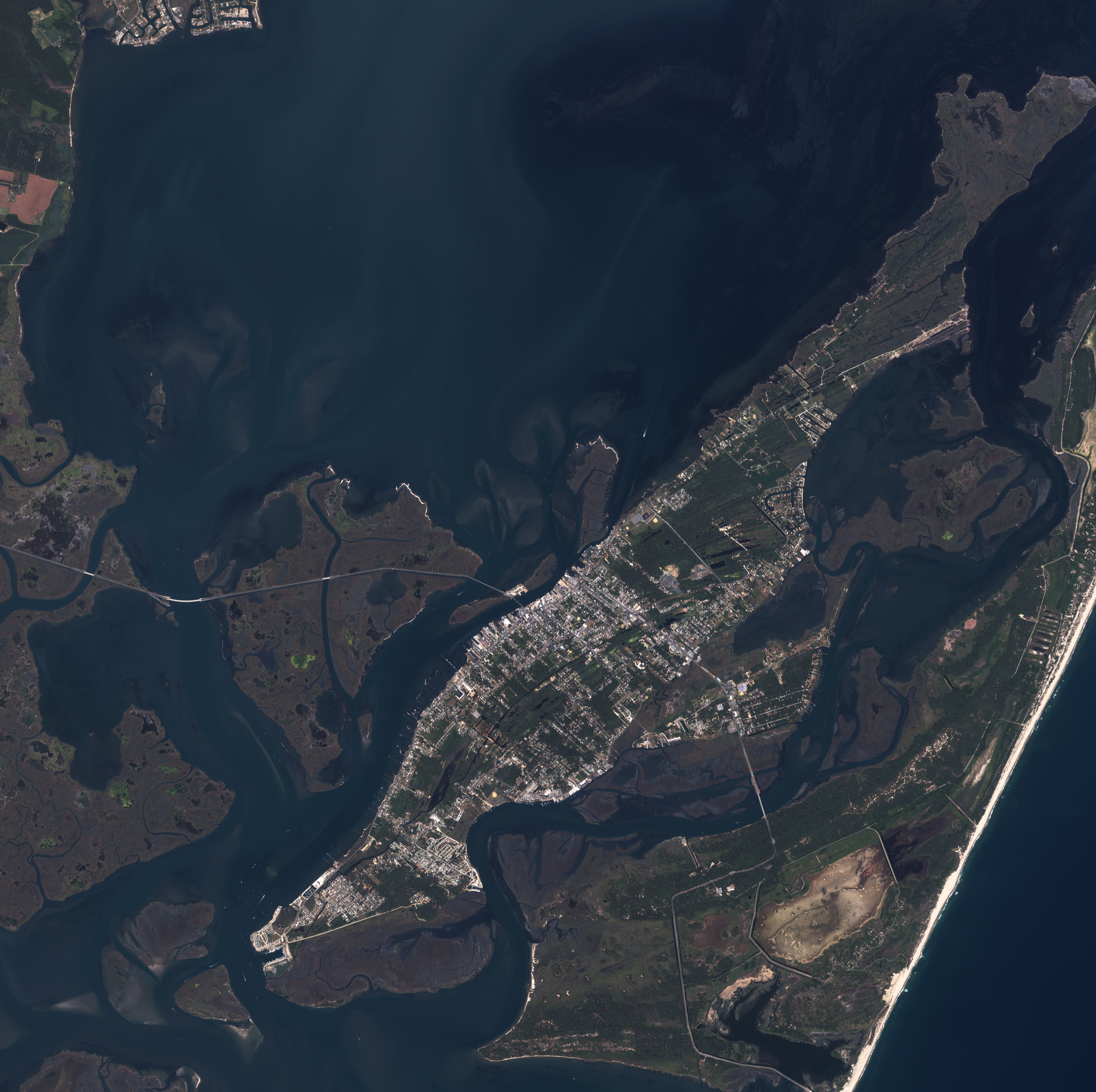
Assateague and Chincoteague Islands, Virginia
Published October 28, 2008
This photo-like image of Chincoteague Island and the southern section of Assateague was acquired by the IKONOS satellite on June 27, 2001.
Related images:
2766 x 2755
2 MB - JPEG

6548 x 6552
5 MB - JPEG
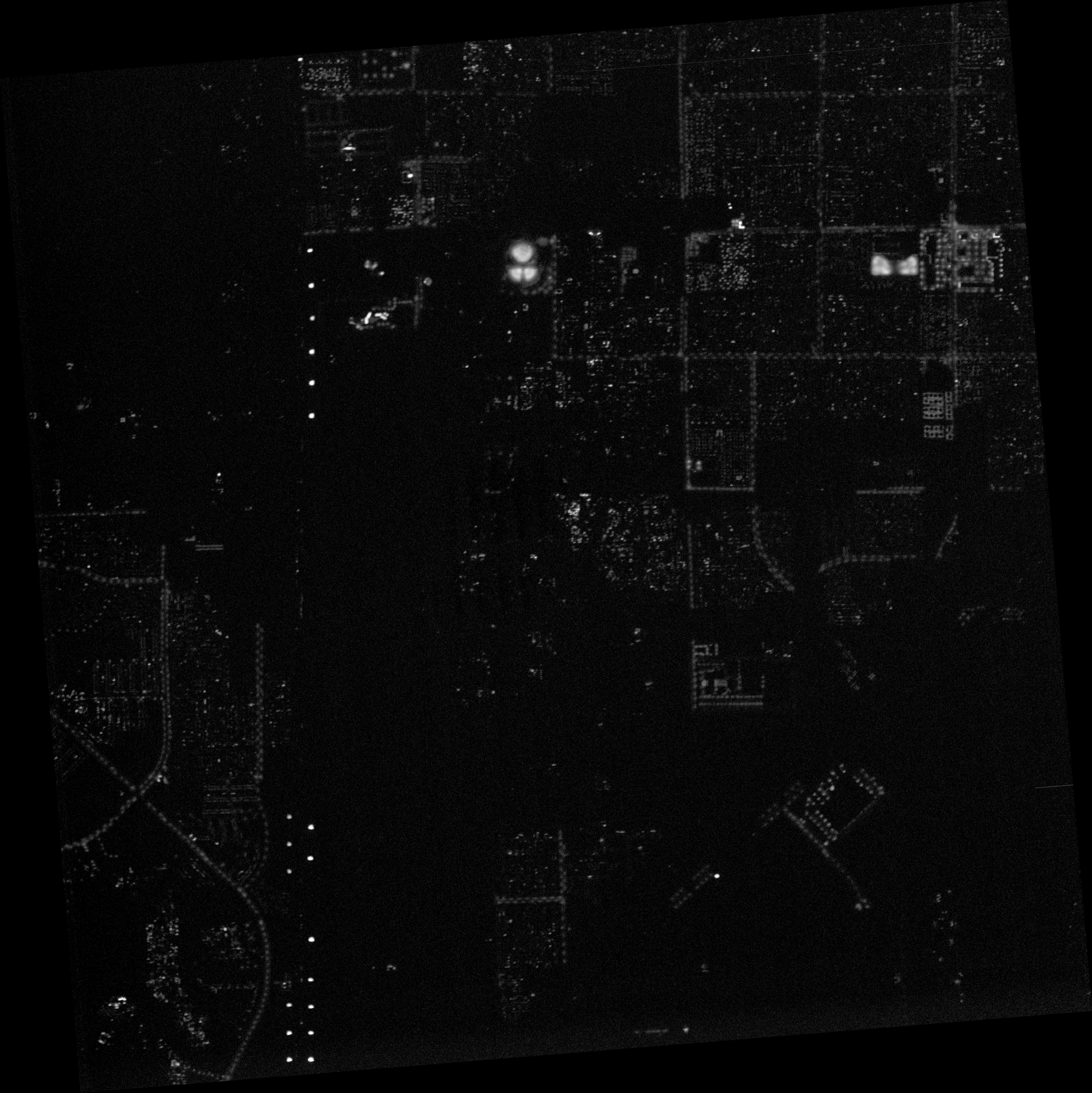
Lights of Las Vegas
Published October 2, 2008
This image of nighttime lights in the southwestern outskirts of Las Vegas, Nevada, was one of several images that an international team of scientists analyzed in 2007.
Related images:
6548 x 6552
13 MB - JPEG
JPEG
JPEG
6548 x 6552
5 MB - JPEG
6548 x 6552
13 MB - JPEG
Lights of Las Vegas
Published October 2, 2008
This image of nighttime lights in the southwestern outskirts of Las Vegas, Nevada, was one of several images that an international team of scientists analyzed in 2007.
Related images:
6548 x 6552
5 MB - JPEG
JPEG
JPEG
6548 x 6552
13 MB - JPEG
540 x 405
JPEG
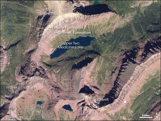
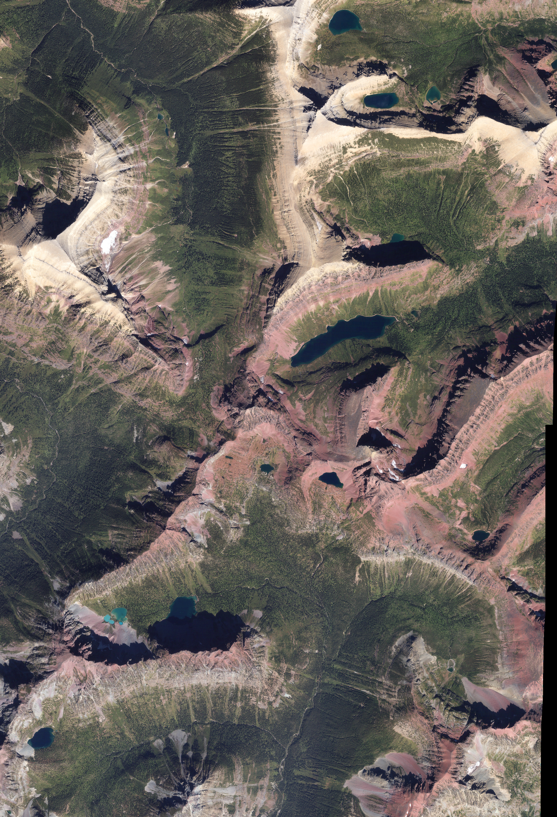
Red Rocks in Glacier National Park
Published August 21, 2008
Geologically recent events sculpted the rocks of Glacier National Park into sharp mountain peaks and steep-walled valleys.
Related images:
2353 x 3446
5 MB - JPEG
540 x 405
JPEG
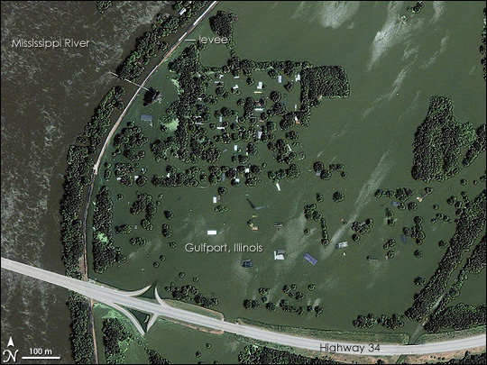
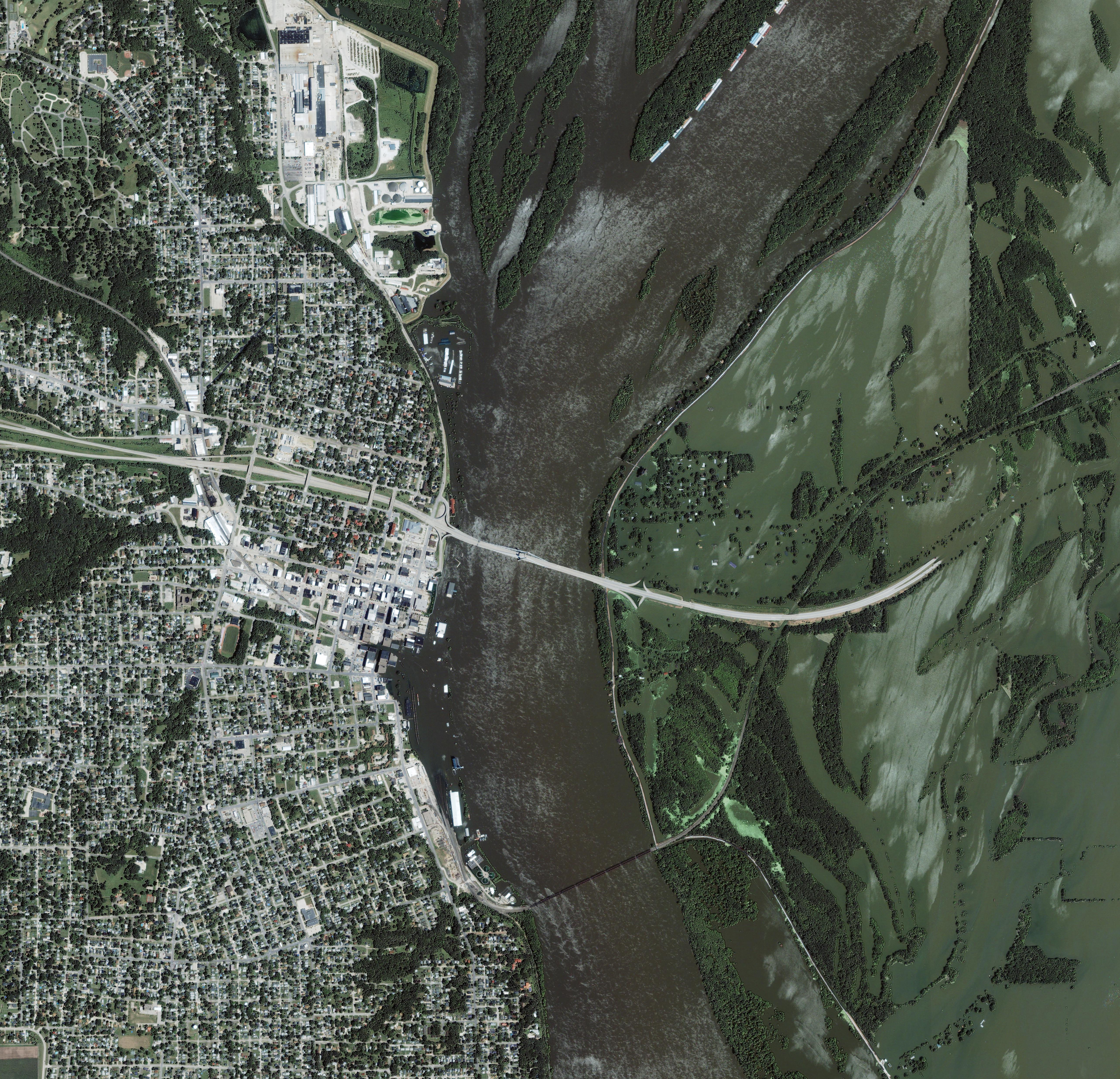
Mississippi River Floods Gulfport, Illinois
Published June 26, 2008
A wall of water washed over the small riverside city of Gulfport, Illinois, when at least two levees on the flooded Mississippi River burst on June 18, 2008, reported CNN. Only treetops and a few roofs were visible above the surface of the blue-green water two days later on June 20, when the commercial satellite Ikonos captured this detailed photo-like image.
Related images:
5134 x 4947
5 MB - JPEG
540 x 704
JPEG
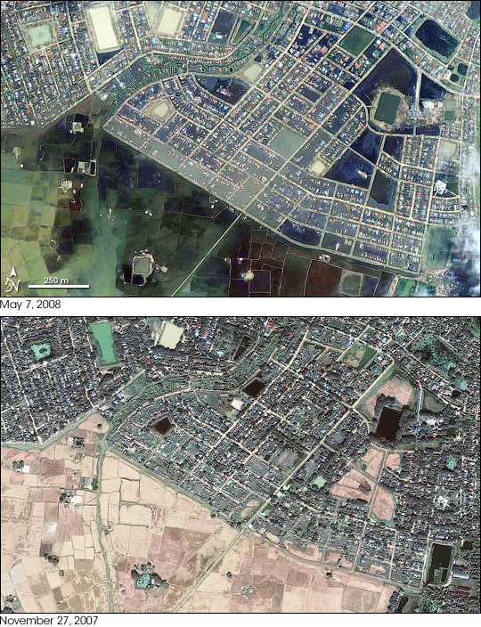
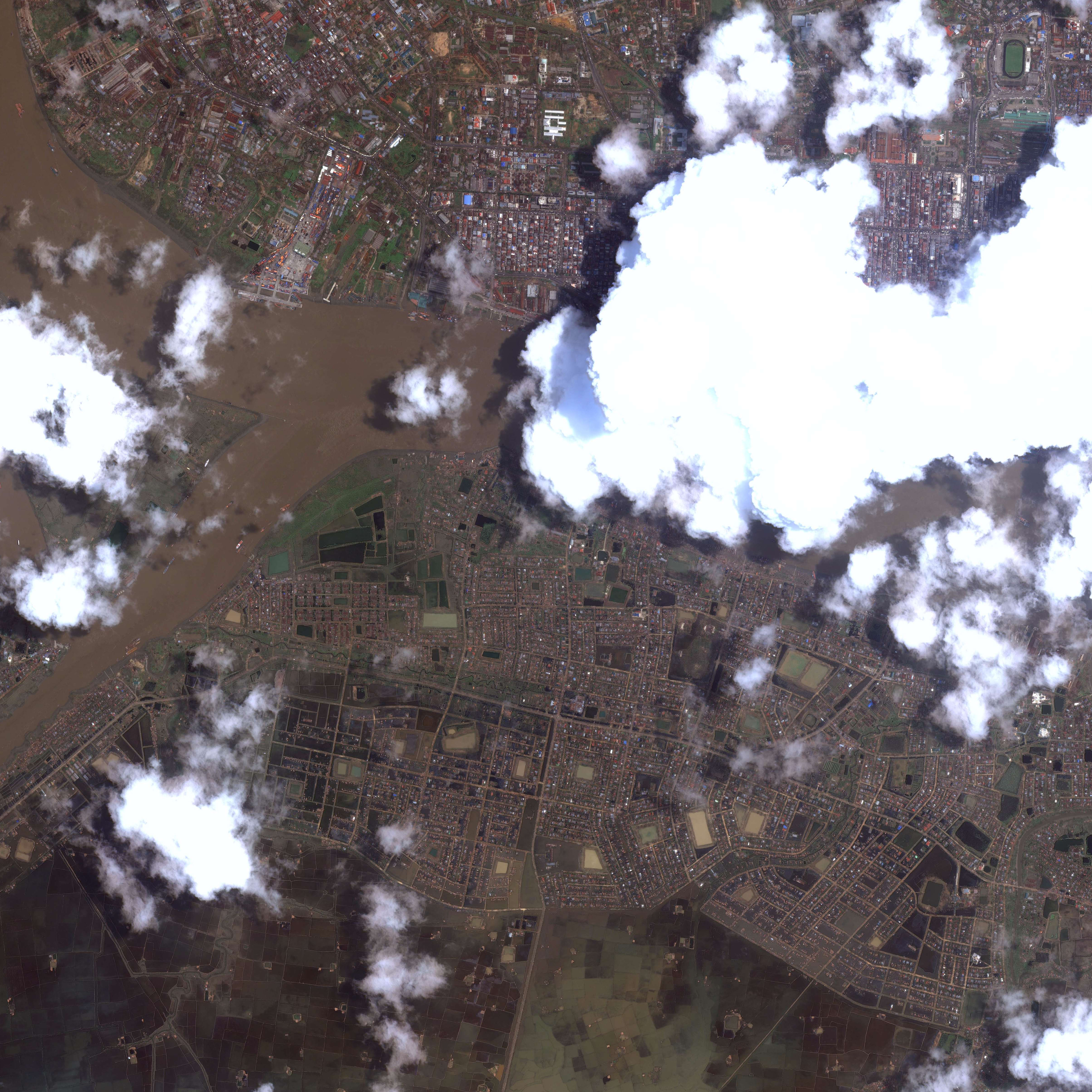
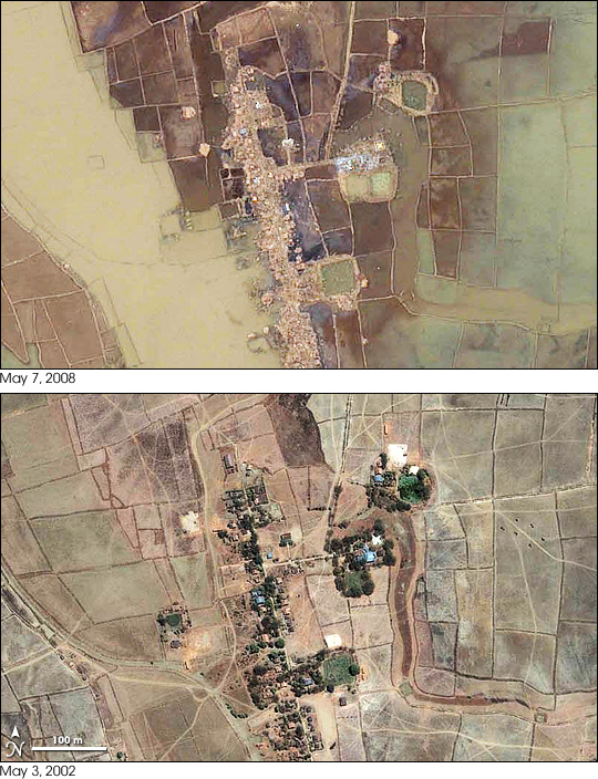
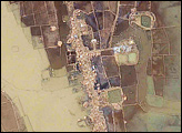
Flooding in Yangon, Burma (Myanmar)
Published May 9, 2008
Though Yangon (Rangoon) escaped the total destruction that Cyclone Nargis brought to much of the rest of the Irrawaddy Delta in Burma (Myanmar), its southern suburbs were completely submerged on May 7, 2008.
Related images:
6000 x 6000
4 MB - JPEG
540 x 405
JPEG
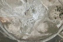
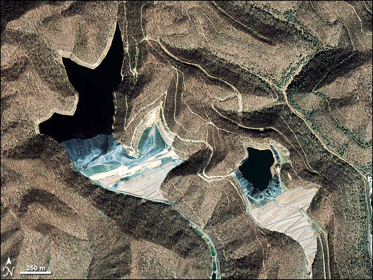
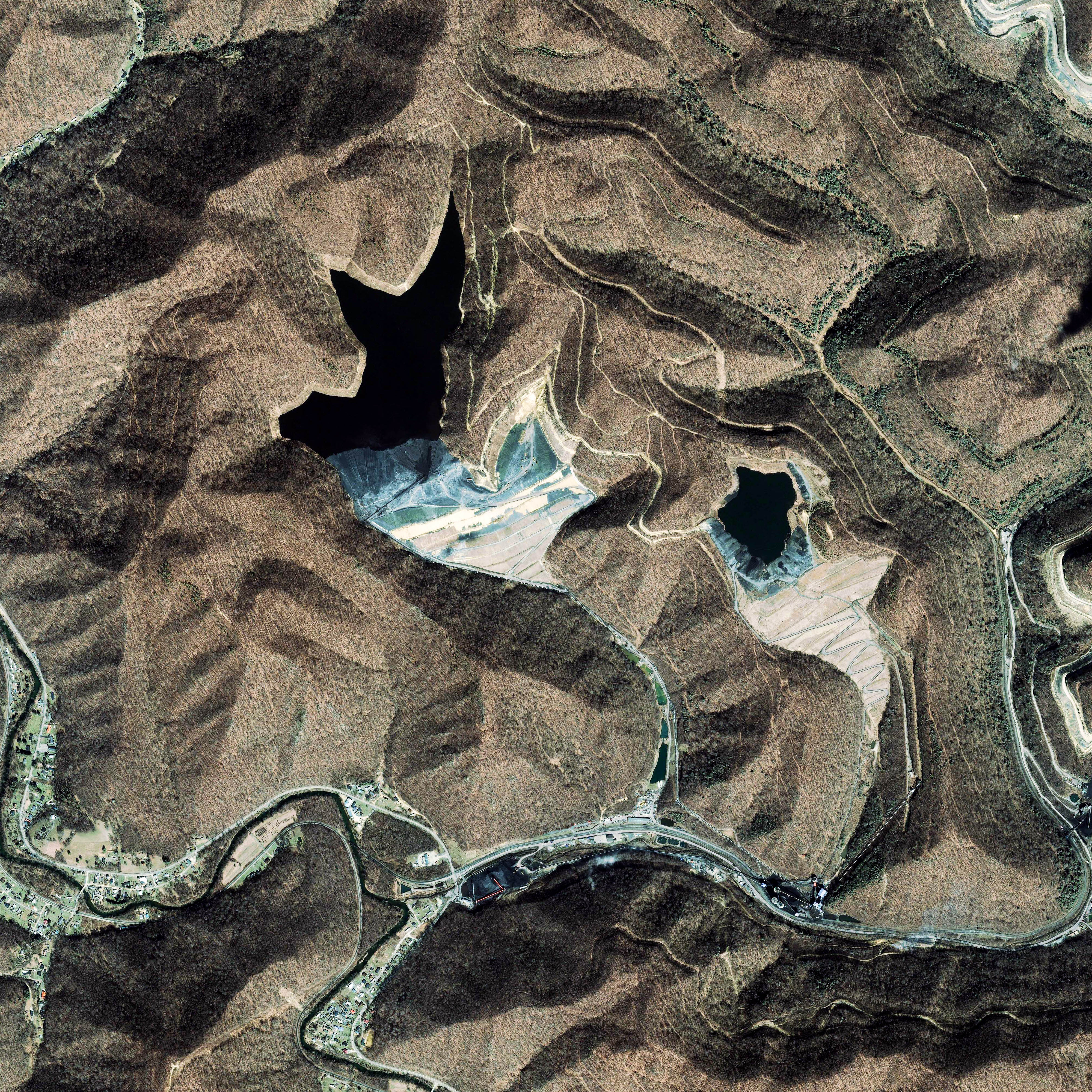
Coal Sludge Impoundments, West Virginia
Published April 25, 2008
Since the mid- to late 1990s, the number and size of coal mines known as mountaintop removal mines increased dramatically in parts of Virginia, West Virginia, Pennsylvania, and Kentucky. The final step in processing this coal creates sludge that contains coal dust, sediment, and possibly heavy metals and chemicals. Mine operators contain the coal sludge in nearby valleys, behind huge earthen dams known as valley fills.
Related images:
4000 x 4000
5 MB - JPEG