NASA satellites and sensors constantly take the pulse of our planet, measuring how Earth changes by the day, season, year, and decade. Researchers and resource managers analyze those measurements and apply them on local and regional scales to better manage things like our food and water supplies, health, safety, land use, and ecosystems. NASA data is also used by other government agencies to help with responses to natural disasters and emergencies around the country and the world.
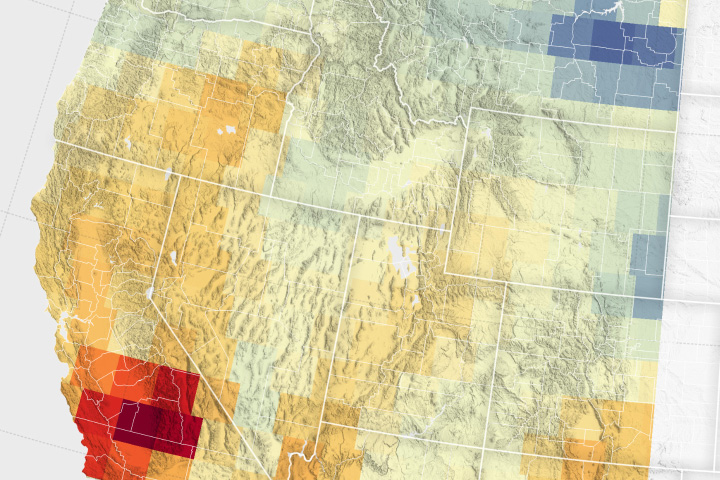
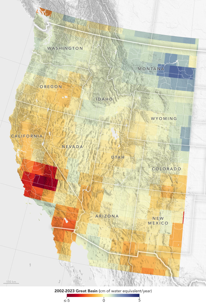
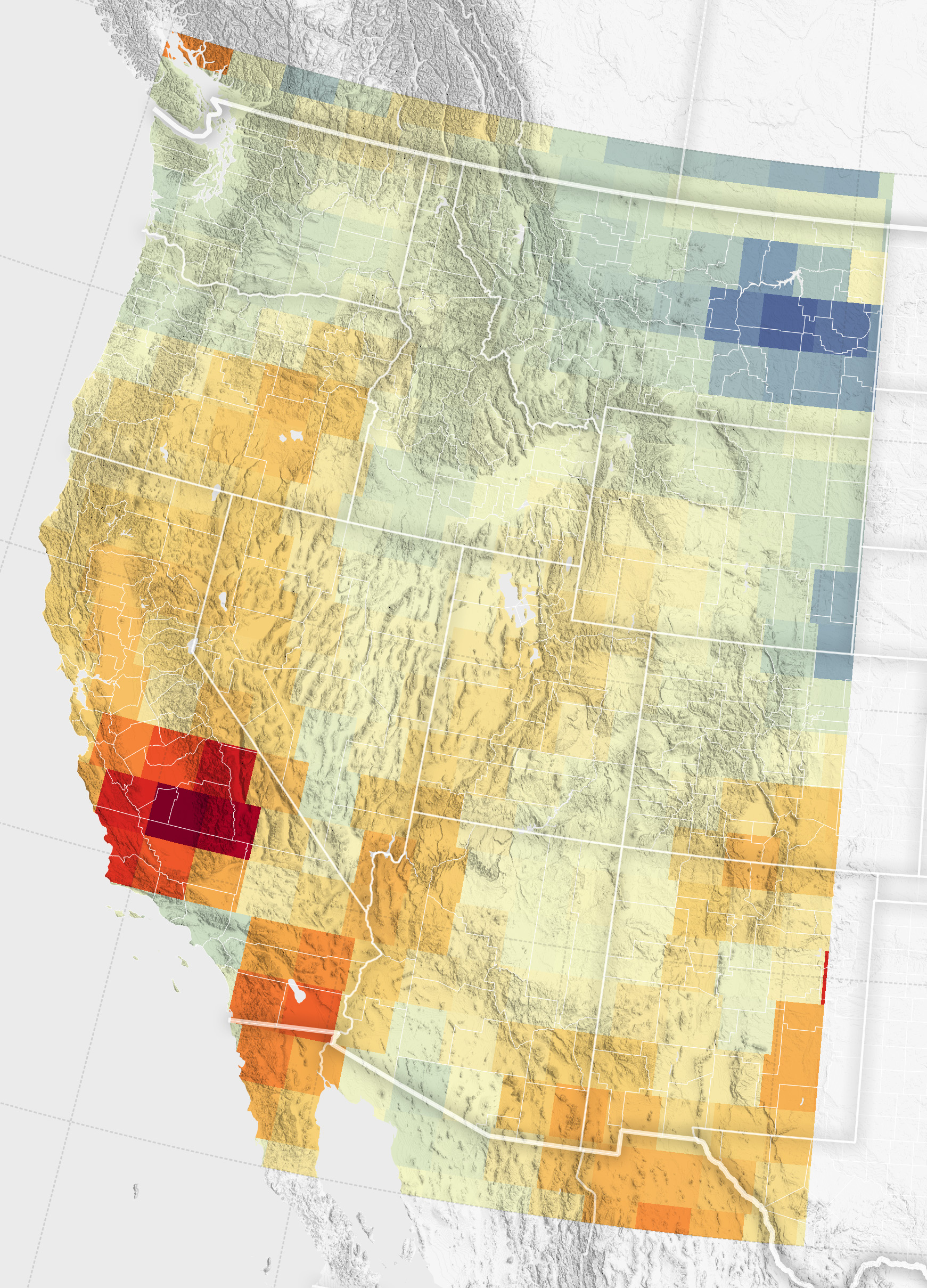
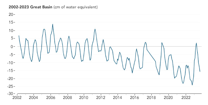
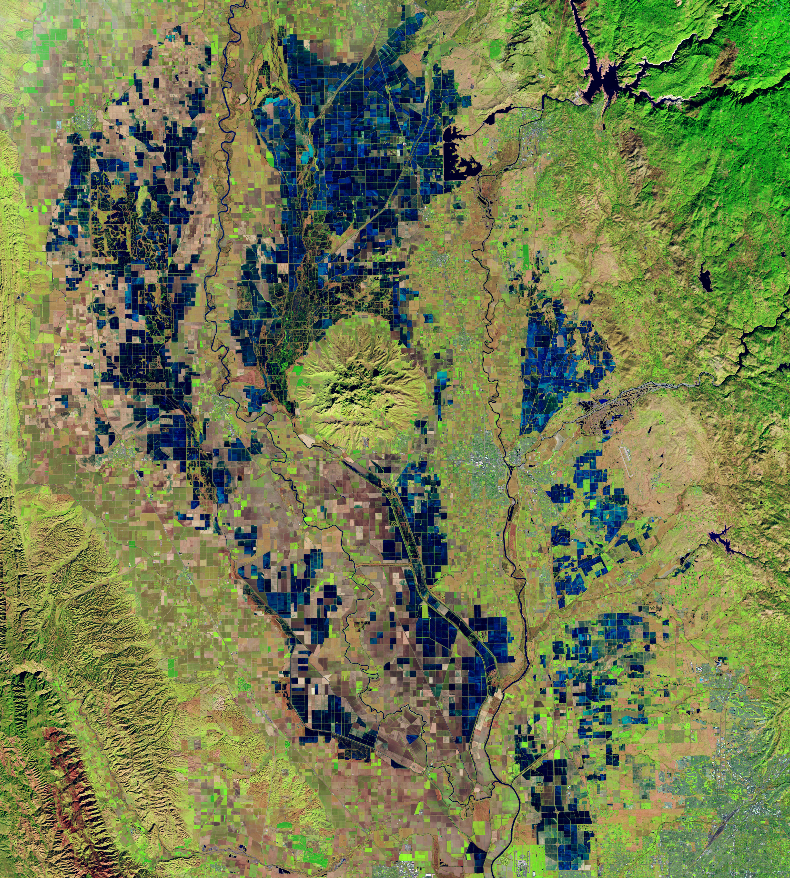
Groundwater Declines in the U.S. Southwest
Published June 25, 2024
Record snowfall has not been enough to offset groundwater losses amid long-term drying and a heightened demand for the resource.
Related images:
720 x 1065
JPEG
1741 x 2418
1 MB - JPEG
720 x 365
JPEG
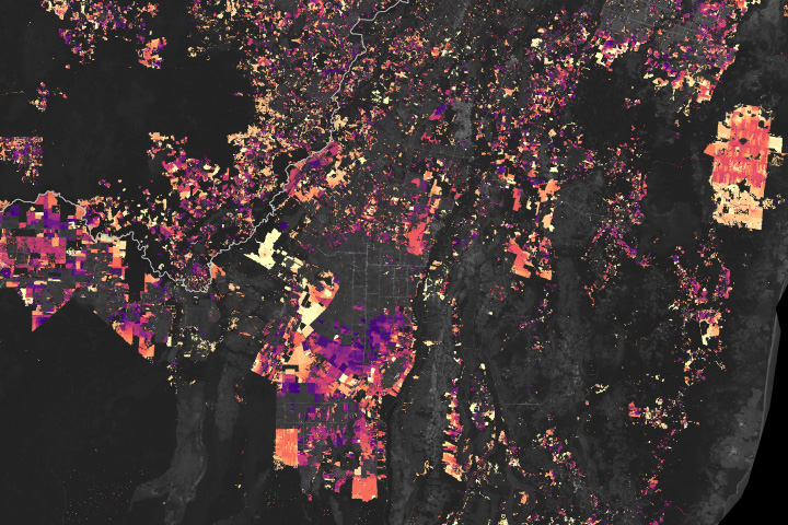
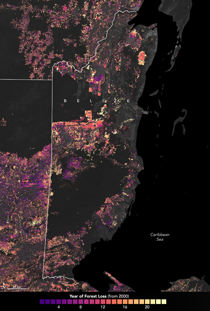
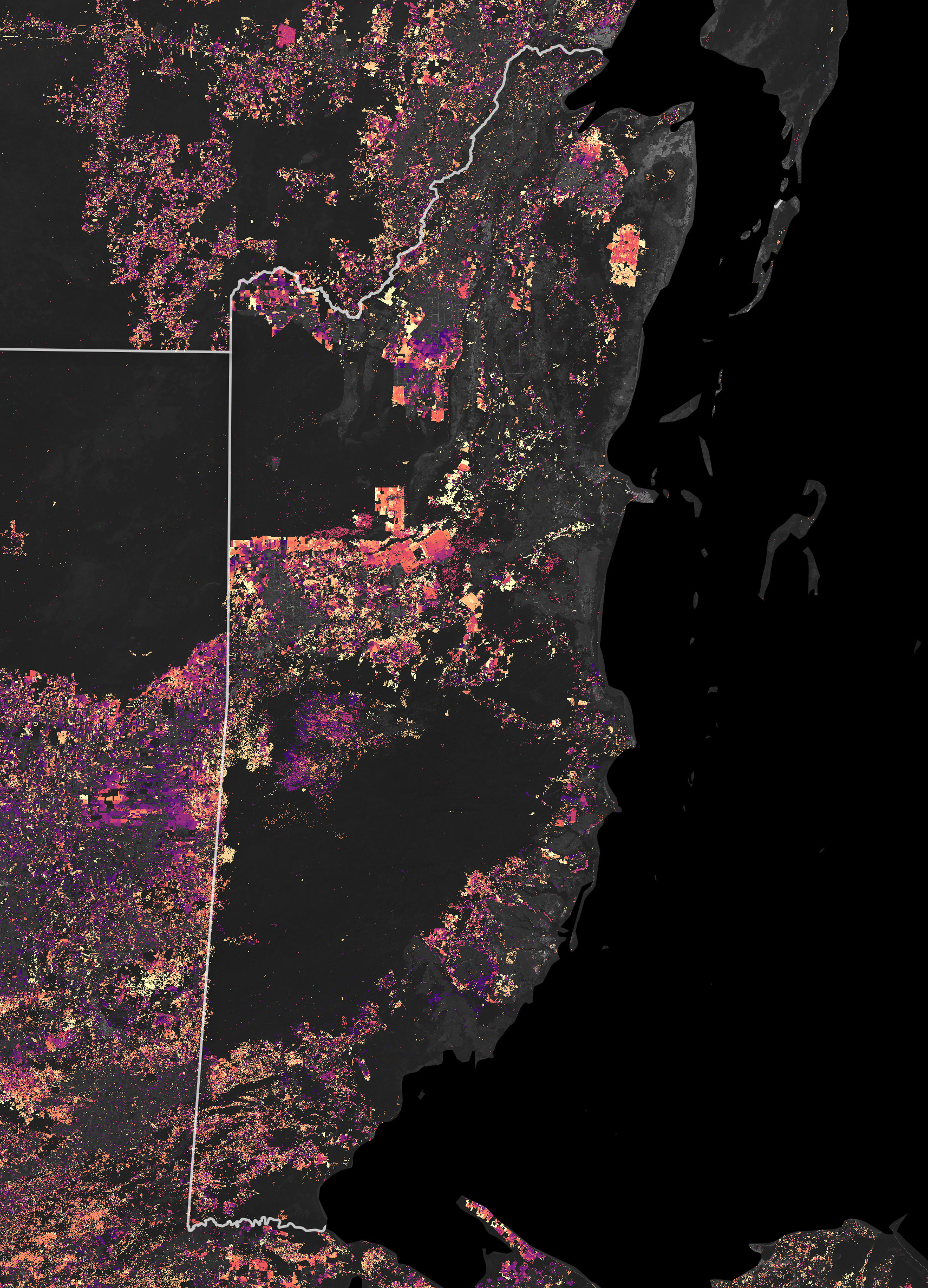
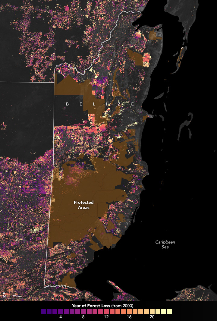
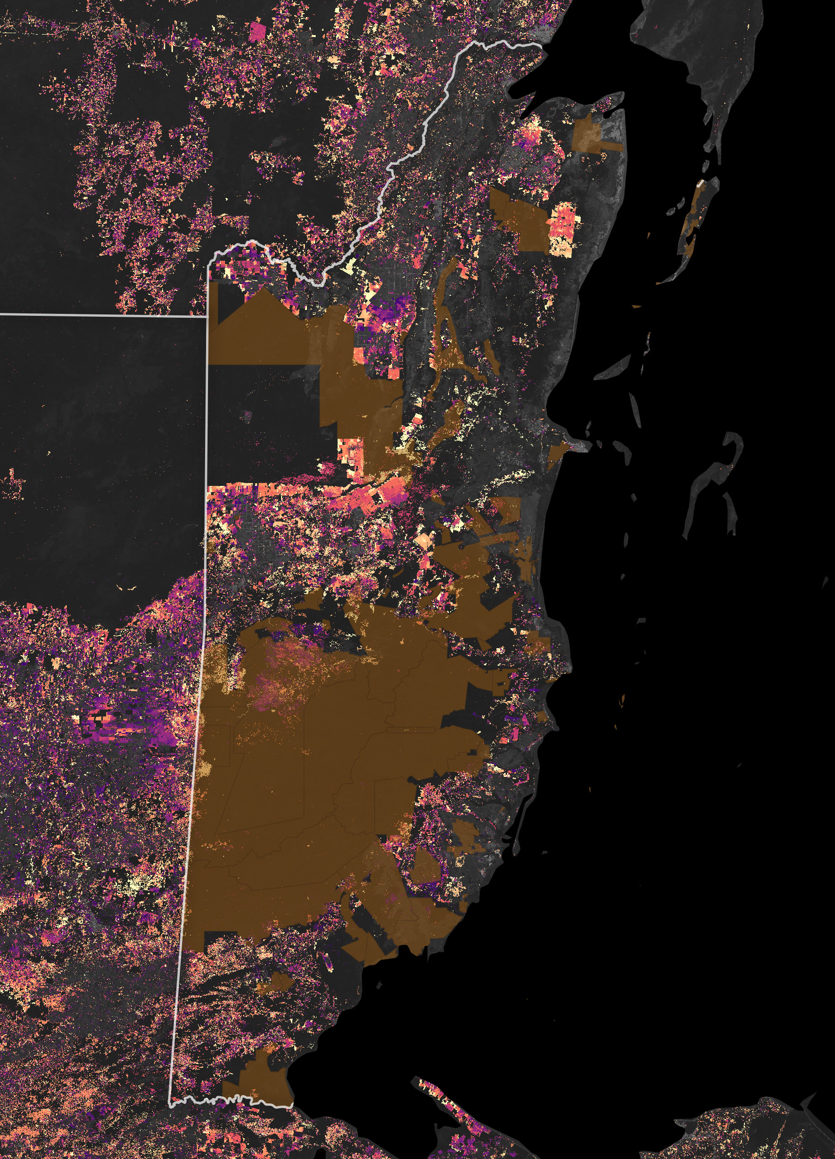
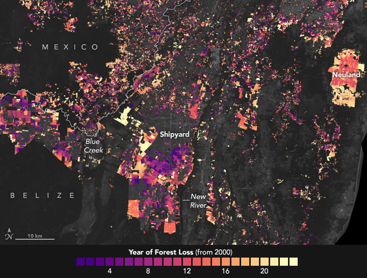
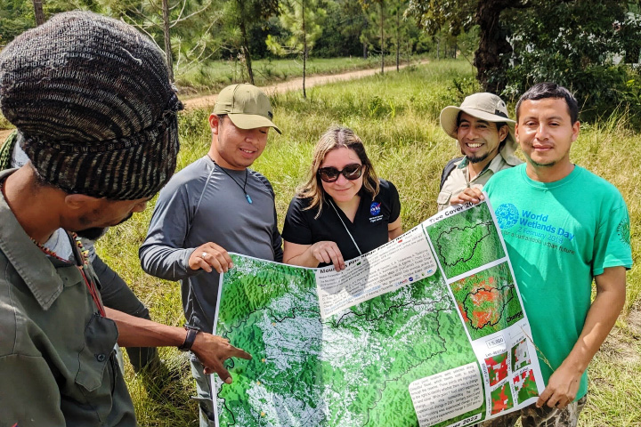
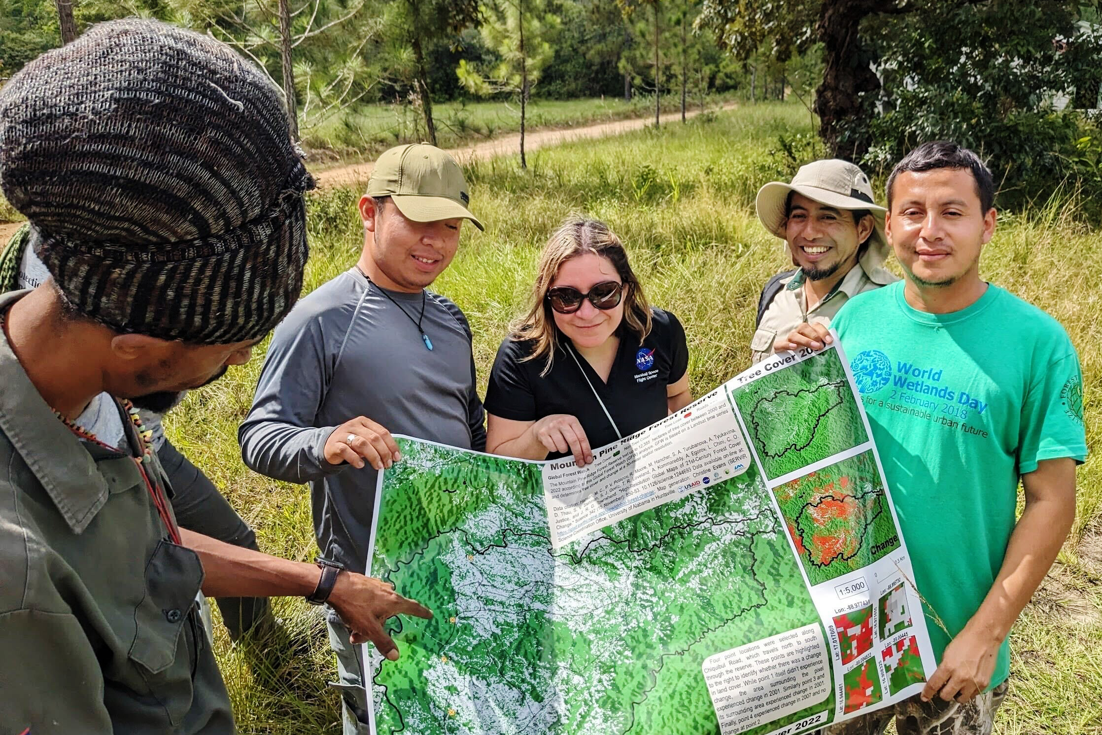
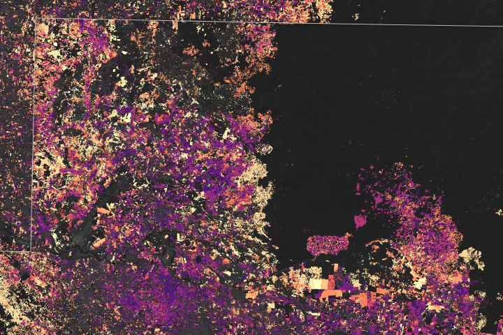
Tracking Forest Cover in Belize
Published June 19, 2024
Decades of satellite data paint a picture of how forests in this Central American country are changing.
Related images:
720 x 1065
JPEG
1714 x 2378
2 MB - JPEG
720 x 1065
JPEG
1714 x 2378
2 MB - JPEG
720 x 545
JPEG

3507 x 2338
4 MB - JPEG
720 x 480
JPEG
2236 x 1491
1 MB - JPEG
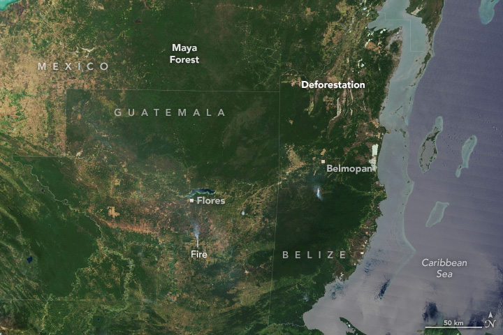
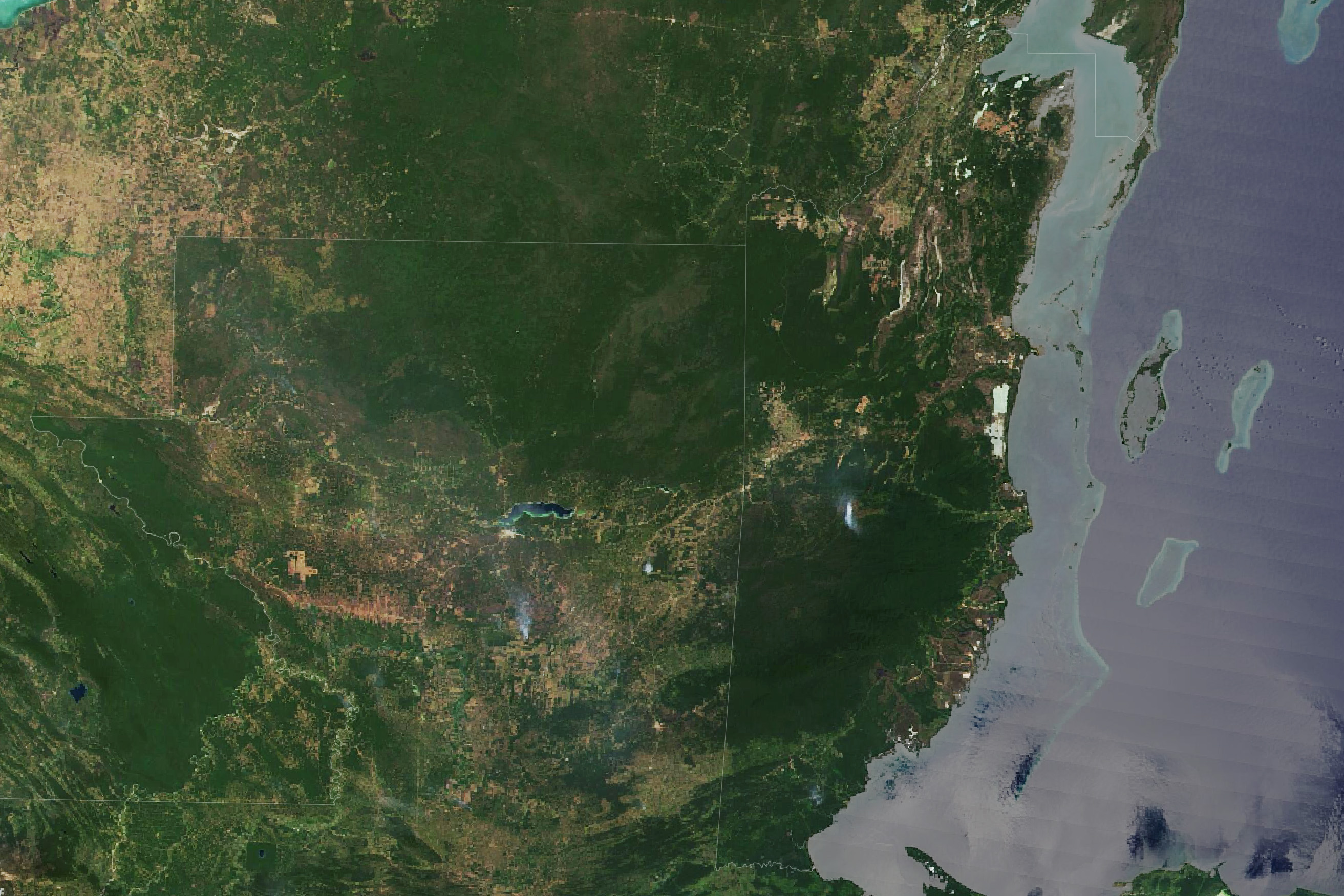
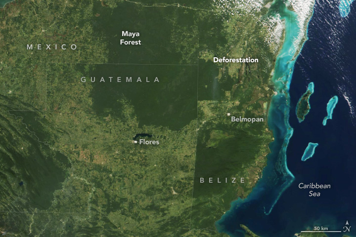
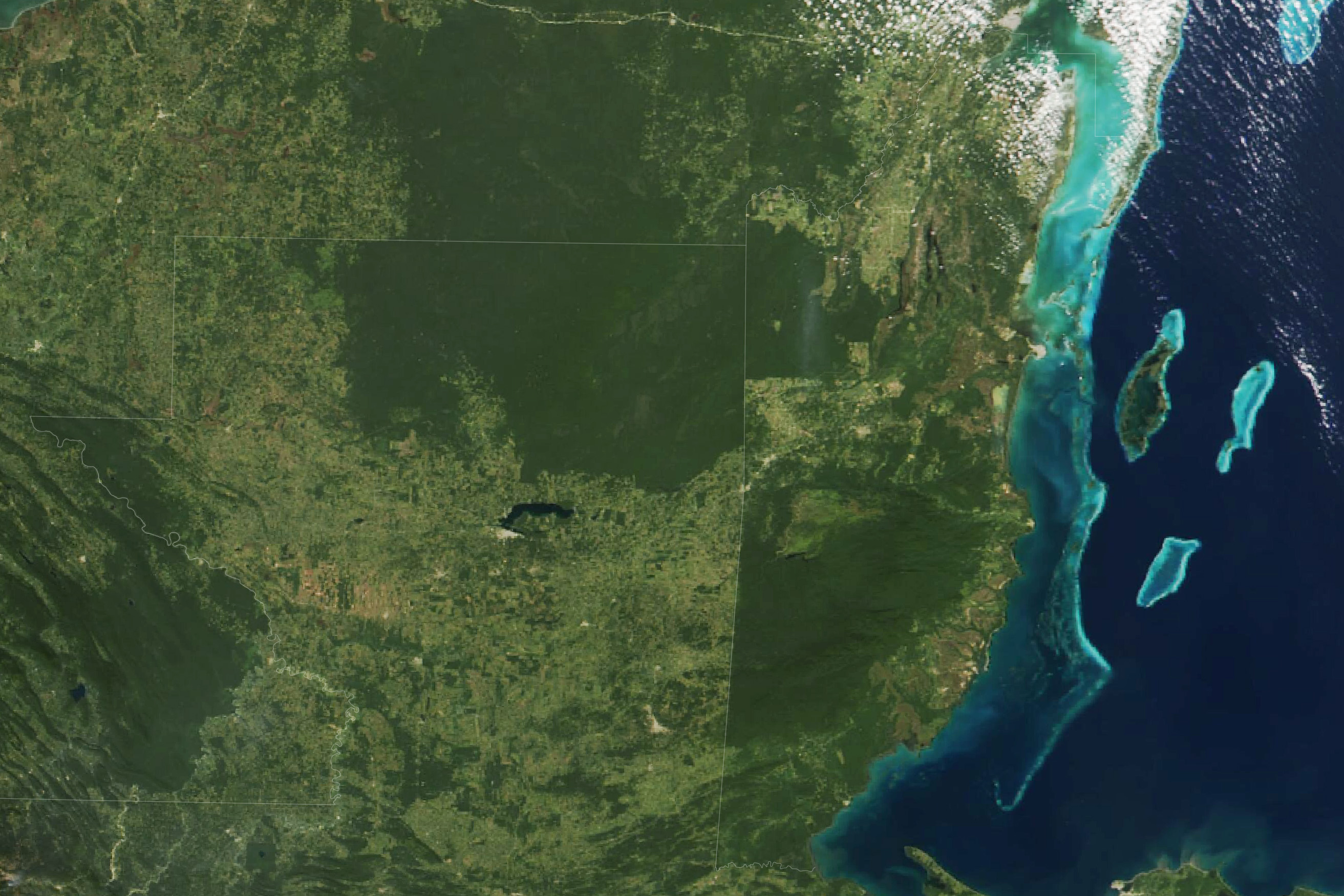
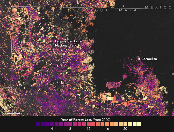
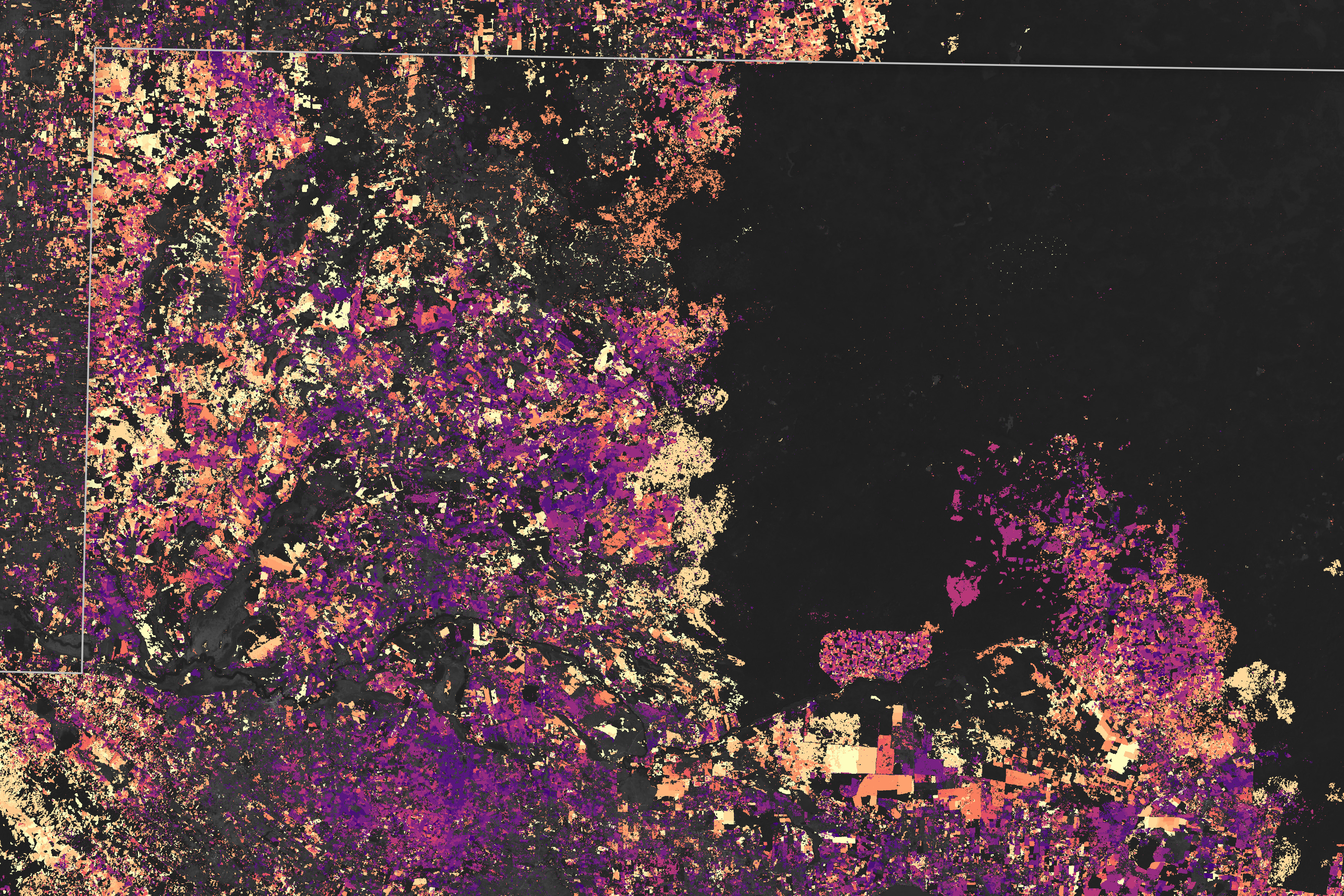
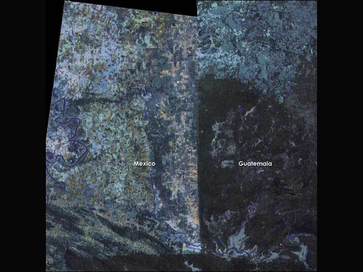
The Shrinking Selva Maya
Published June 18, 2024
The largest tropical rainforest in Mesoamerica is shrinking as pastures and croplands spread across Guatemala, Belize, and Mexico.
Related images:
720 x 480
JPEG
2625 x 1750
1 MB - JPEG
720 x 480
JPEG
2625 x 1750
1 MB - JPEG
720 x 545
JPEG
3507 x 2338
6 MB - JPEG
720 x 540
JPEG

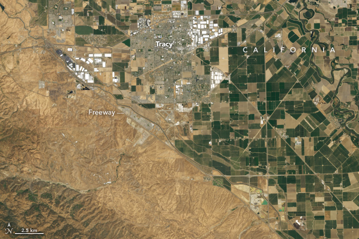
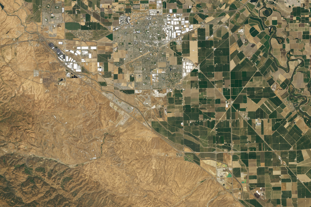
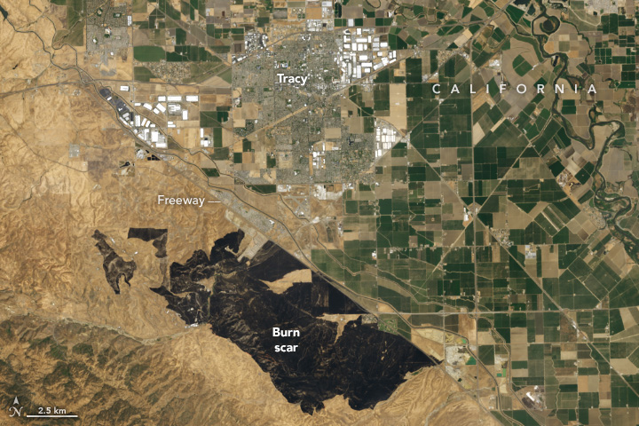
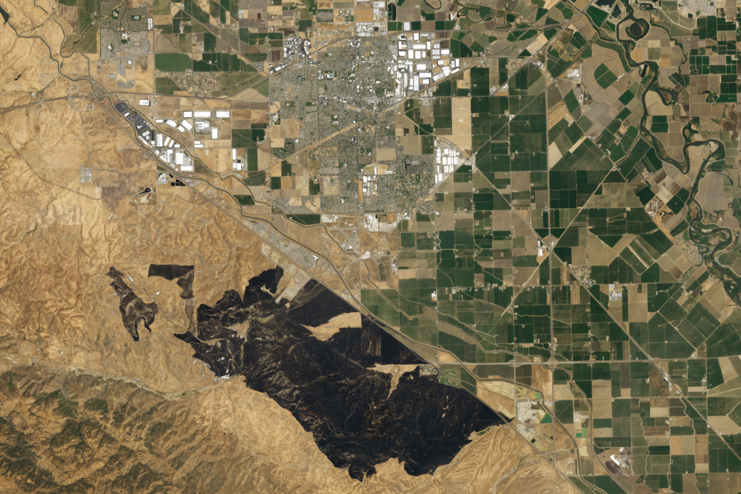
Grass Fire Chars California
Published June 5, 2024
Strong winds and ample fuel helped spread flames over 14,000 acres of grassland in San Joaquin County.
Related images:
720 x 480
JPEG
1044 x 696
389 KB - JPEG
720 x 480
JPEG
1044 x 696
380 KB - JPEG
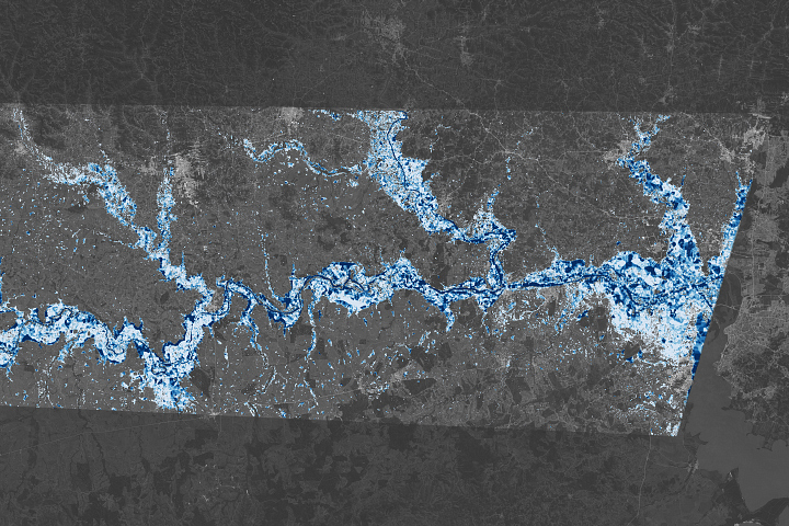
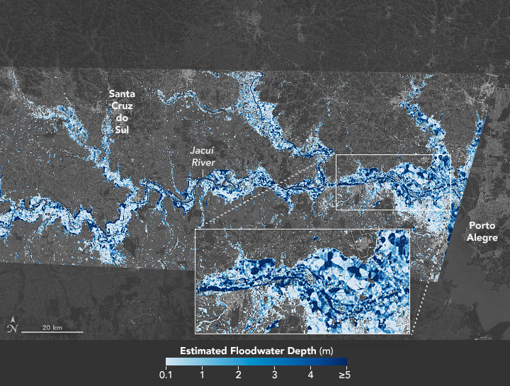
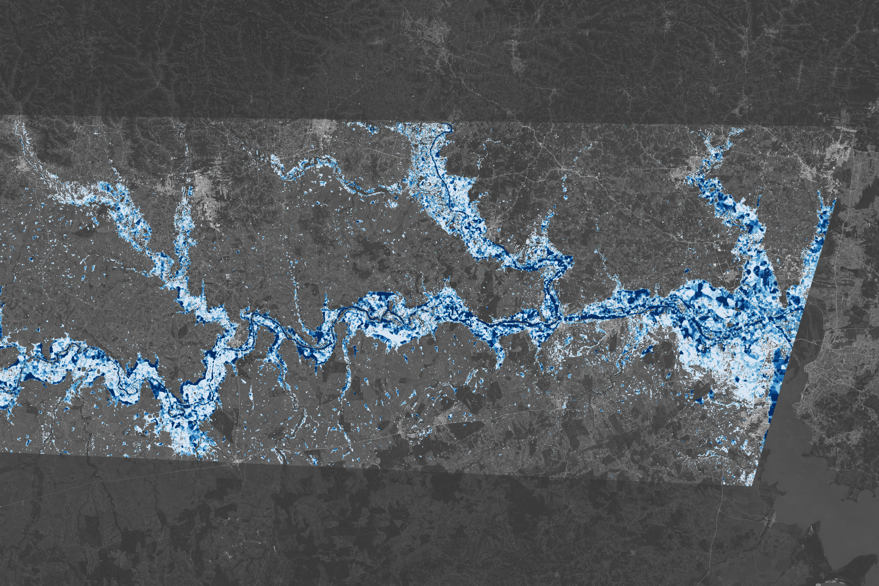
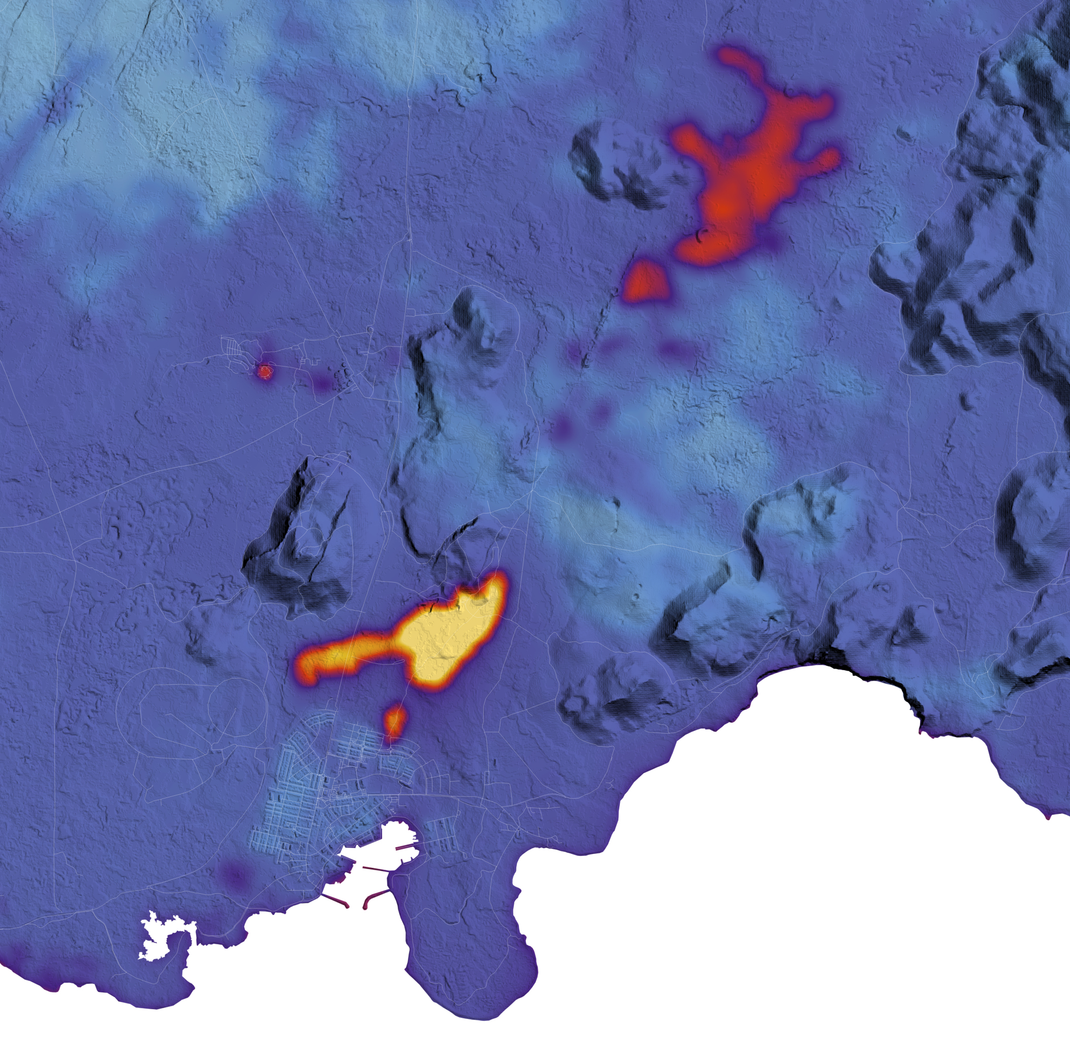
Southern Brazil Submerged
Published May 31, 2024
This map reveals the depth of floodwater that covered Rio Grande do Sul in May 2024.
Related images:
720 x 545
JPEG
3009 x 2006
5 MB - JPEG
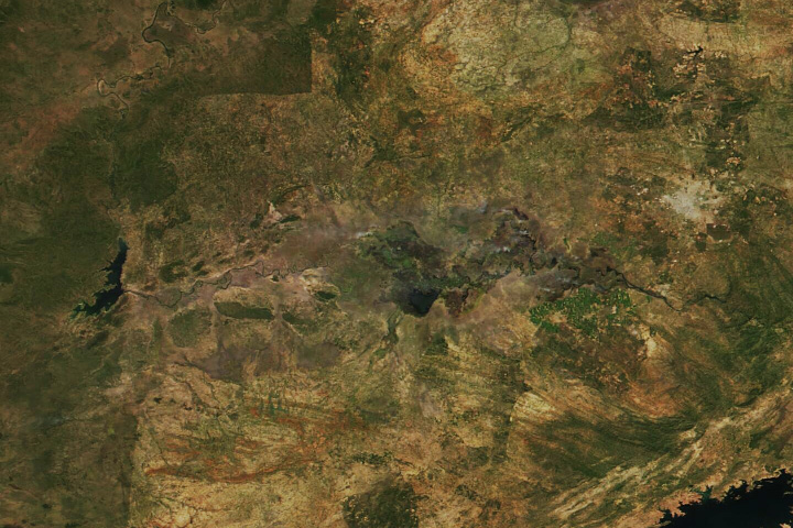
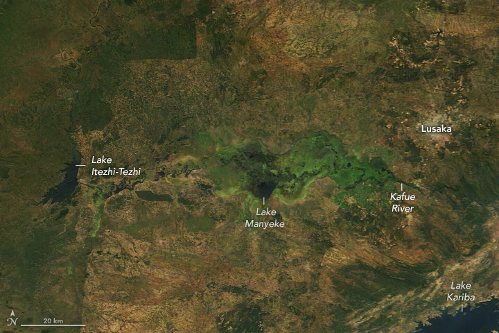
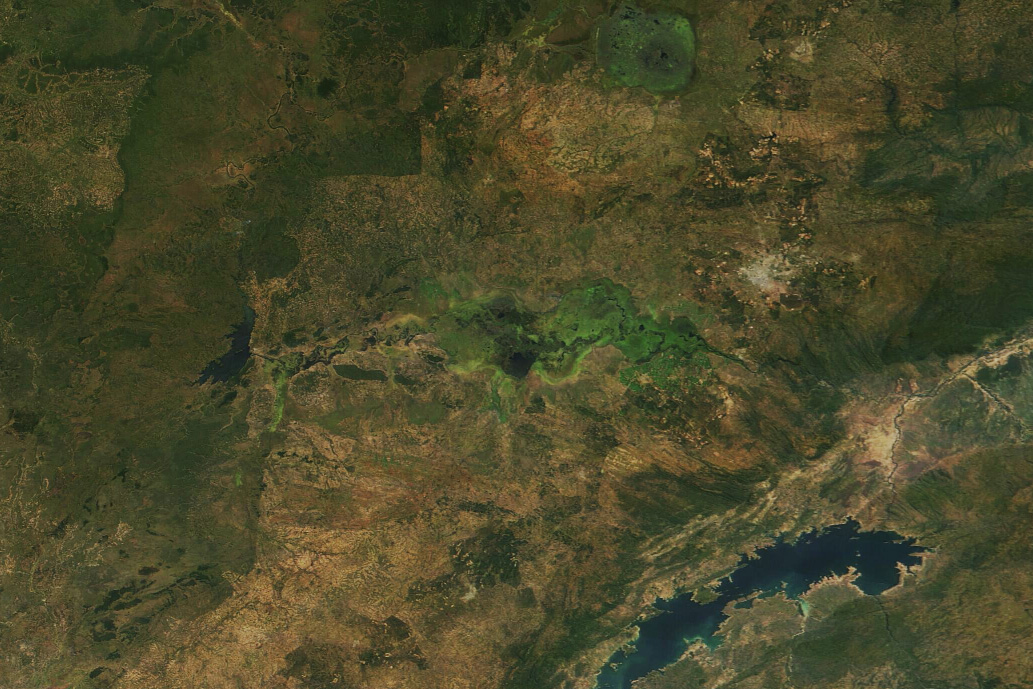
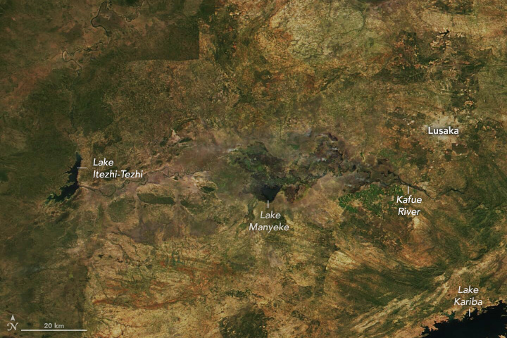
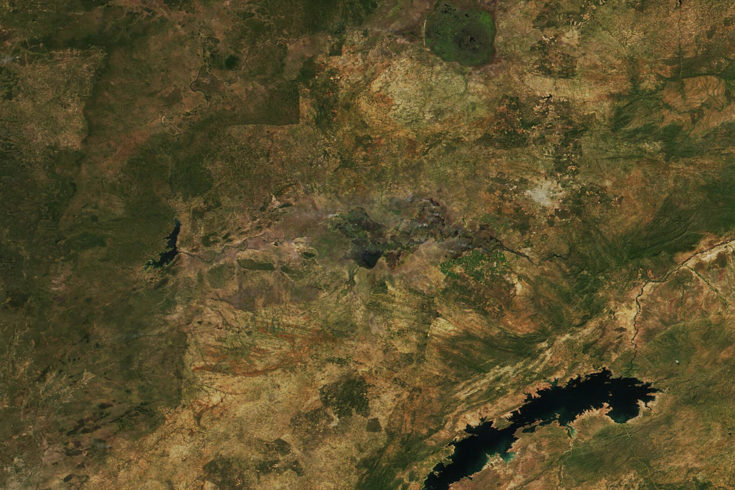
Parched Kafue Flats
Published April 30, 2024
Severe drought in Zambia jeopardizes electricity supplies and food security for millions of people.
Related images:
720 x 480
JPEG
1033 x 689
336 KB - JPEG
720 x 480
JPEG
1033 x 689
362 KB - JPEG
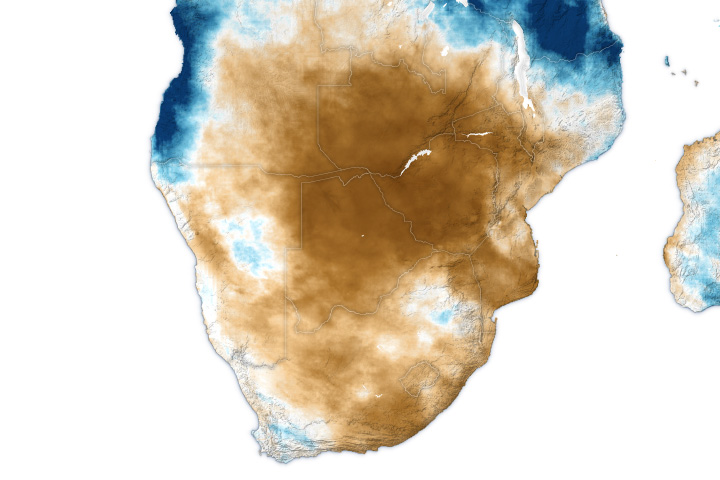
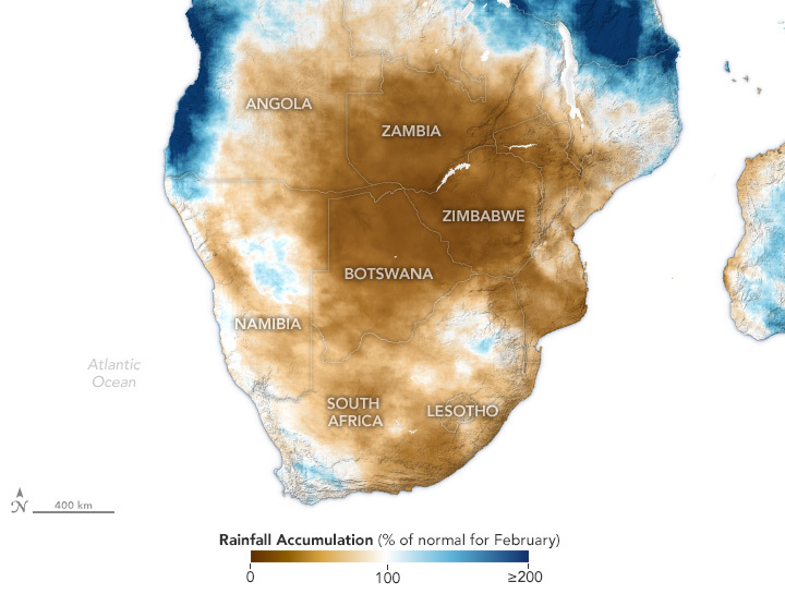
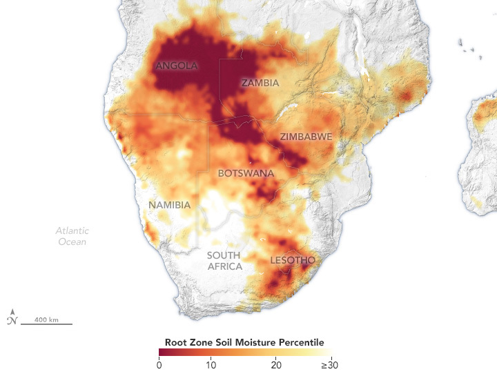
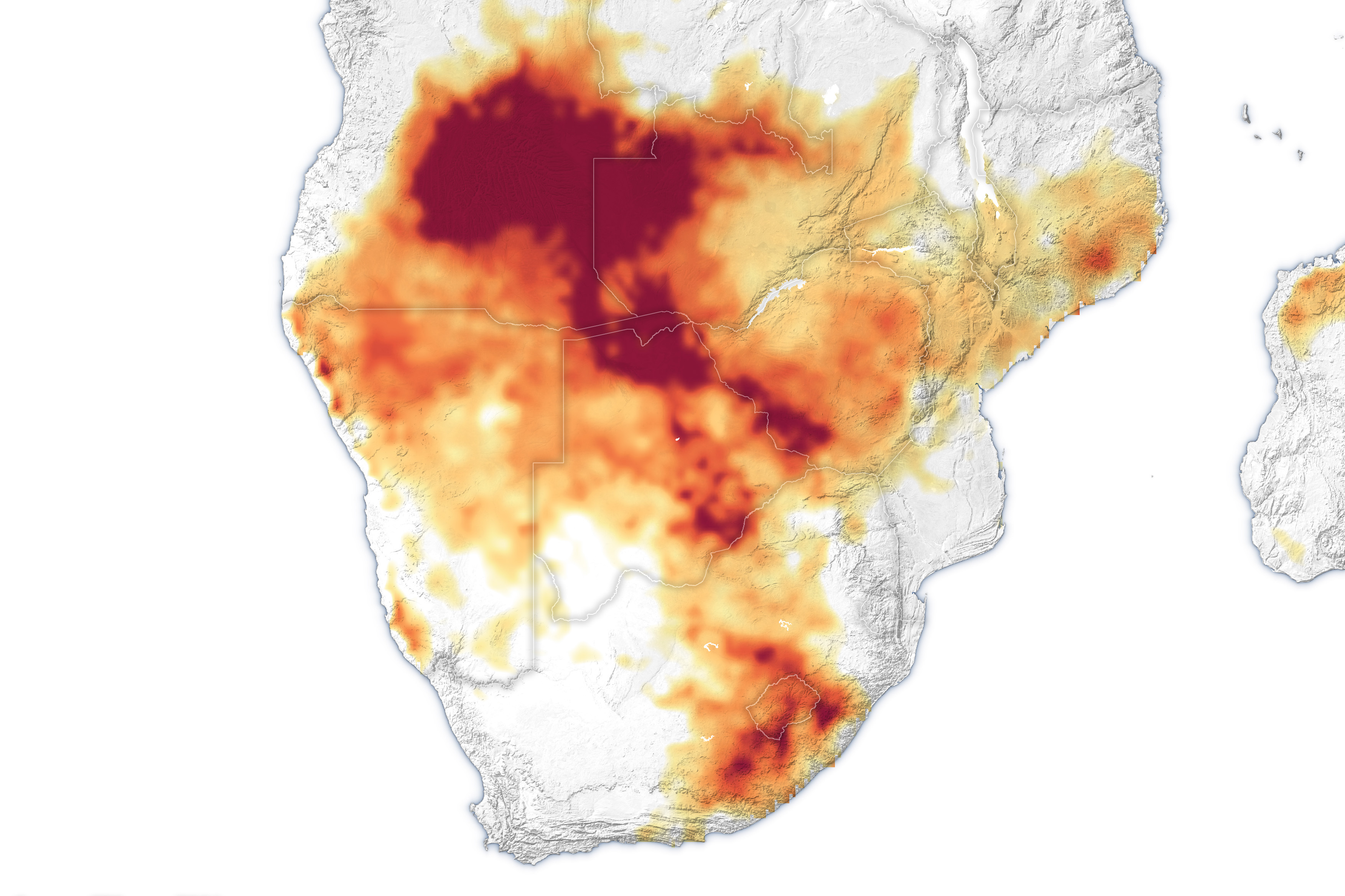
Severe Drought in Southern Africa
Published April 22, 2024
One of the driest growing seasons in decades has decimated crops and left millions hungry.
Related images:
720 x 545
JPEG

3507 x 2338
1 MB - JPEG
720 x 545
JPEG
3507 x 2338
1 MB - JPEG
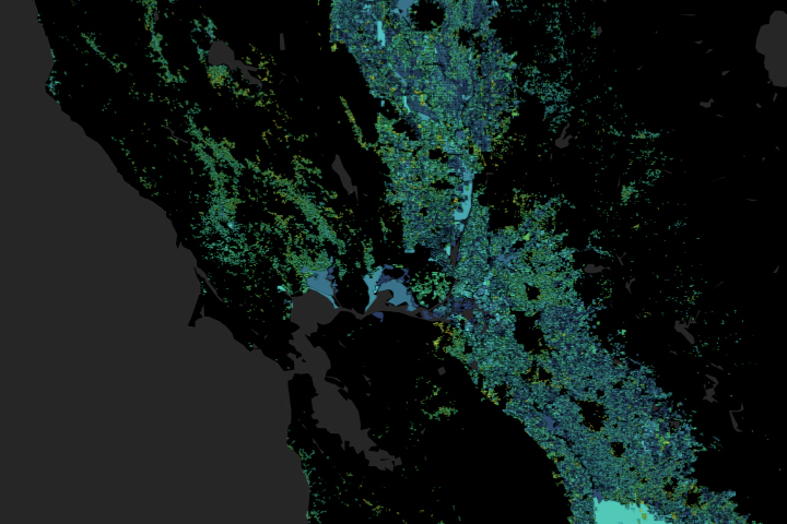
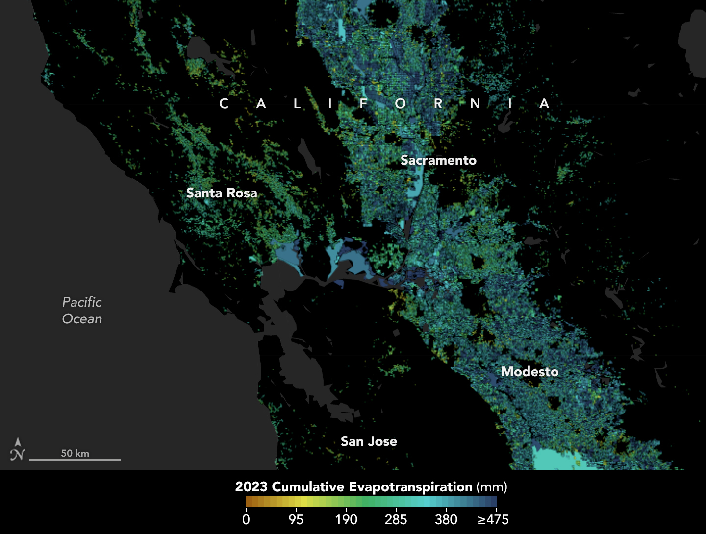
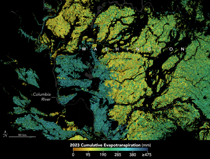
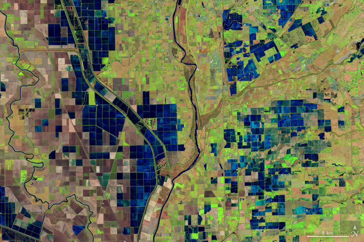
Tracking the Invisible Movement of Water
Published February 2, 2024
A moisture measurement tool known as OpenET is improving the way farmers, ranchers, and water resource managers steward one of Earth’s most precious resources.
Related images:

720 x 545
JPEG
1440 x 1090
637 KB - JPEG
720 x 545
JPEG

1440 x 1090
1 MB - JPEG
720 x 480
JPEG
3238 x 3598
6 MB - JPEG
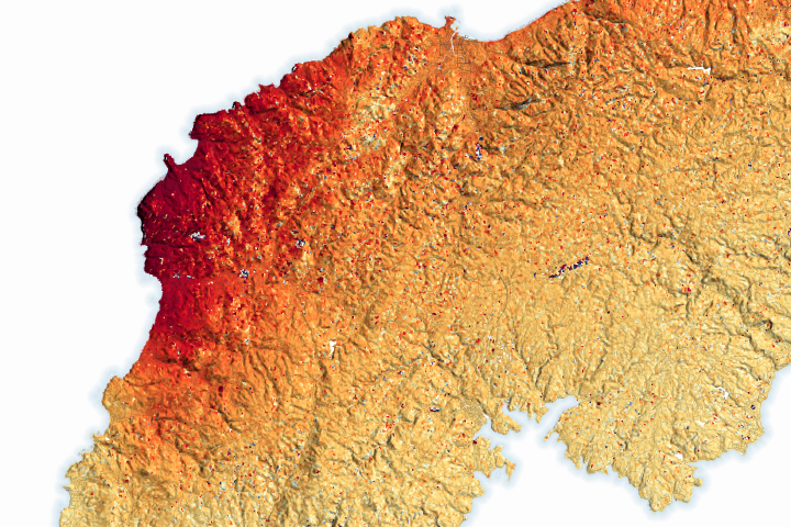
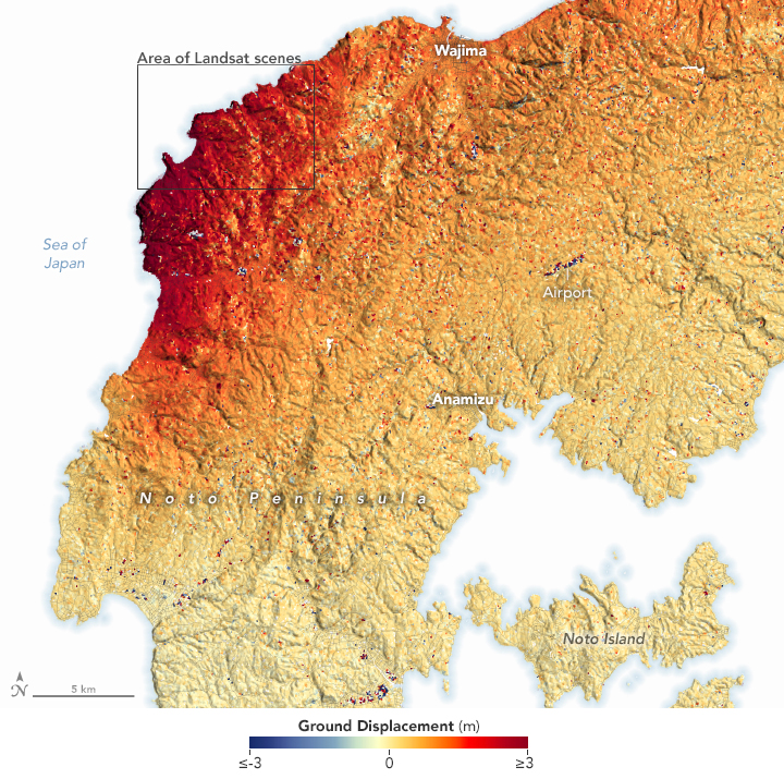
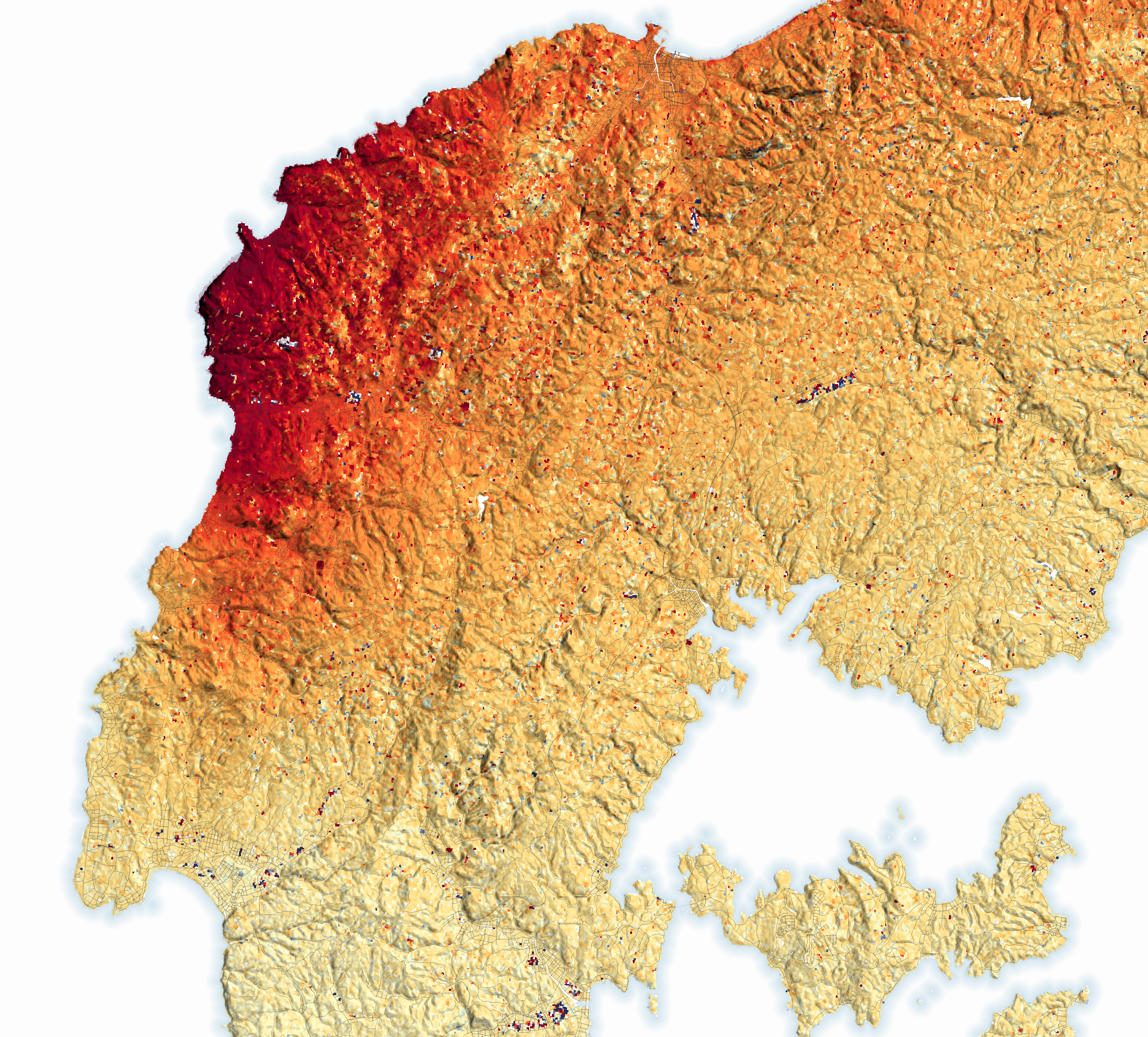
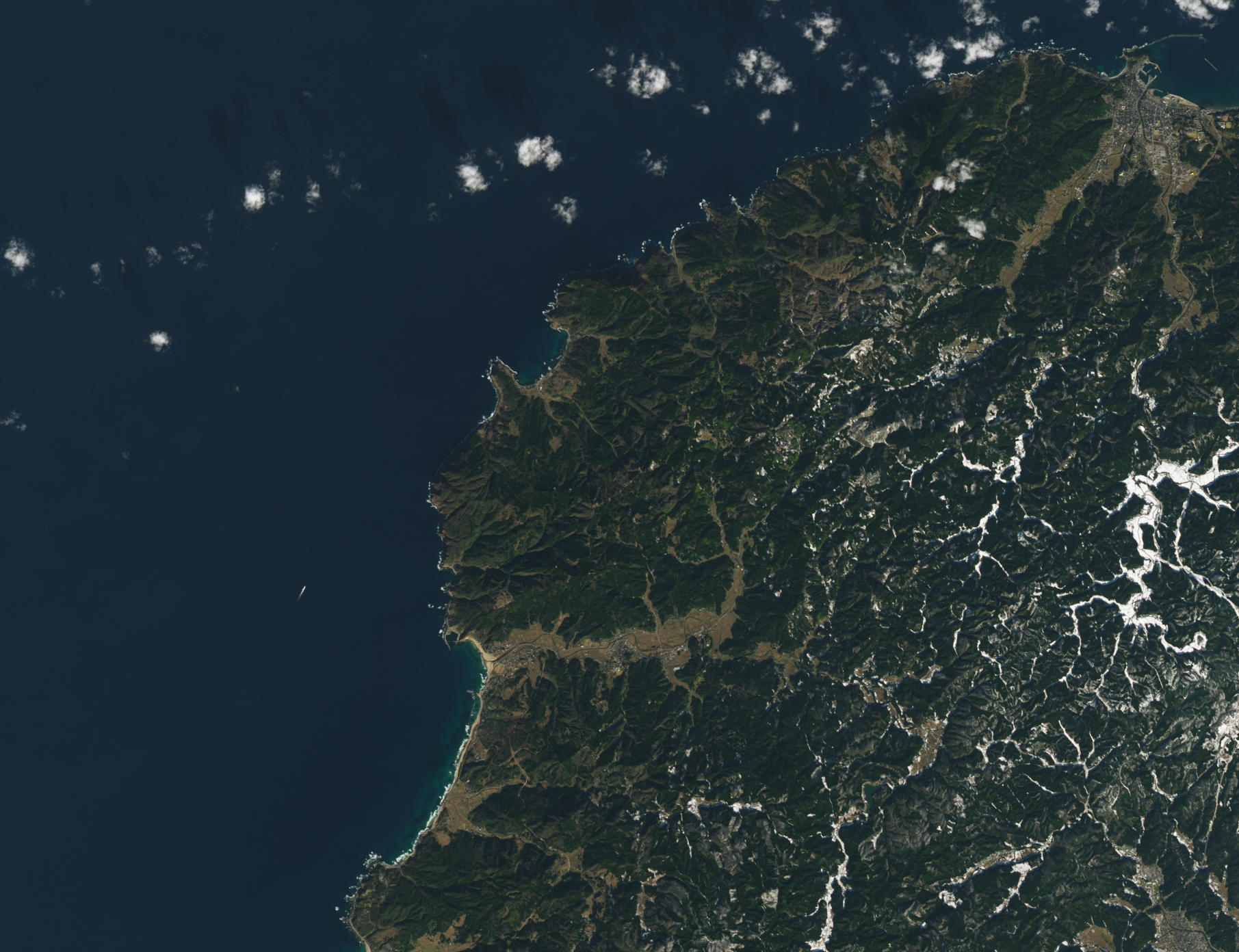
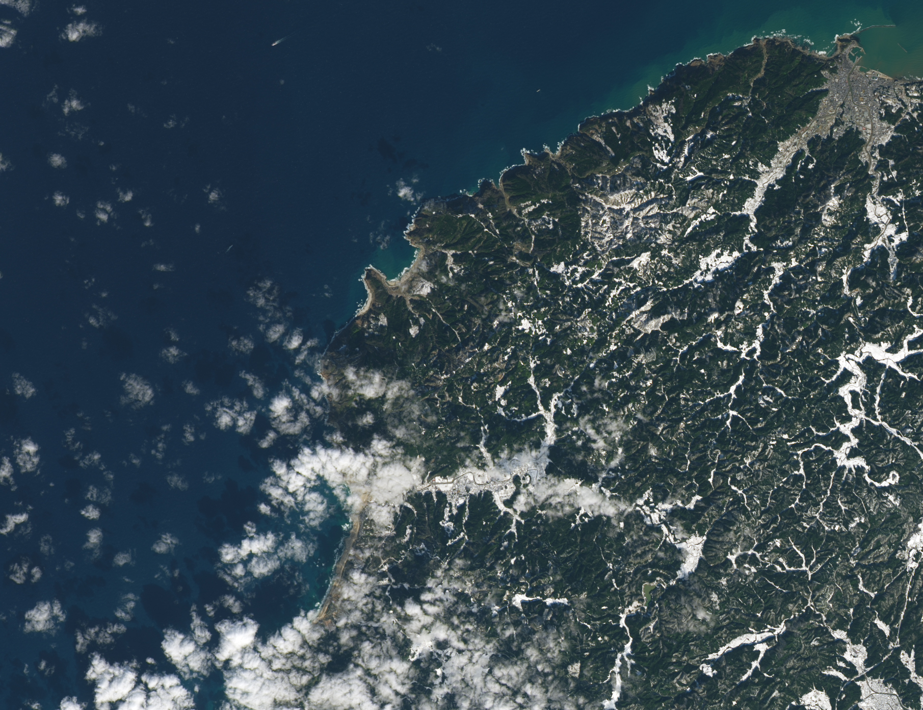
Earthquake Lifts the Noto Peninsula
Published January 23, 2024
Some parts of the peninsula rose up to 4 meters (13 feet), shifting the position of coastlines and leaving some ports dry.
Related images:
720 x 715
JPEG
2363 x 2133
5 MB - JPEG

MPEG
1811 x 1392
1 MB - JPEG
1811 x 1392
2 MB - JPEG
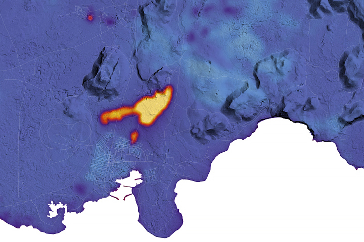
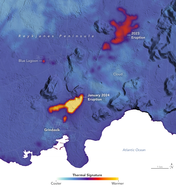
New Fissures Spill Lava in Iceland
Published January 19, 2024
The latest round of eruptions on the Reykjanes peninsula destroyed homes in the town of Grindavík.
Related images:
720 x 765
JPEG
2108 x 2049
2 MB - JPEG

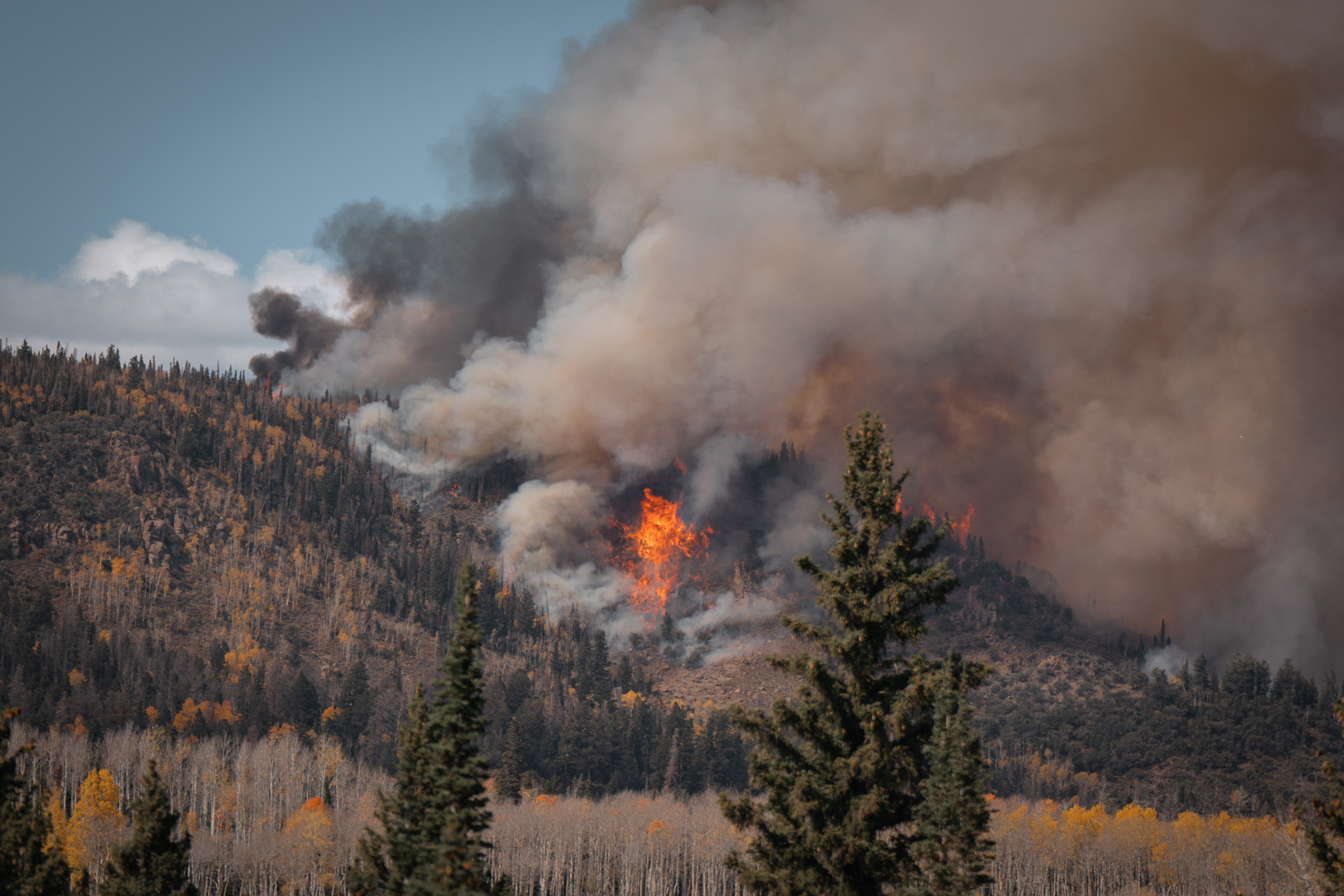
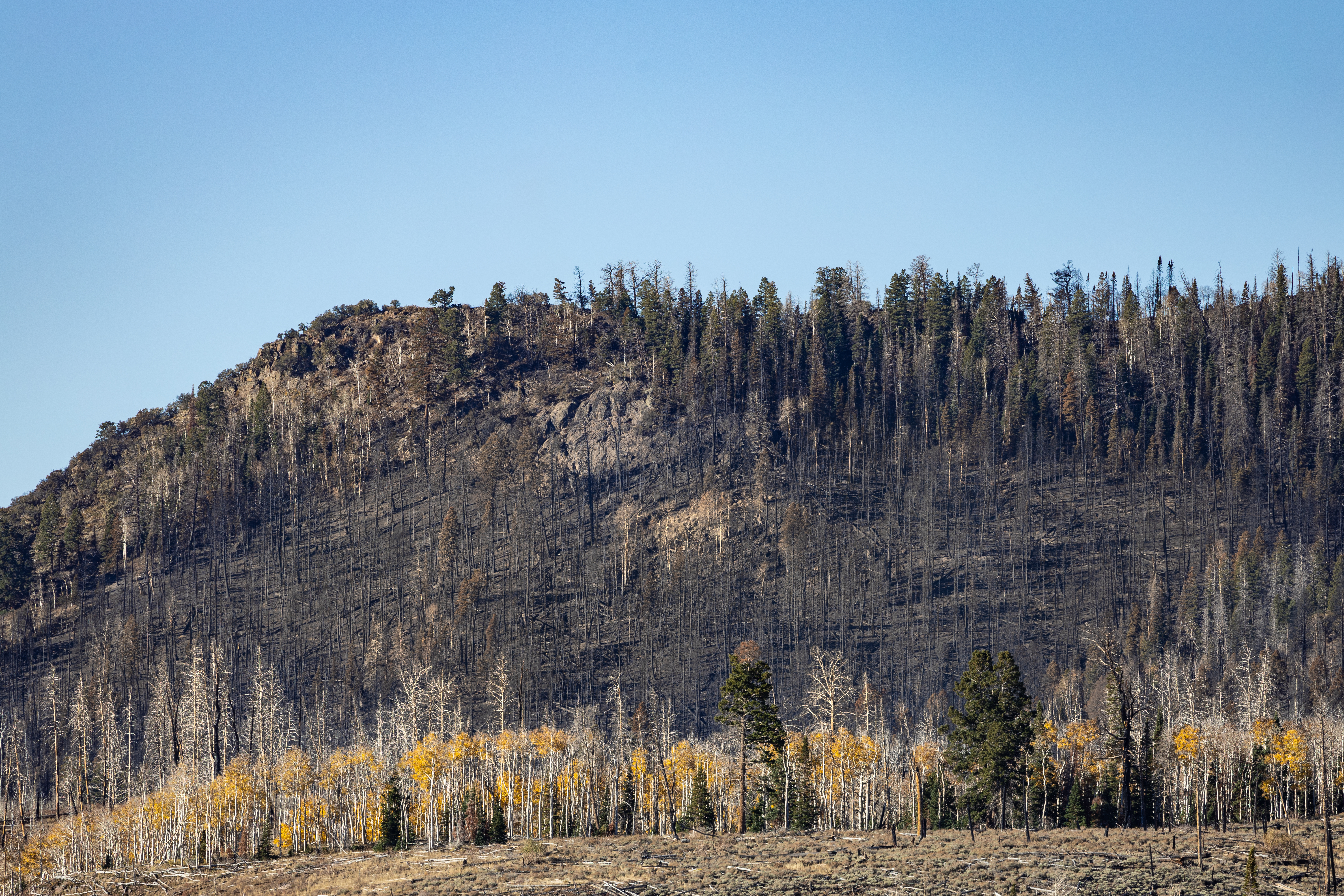
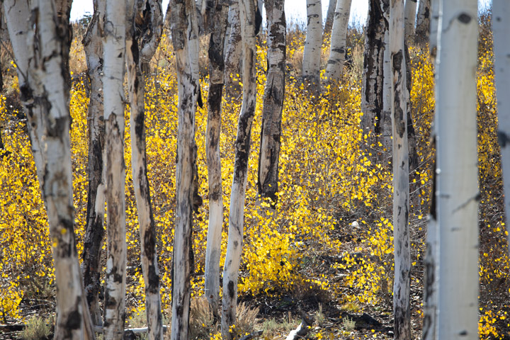
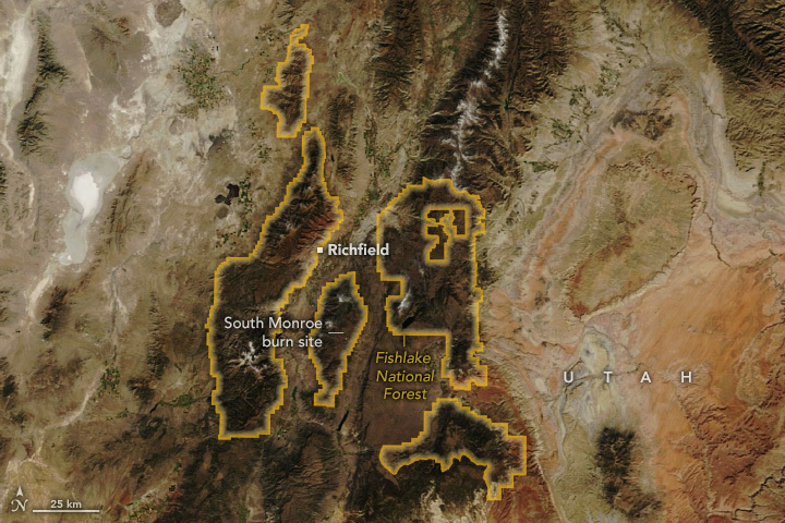
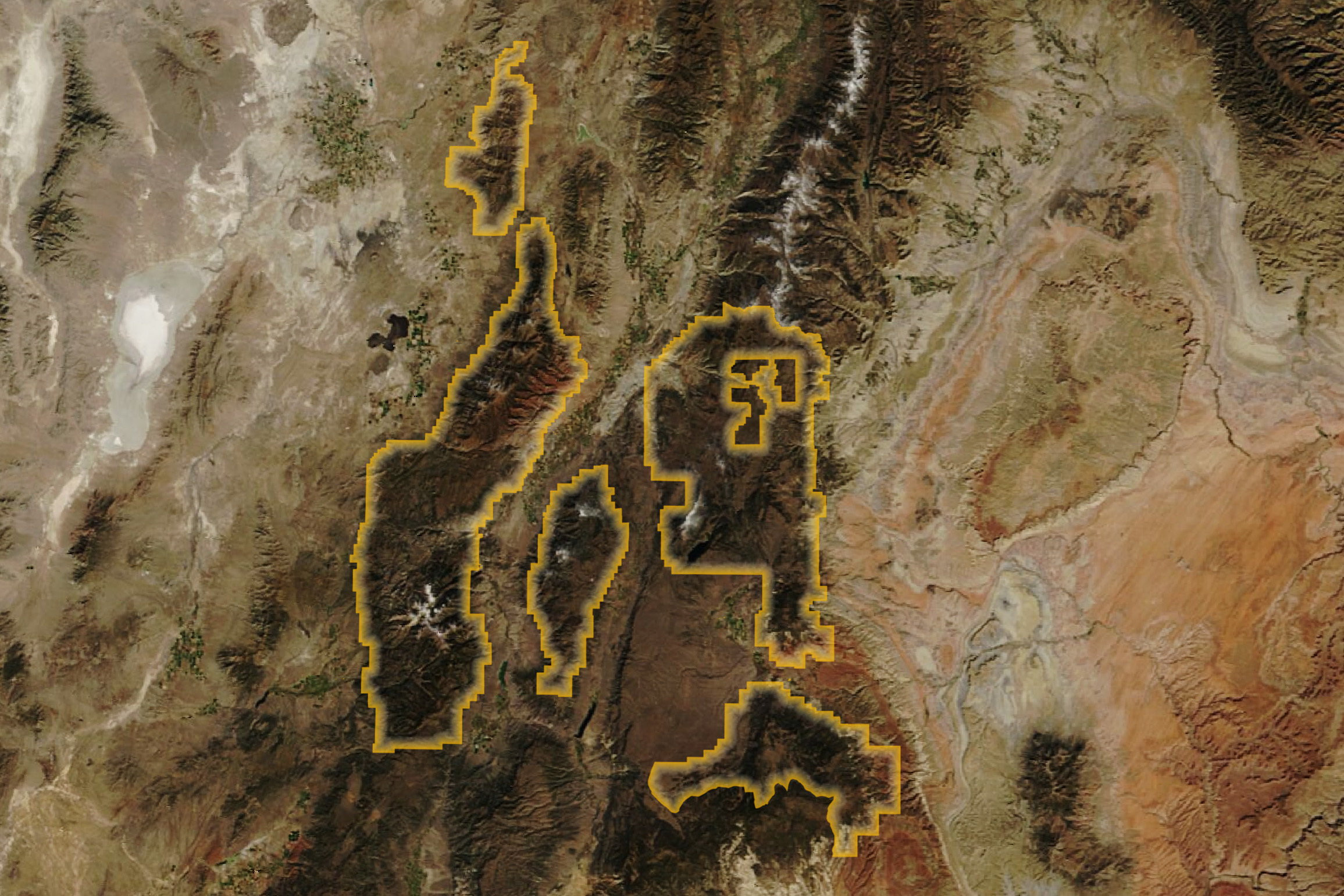
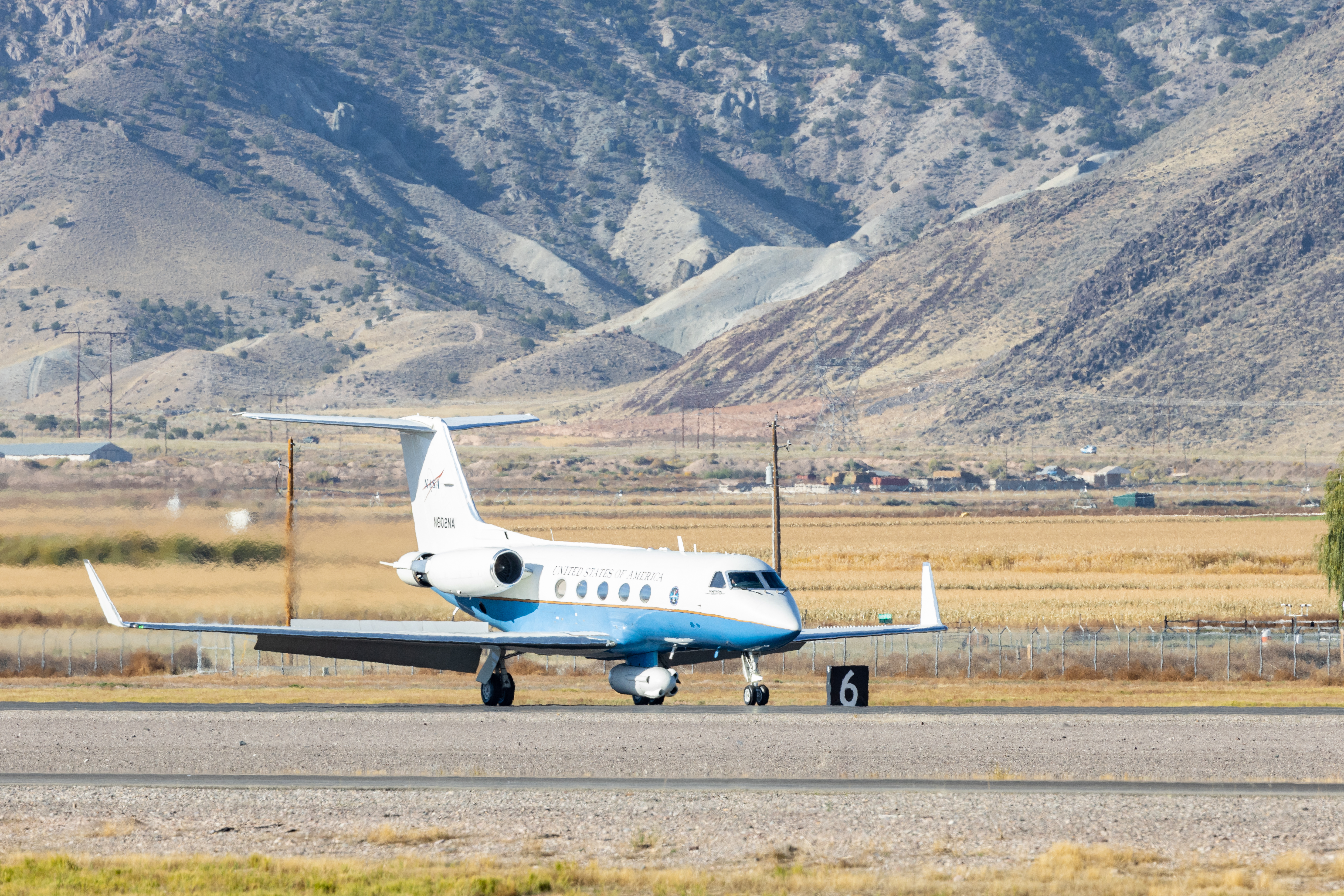
Making Fire Sense on Monroe Mountain
Published December 14, 2023
A high-intensity prescribed burn in south-central Utah will help restore the region’s aspen trees. It could also improve the lives of people managing, fighting, and living with fire.
Related images:
720 x 480
JPEG
5194 x 3463
3 MB - JPEG

720 x 480
JPEG
6000 x 4000
19 MB - JPEG
720 x 480
JPEG

6000 x 4000
19 MB - JPEG
720 x 480
JPEG
2311 x 1541
1 MB - JPEG

720 x 480
JPEG
5772 x 3848
15 MB - JPEG
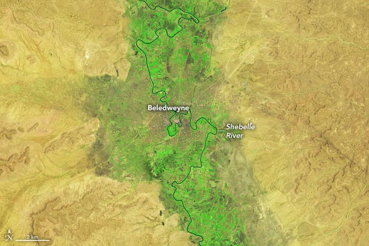
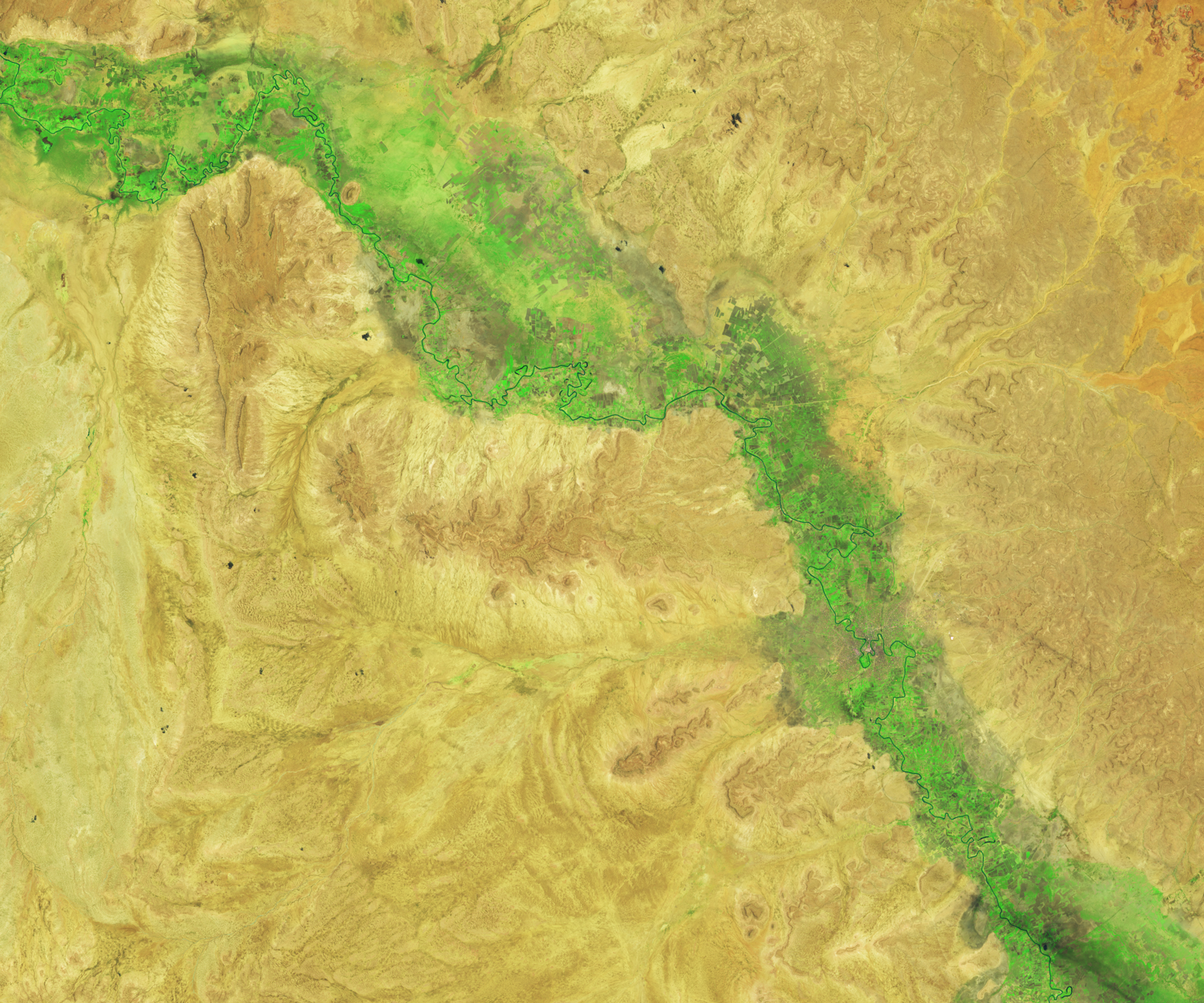
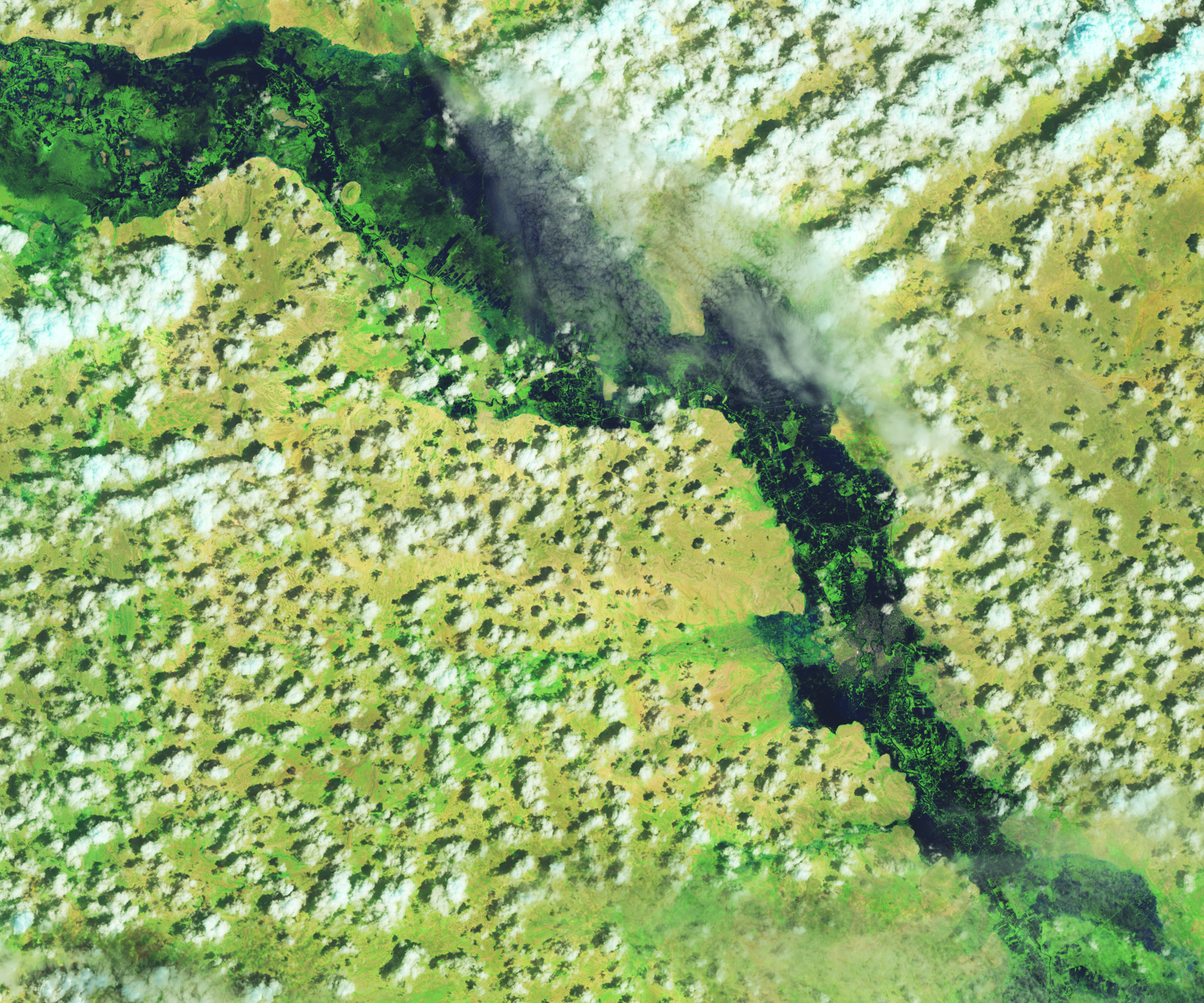
Devastating Flooding in East Africa
Published November 21, 2023
Heavy rainfall in the Horn of Africa submerged entire towns in floodwater.
Related images:
720 x 480
JPEG

720 x 480
JPEG
MPEG
2070 x 1725
3 MB - JPEG
2070 x 1725
4 MB - JPEG