720 x 673
PNG
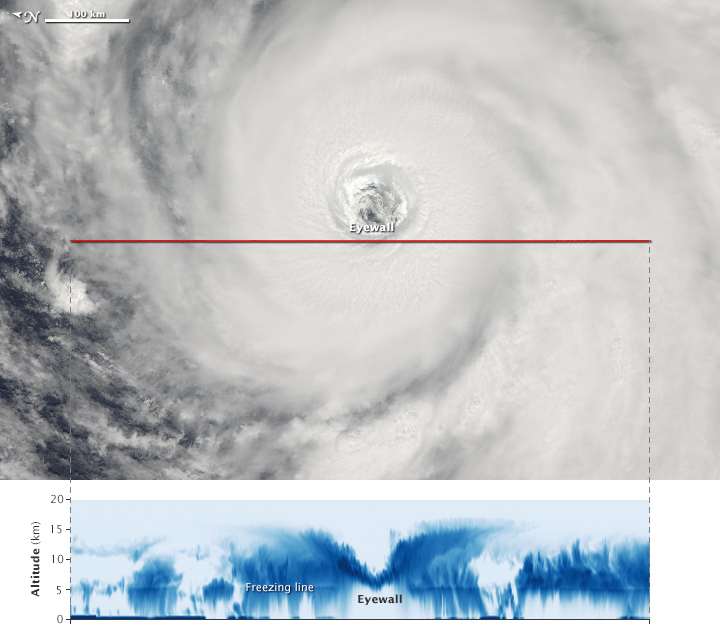
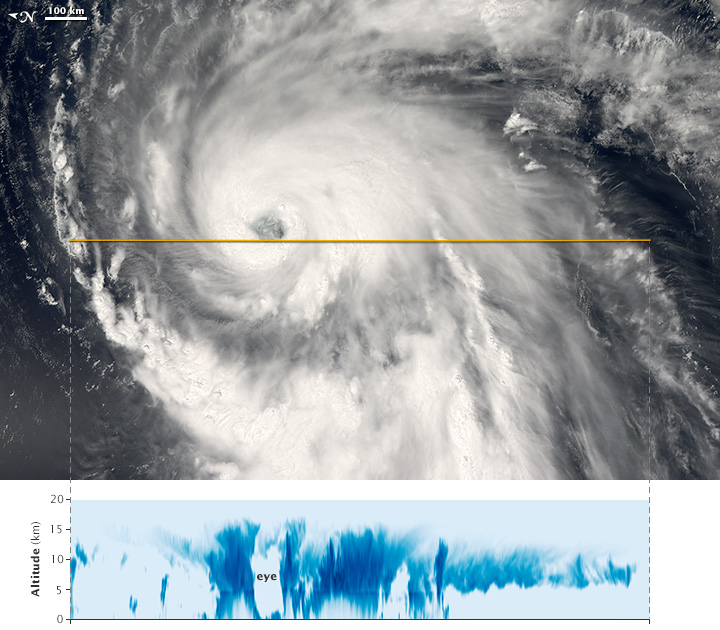
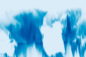
Looking Into the Eye of Yutu
Published November 2, 2018
A stroke of luck brought the CloudSat radar directly over the center of one of the strongest typhoons of the year.
Related images:
9025 x 9649
11 MB - JPEG
720 x 673
PNG
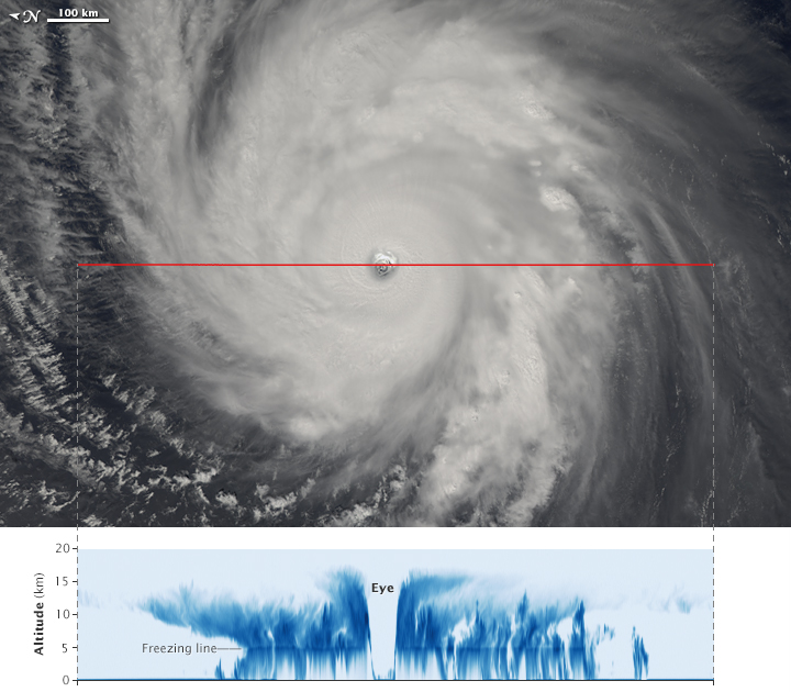
A View Inside Hurricane Florence
Published September 13, 2018
Though flying in a lowered orbit, twelve-year-old CloudSat continues to deliver impressive science data that reveals the vertical structure of clouds.
Related images:
5489 x 3953
5 MB - JPEG

720 x 681
JPEG
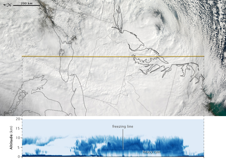
Looking Through the Storm That Swamped Houston
Published April 29, 2016
CloudSat observed a destructive rain storm as it passed across the central United States in April 2016.
Related images:
10000 x 10000
12 MB - JPEG

10000 x 10000
98 MB - GeoTIFF

720 x 630
JPEG
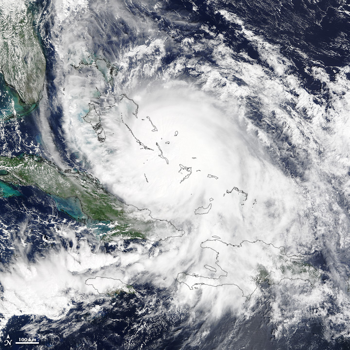
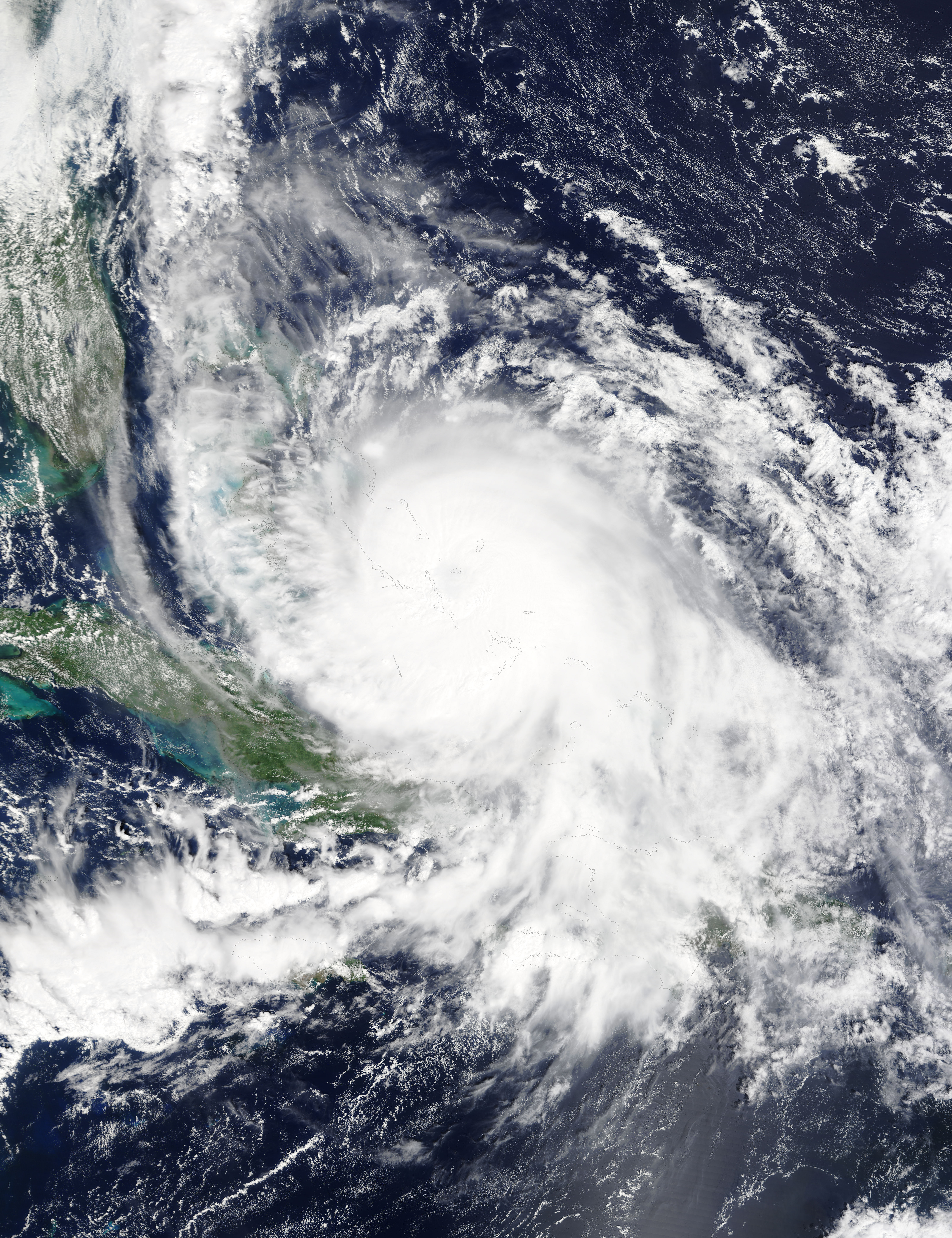
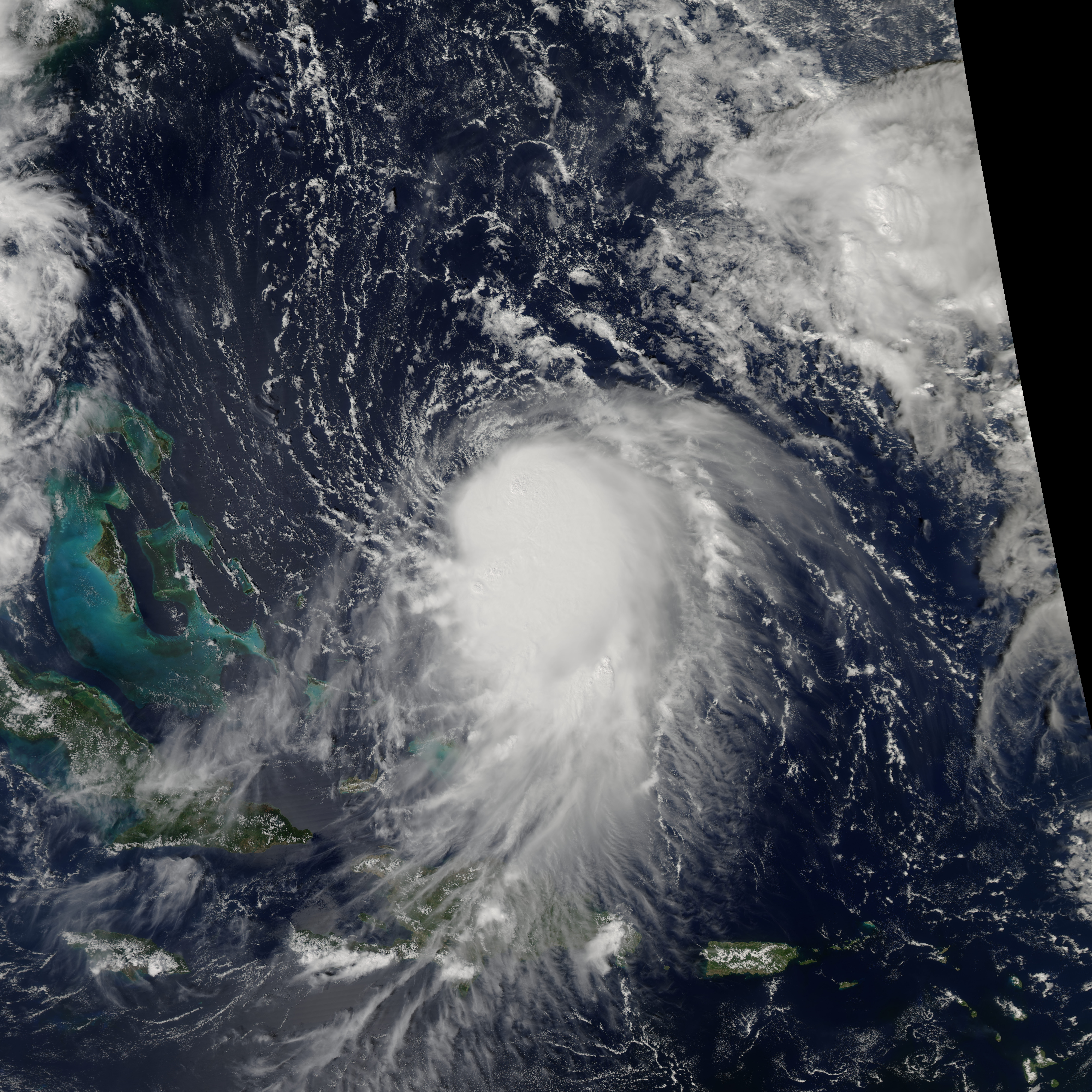
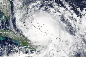
Hurricane Joaquin
Published October 3, 2015
Forecasters expected the third hurricane of the 2015 Atlantic season to follow a trajectory away from the U.S. East Coast, but large amounts of precipitation could not be ruled out.
Related images:
720 x 720
JPEG
6000 x 7800
8 MB - JPEG

6000 x 7800
71 MB - GeoTIFF

8000 x 8000
6 MB - JPEG
8000 x 8000
69 MB - GeoTIFF
720 x 630
JPEG
A View Inside Typhoon Atsani
Published August 21, 2015
A radar on CloudSat imaged the internal structure of a powerful typhoon that will likely skirt east of Japan in the coming days.
Related images:

8000 x 8000
53 MB - GeoTIFF

720 x 630
JPEG
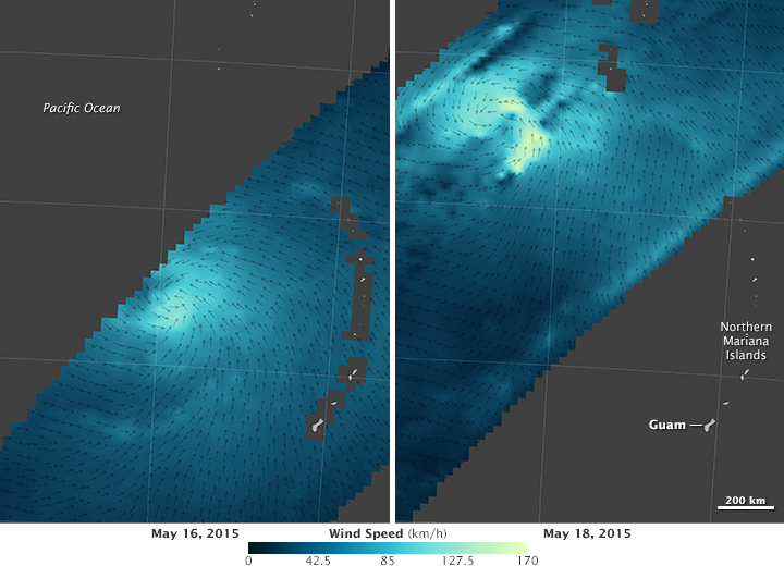
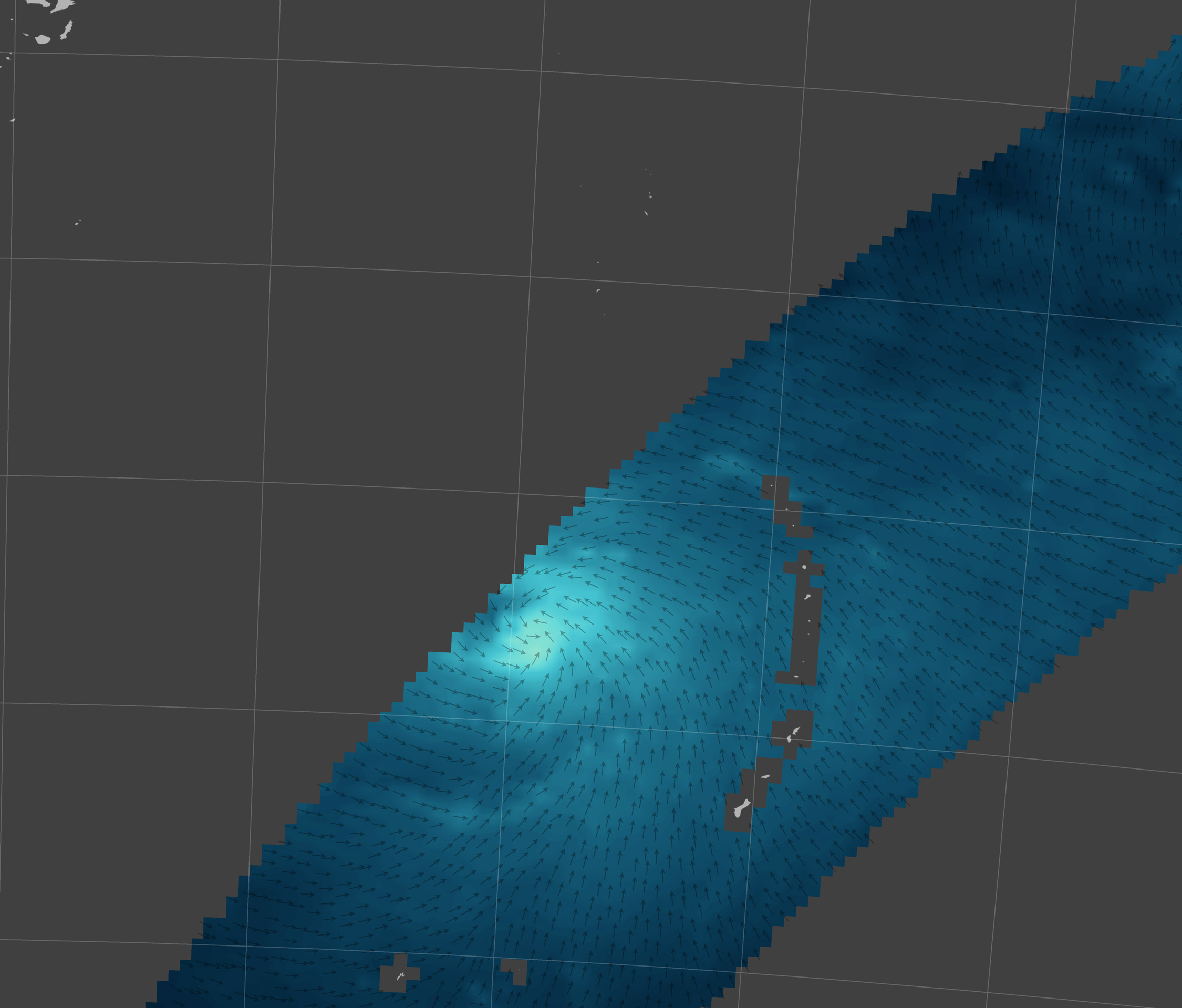
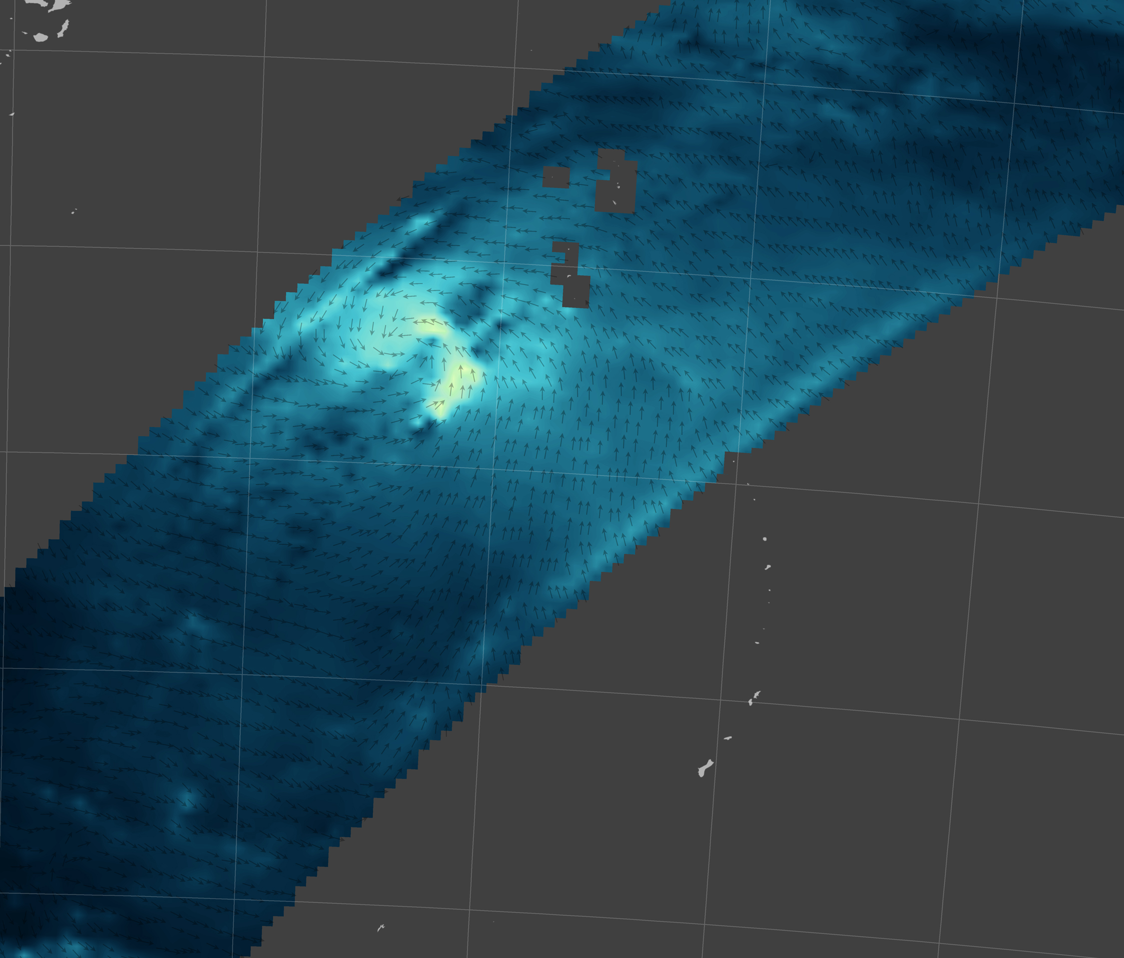
Satellite Eyes on Typhoon Dolphin
Published May 24, 2015
While RapidScat measured the strength of Typhoon Dolphin’s winds, CloudSat captured a rare glimpse inside the storm’s eye.
Related images:
720 x 520
JPEG
2250 x 1919
923 KB - JPEG
2250 x 1919
1 MB - JPEG
720 x 520
JPEG
Satellite Eyes on Typhoon Dolphin
Published May 24, 2015
While RapidScat measured the strength of Typhoon Dolphin’s winds, CloudSat captured a rare glimpse inside the storm’s eye.
Related images:
720 x 630
JPEG
2250 x 1919
923 KB - JPEG
2250 x 1919
1 MB - JPEG
2250 x 1919
1 MB - JPEG
Satellite Eyes on Typhoon Dolphin
Published May 24, 2015
While RapidScat measured the strength of Typhoon Dolphin’s winds, CloudSat captured a rare glimpse inside the storm’s eye.
Related images:
720 x 630
JPEG
720 x 520
JPEG
2250 x 1919
923 KB - JPEG
720 x 630
JPEG
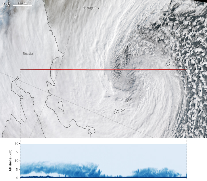
Inside the Bering Sea Superstorm
Published November 19, 2014
A slice through the storm clouds depicts areas of intense snowfall.
Related images:

69 MB - GeoTIFF

720 x 630
JPEG
Side Profile of Typhoon Neoguri
Published July 8, 2014
CloudSat captured a vertical slice of the potent storm on July 5.
Related images:

1242 x 82
102 KB - PNG
720 x 630
JPEG
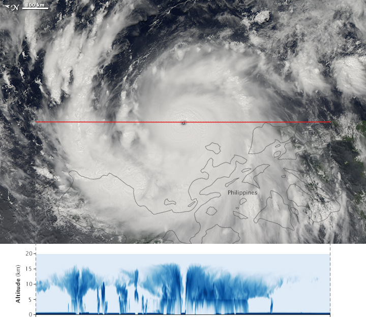
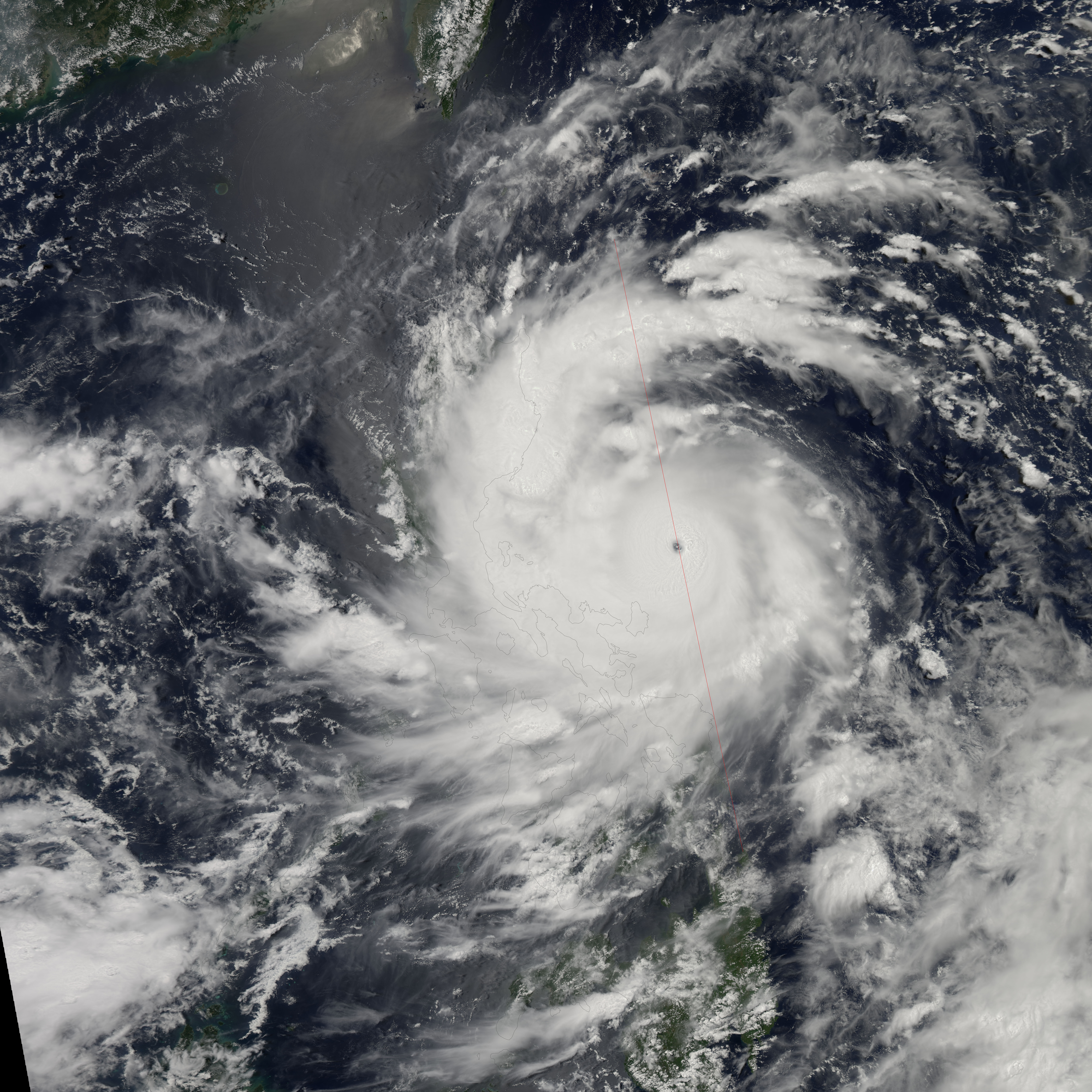
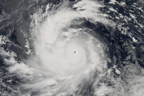
Dissecting Typhoon Utor
Published August 31, 2013
In a rare, perfectly centered overpass, CloudSat captured a vertical profile of Super Typhoon Utor as the storm approached the Philippines on August 11, 2013.
Related images:
8000 x 8000
5 MB - JPEG

133 MB - GeoTIFF
720 x 510
JPEG
A View Inside Sandy
Published November 1, 2012
Cloudsat’s radar captured a unique view of Sandy's internal cloud structure.
Related images:

1255 x 86
66 KB - JPEG