720 x 480
PNG
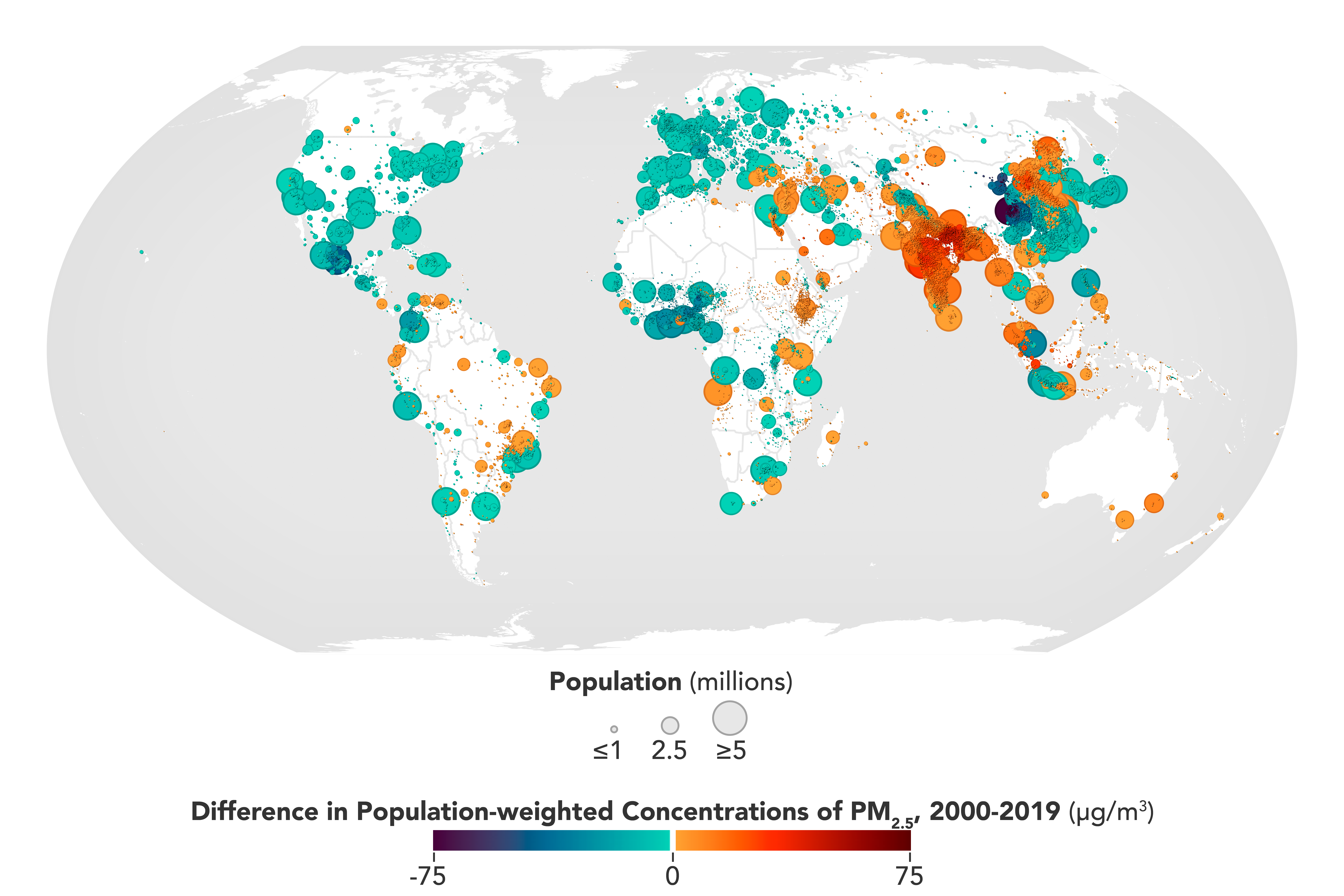
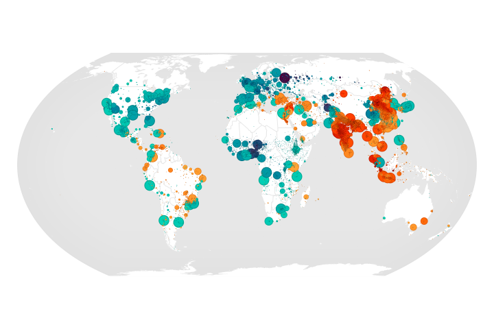
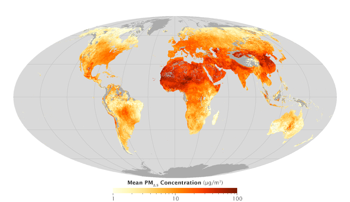
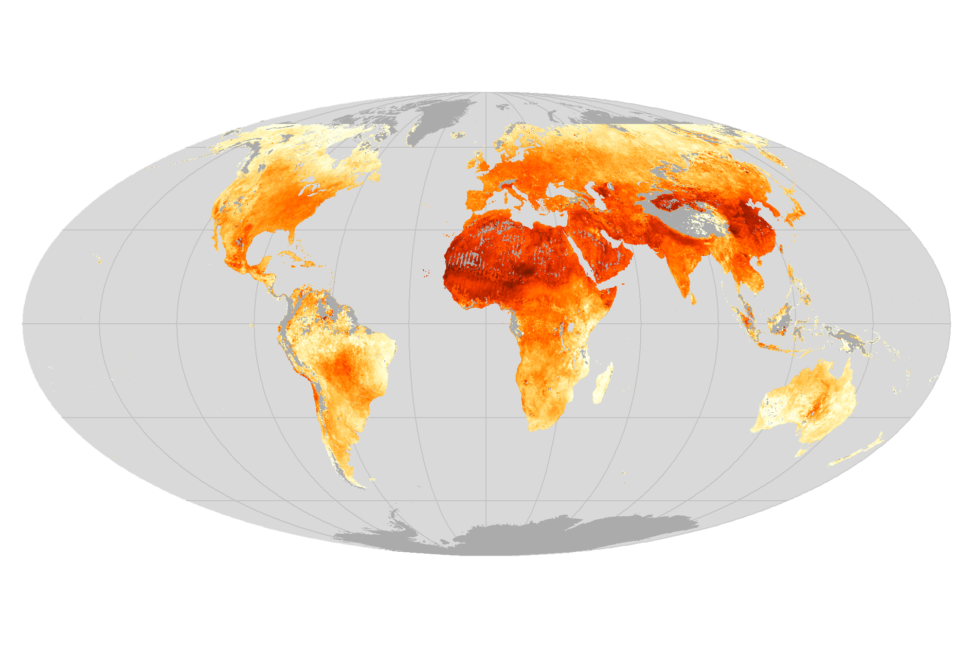
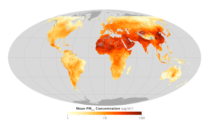
No Breathing Easy for City Dwellers: Particulates
Published March 15, 2022
A new satellite-derived dataset links concentrations of fine particulate matter in air pollution with health outcomes in cities around the world.
Related images:
7200 x 4800
6 MB - PNG
720 x 480
PNG

7200 x 4800
6 MB - PNG
720 x 228
PNG
720 x 480
PNG
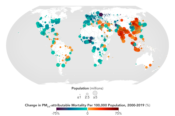
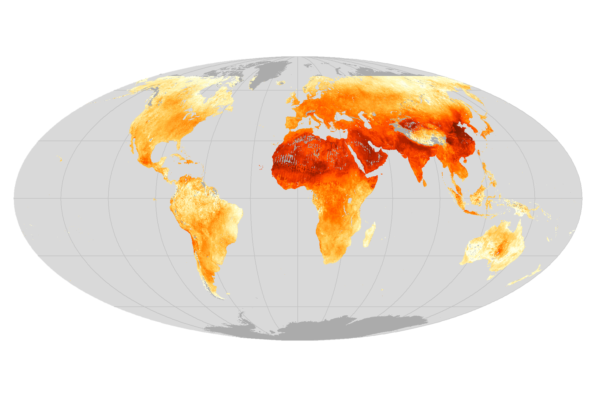
No Breathing Easy for City Dwellers: Particulates
Published March 15, 2022
A new satellite-derived dataset links concentrations of fine particulate matter in air pollution with health outcomes in cities around the world.
Related images:
720 x 480
PNG
7200 x 4800
6 MB - PNG
7200 x 4800
6 MB - PNG
720 x 228
PNG
720 x 228
PNG
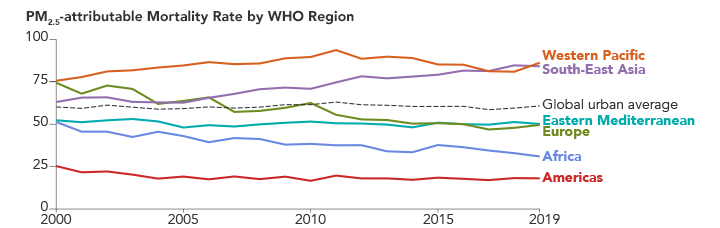
No Breathing Easy for City Dwellers: Particulates
Published March 15, 2022
A new satellite-derived dataset links concentrations of fine particulate matter in air pollution with health outcomes in cities around the world.
Related images:
720 x 480
PNG
7200 x 4800
6 MB - PNG
720 x 480
PNG
7200 x 4800
6 MB - PNG
720 x 916
PNG
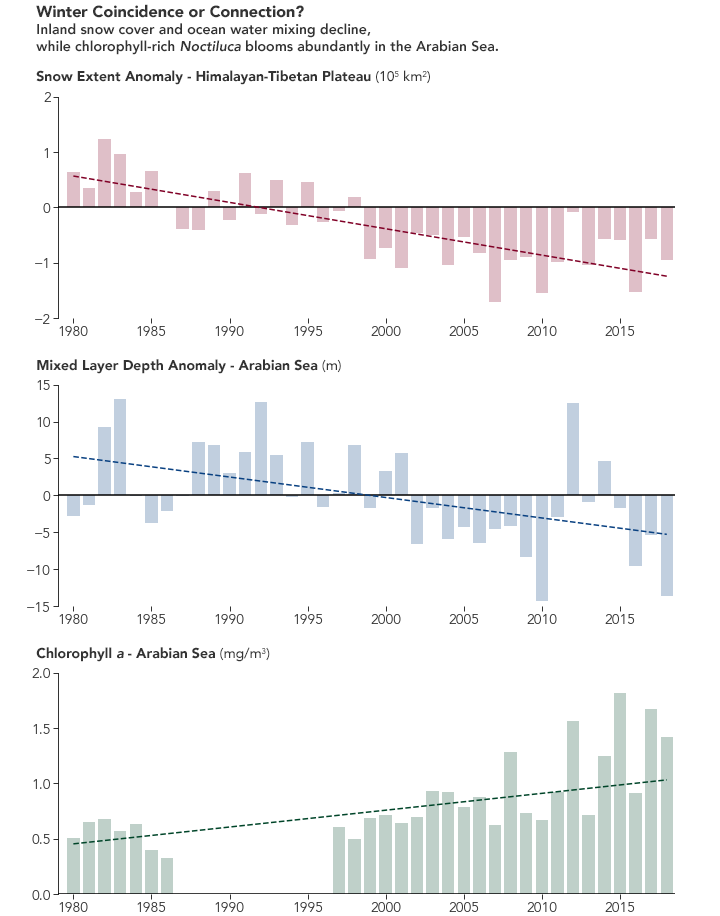
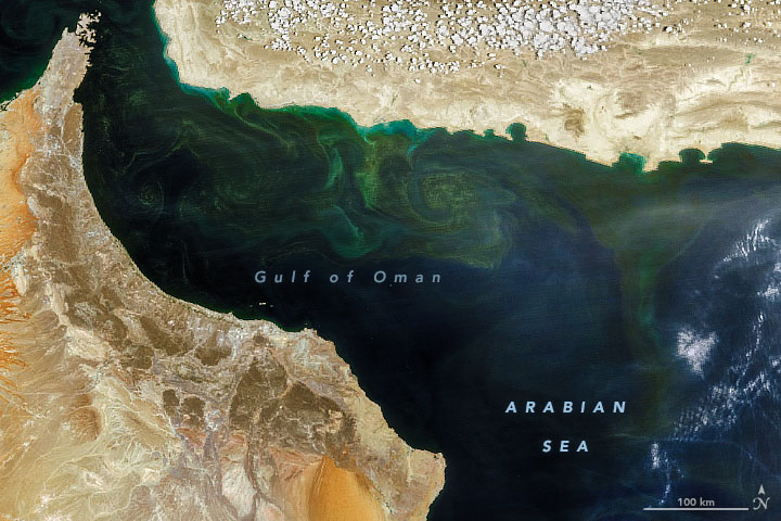
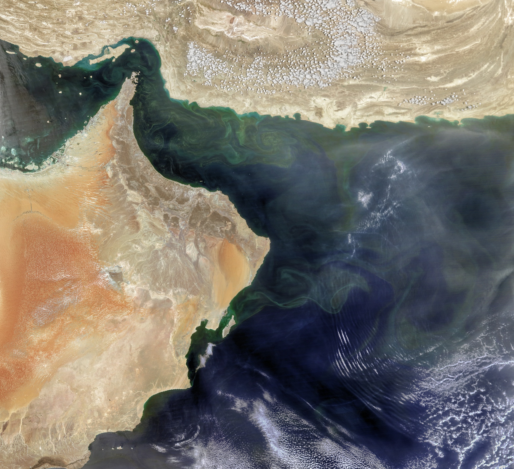
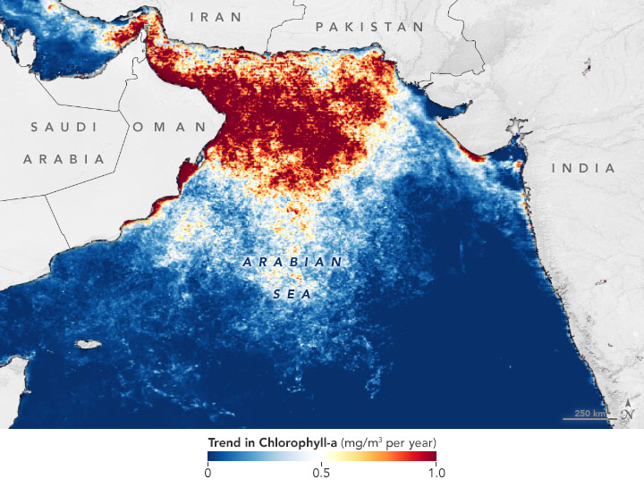
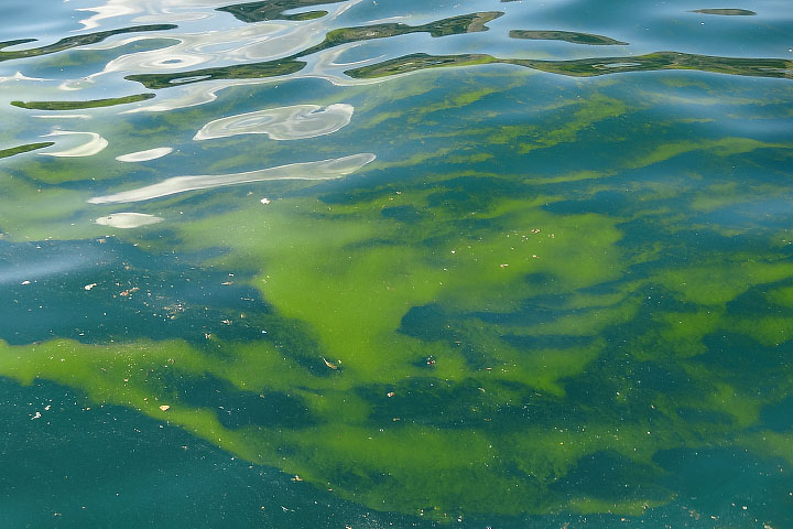
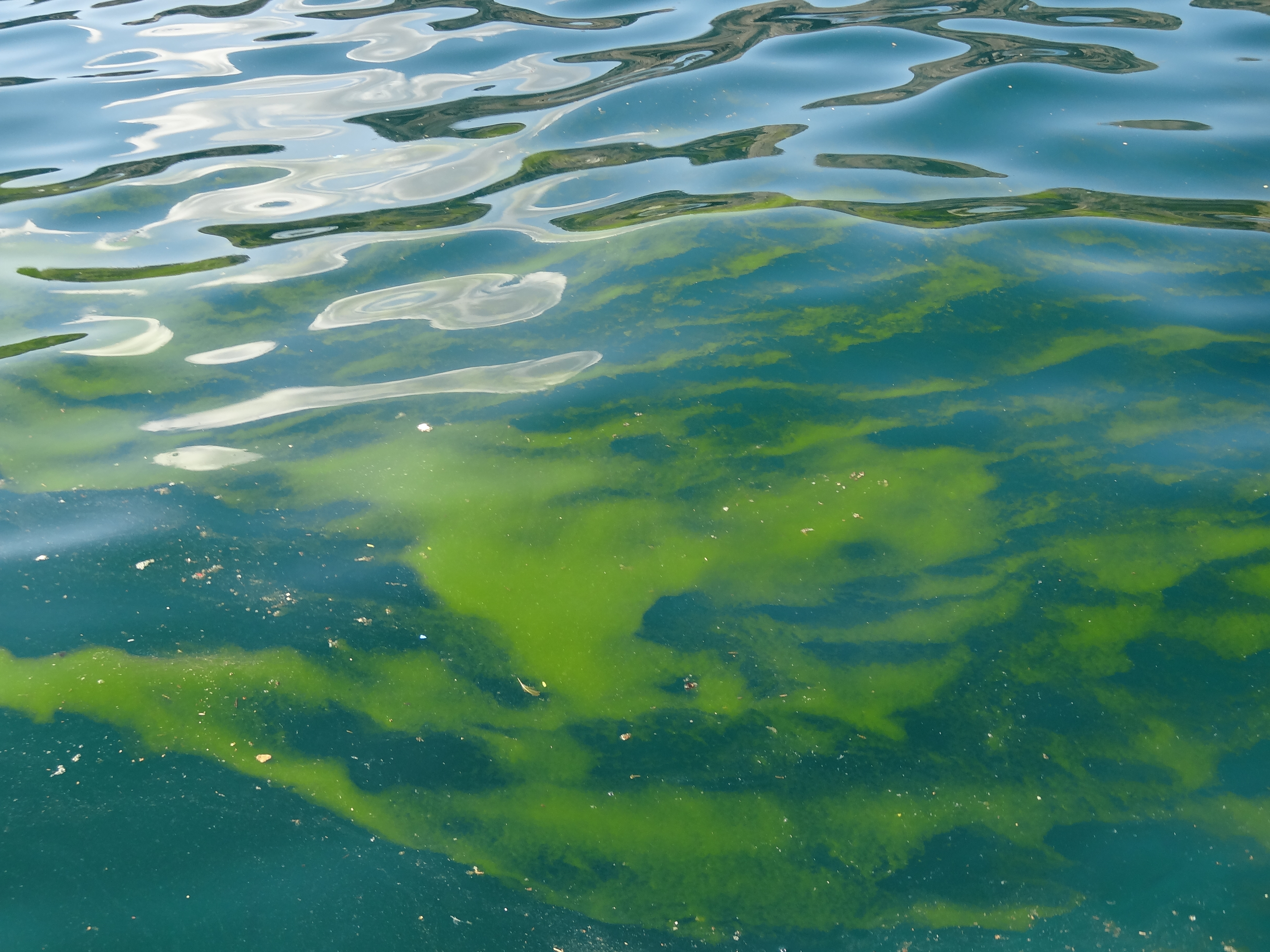
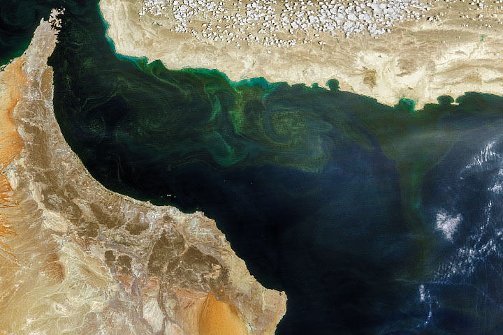
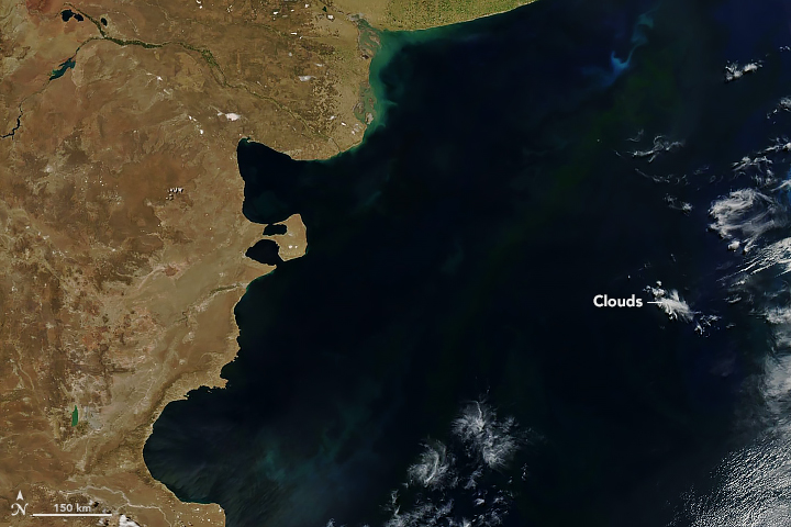
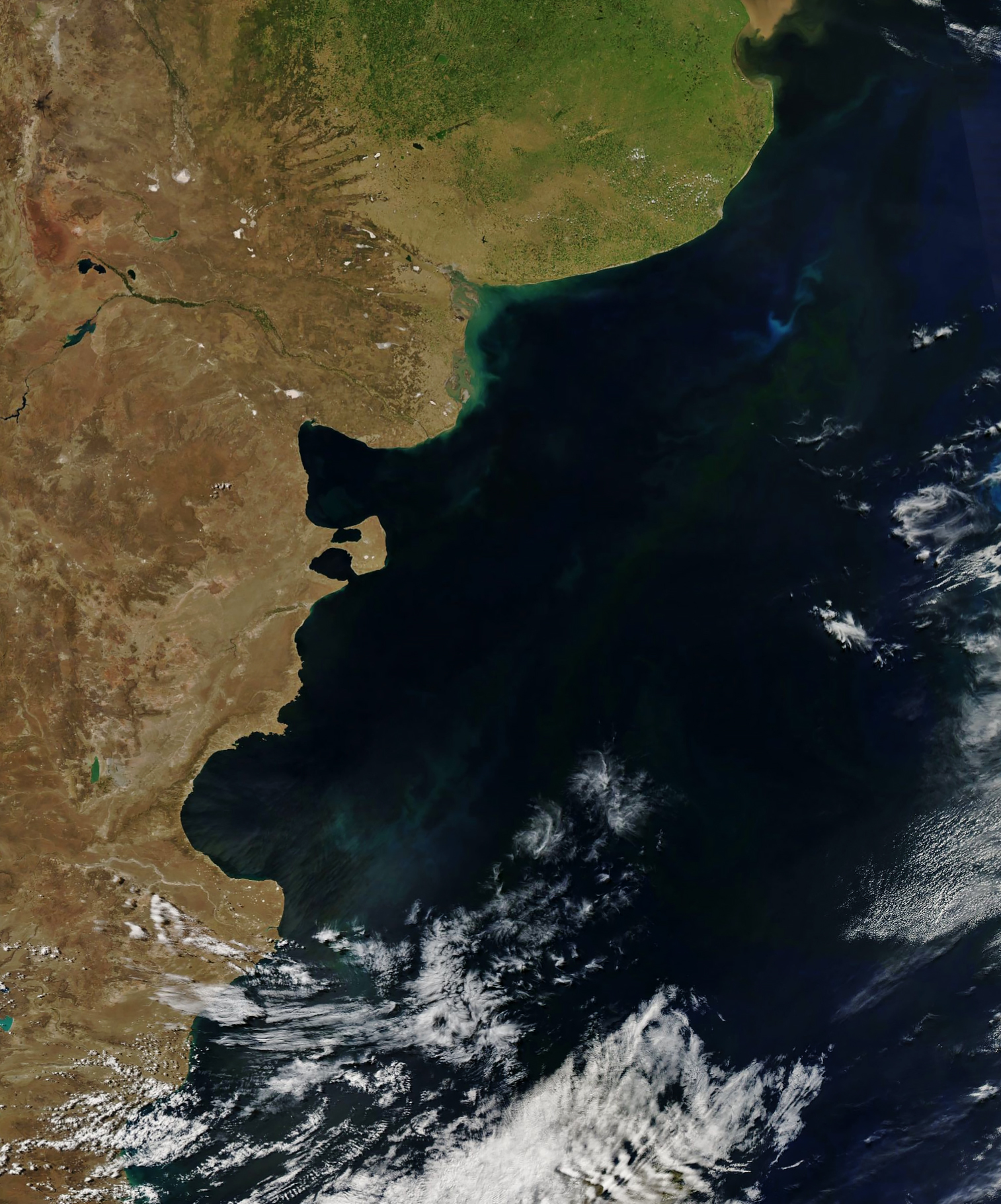
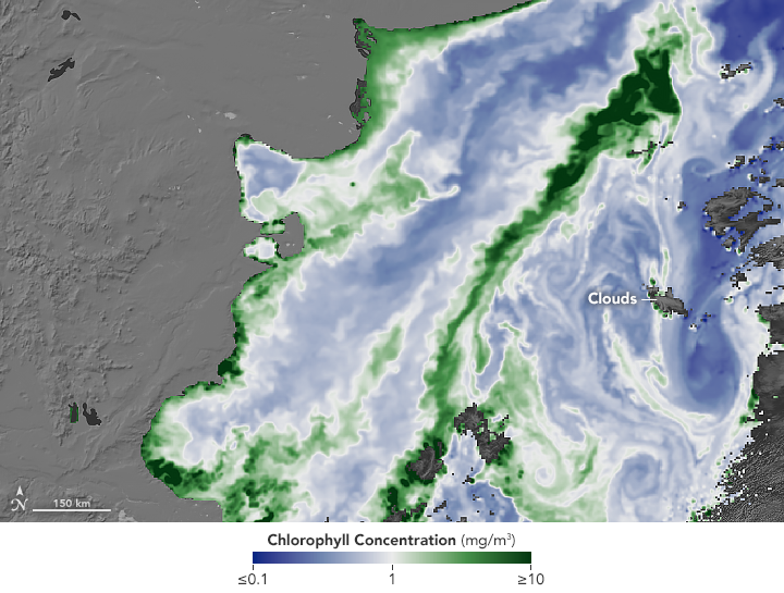
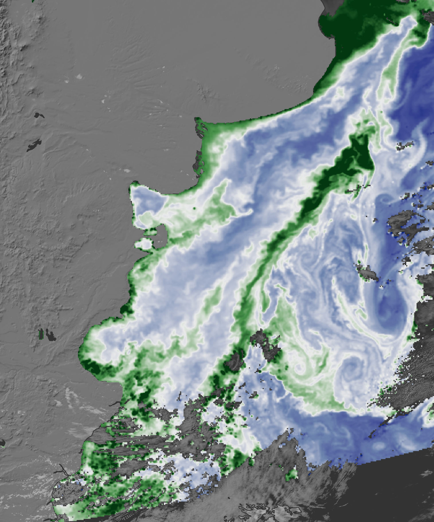
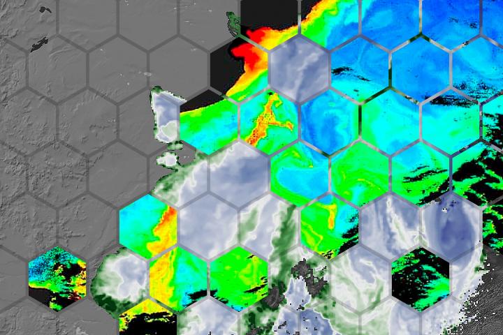
An Upended Ecosystem in the Arabian Sea
Published August 5, 2021
How can snow cover on the Himalayas influence the species that thrive in the ocean a thousand kilometers away?
Related images:
720 x 480
JPEG
1735 x 1584
1 MB - JPEG
720 x 545
JPEG
720 x 480
JPEG
4896 x 3672
5 MB - JPEG
720 x 745
JPEG
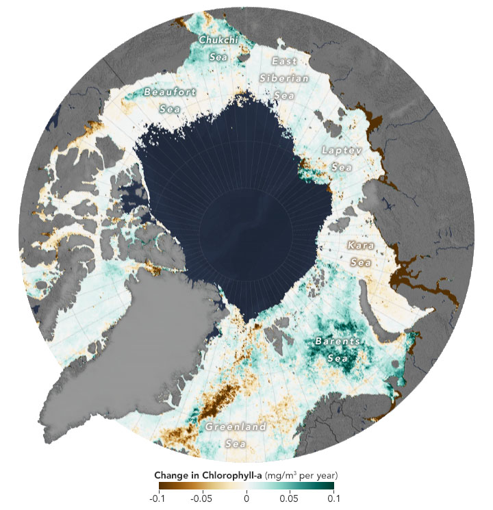
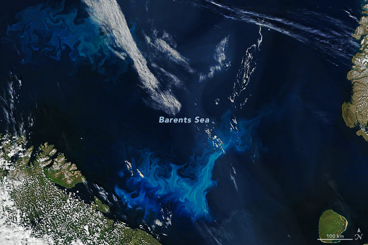
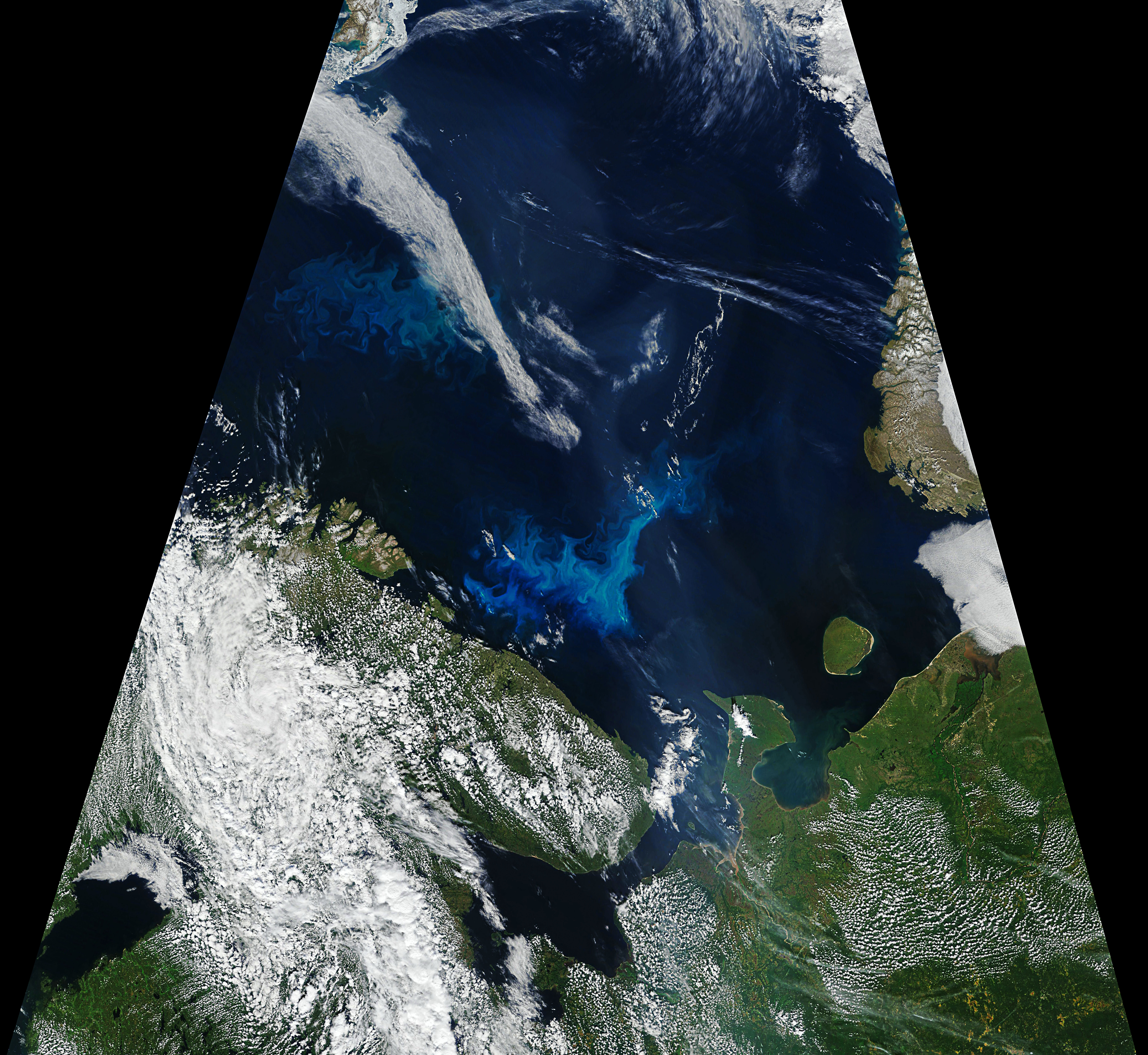
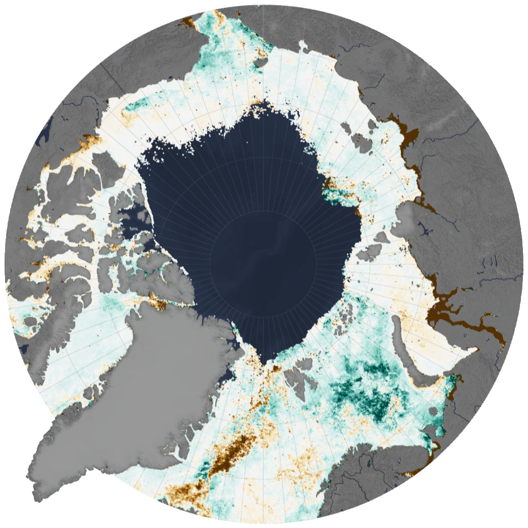
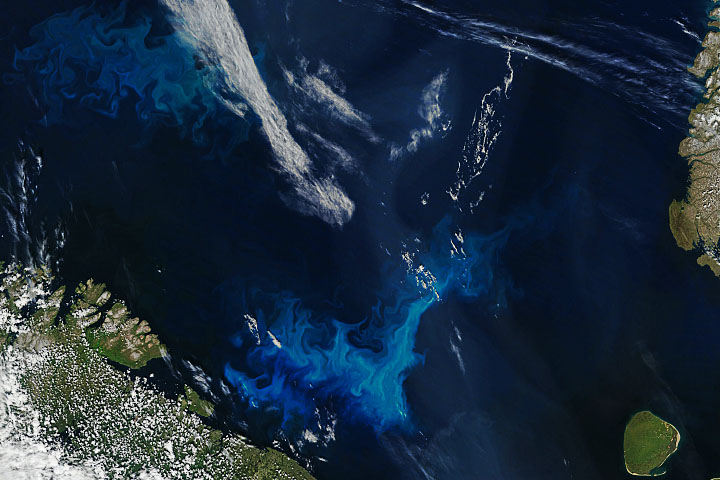
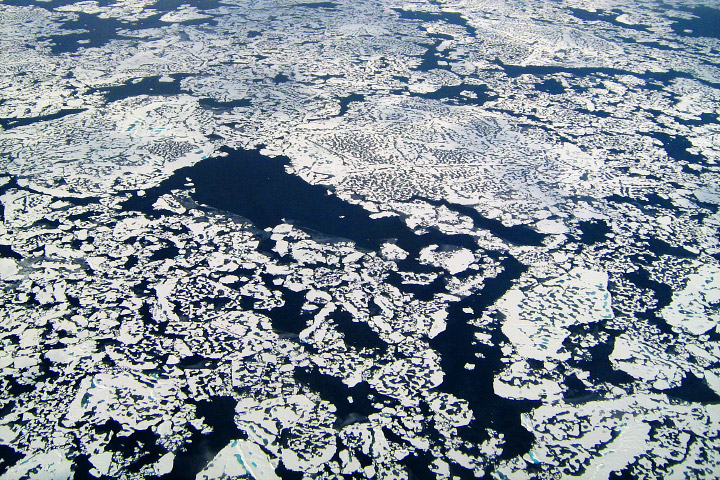
Phytoplankton Surge in Arctic Waters
Published July 30, 2020
The floating plant-like organisms are showing up in higher concentrations across the Arctic Ocean.
Related images:
720 x 480
JPEG
7407 x 6810
6 MB - JPEG
1050 x 1050
234 KB - JPEG
720 x 623
JPEG
Seeing the Sea Through the Years
Published April 30, 2019
In several decades of observing the ocean with satellites, our vision has changed as much as the sea.
Related images:
720 x 480
JPEG
1514 x 1821
1 MB - JPEG
720 x 545
PNG
1514 x 1821
354 KB - JPEG
720 x 268
PNG
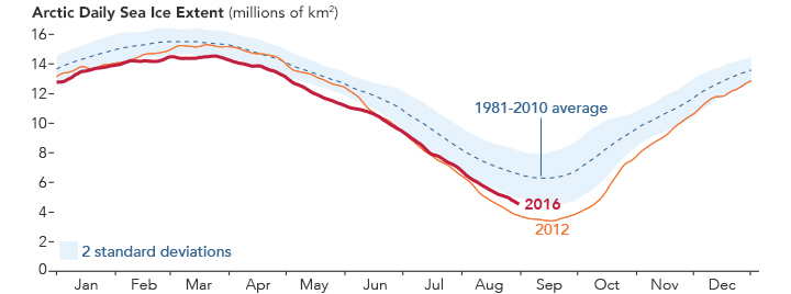
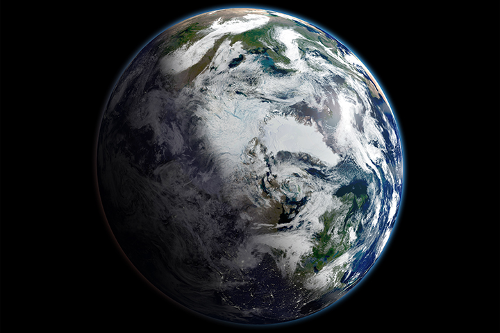
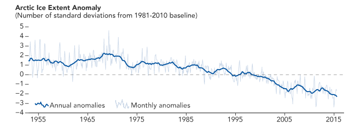
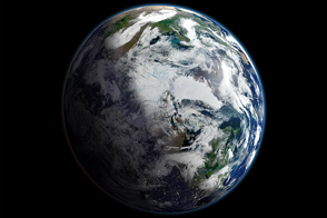
Mosaic of the Arctic
Published October 28, 2016
The fragility of our home planet is apparent in this view of the whole Arctic region in September 2012, when sea ice reached its lowest minimum extent ever observed in the satellite record.
Related images:
720 x 480
JPEG

5000 x 3333
6 MB - JPEG
720 x 249
PNG
720 x 599
JPEG
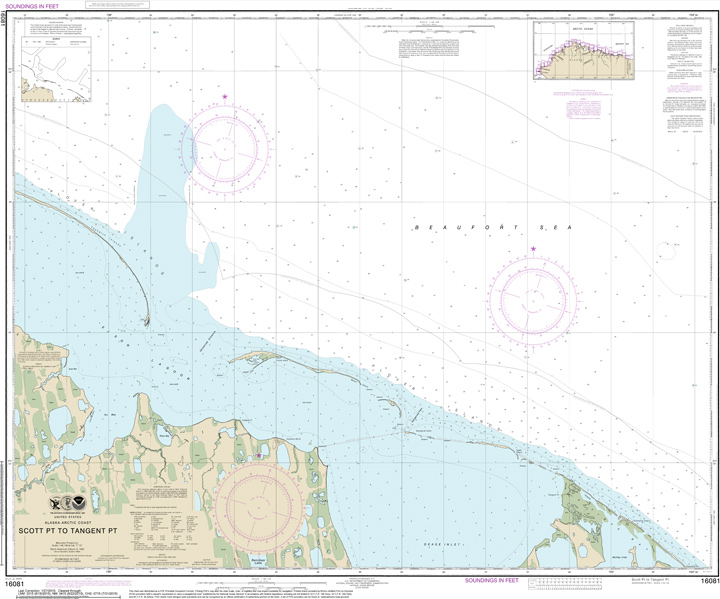
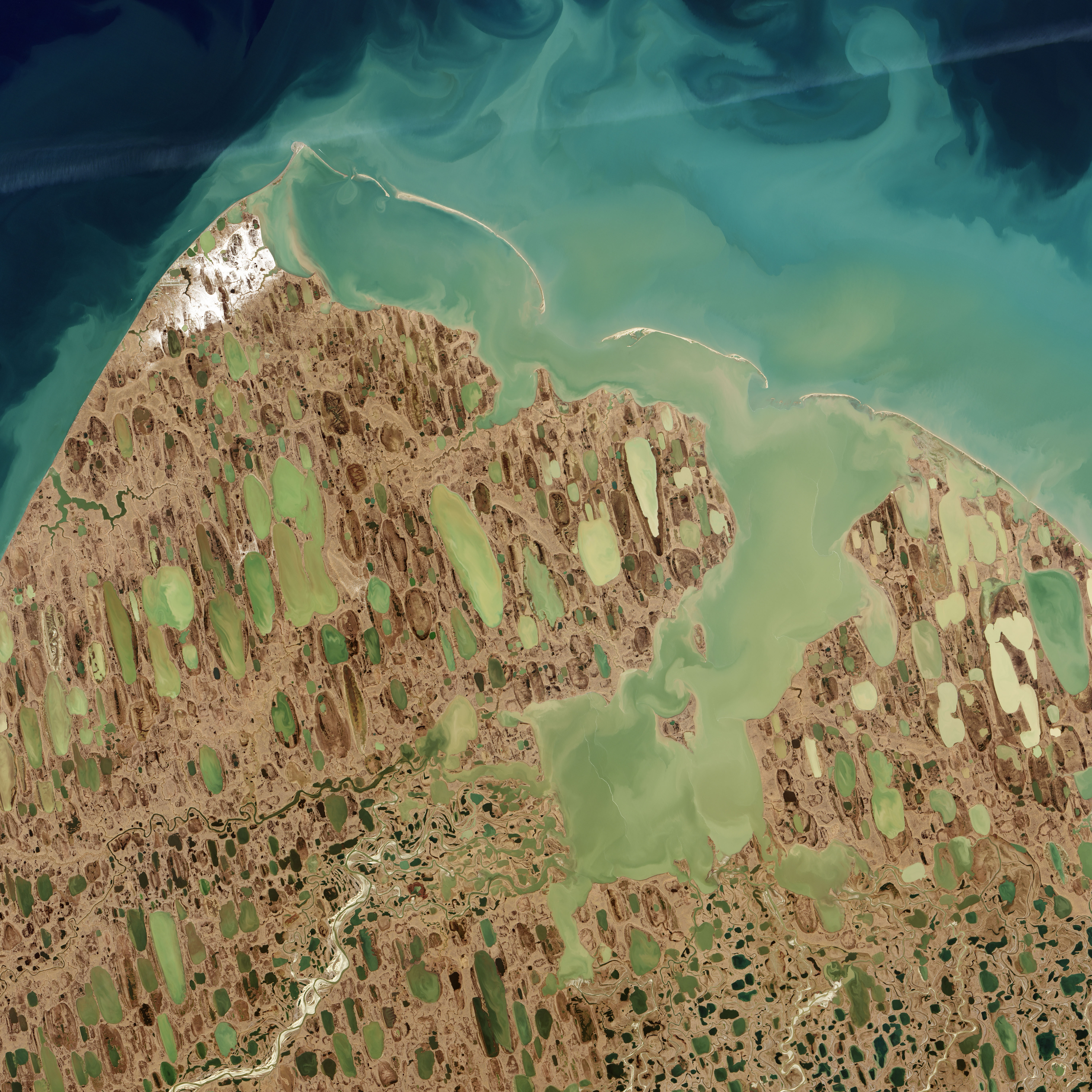
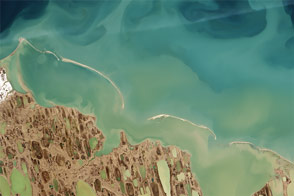
Finding Hidden Shoals on the North Slope
Published September 17, 2015
By analyzing satellite images of sediments, coastal researchers and cartographers can identify potential shallows, shoals, and shipping hazards.
Related images:

720 x 480
JPEG
6000 x 6000
5 MB - JPEG

6000 x 6000
67 MB - GeoTIFF

76 KB - KML/KMZ

3 MB - PDF
720 x 415
JPEG
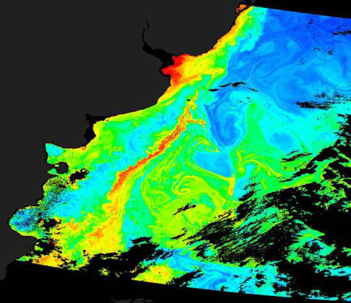
Changing Views of Fine Particulate Pollution
Published June 24, 2015
Improved data from several satellites illustrates how concentrations of fine particulate pollution have changed over time.
Related images:
2000 x 1333
975 KB - JPEG
720 x 415
JPEG
2000 x 1333
946 KB - JPEG
720 x 415
JPEG
Changing Views of Fine Particulate Pollution
Published June 24, 2015
Improved data from several satellites illustrates how concentrations of fine particulate pollution have changed over time.
Related images:
720 x 415
JPEG
2000 x 1333
975 KB - JPEG
2000 x 1333
946 KB - JPEG
720 x 480
JPEG
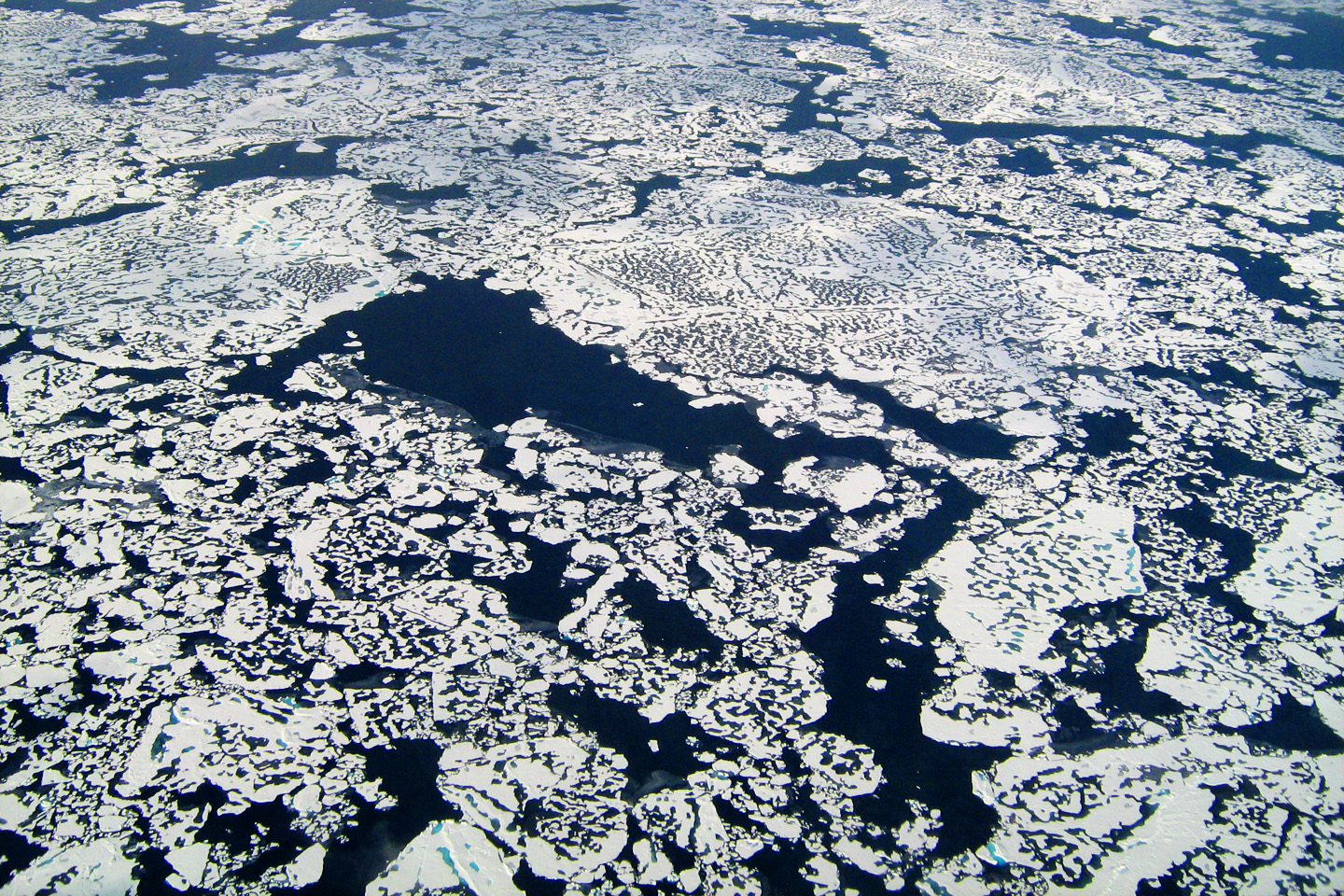
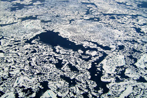
Methane Emissions from the Arctic Ocean
Published May 9, 2012
Airborne measurements detect the greenhouse gas rising out of cracks in the ice cap.
Related images:
1440 x 960
993 KB - JPEG
720 x 360
PNG
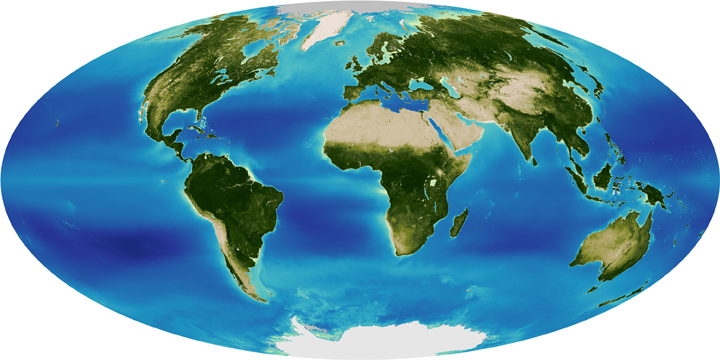
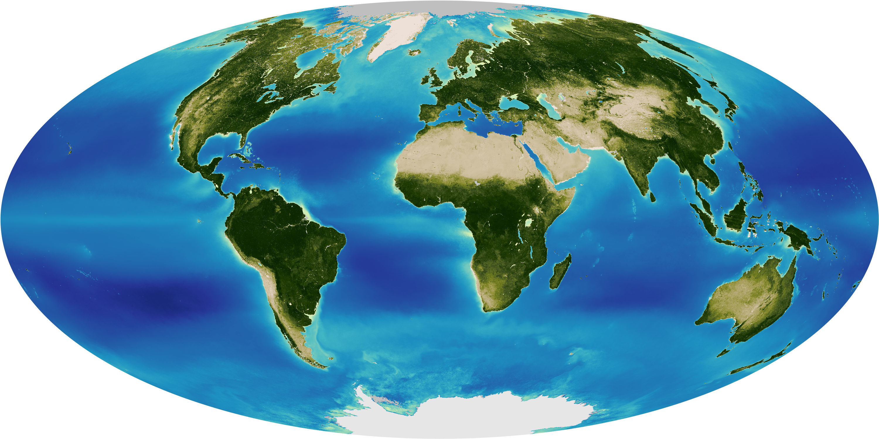
Thirteen Years of Greening from SeaWiFS
Published April 5, 2011
The image of SeaWiFS data as a global average over the entire 13-year record shows the greenness of Earth's oceans and land masses.
Related images:
3000 x 1500
4 MB - PNG