720 x 480
JPEG
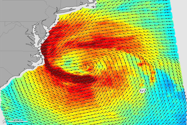
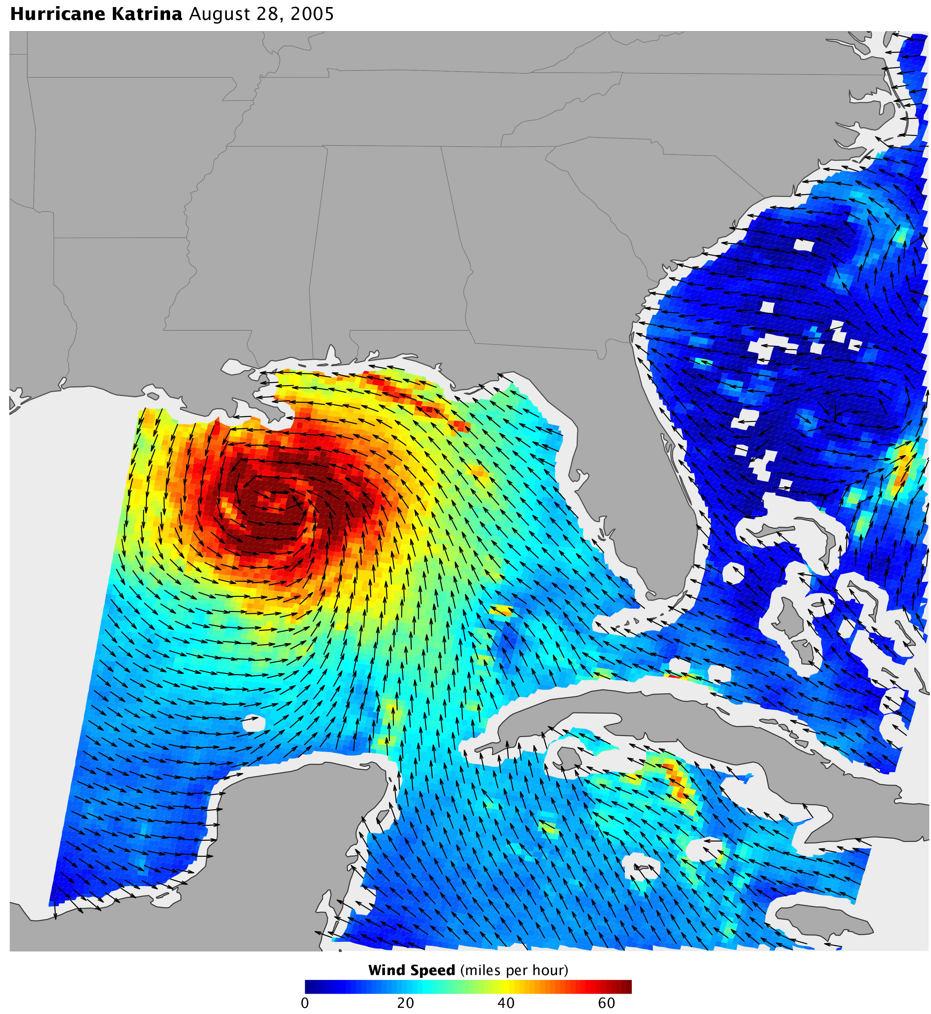
Comparing the Winds of Sandy and Katrina
Published November 6, 2012
The scenes of devastation and wreckage that these two hurricanes left behind were tragically similar, but the meteorology was very different.
Related images:
3001 x 3001
2 MB - JPEG
720 x 480
JPEG
3037 x 3306
1 MB - JPEG
720 x 480
JPEG
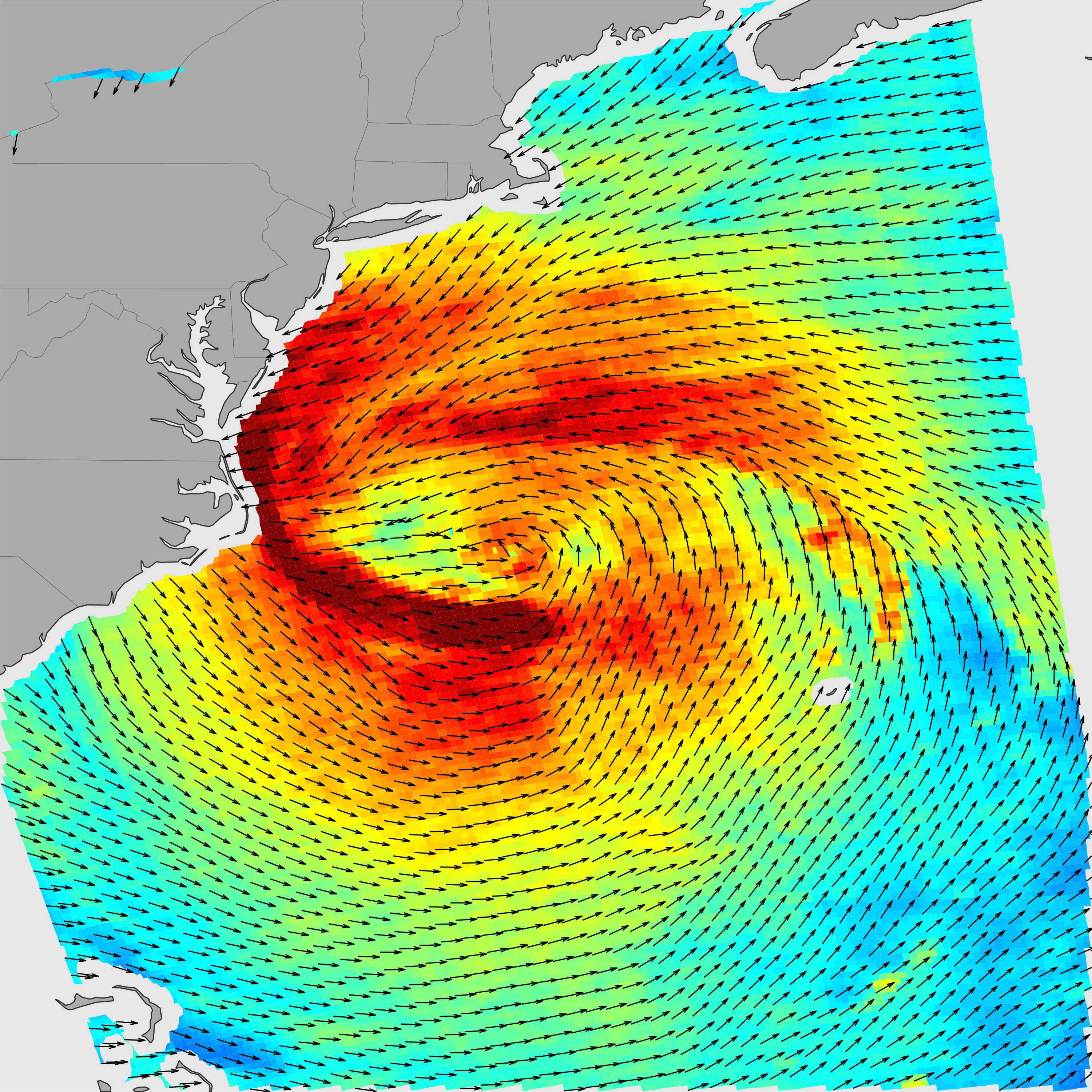
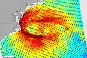
Comparing the Winds of Sandy and Katrina
Published November 6, 2012
The scenes of devastation and wreckage that these two hurricanes left behind were tragically similar, but the meteorology was very different.
Related images:
720 x 480
JPEG
3001 x 3001
2 MB - JPEG
3037 x 3306
1 MB - JPEG
720 x 720
JPEG
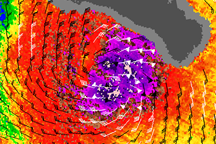
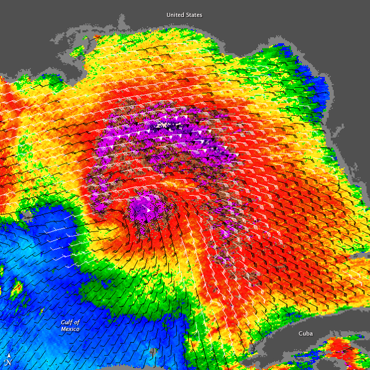
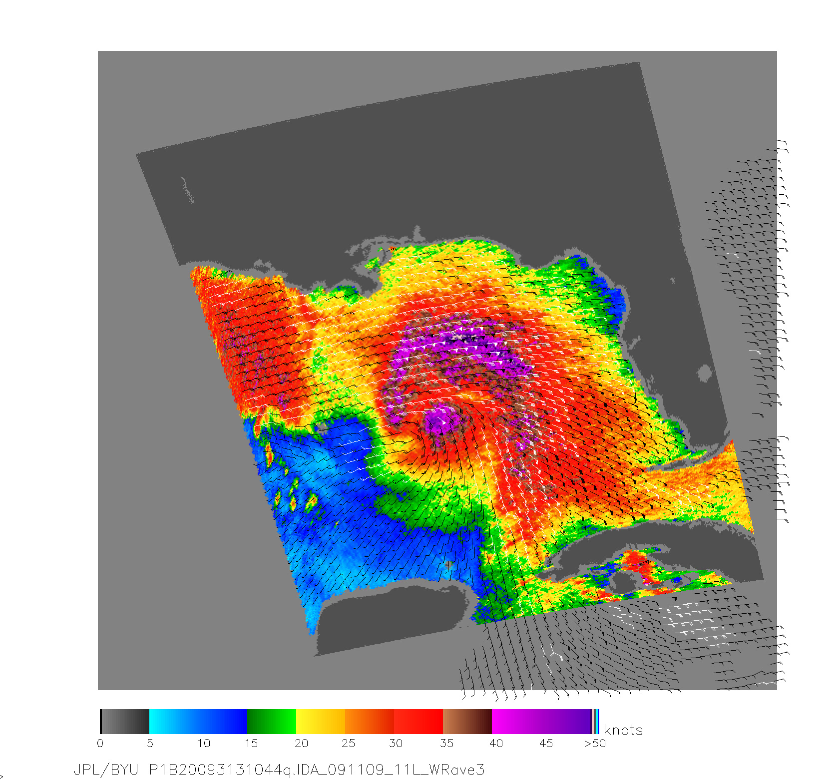
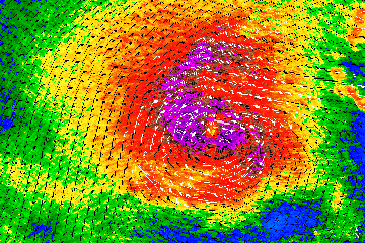
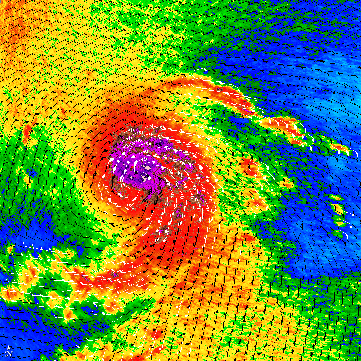
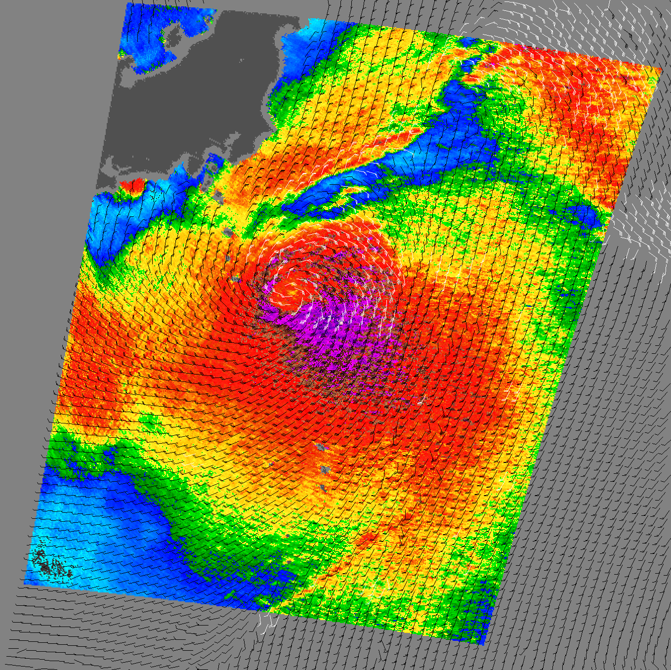
Hurricane Ida
Published November 9, 2009
Hurricane Ida has a concentrated center of strong winds in this visualization of the storm’s wind field as observed by the QuikSCAT satellite on November 9, 2009.
Related images:
1660 x 1560
895 KB - JPEG
720 x 480
JPEG
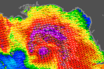
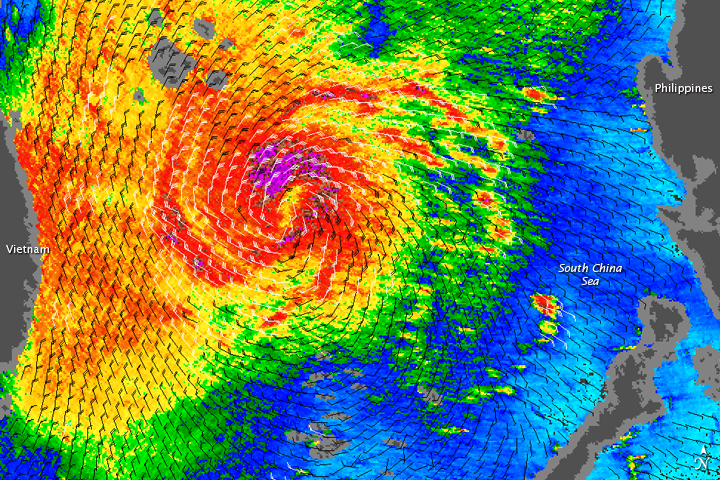
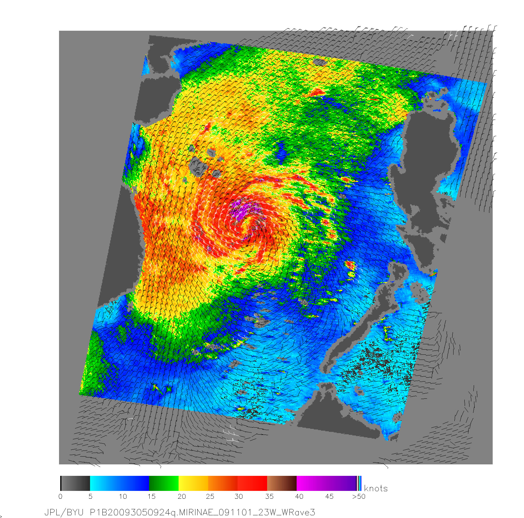
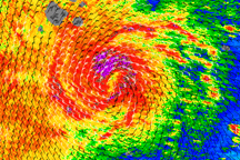
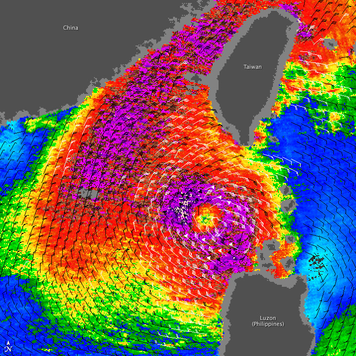
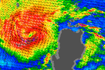
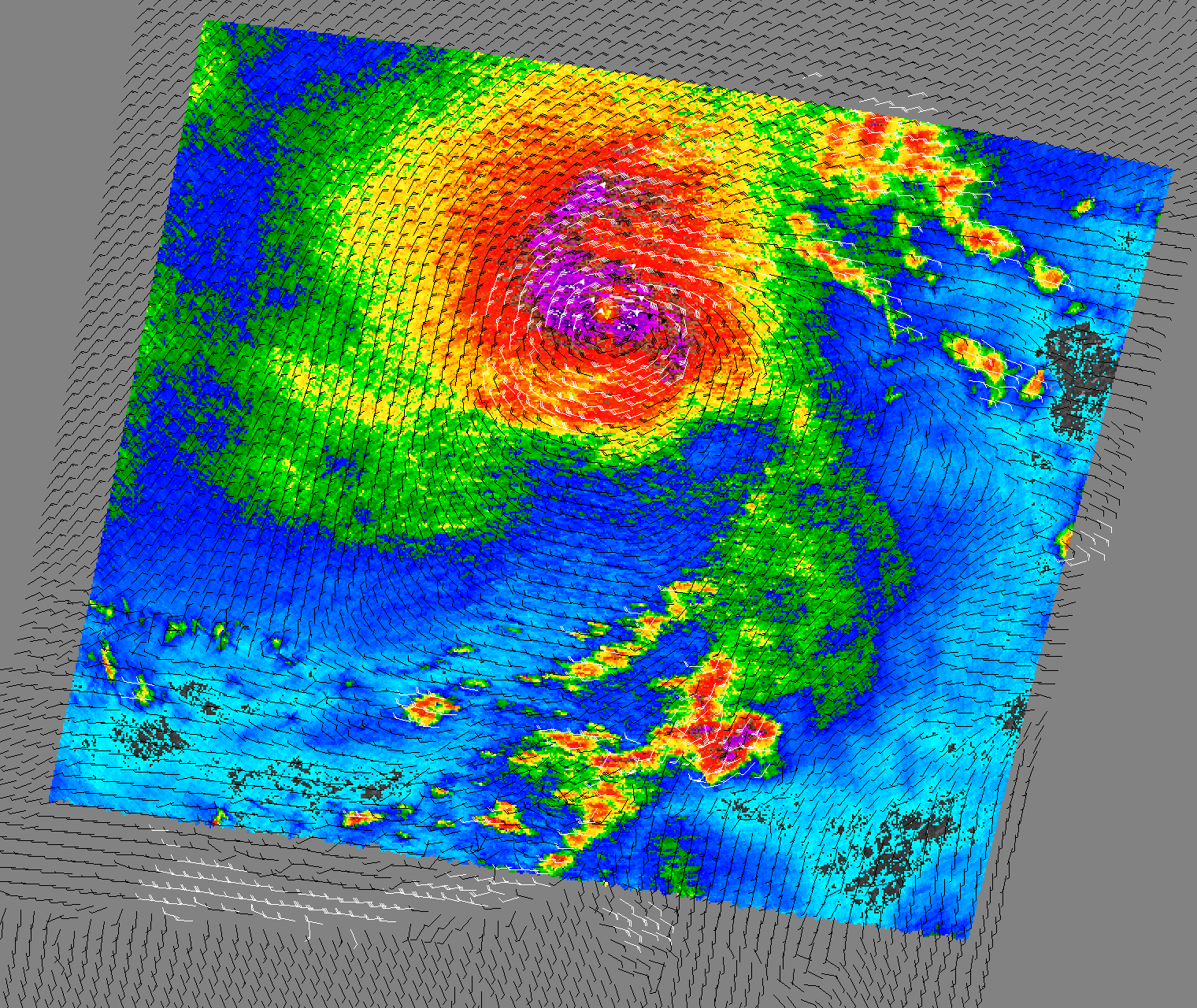
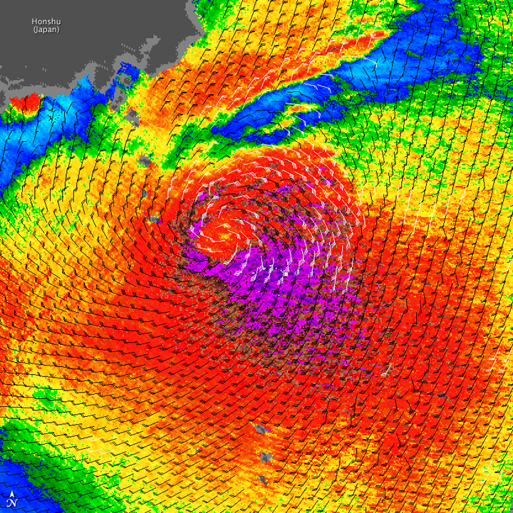
Typhoon Mirinae
Published November 3, 2009
Although Mirinae was weakening, its winds maintained the classic spiral structure associated with well-organized tropical cyclones in this image of the storm’s wind structure on November 1, 2009.
Related images:
1740 x 1720
1 MB - JPEG
720 x 720
JPEG
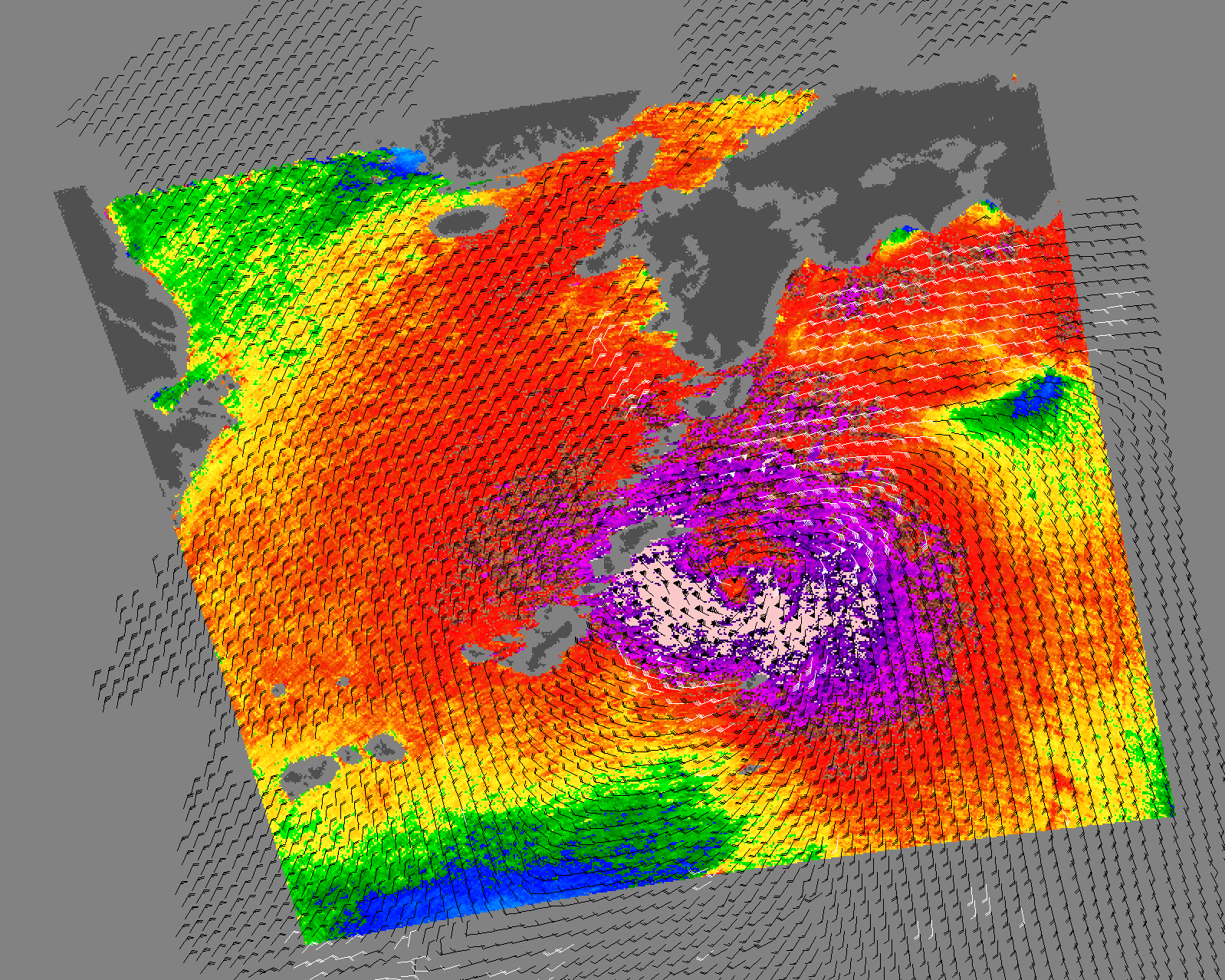
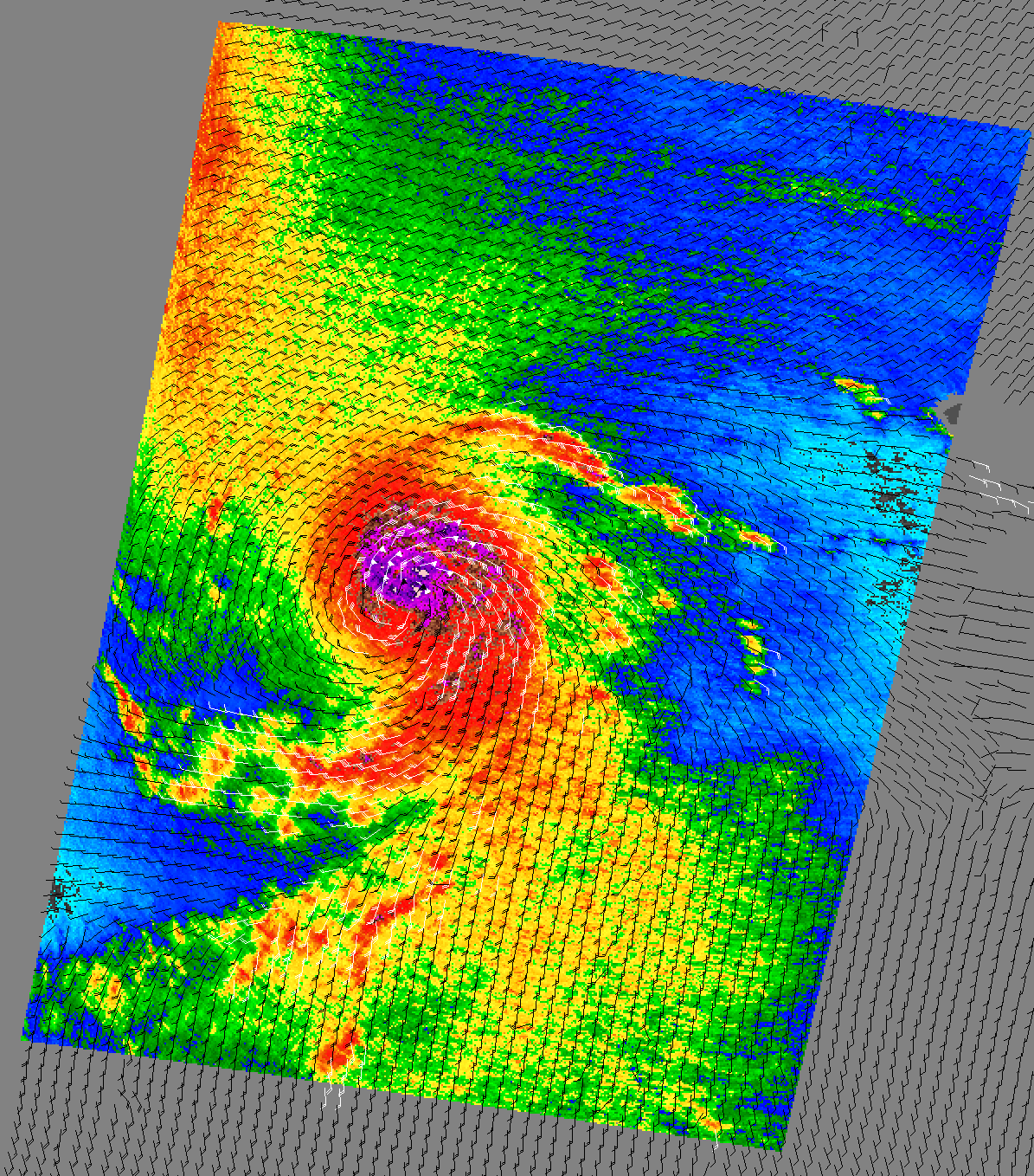
Typhoon Lupit
Published October 22, 2009
This color-coded image shows wind speeds associated with Typhoon Lupit on October 22, 2009.
Related images:
1441 x 1360
3 MB - JPEG
720 x 720
JPEG
Super Typhoon Melor
Published October 7, 2009
This image depicts winds associated with Typhoon Melor on October 7, 2009.
Related images:
1598 x 1278
2 MB - JPEG
720 x 720
JPEG
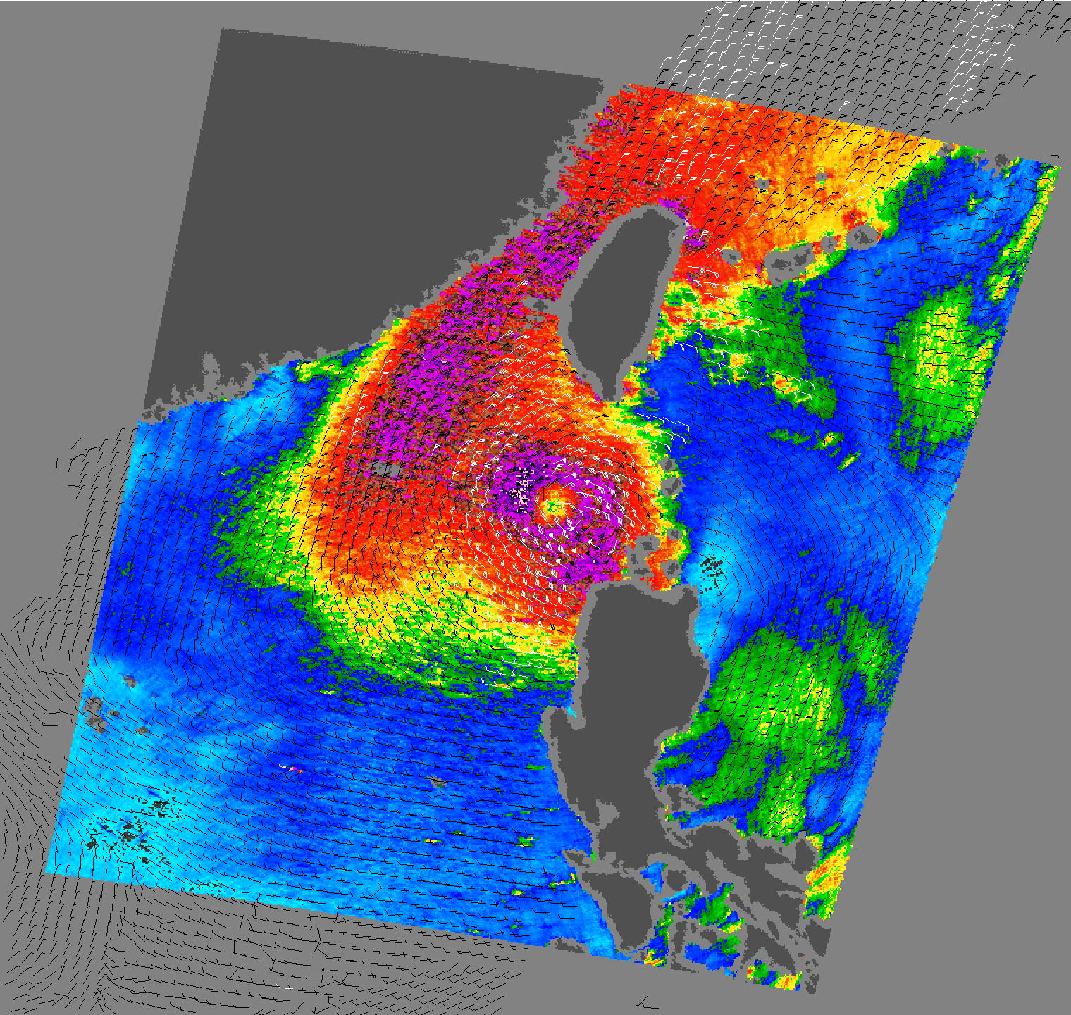
Typhoon Parma
Published October 5, 2009
As this wind speed image illustrates, Tropical Storm Parma still had a core of strong winds on October 5, 2009.
Related images:
1520 x 1441
2 MB - JPEG
720 x 480
PNG
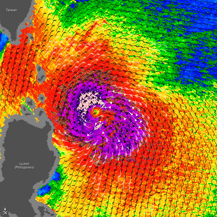
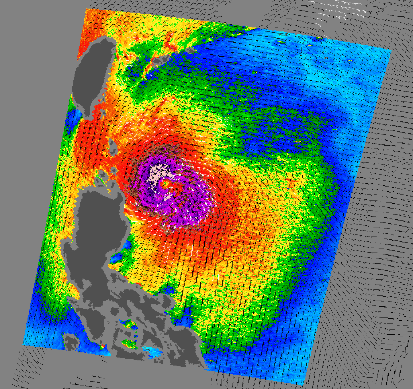
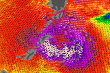
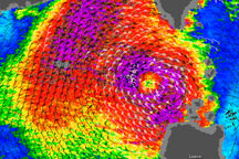
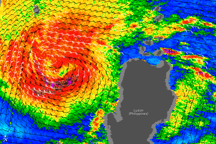
Tropical Storm Mujigae
Published September 11, 2009
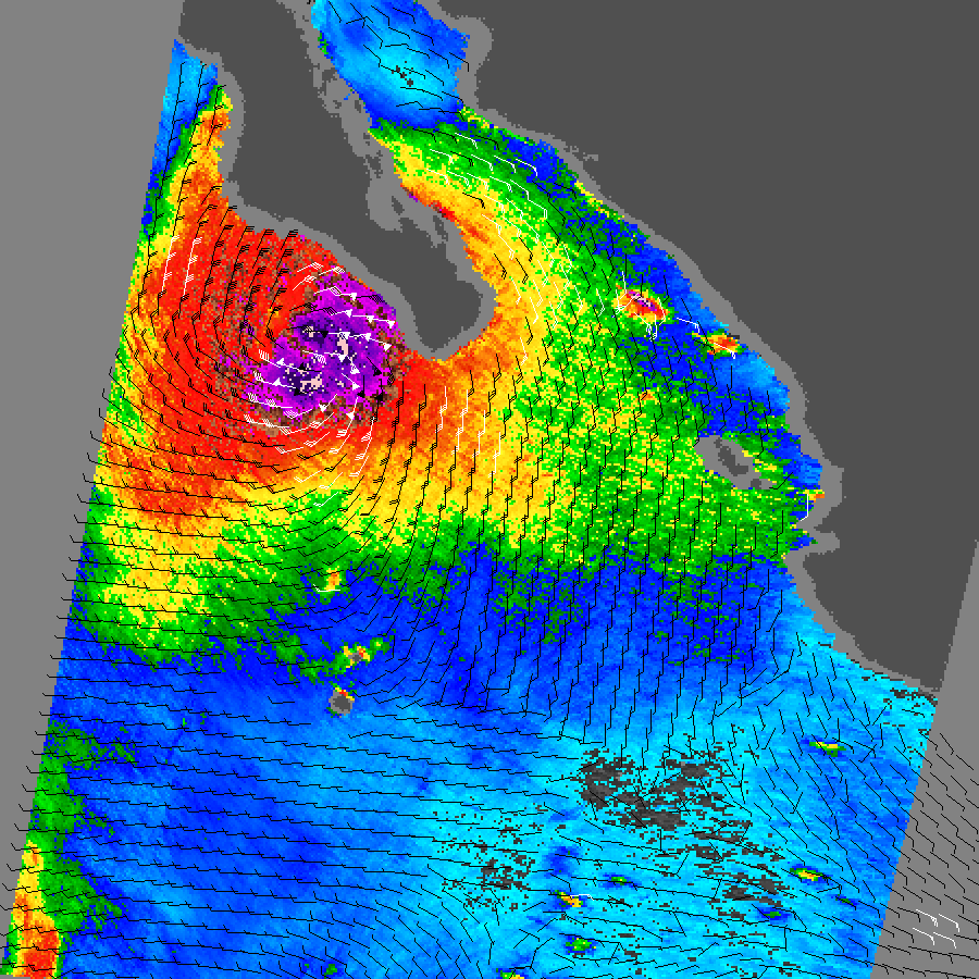
Acquired September 9, 2009, this image uses color coding and barbs to indicate wind speed and direction for Tropical Storm Mujigae. The image captures the storm center immediately west of the Philippine island of Luzon.
Related images:

1040 x 1198
2 MB - JPEG
720 x 480
JPEG
Tropical Storm Linda
Published September 11, 2009
This image uses color codes and barbs to show relative wind speeds and wind directions of Tropical Storm Linda on September 10, 2009.
Related images:
1520 x 1280
3 MB - JPEG

720 x 720
PNG
Hurricane Fred
Published September 10, 2009
In this image of wind speed and direction, Hurricane Fred exhibits a distinctive “s” shape—a structure left over, perhaps, from its time as a Category 4 storm.
Related images:
1195 x 1358
755 KB - PNG
720 x 720
PNG
Tropical Storm Dujuan
Published September 9, 2009
This image shows the wind structure inside Tropical Storm Dujuan as observed by the QuikSCAT satellite on September 8.
Related images:
1358 x 1356
3 MB - JPEG
720 x 480
PNG
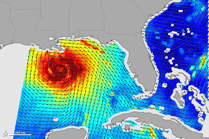
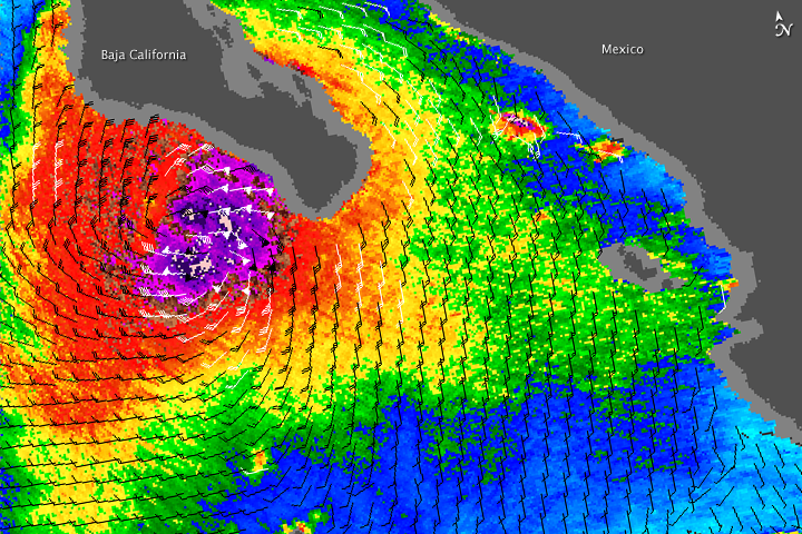
Hurricane Jimena
Published September 4, 2009
In this QuikSCAT image, Hurricane Jimena has a core of strong winds, shown in purple and pink, surrounded target-like by gradually weakening winds.
Related images:
900 x 900
301 KB - PNG