720 x 715
JPEG
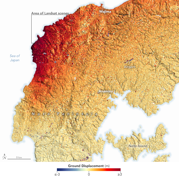
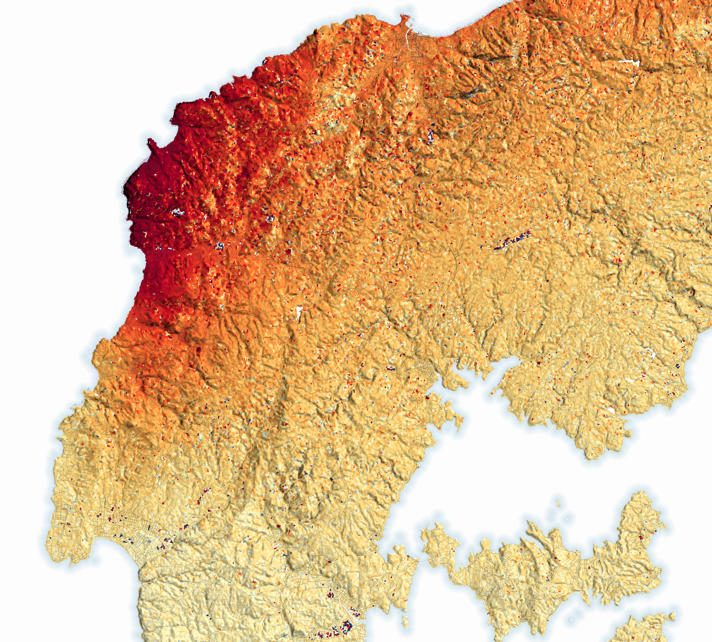
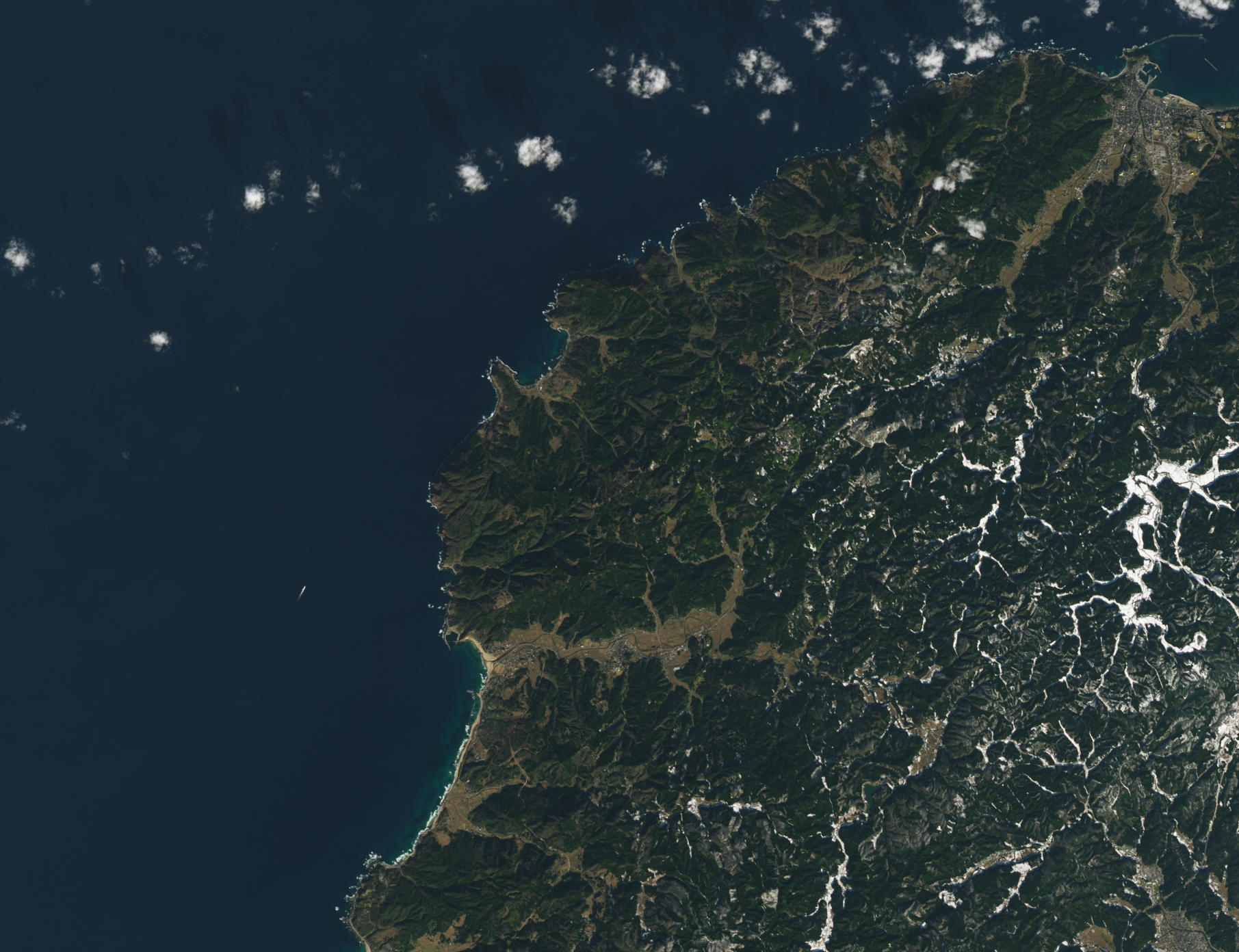
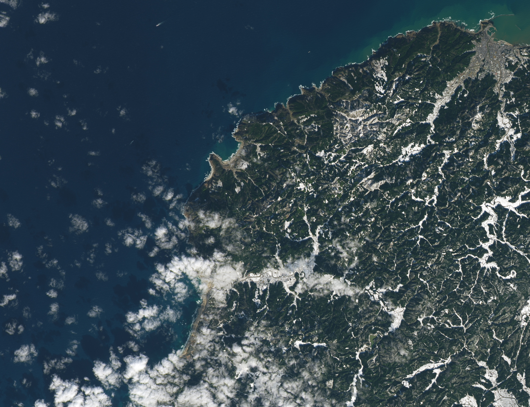
Earthquake Lifts the Noto Peninsula
Published January 23, 2024
Some parts of the peninsula rose up to 4 meters (13 feet), shifting the position of coastlines and leaving some ports dry.
Related images:
2363 x 2133
5 MB - JPEG

MPEG
1811 x 1392
1 MB - JPEG
1811 x 1392
2 MB - JPEG

720 x 480
JPEG
Earthquake Damage in Türkiye
Published February 9, 2023
Scientists from NASA and other agencies are using satellites to map damage caused by the devastating earthquake.
Related images:
720 x 480
JPEG
5817 x 6535
18 MB - JPEG
720 x 480
JPEG
Earthquake Damage in Türkiye
Published February 9, 2023
Scientists from NASA and other agencies are using satellites to map damage caused by the devastating earthquake.
Related images:
720 x 480
JPEG
5817 x 6535
18 MB - JPEG
720 x 480
JPEG
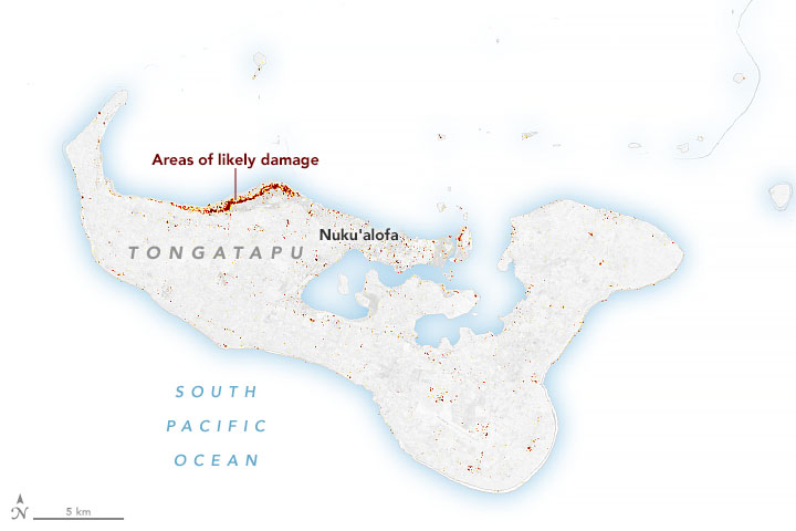
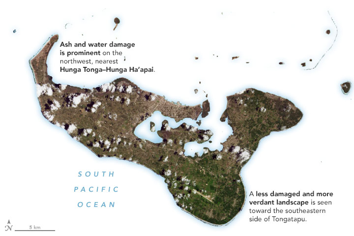
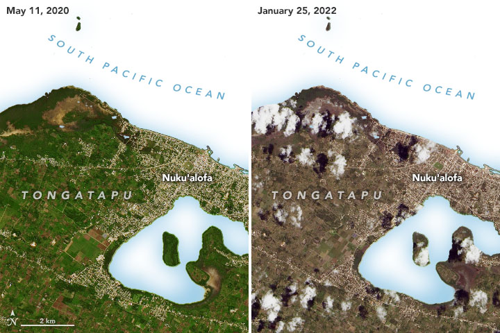
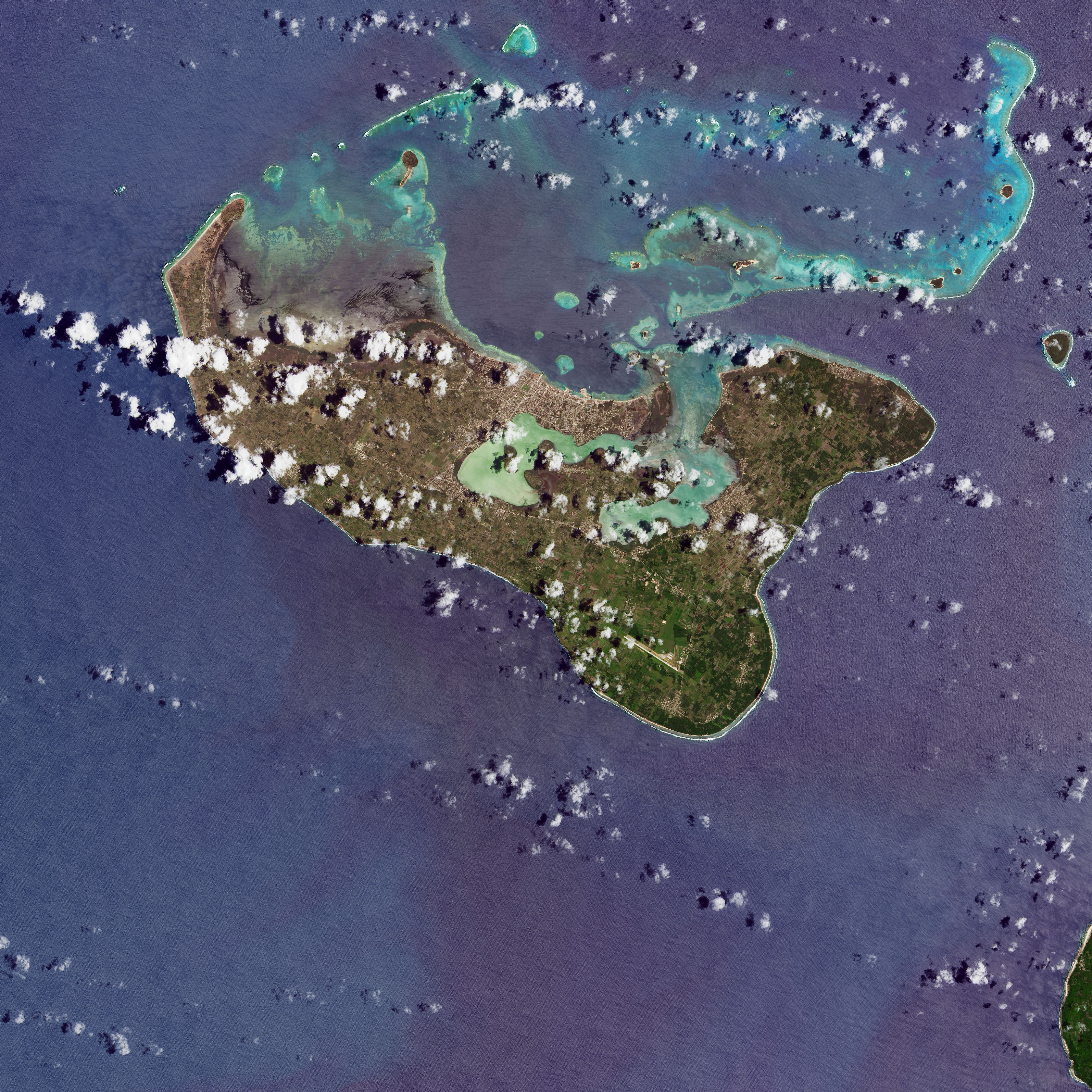
Island Nation Hit Hard by Eruption
Published January 28, 2022
Tsunami waves battered the coasts of several Tongan islands and ash blankets everything.
Related images:
720 x 480
JPEG
720 x 480
JPEG
3189 x 3189
3 MB - JPEG

3189 x 3189
1 MB - JPEG
5863 x 4895
466 KB - JPEG
720 x 480
PNG
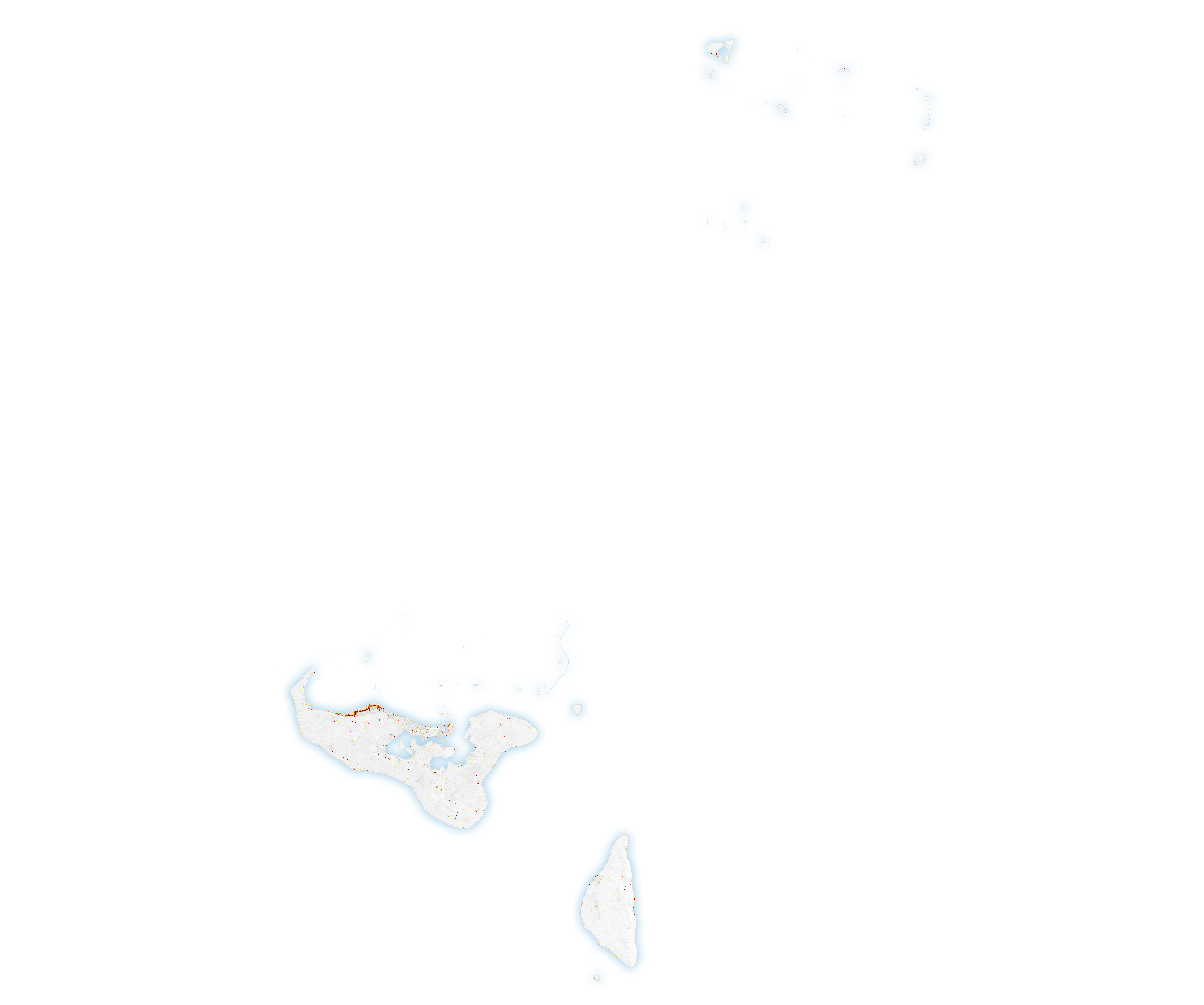
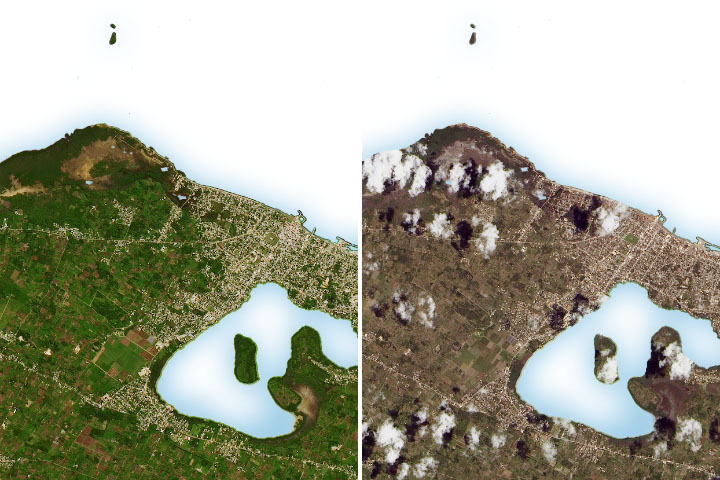
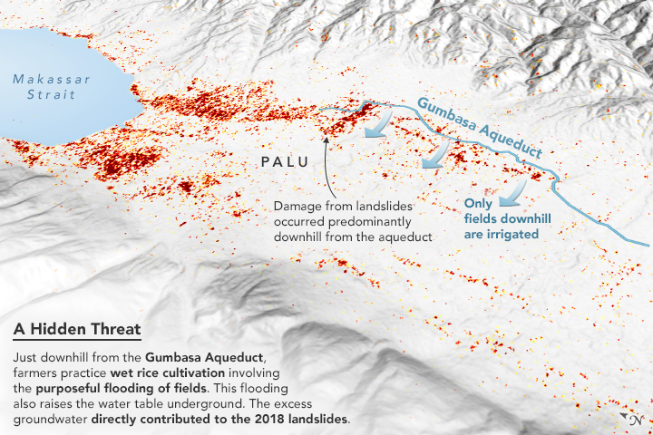
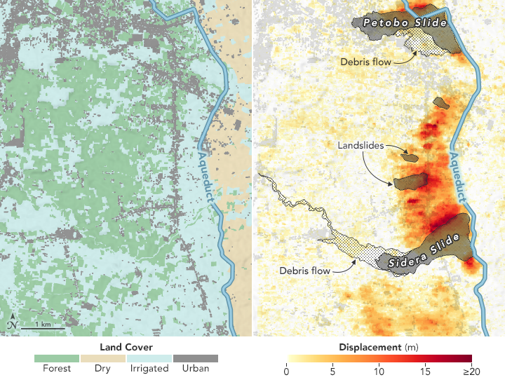
Palu Landslides Linked to Rice Irrigation
Published November 1, 2019
An earthquake in Indonesia made the land flow like mud in a place where science previously said it shouldn't.
Related images:
720 x 545
PNG

720 x 545
JPEG
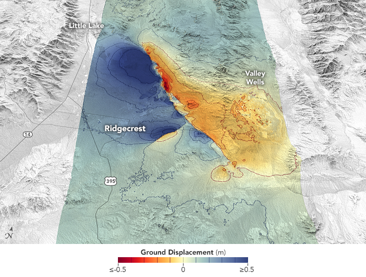
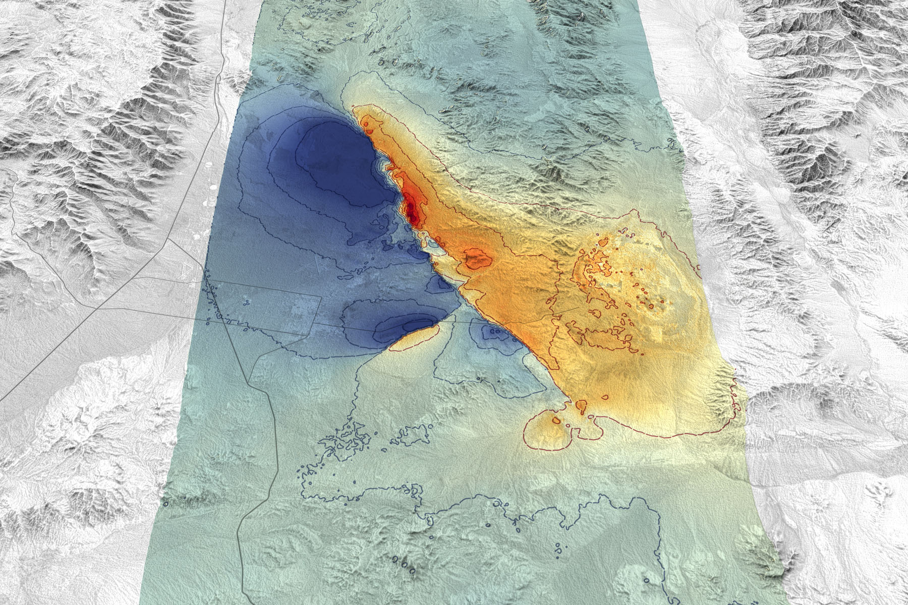
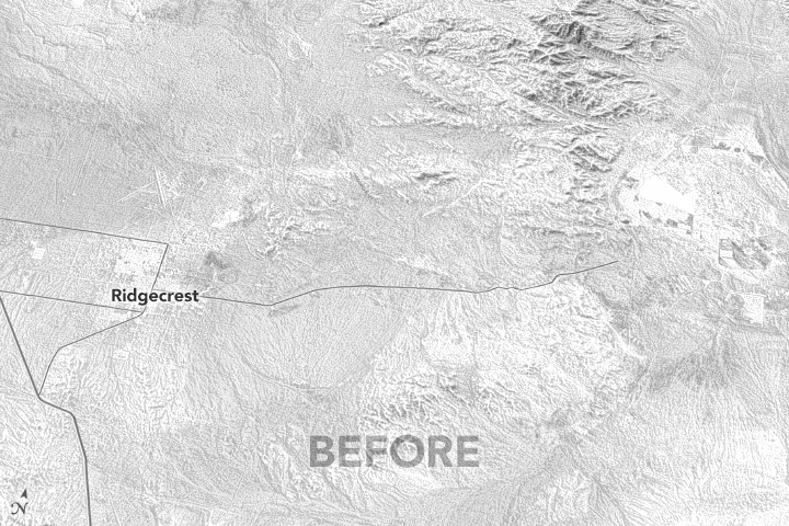
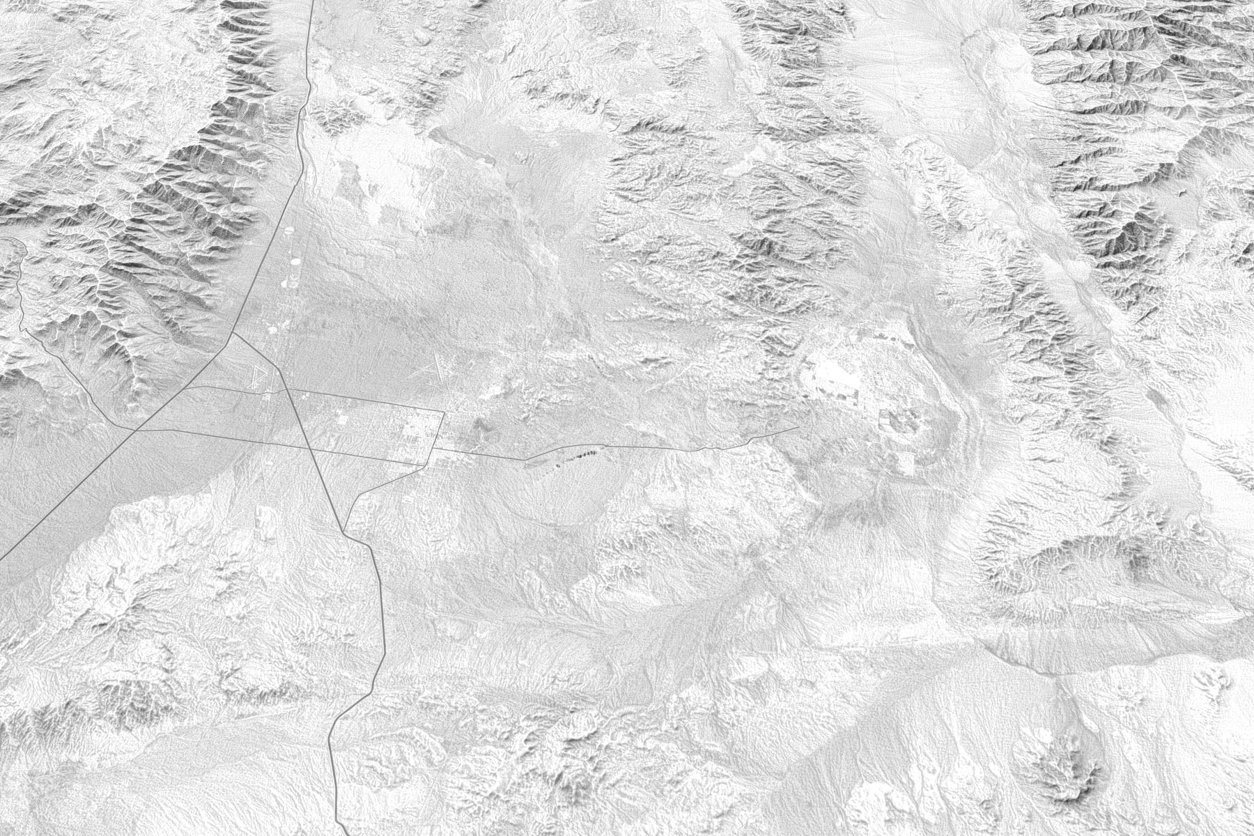
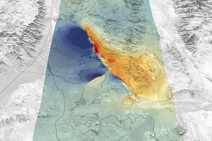
Measuring Movement from the Ridgecrest Quake
Published July 25, 2019
Remote sensing scientists are getting better at measuring such events and showing how they disrupt and move the land surface.
Related images:
1800 x 1200
604 KB - JPEG
720 x 480
GIF

1800 x 1200
588 KB - JPEG
1800 x 1200
588 KB - JPEG
720 x 480
GIF
Measuring Movement from the Ridgecrest Quake
Published July 25, 2019
Remote sensing scientists are getting better at measuring such events and showing how they disrupt and move the land surface.
Related images:
720 x 545
JPEG
1800 x 1200
604 KB - JPEG
1800 x 1200
588 KB - JPEG
1800 x 1200
588 KB - JPEG
1800 x 1200
588 KB - JPEG
Measuring Movement from the Ridgecrest Quake
Published July 25, 2019
Remote sensing scientists are getting better at measuring such events and showing how they disrupt and move the land surface.
Related images:
720 x 545
JPEG
1800 x 1200
604 KB - JPEG
720 x 480
GIF
1800 x 1200
588 KB - JPEG
1800 x 1200
588 KB - JPEG
Measuring Movement from the Ridgecrest Quake
Published July 25, 2019
Remote sensing scientists are getting better at measuring such events and showing how they disrupt and move the land surface.
Related images:
720 x 545
JPEG
1800 x 1200
604 KB - JPEG
720 x 480
GIF
1800 x 1200
588 KB - JPEG