720 x 480
JPEG
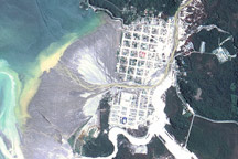
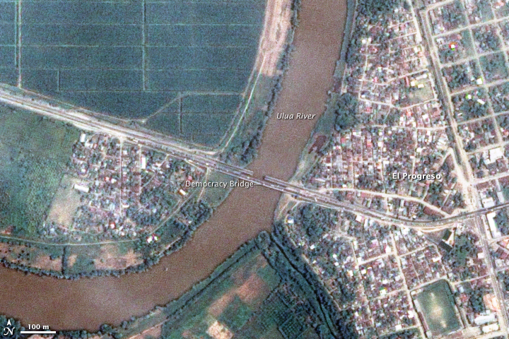
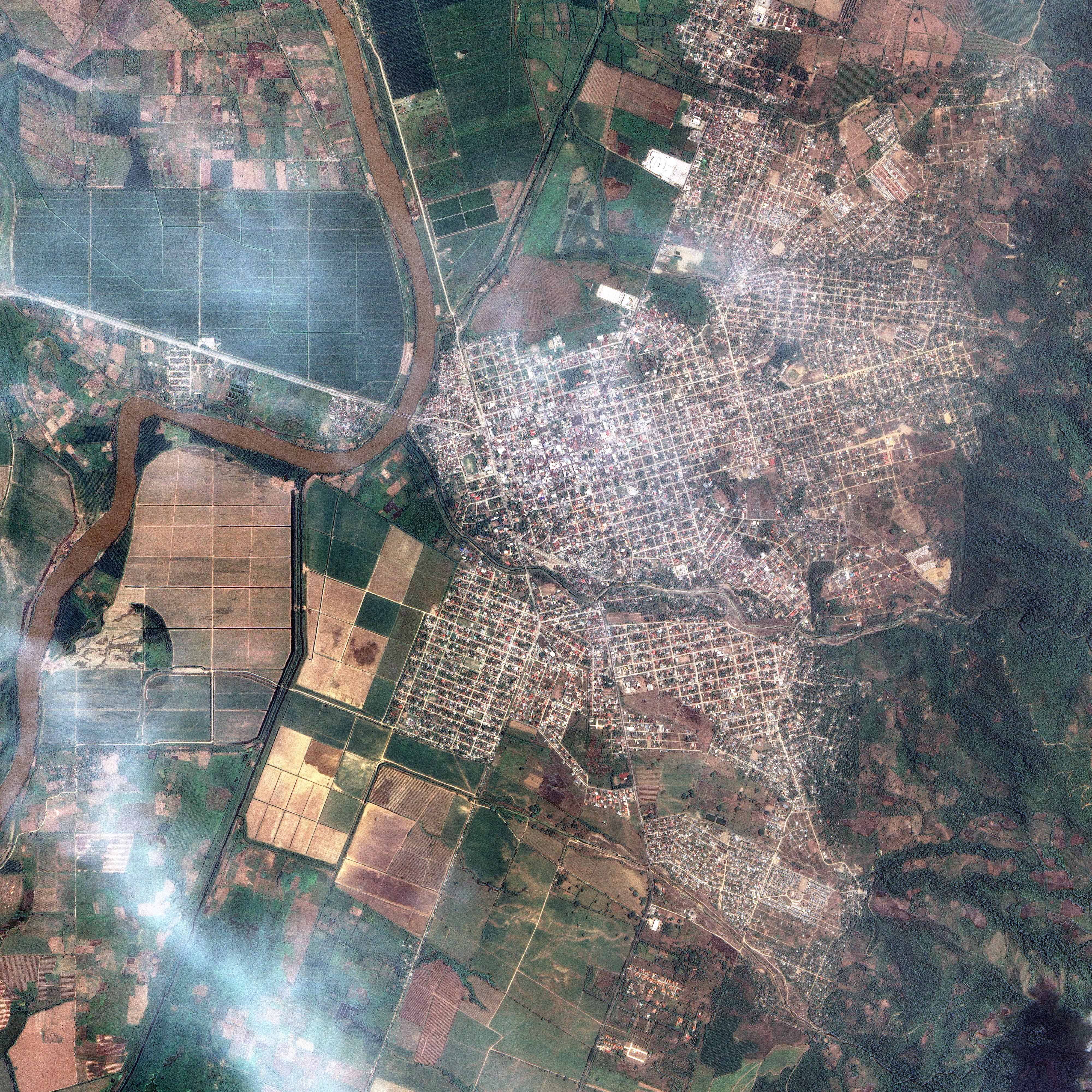
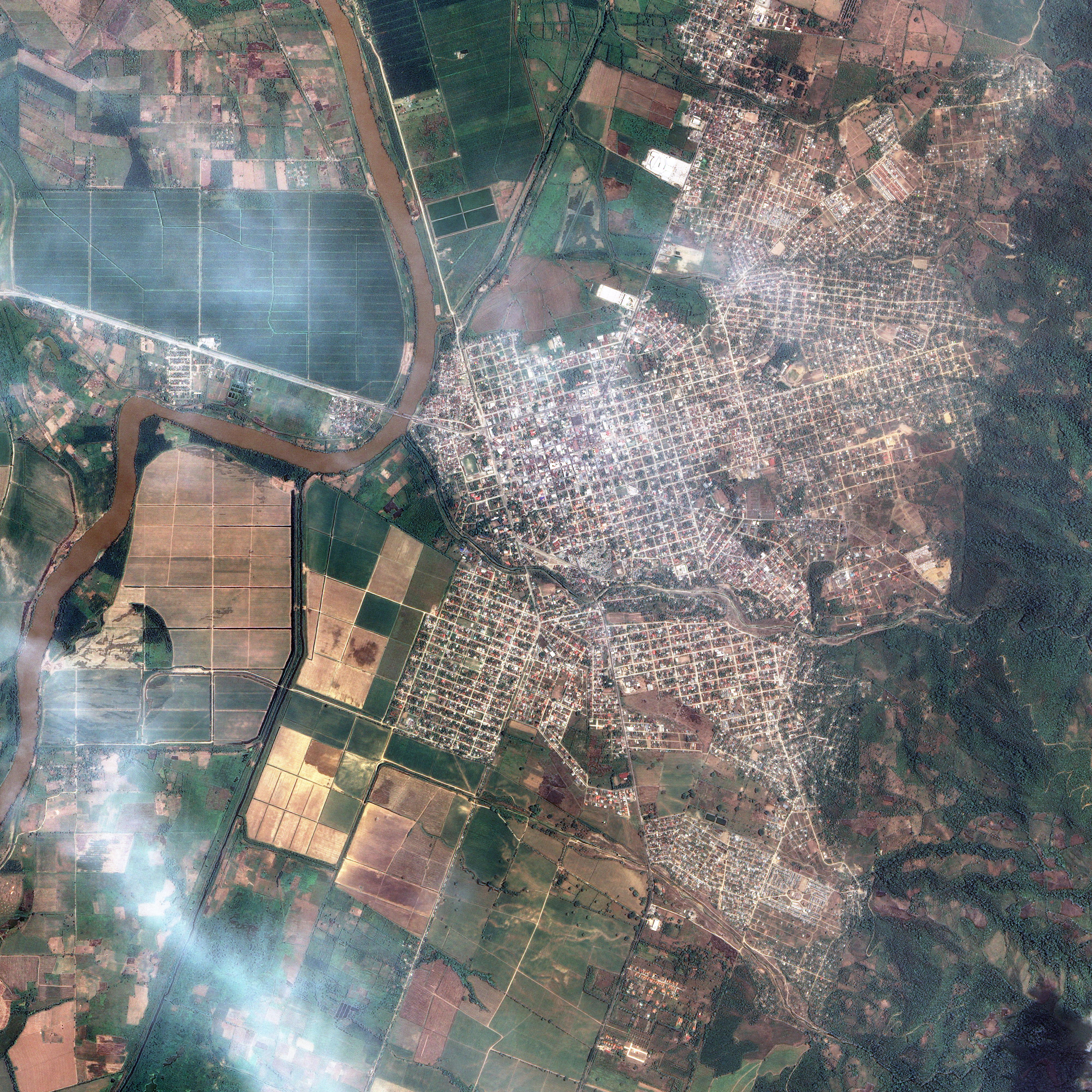
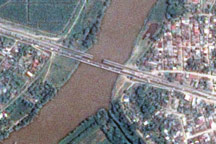
Democracy Bridge Damaged by Earthquake
Published June 3, 2009
The day after a powerful 7.3-magnitude earthquake shook Honduras, Taiwan’s Formosat-2 satellite captured this detailed, photo-like image showing the collapsed span of the earthquake-damaged Democracy bridge.
Related images:
4000 x 4000
6 MB - JPEG
4000 x 4000
53 MB - GeoTIFF

57 KB - KML/KMZ

4000 x 4000
53 MB - GeoTIFF
Democracy Bridge Damaged by Earthquake
Published June 3, 2009
The day after a powerful 7.3-magnitude earthquake shook Honduras, Taiwan’s Formosat-2 satellite captured this detailed, photo-like image showing the collapsed span of the earthquake-damaged Democracy bridge.
Related images:
720 x 480
JPEG
4000 x 4000
6 MB - JPEG
57 KB - KML/KMZ
57 KB - KML/KMZ
Democracy Bridge Damaged by Earthquake
Published June 3, 2009
The day after a powerful 7.3-magnitude earthquake shook Honduras, Taiwan’s Formosat-2 satellite captured this detailed, photo-like image showing the collapsed span of the earthquake-damaged Democracy bridge.
Related images:
720 x 480
JPEG
4000 x 4000
6 MB - JPEG
4000 x 4000
53 MB - GeoTIFF
720 x 720
JPEG
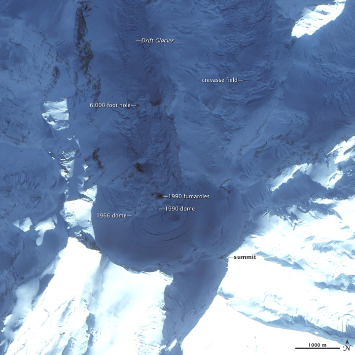
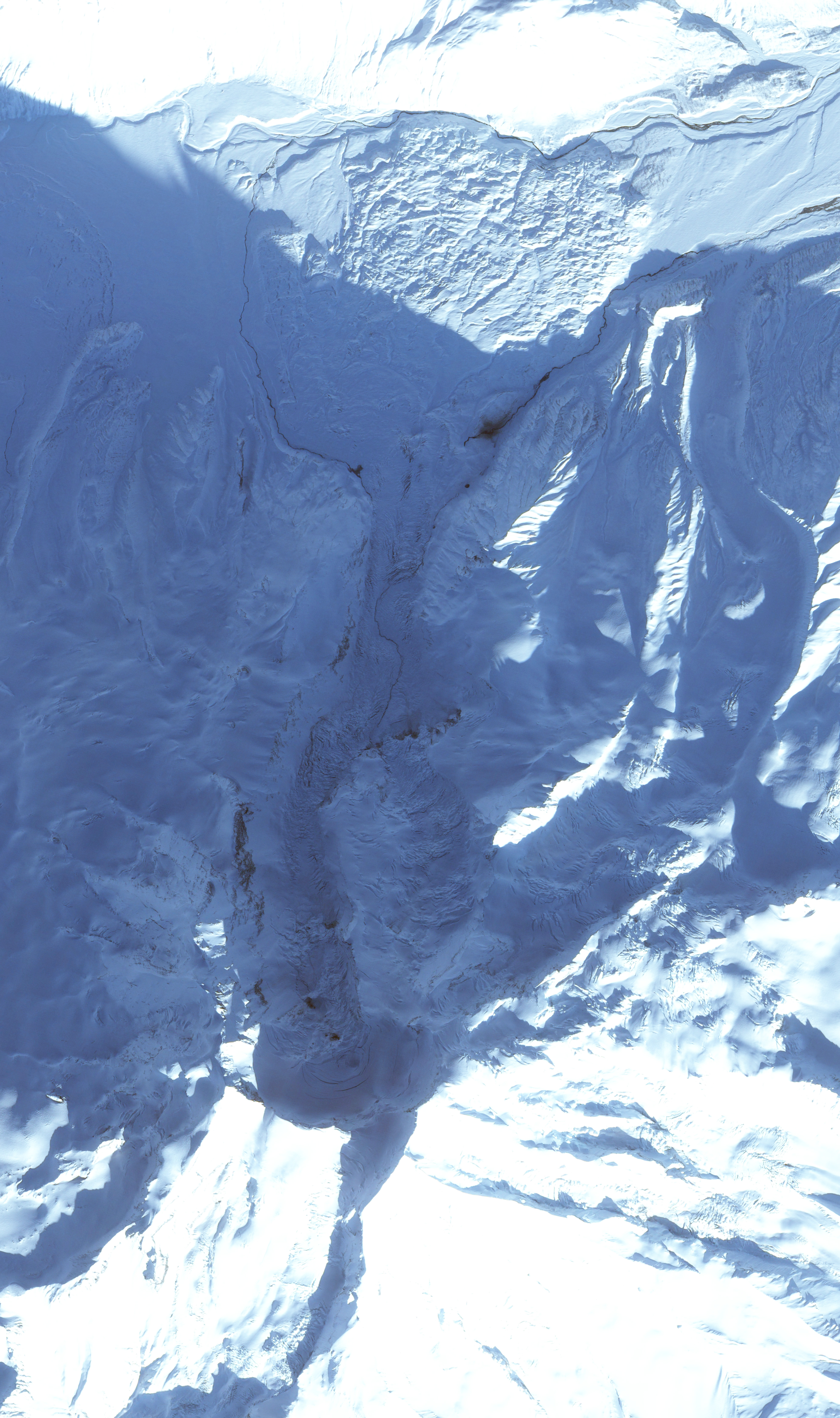
Redoubt Volcano Summit
Published February 27, 2009
This satellite image shows volcanic features on the summit of Redoubt Volcano, Alaska. Scientists believe an eruption at the volcano is likely in the coming weeks and months.
Related images:
3952 x 6671
5 MB - JPEG
43 KB - KML/KMZ
43 KB - KML/KMZ
Redoubt Volcano Summit
Published February 27, 2009
This satellite image shows volcanic features on the summit of Redoubt Volcano, Alaska. Scientists believe an eruption at the volcano is likely in the coming weeks and months.
Related images:
720 x 720
JPEG
3952 x 6671
5 MB - JPEG
720 x 480
JPEG
Floods in Australia
Published February 20, 2009
Flood waters nearly surround the tiny town of Normanton, Australia in this satellite image.
Related images:
13529 x 13169
25 MB - JPEG

8000 x 8000
125 MB - GeoTIFF
25 KB - KML/KMZ
25 KB - KML/KMZ
Floods in Australia
Published February 20, 2009
Flood waters nearly surround the tiny town of Normanton, Australia in this satellite image.
Related images:
720 x 480
JPEG
13529 x 13169
25 MB - JPEG
8000 x 8000
125 MB - GeoTIFF
8000 x 8000
125 MB - GeoTIFF
Floods in Australia
Published February 20, 2009
Flood waters nearly surround the tiny town of Normanton, Australia in this satellite image.
Related images:
720 x 480
JPEG
13529 x 13169
25 MB - JPEG
25 KB - KML/KMZ
720 x 480
JPEG
Volcanic Activity on Mt. Asama, Japan
Published February 20, 2009
Volcanic ash covers the upper slopes of Mount Asama, the most active volcano on the island of Honshu, Japan
Related images:
4526 x 4526
3 MB - JPEG
720 x 540
JPEG
November 2008 Alu/Dalaffilla Fissure Eruption
Published February 4, 2009
The landscape of the Afar region in northern Ethiopia results from tectonic forces working deep below the surface, both splitting Africa apart and producing volcanic eruptions. Lava from a November 2008 eruption at the Erta Ale Range remained visible months later.
Related images:
7700 x 9720
7 MB - JPEG
46 KB - KML/KMZ

46 KB - KML/KMZ
November 2008 Alu/Dalaffilla Fissure Eruption
Published February 4, 2009
The landscape of the Afar region in northern Ethiopia results from tectonic forces working deep below the surface, both splitting Africa apart and producing volcanic eruptions. Lava from a November 2008 eruption at the Erta Ale Range remained visible months later.
Related images:
720 x 540
JPEG
7700 x 9720
7 MB - JPEG
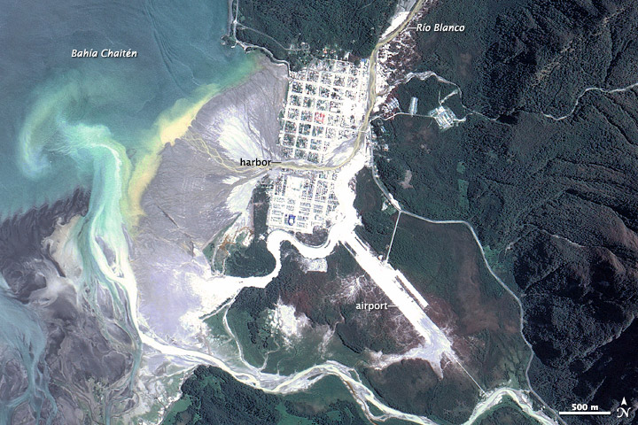
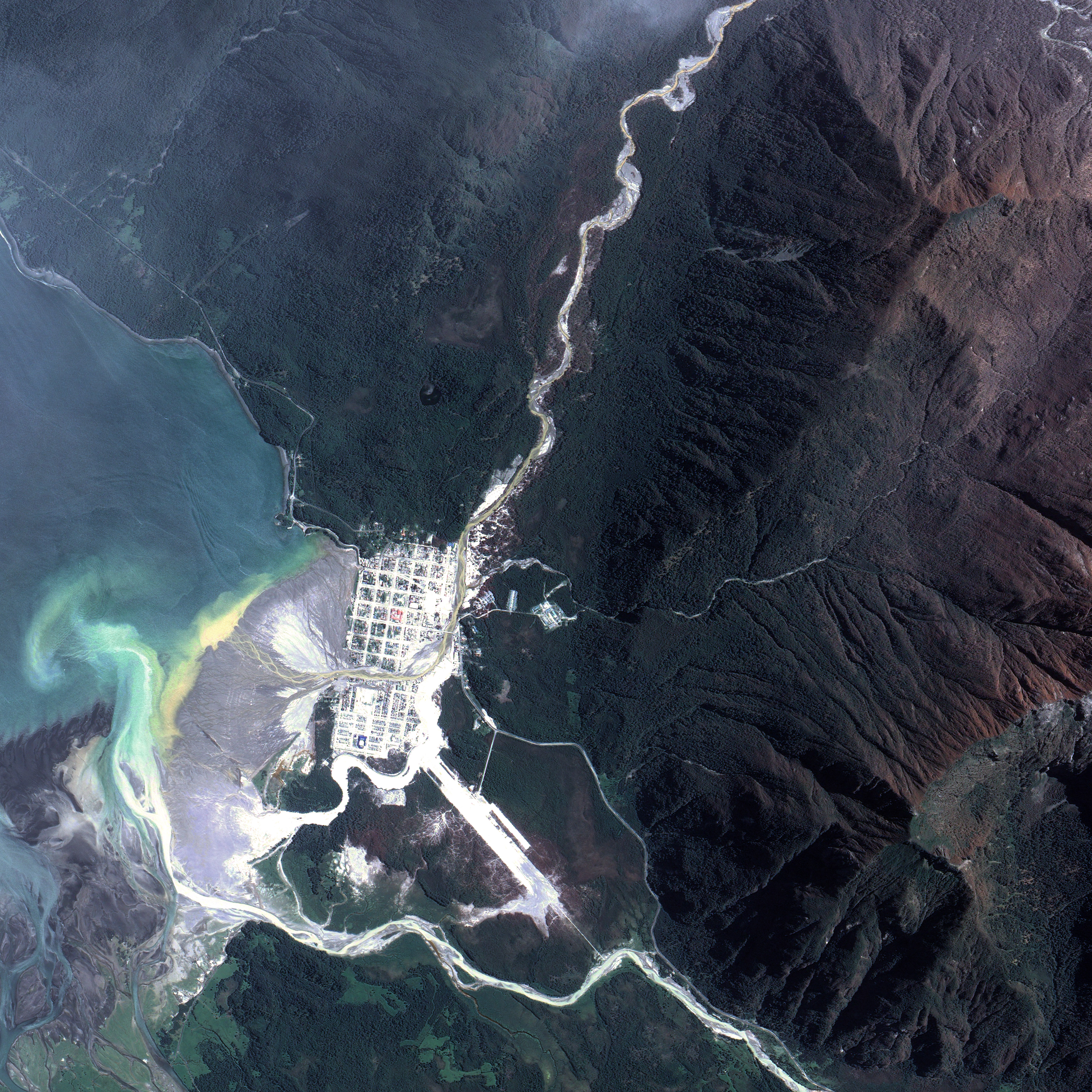
720 x 480
JPEG
Continued Activity at Chaiten Volcano
Published December 21, 2008
Months after its violent eruption in May 2008, Chile’s Chaitén Volcano remained active, and continued to send lahars—avalanches of volcanic ash, water, and mud—into the town of the same name.
Related images:
4304 x 4304
6 MB - JPEG
27 KB - KML/KMZ