720 x 545
JPEG
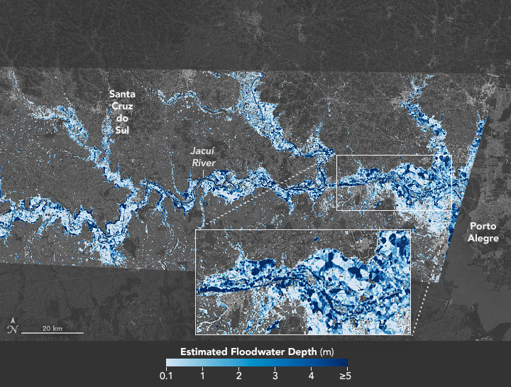
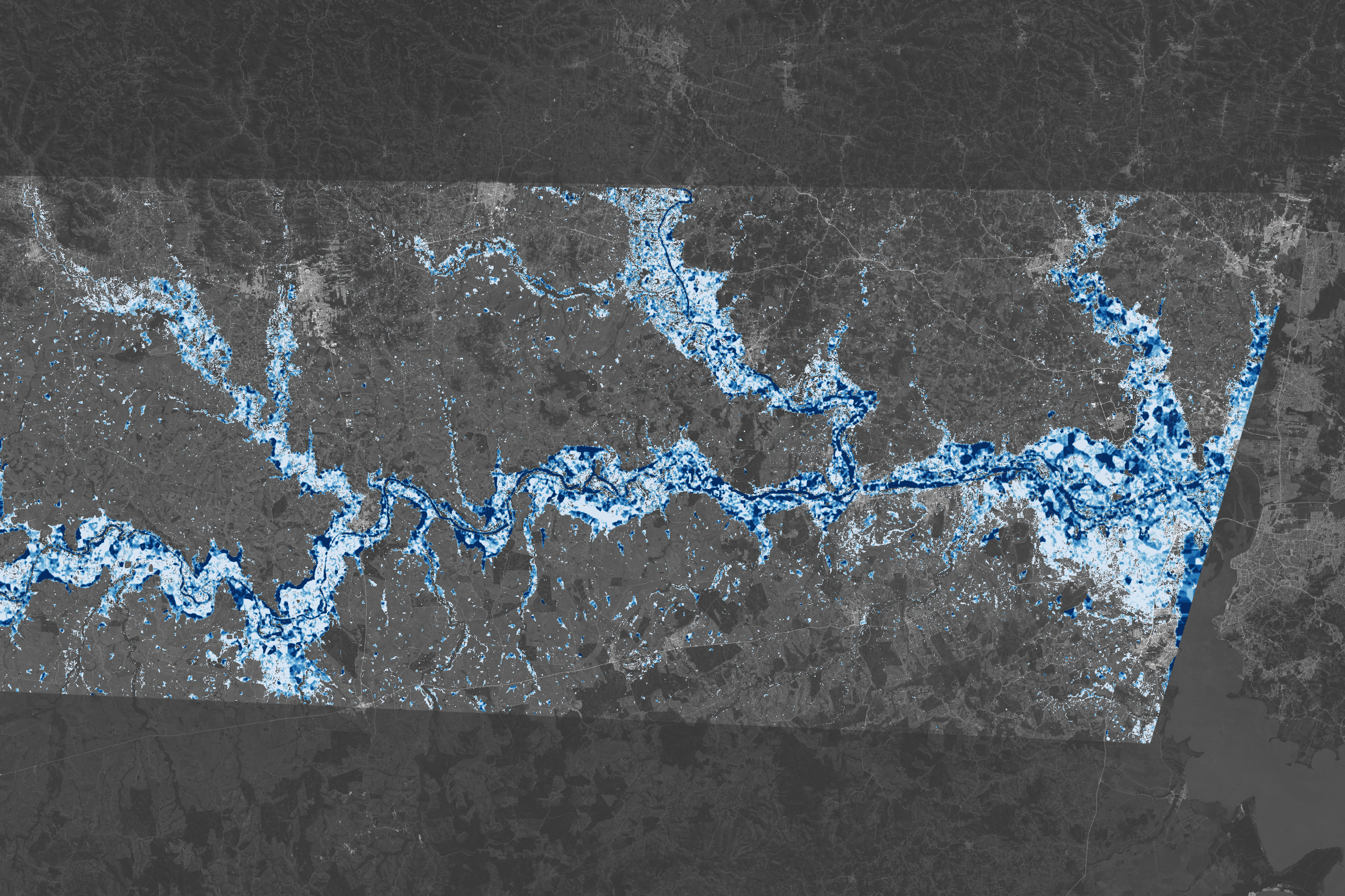
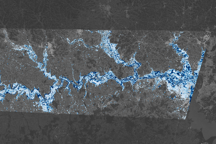
Southern Brazil Submerged
Published May 31, 2024
This map reveals the depth of floodwater that covered Rio Grande do Sul in May 2024.
Related images:
3009 x 2006
5 MB - JPEG
720 x 545
JPEG
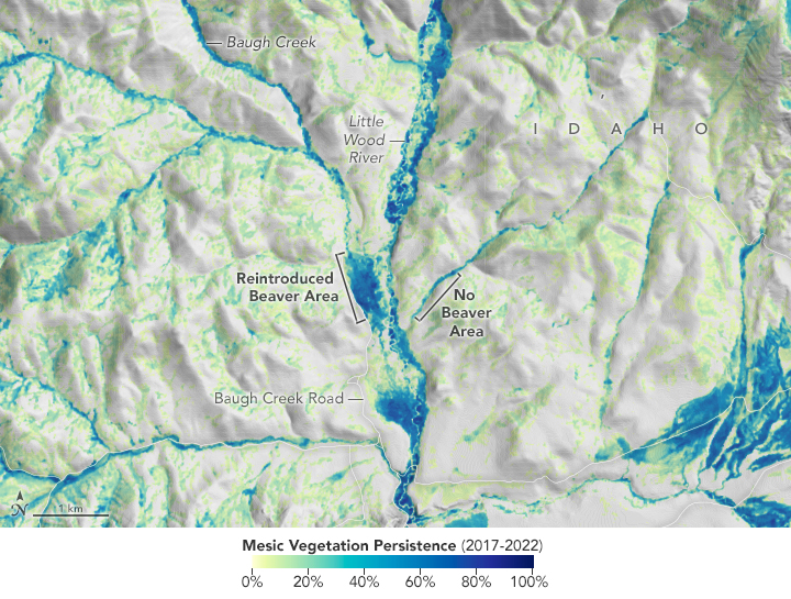
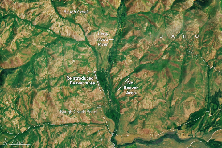
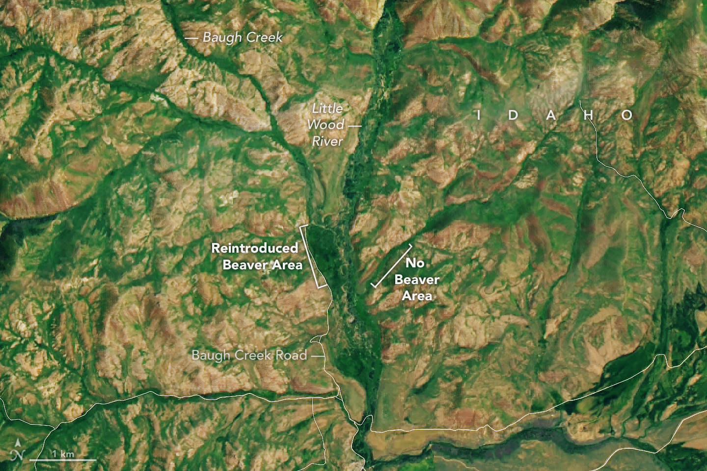
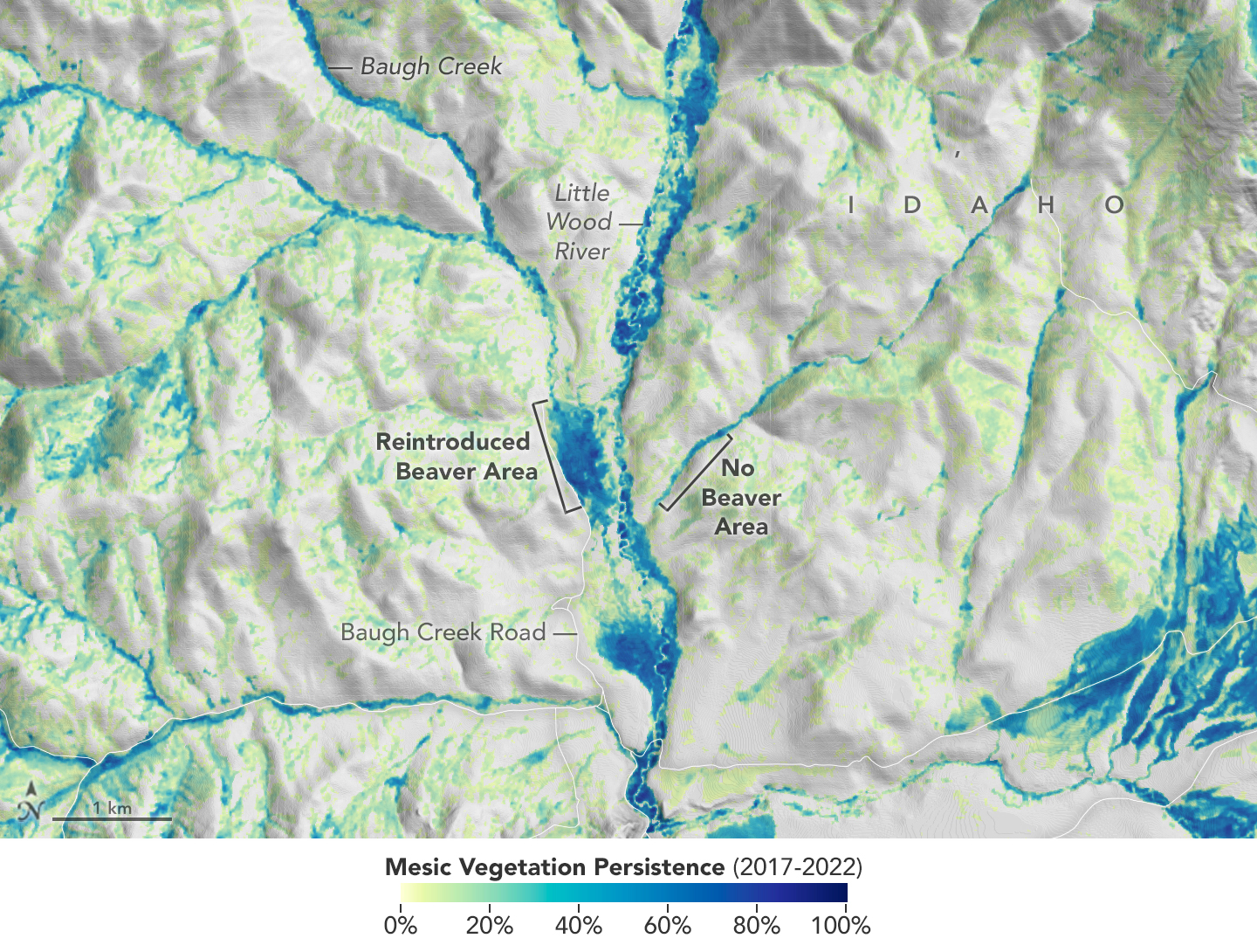
Idaho’s Emerald Refuge
Published July 24, 2023
Plants are abundant along Baugh Creek, thanks to the ponded water from beaver dams.
Related images:
720 x 480
JPEG
1440 x 960
1 MB - JPEG
1440 x 1090
1 MB - JPEG
720 x 480
JPEG
720 x 950
JPEG
Sea of Pollen Visible From Space
Published May 1, 2023
Researchers used satellites to distinguish blankets of pine pollen from other floating materials on the Baltic Sea.
Related images:
7565 x 9976
5 MB - JPEG
720 x 480
JPEG
720 x 480
JPEG

720 x 480
JPEG
Sea of Pollen Visible From Space
Published May 1, 2023
Researchers used satellites to distinguish blankets of pine pollen from other floating materials on the Baltic Sea.
Related images:
720 x 950
JPEG
7565 x 9976
5 MB - JPEG
720 x 480
JPEG
720 x 700
JPEG
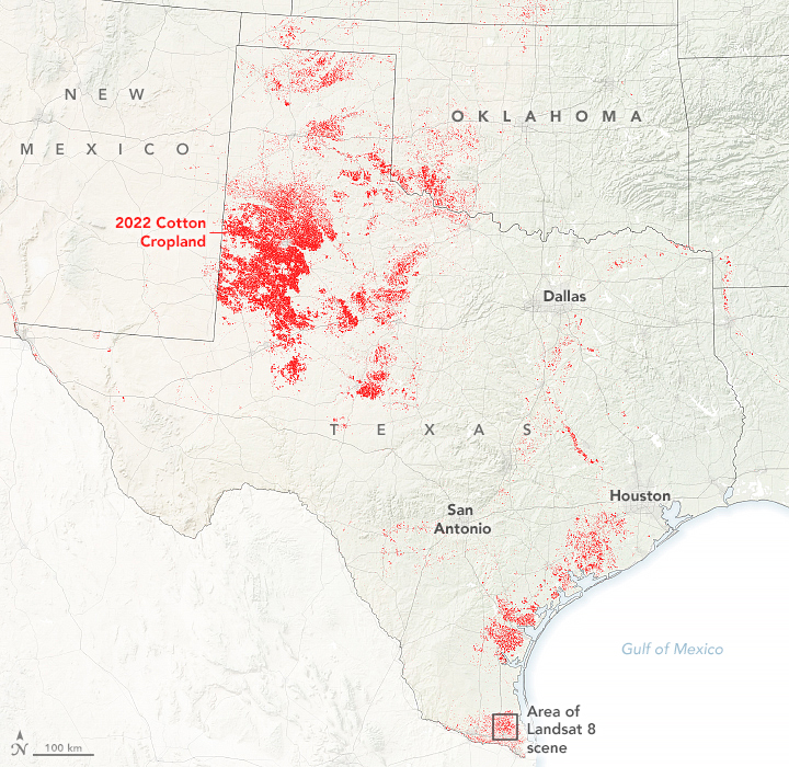
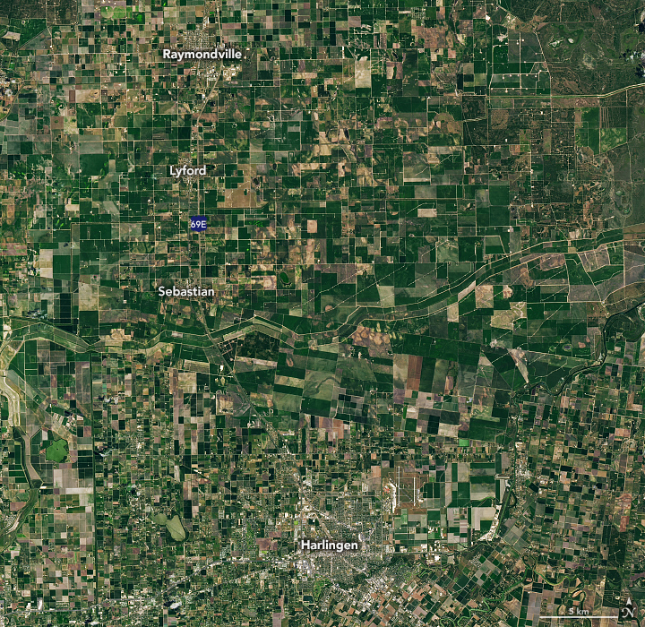
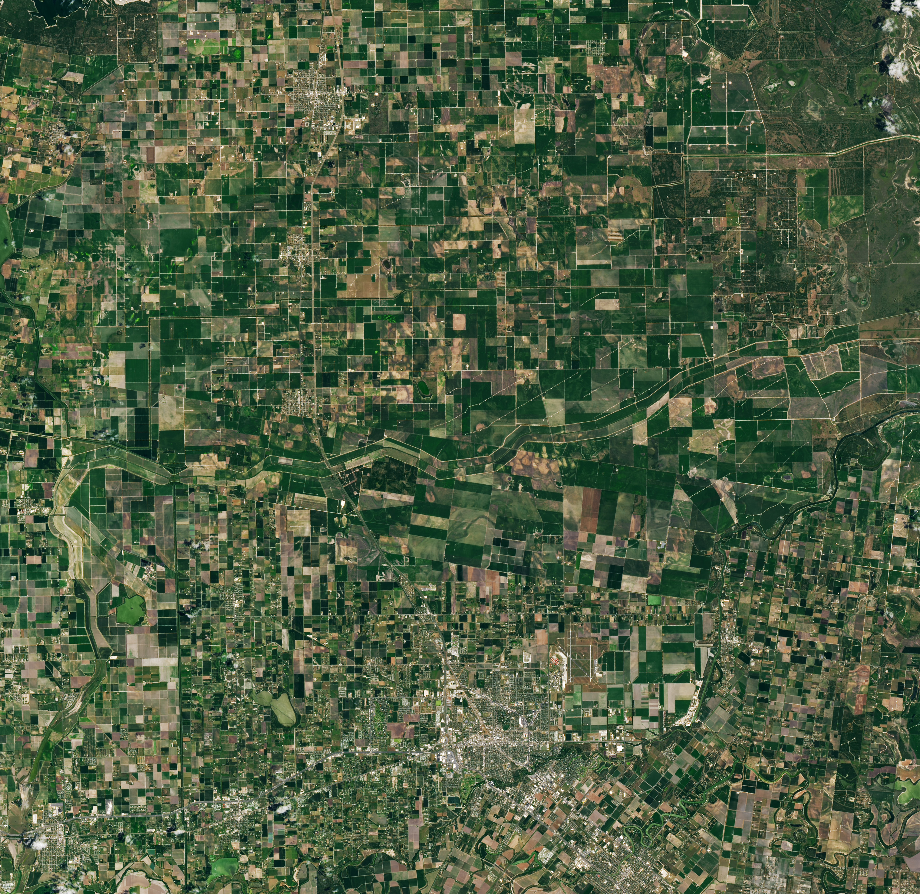
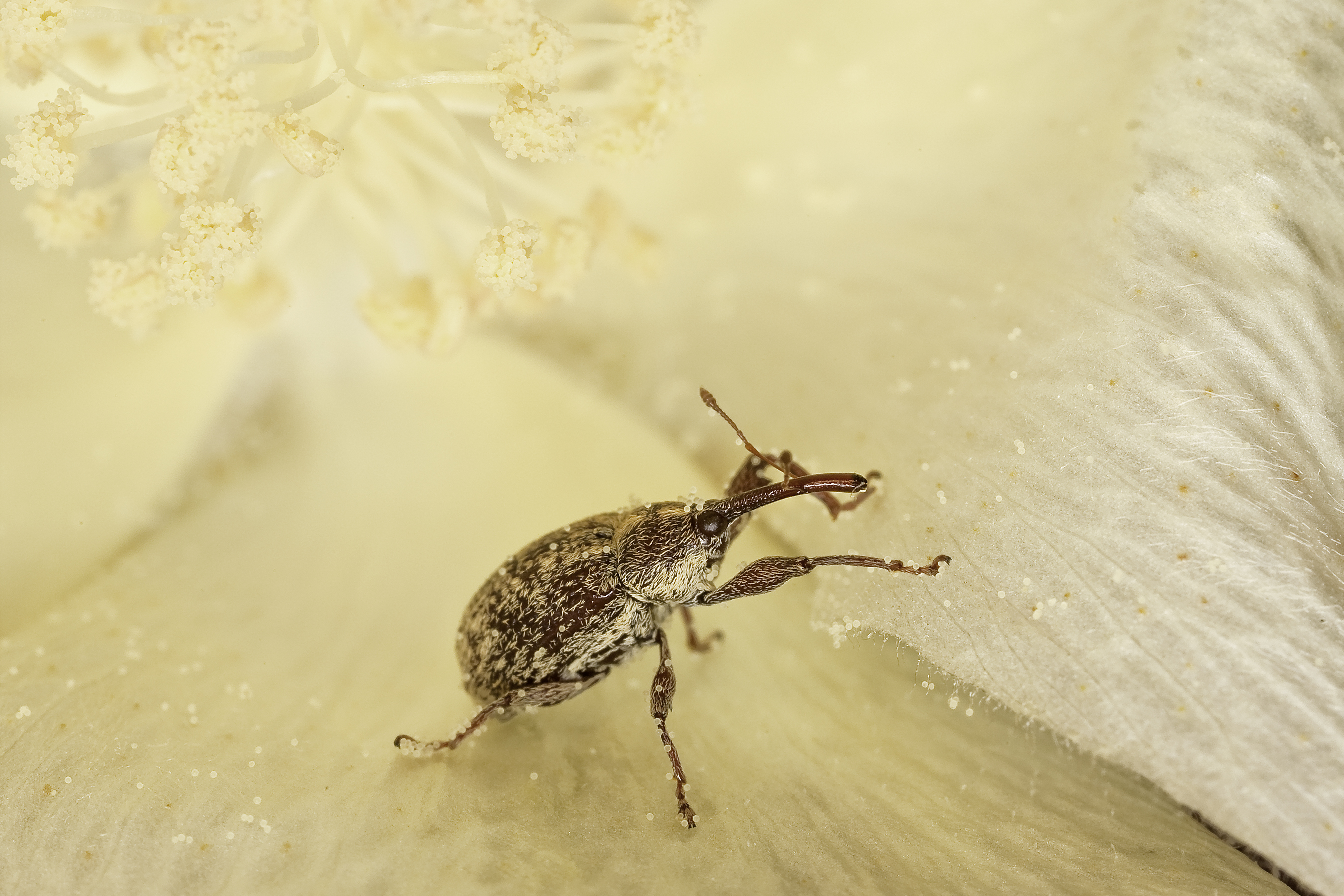
Battling Boll Weevils in Texas
Published April 3, 2023
Satellites are helping farmers in the Rio Grande Valley take on the cotton-loving beetles.
Related images:
720 x 700
JPEG
3039 x 2955
4 MB - JPEG

720 x 480
JPEG
2700 x 1800
3 MB - JPEG
720 x 700
JPEG
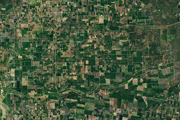
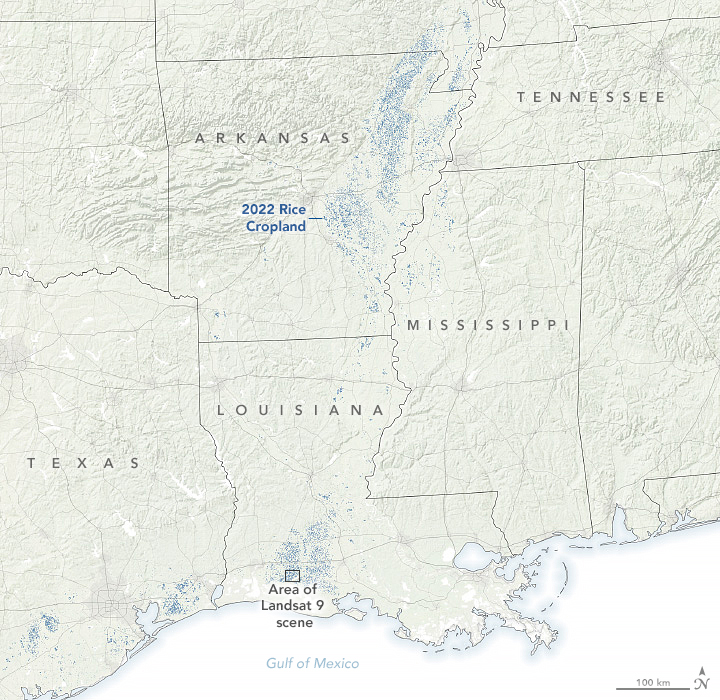
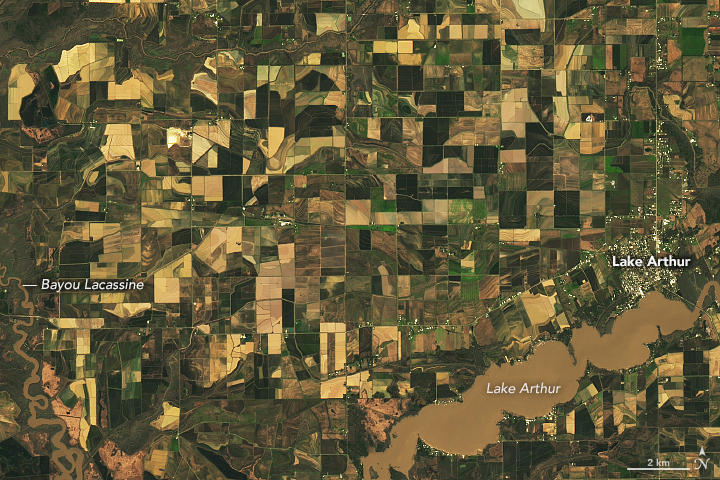
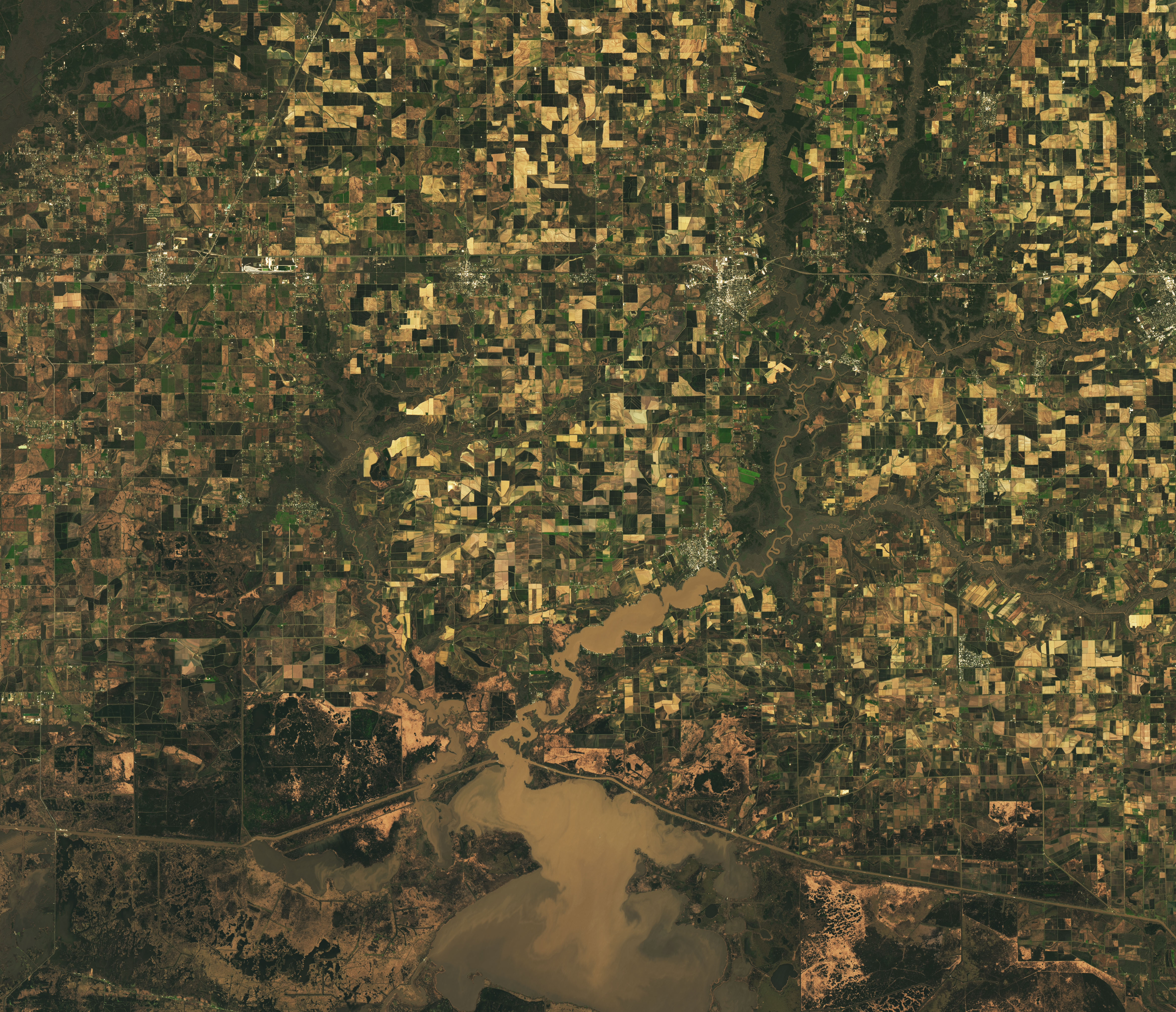
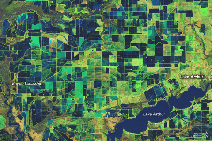
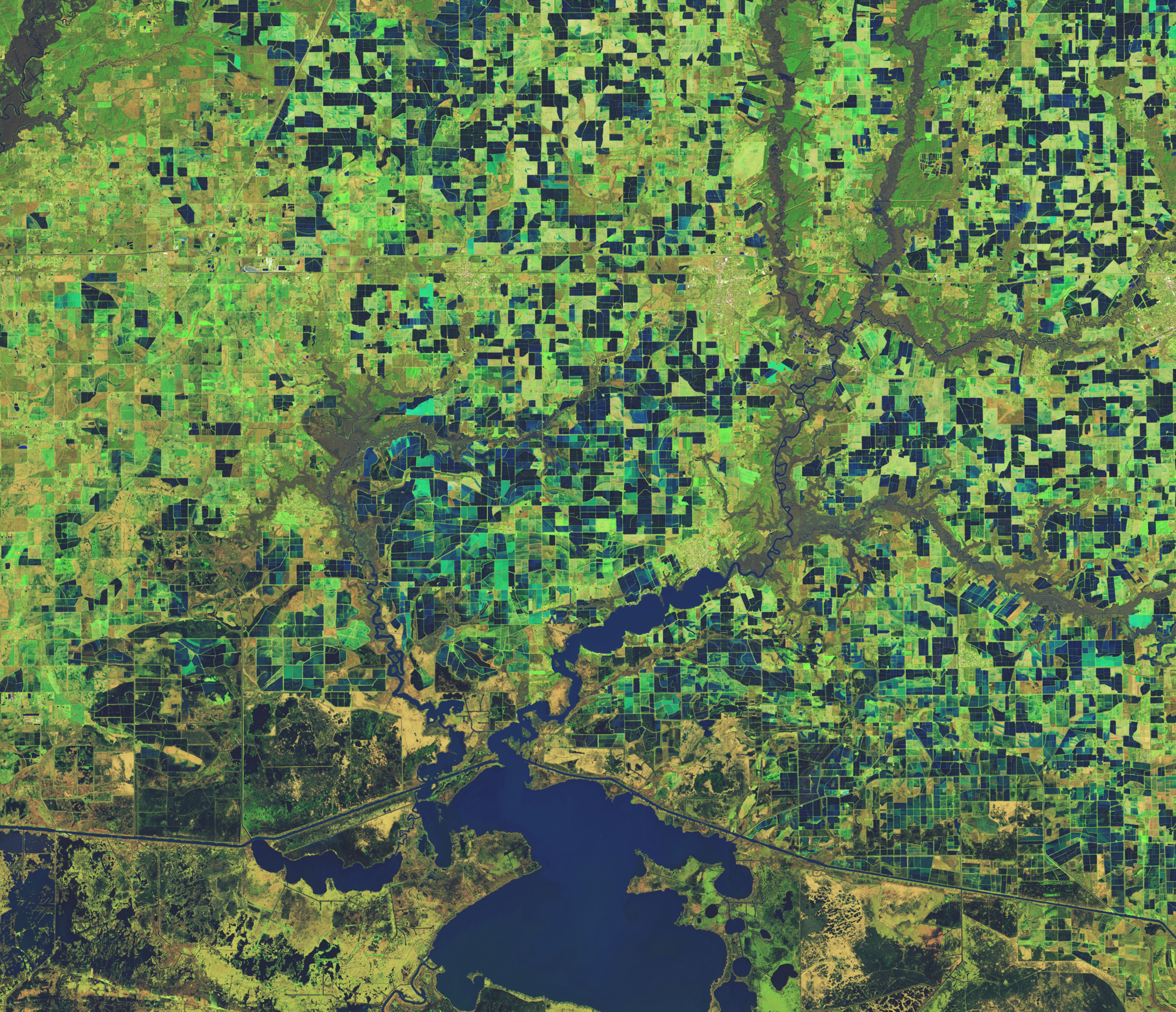
Flooded Rice Fields in Louisiana
Published March 10, 2023
The low-lying alluvial plain of the Mississippi River Valley is home to much of the nation’s rice farms.
Related images:
720 x 480
JPEG
4729 x 4071
4 MB - JPEG
720 x 480
JPEG
4729 x 4071
4 MB - JPEG

720 x 480
JPEG
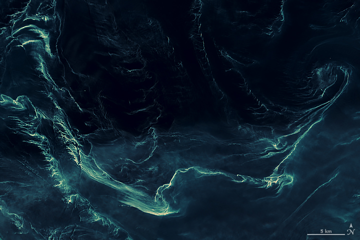
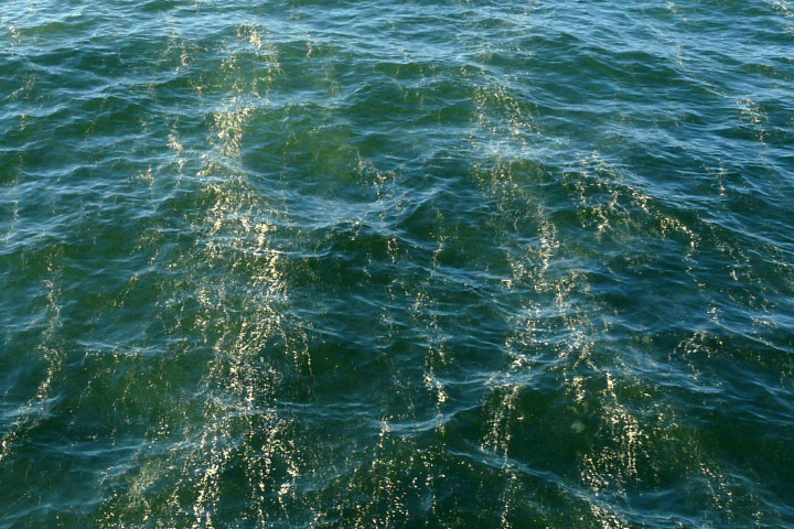
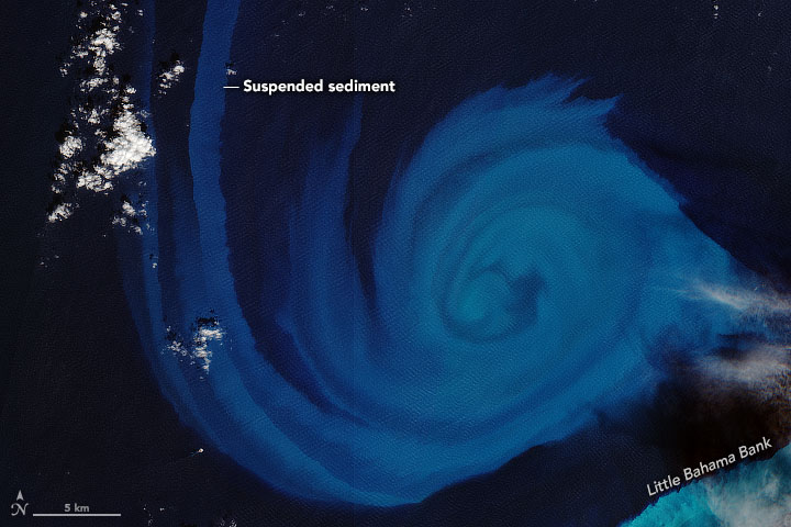
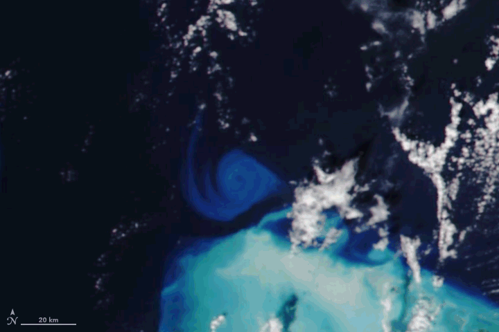
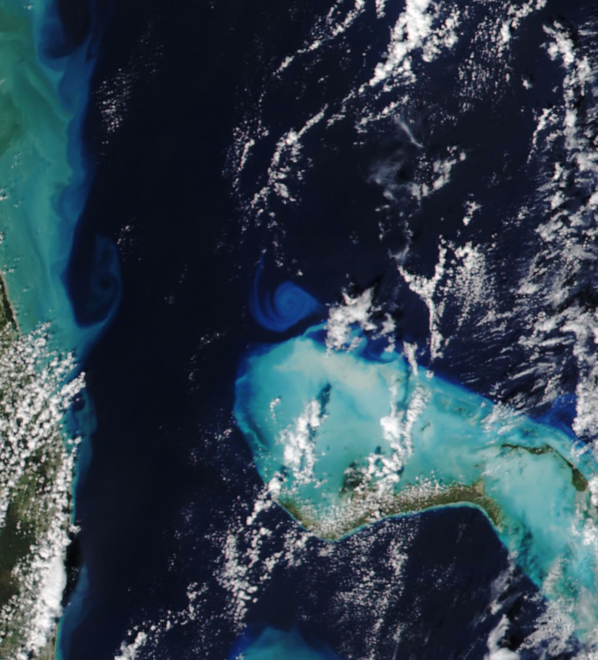
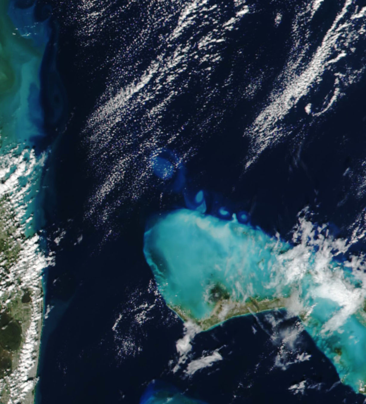
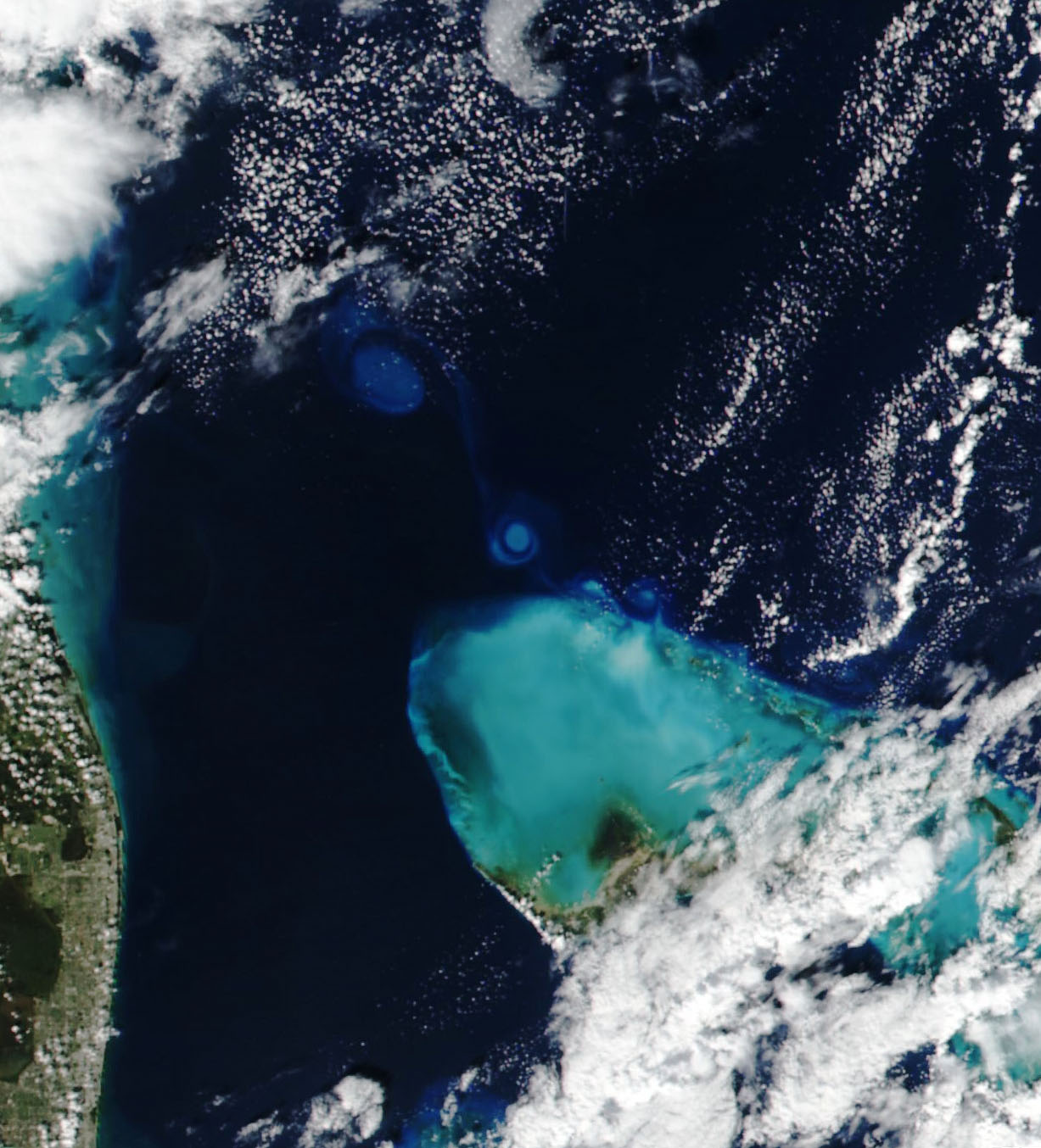
Carbonate Swirls Spin from the Bahamas
Published November 17, 2022
Hurricane Nicole turned the shallow waters along the Abaco Islands into an eddy factory.
Related images:
720 x 480
GIF
1227 x 1354
226 KB - JPEG
1227 x 1354
237 KB - JPEG
1227 x 1354
262 KB - JPEG
7442 x 7442
6 MB - JPEG
720 x 591
JPEG
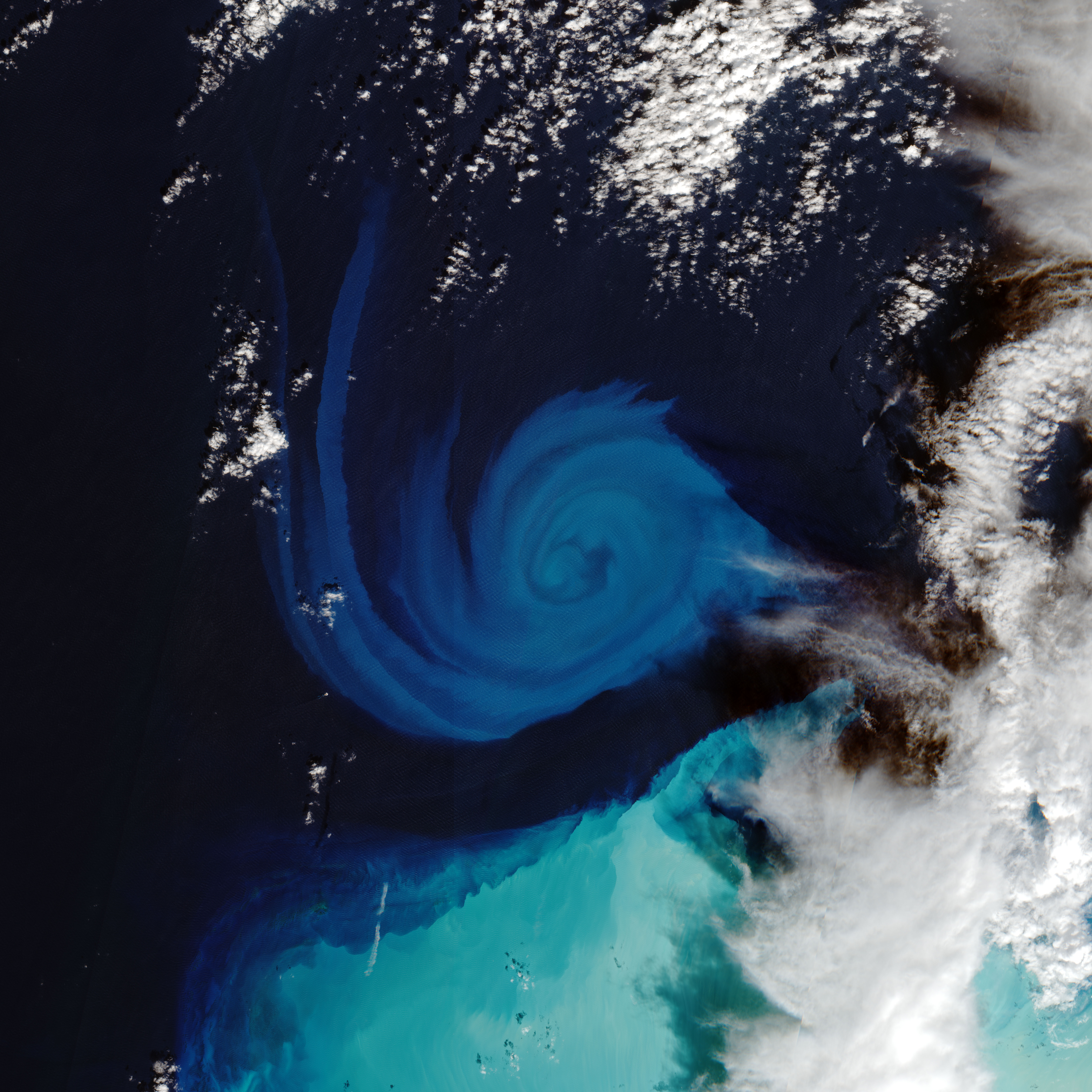
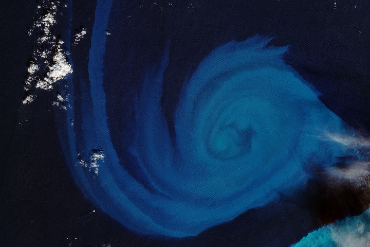
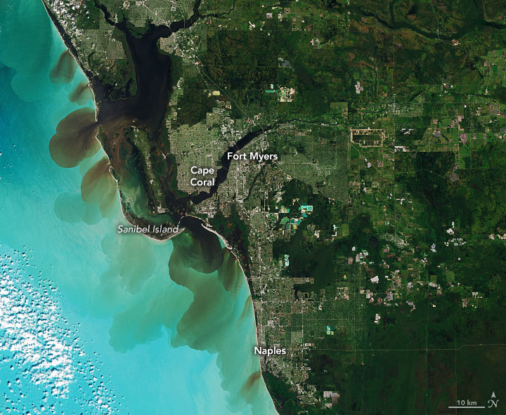
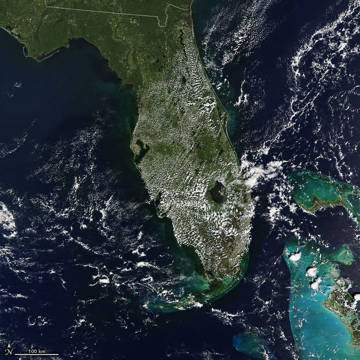
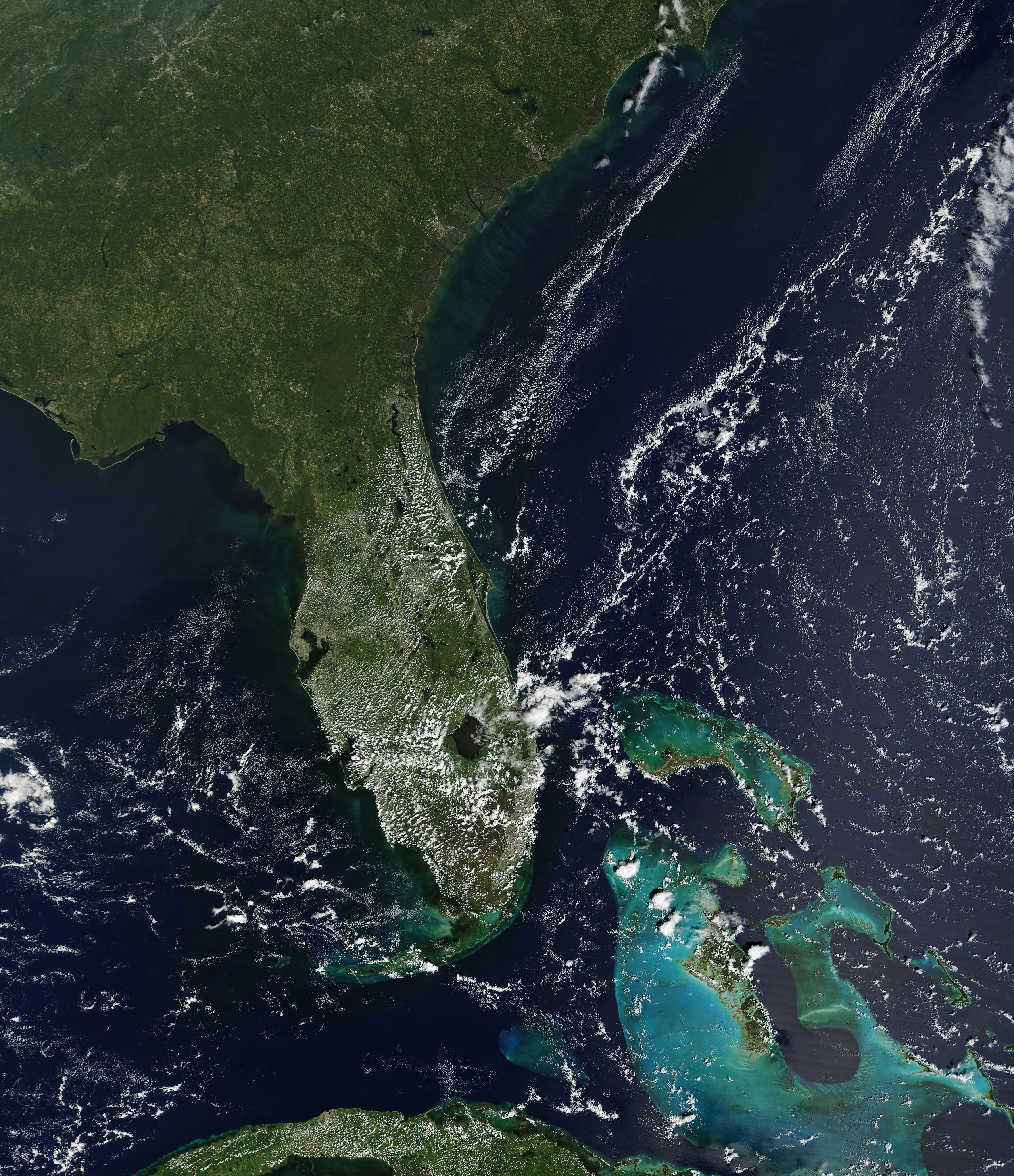
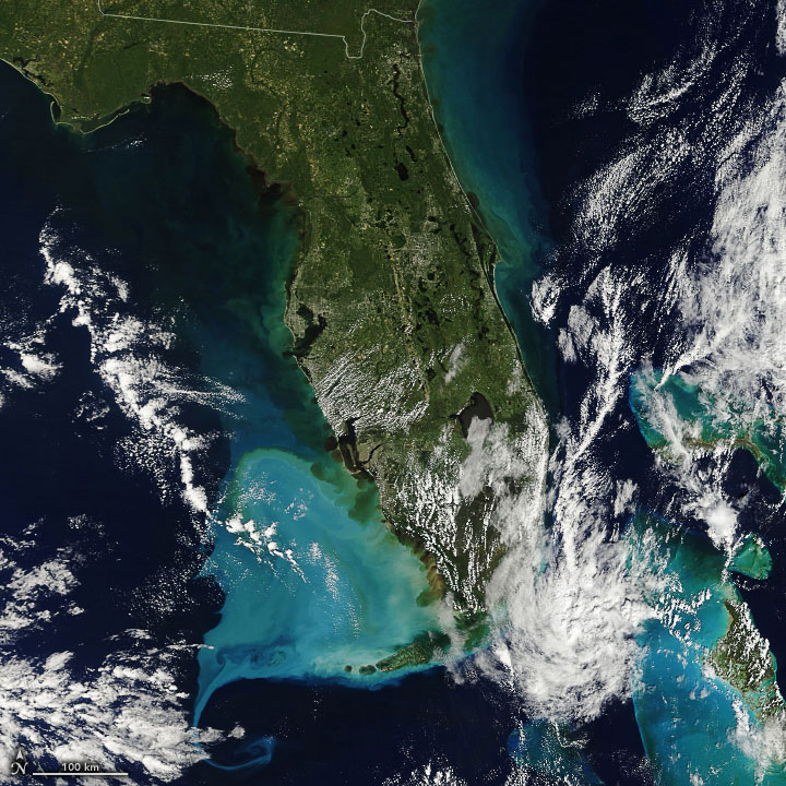
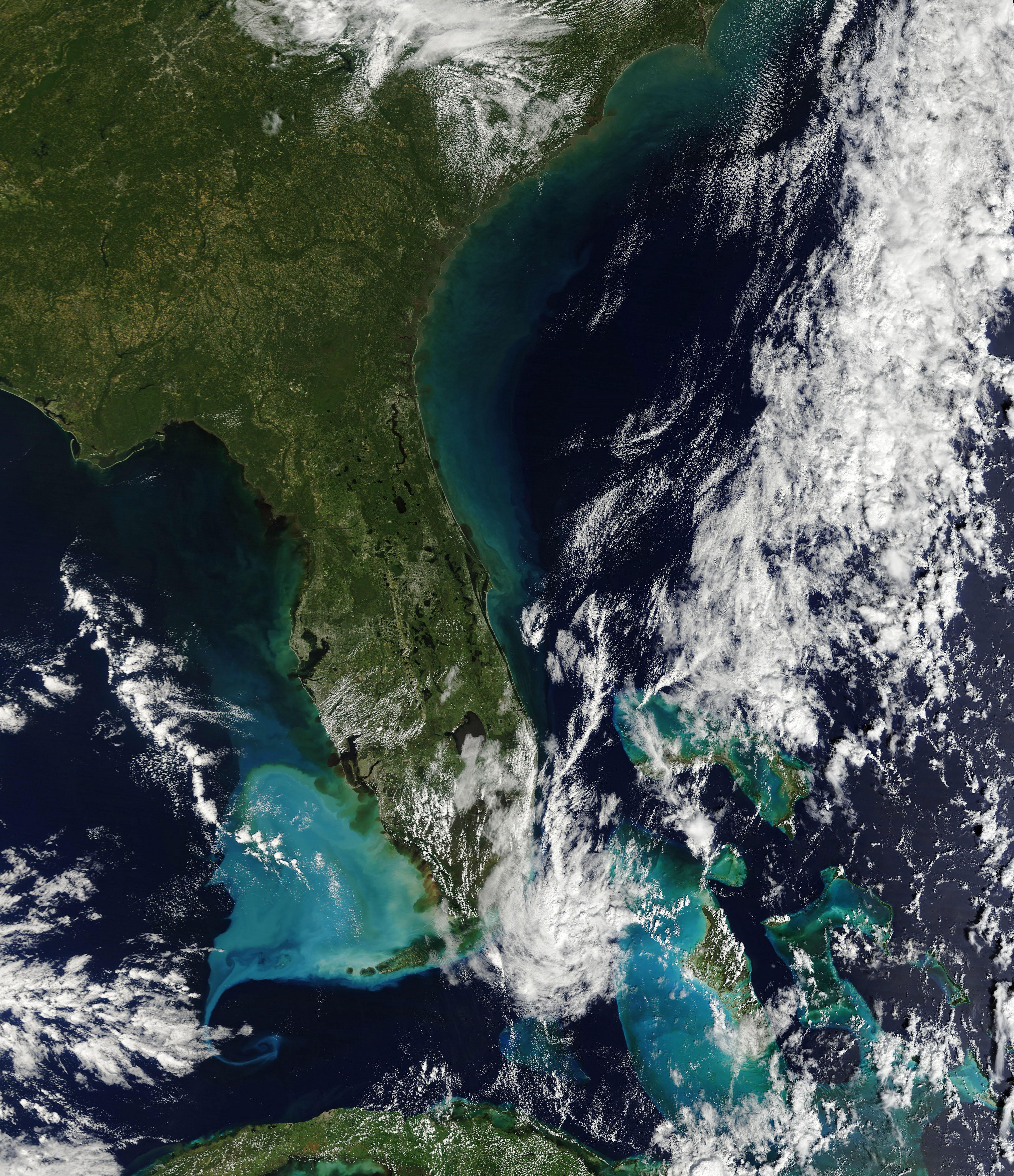
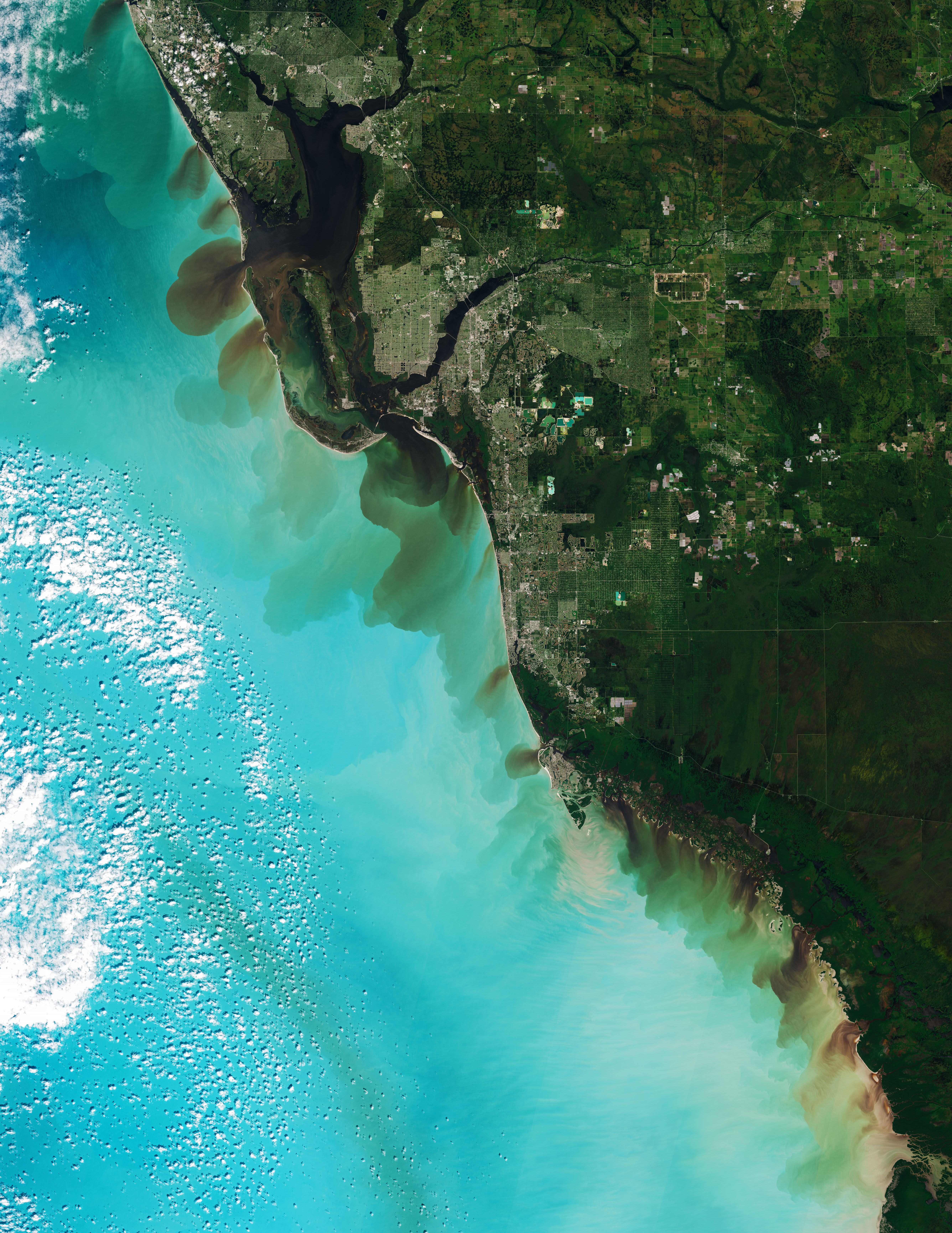
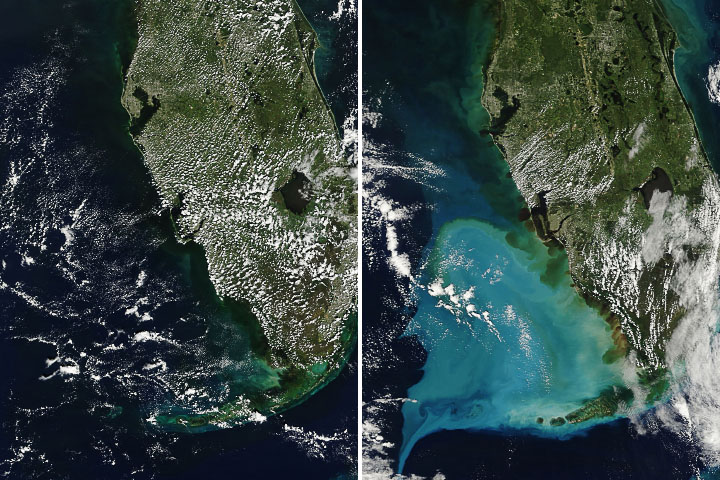
Watercolor Seas in the Wake of Hurricane Ian
Published October 4, 2022
Storm-stirred sediment produced colorful swirls along the western coast of Florida.
Related images:
720 x 720
JPEG
4542 x 5269
4 MB - JPEG
720 x 720
JPEG
4542 x 5269
4 MB - JPEG
5345 x 6919
6 MB - JPEG
720 x 429
PNG
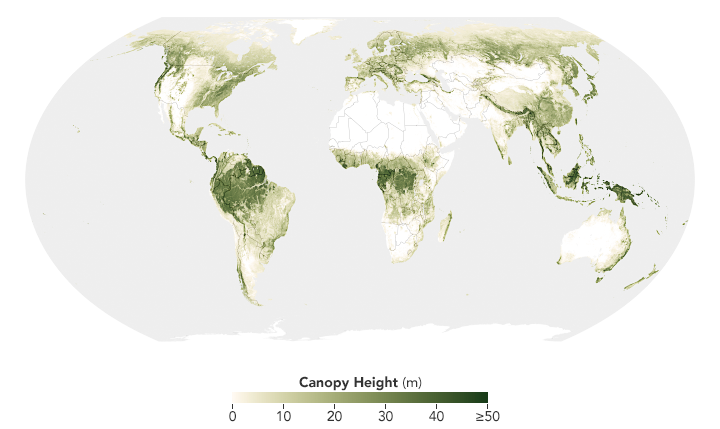
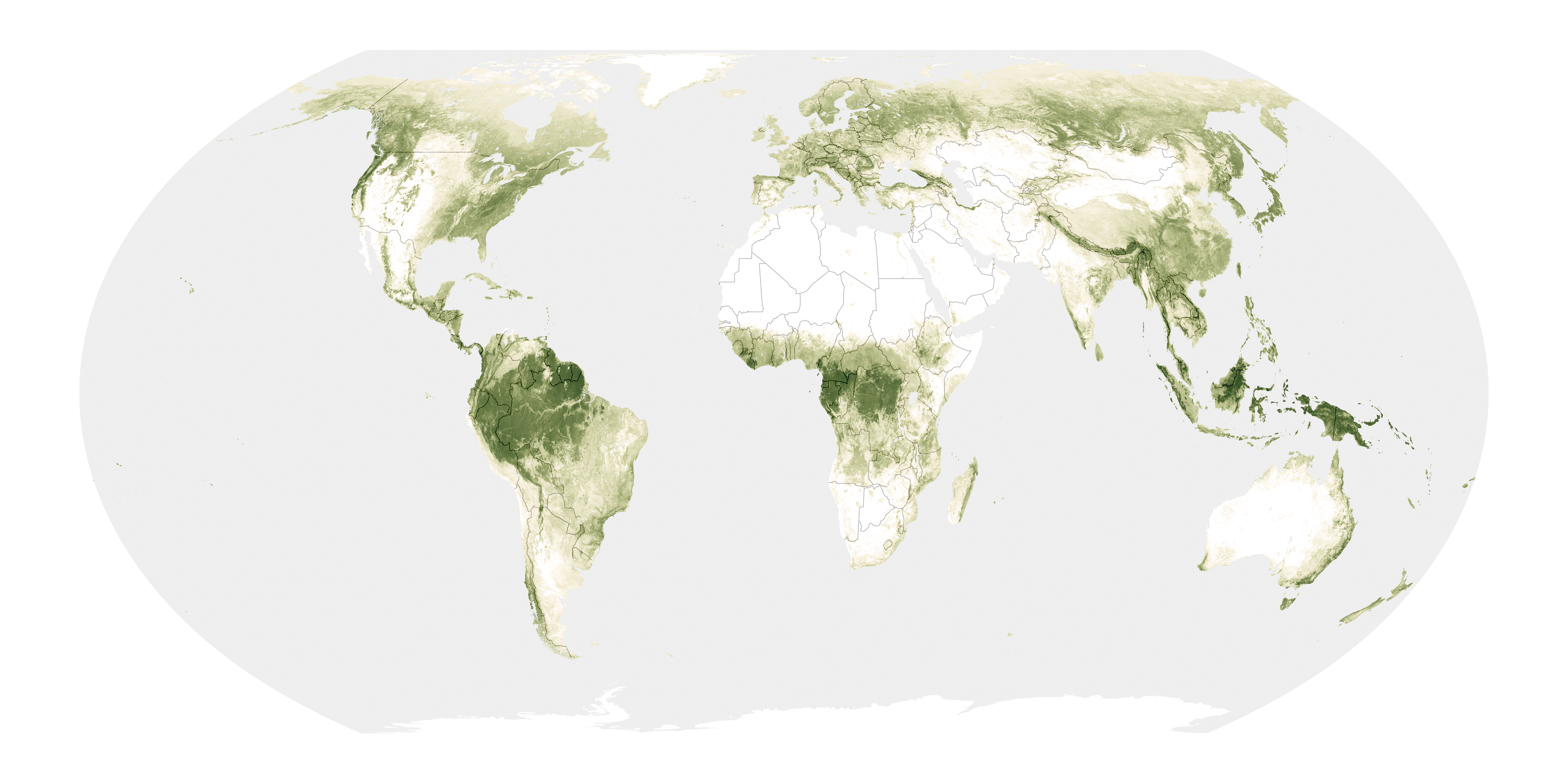
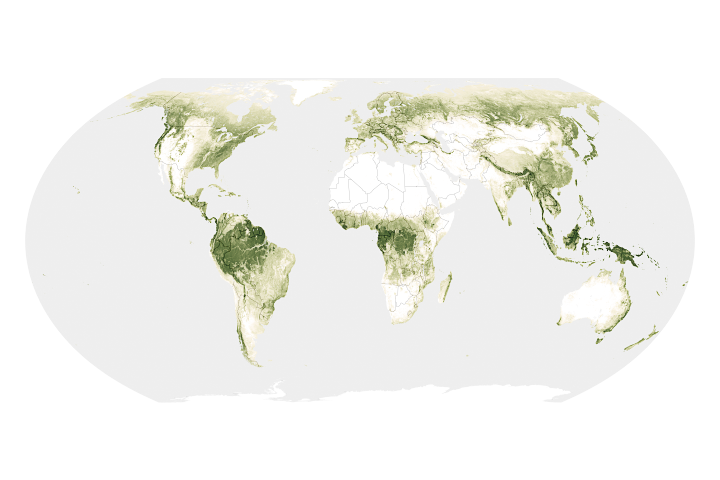
Scientists Show How Forests Measure Up
Published May 13, 2022
A new map shows the height of Earth’s forests, from stubby saplings to timbers towering more than 50 meters tall, across the entire land surface.
Related images:
8000 x 4000
12 MB - PNG
720 x 545
JPEG
6342 x 5109
5 MB - JPEG
720 x 545
JPEG
3651 x 2292
1 MB - JPEG
720 x 545
JPEG
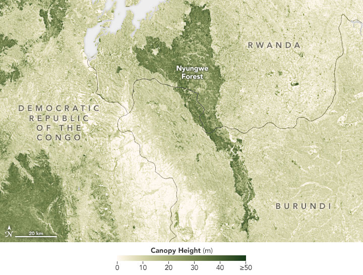
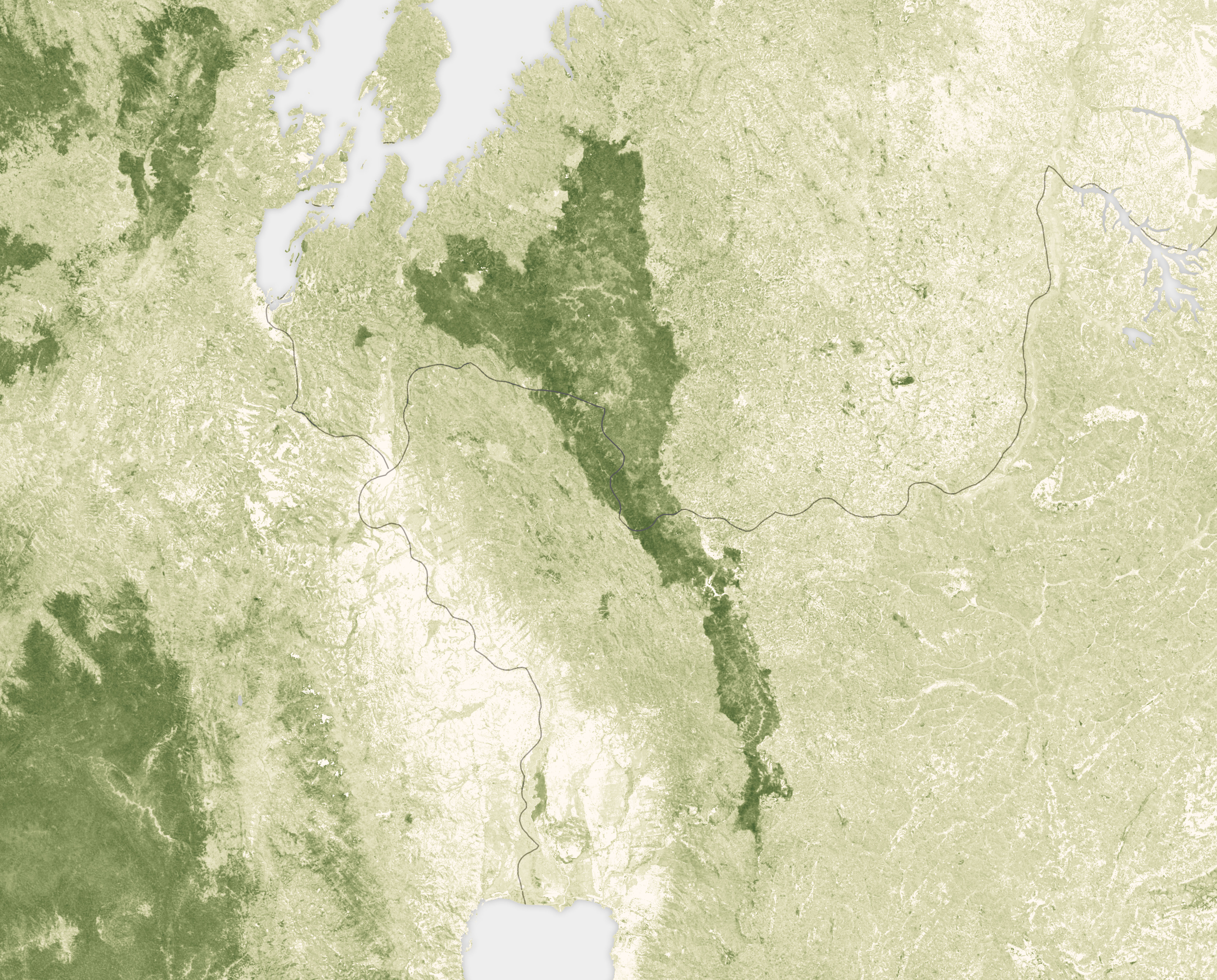
Scientists Show How Forests Measure Up
Published May 13, 2022
A new map shows the height of Earth’s forests, from stubby saplings to timbers towering more than 50 meters tall, across the entire land surface.
Related images:
720 x 429
PNG
8000 x 4000
12 MB - PNG
6342 x 5109
5 MB - JPEG
720 x 545
JPEG
3651 x 2292
1 MB - JPEG
720 x 545
JPEG
Scientists Show How Forests Measure Up
Published May 13, 2022
A new map shows the height of Earth’s forests, from stubby saplings to timbers towering more than 50 meters tall, across the entire land surface.
Related images:
720 x 429
PNG
8000 x 4000
12 MB - PNG
720 x 545
JPEG
6342 x 5109
5 MB - JPEG
3651 x 2292
1 MB - JPEG

720 x 545
JPEG
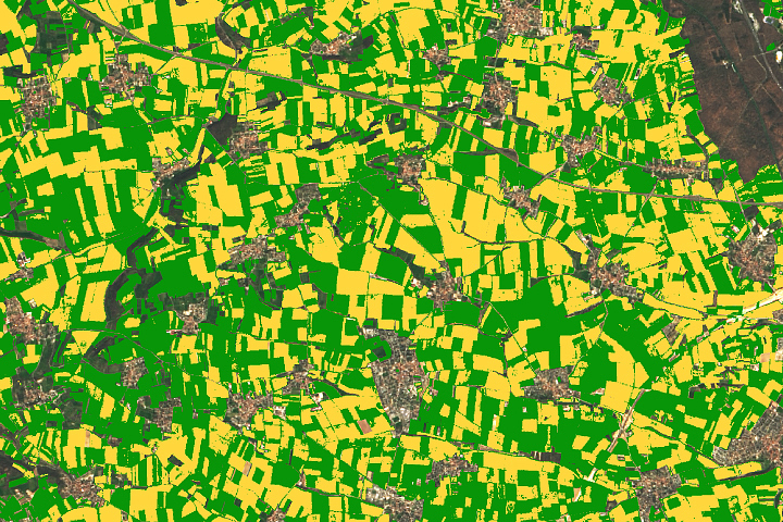
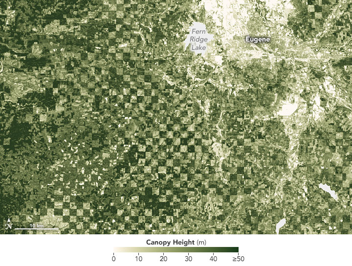
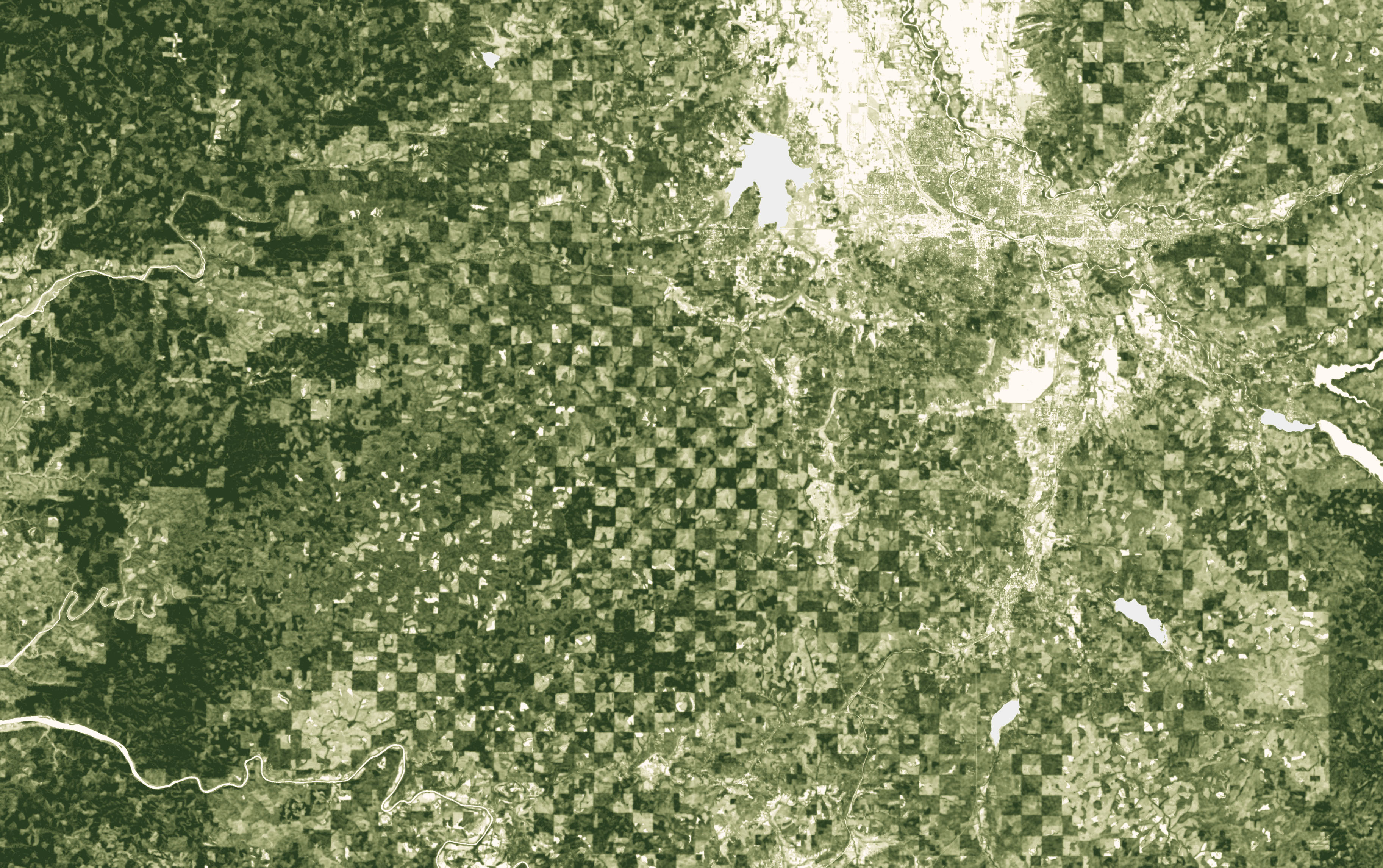
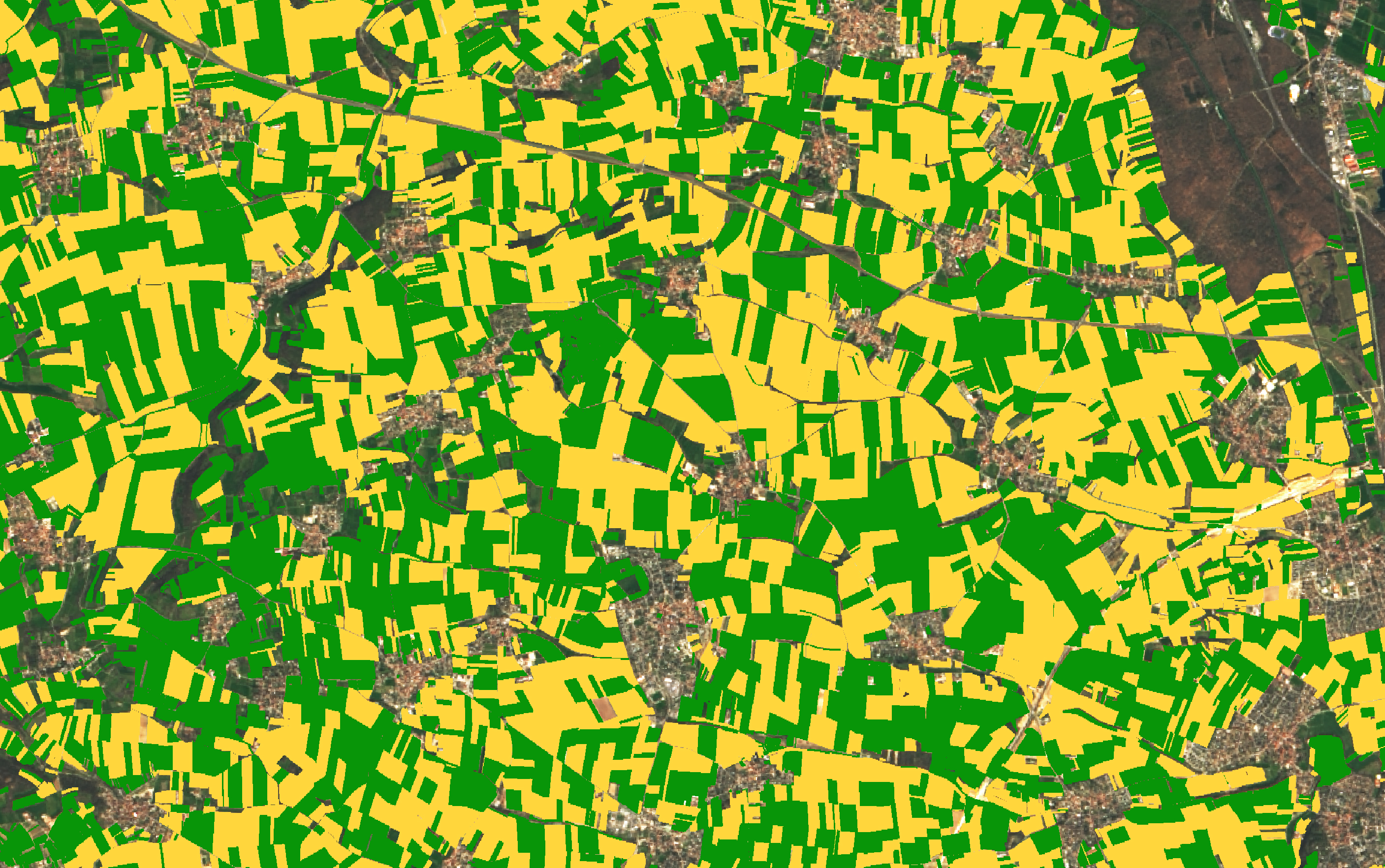
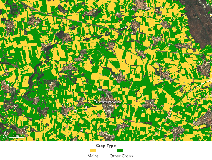
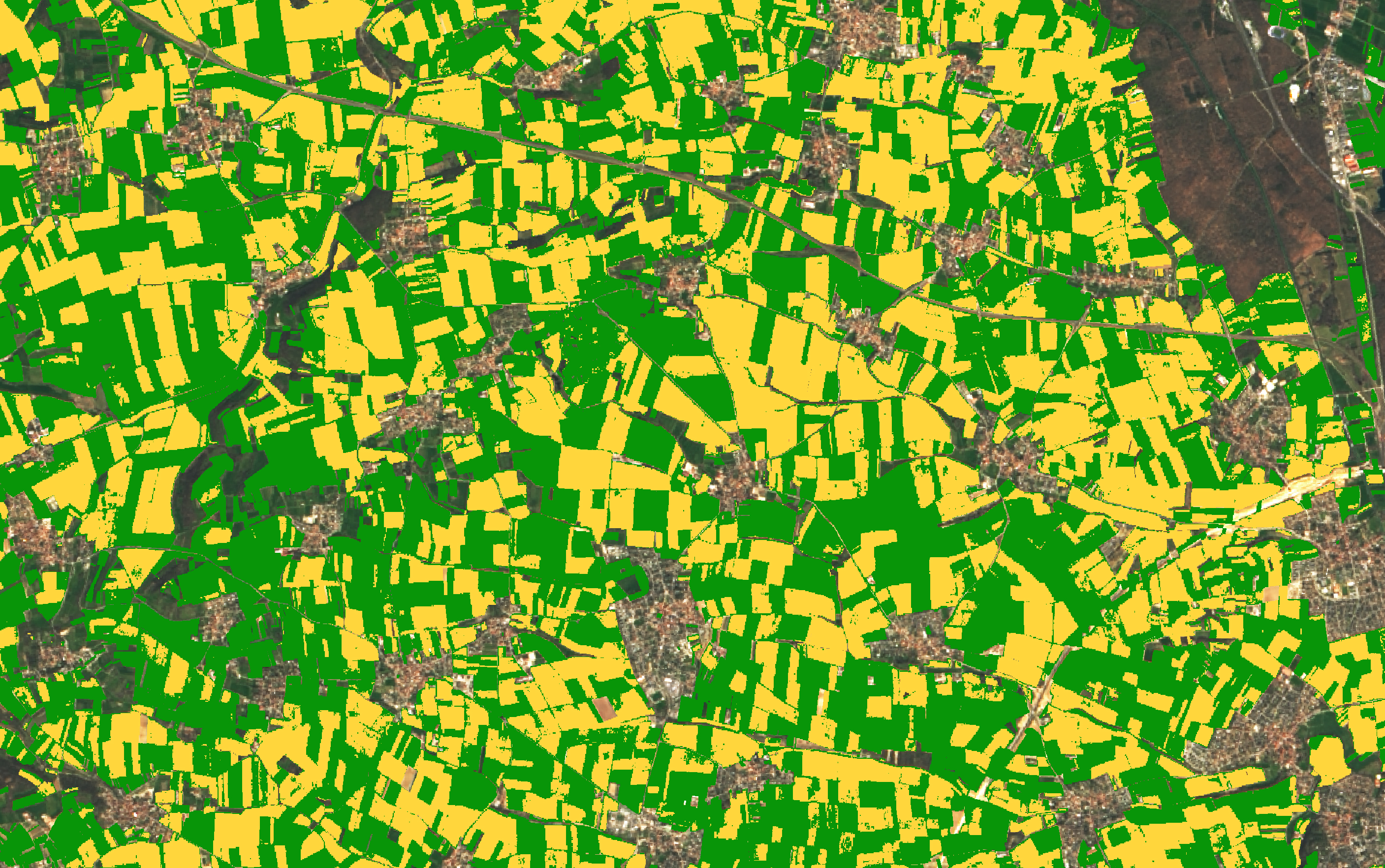
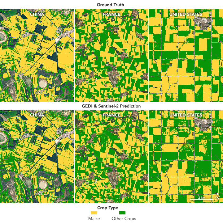
Lasering In on Corn Fields
Published March 7, 2022
An instrument designed to measure tree height can also distinguish corn from other crops.
Related images:
2814 x 1765
4 MB - JPEG
720 x 545
JPEG
2814 x 1765
5 MB - JPEG
720 x 725
JPEG