720 x 970
JPEG
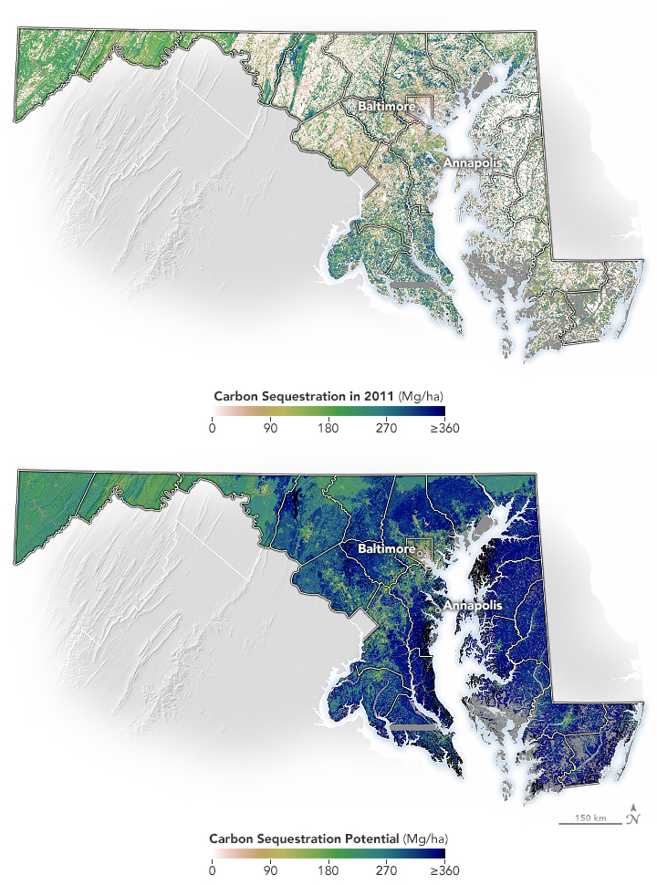
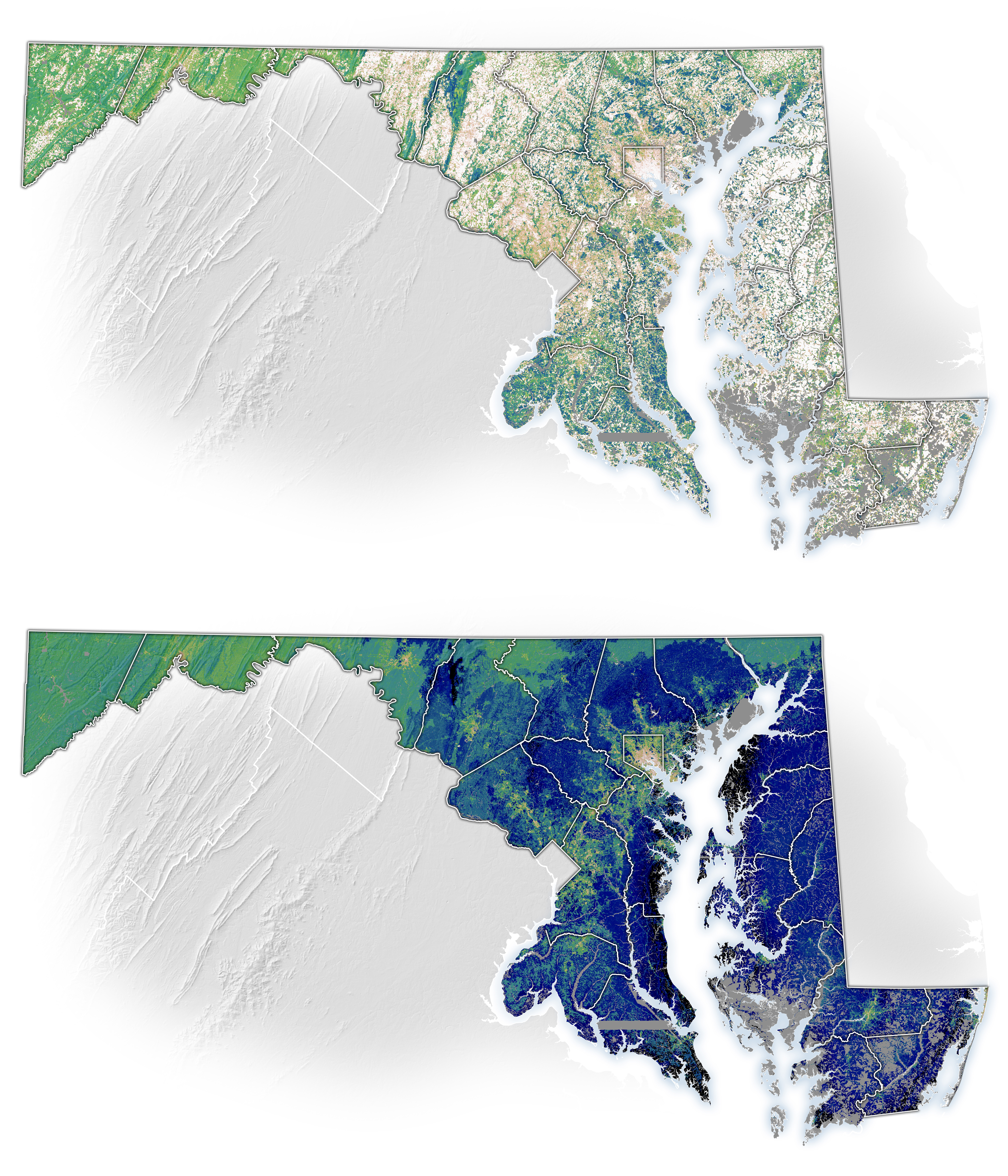
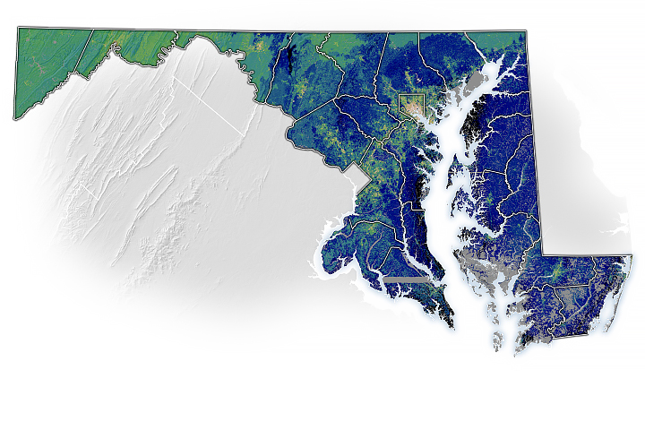
The Best Places to Plant Trees in Maryland
Published September 7, 2023
Using remote sensing, researchers have developed a method to guide the state of Maryland’s tree-planting efforts.
Related images:
3773 x 4402
11 MB - JPEG
720 x 480
JPEG
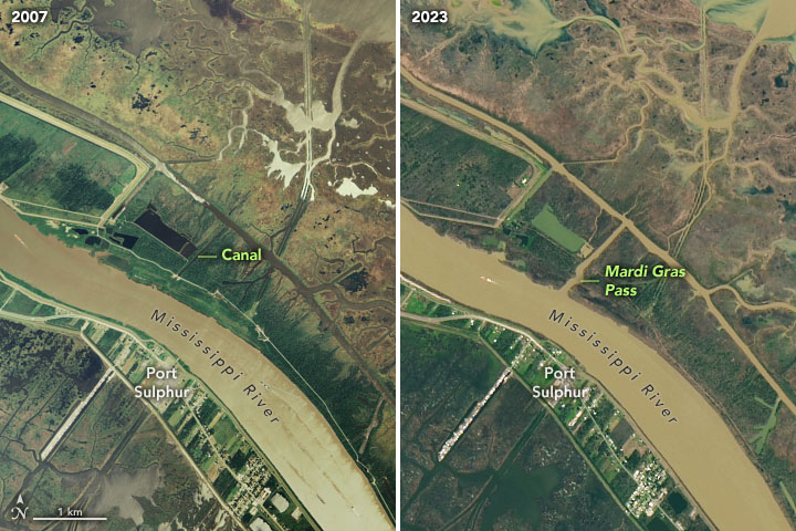
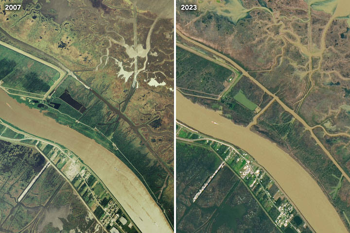
Mardi Gras Pass
Published February 21, 2023
This free-flowing distributary reconnects the mighty Mississippi to the wetlands of Louisiana.
Related images:
6396 x 7273
8 MB - JPEG
2696 x 2696
957 KB - JPEG
6396 x 7273
8 MB - JPEG
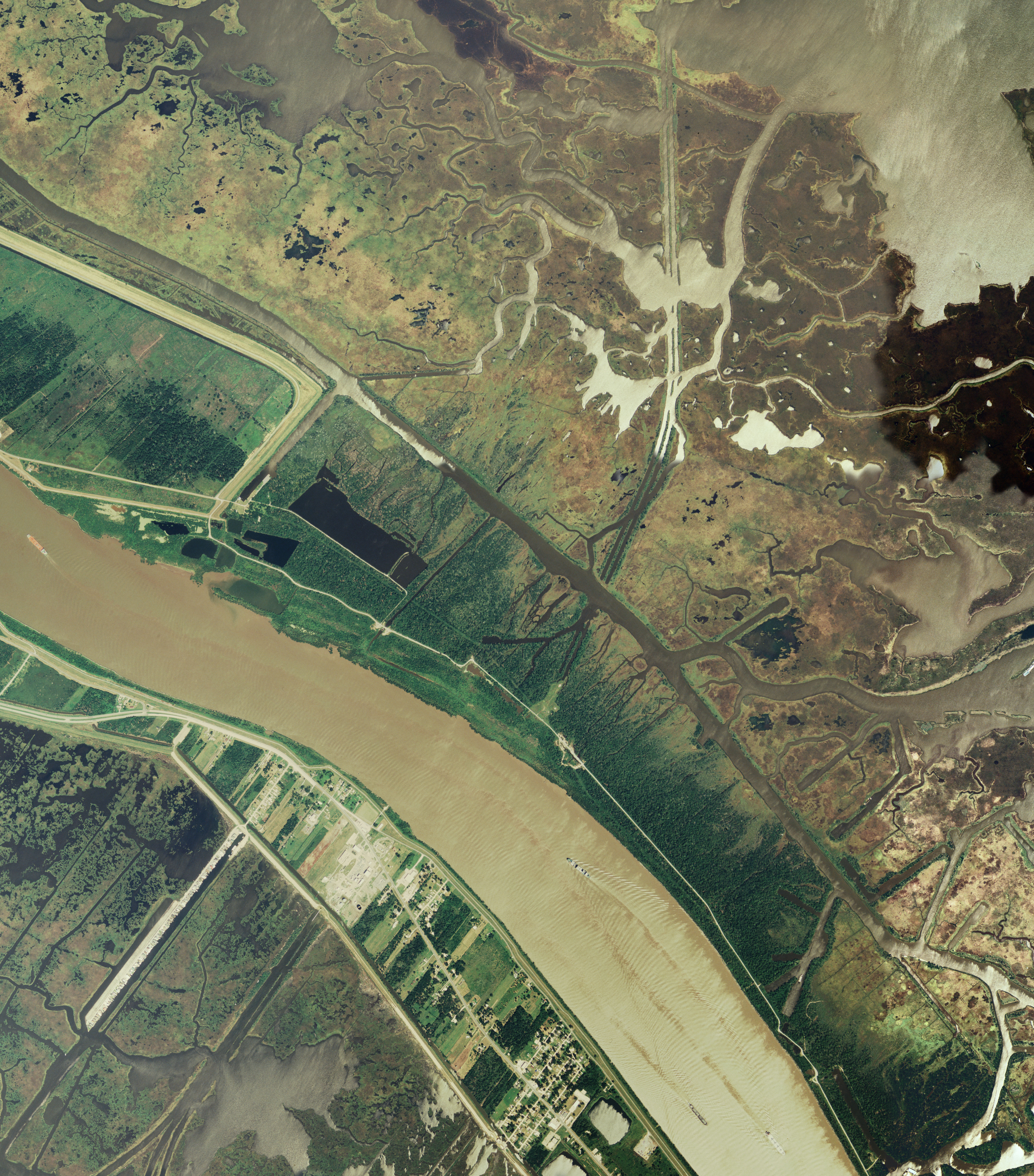
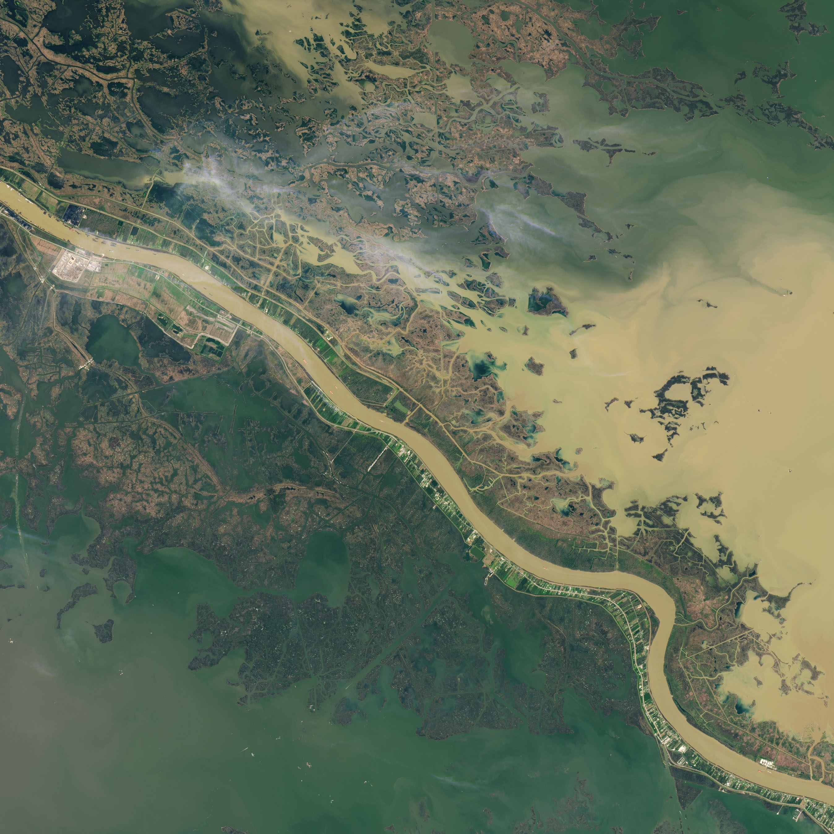
Mardi Gras Pass
Published February 21, 2023
This free-flowing distributary reconnects the mighty Mississippi to the wetlands of Louisiana.
Related images:
720 x 480
JPEG
2696 x 2696
957 KB - JPEG
720 x 480
JPEG
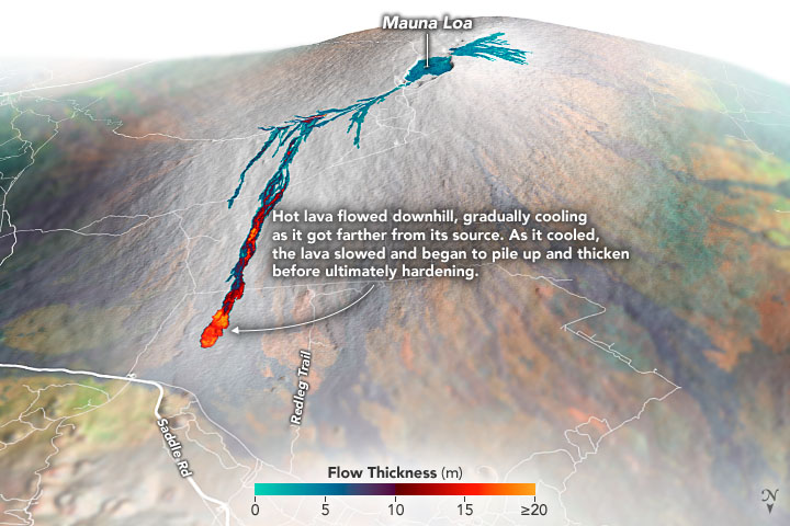
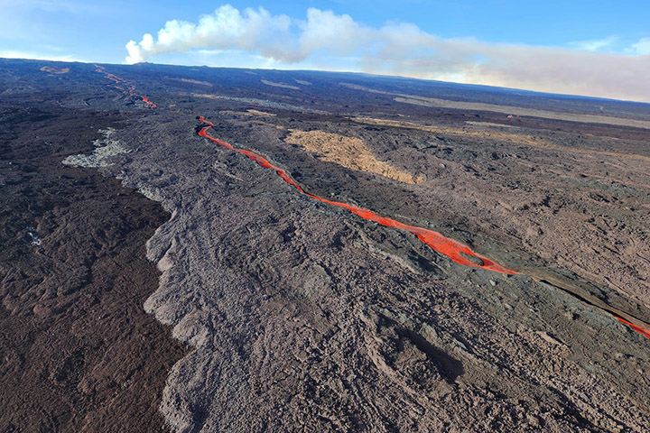
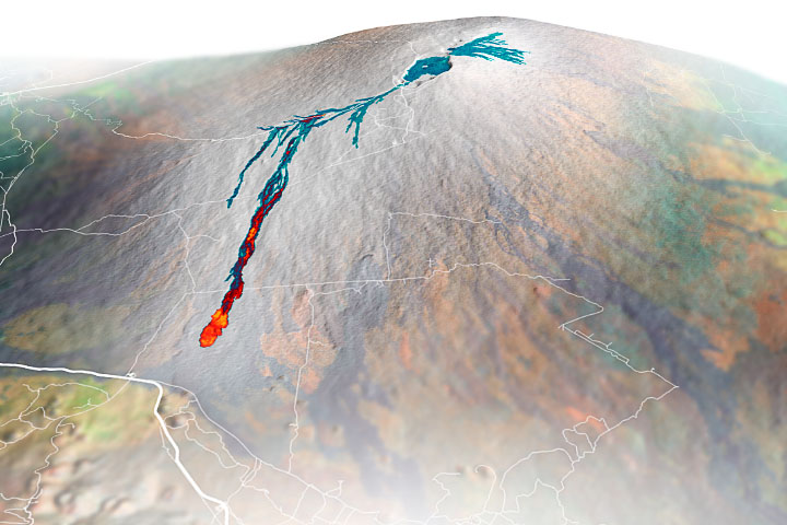
Sizing up Mauna Loa’s Lava Flows
Published December 16, 2022
Airborne mapping of the thickness of the lava flows helped scientists calculate that 230 million cubic meters of molten rock poured from the volcano during the two-week eruption.
Related images:
720 x 480
JPEG

1708 x 1139
2 MB - JPEG
720 x 545
JPEG
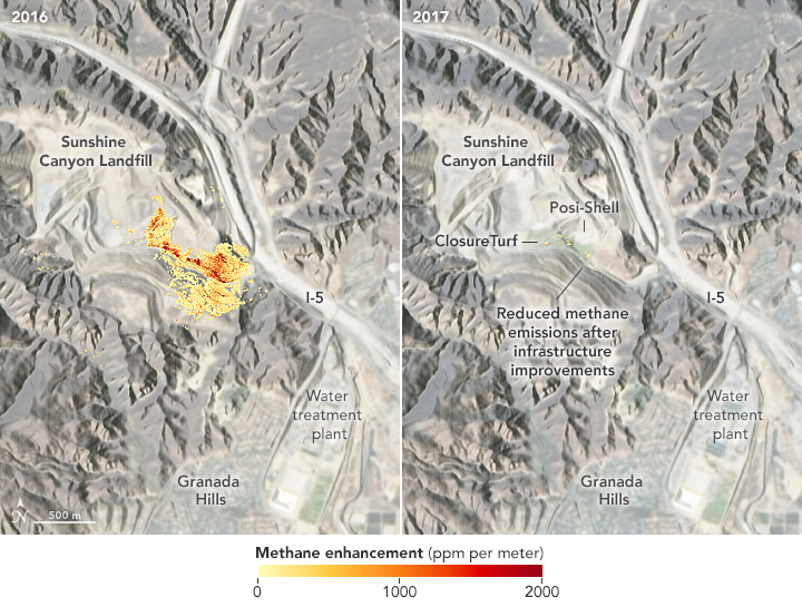
Mapping Methane Emissions in California
Published September 9, 2021
Using precision instruments and new mapping and machine-learning tools, a research team has been pinpointing sources of the greenhouse gas.
Related images:
720 x 480
JPEG
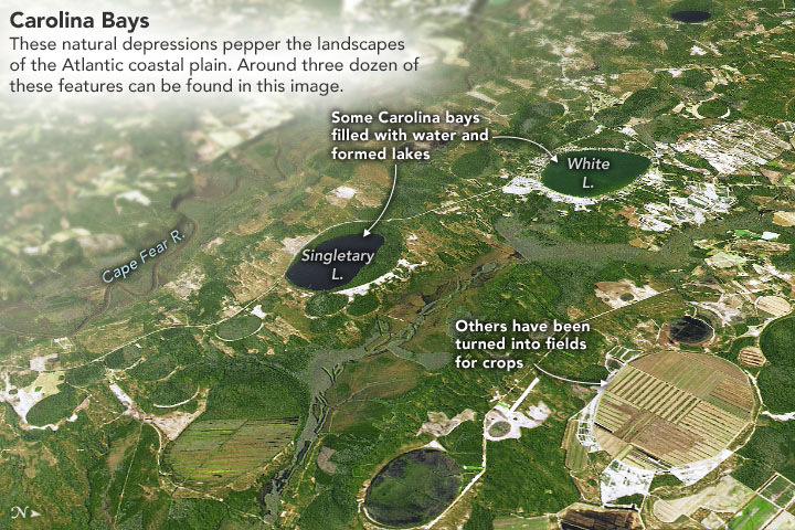
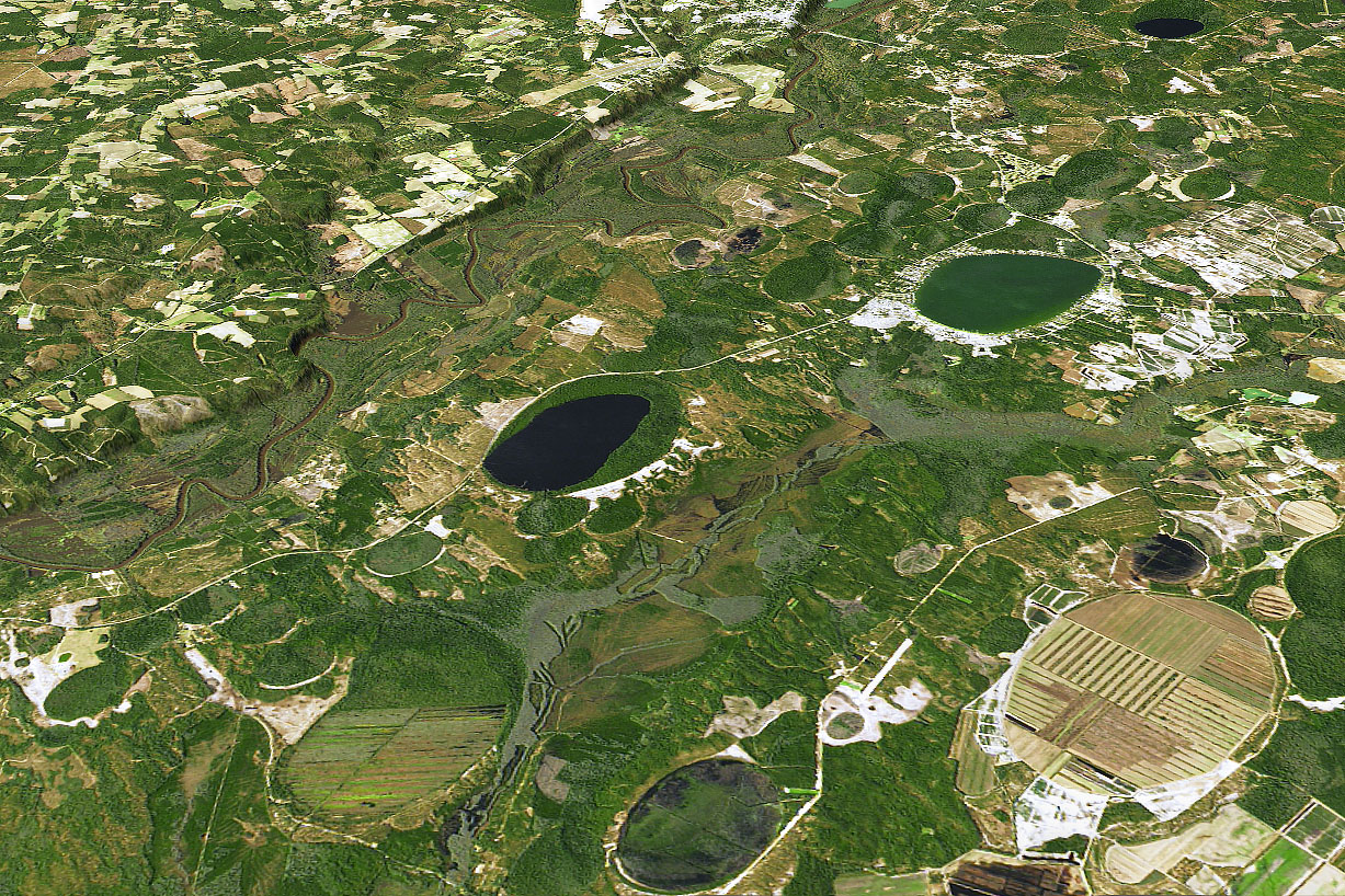
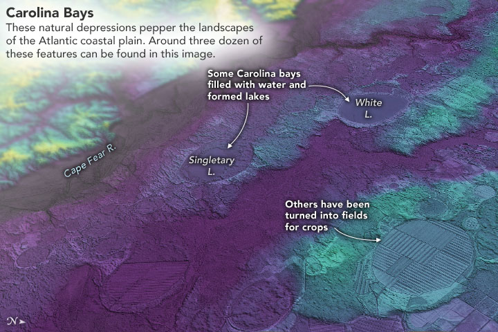
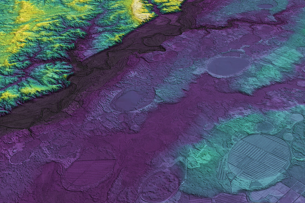
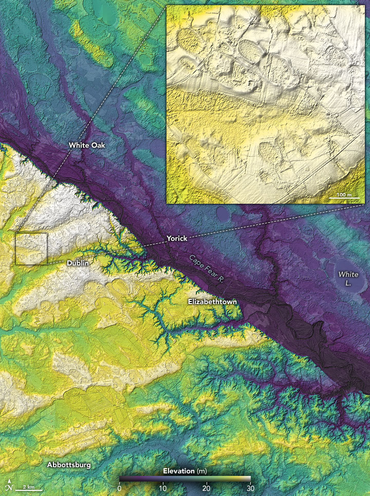
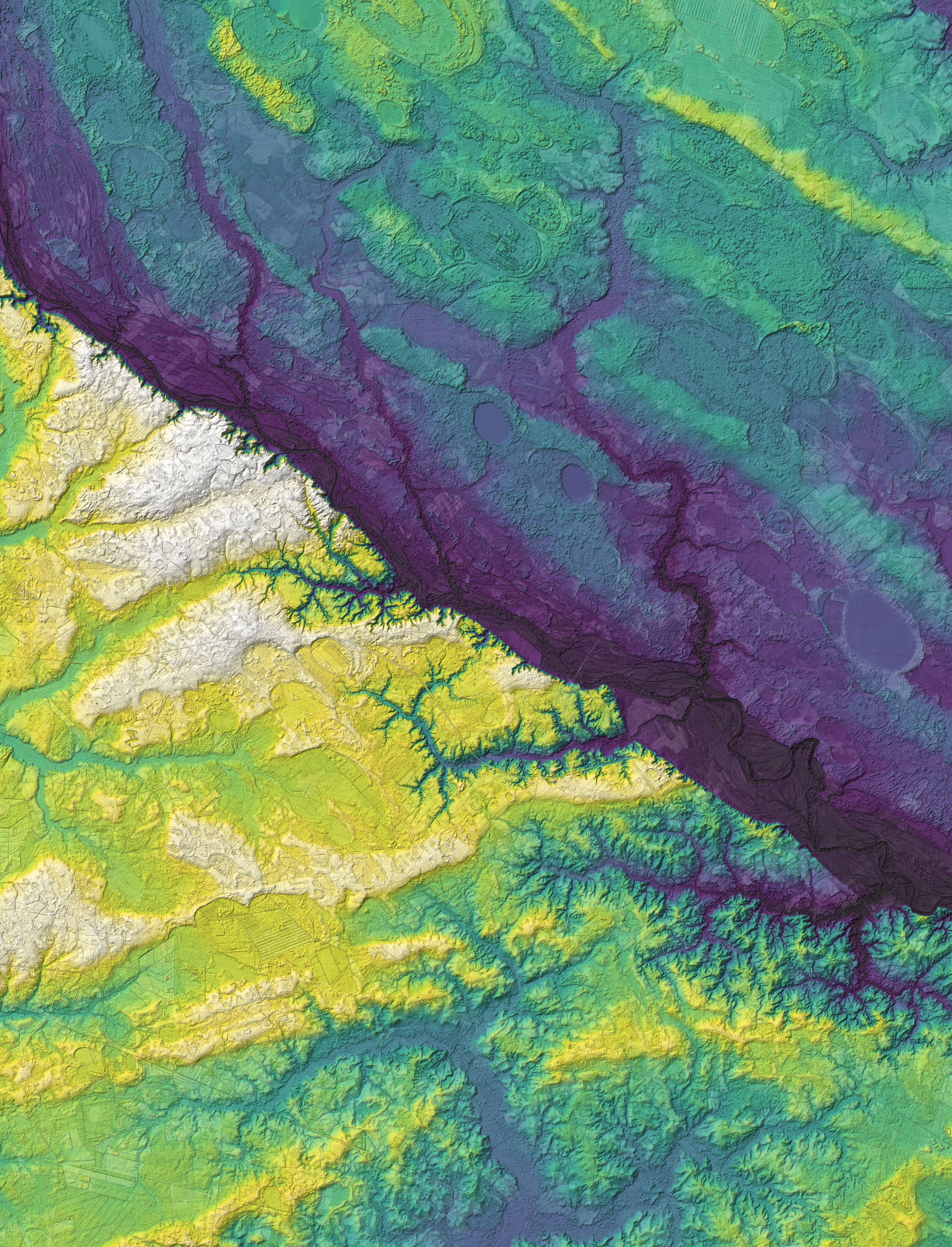
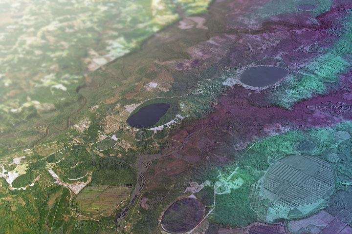
Ice Age Carolinas
Published February 11, 2021
There are hundreds of thousands of oval depressions dotting the Atlantic coastal plain—relicts of a cooler, drier, windier time.
Related images:
1227 x 818
598 KB - JPEG
720 x 480
JPEG
1227 x 818
474 KB - JPEG
720 x 964
JPEG
4938 x 6466
8 MB - JPEG
720 x 480
JPEG
Ice Age Carolinas
Published February 11, 2021
There are hundreds of thousands of oval depressions dotting the Atlantic coastal plain—relicts of a cooler, drier, windier time.
Related images:
720 x 480
JPEG
1227 x 818
598 KB - JPEG
1227 x 818
474 KB - JPEG
720 x 964
JPEG
4938 x 6466
8 MB - JPEG
720 x 964
JPEG
Ice Age Carolinas
Published February 11, 2021
There are hundreds of thousands of oval depressions dotting the Atlantic coastal plain—relicts of a cooler, drier, windier time.
Related images:
720 x 480
JPEG
1227 x 818
598 KB - JPEG
720 x 480
JPEG
1227 x 818
474 KB - JPEG
4938 x 6466
8 MB - JPEG
720 x 227
JPEG
A Mosaic of Fire Data
Published February 6, 2021
Scientists are using radar data to decipher where and how well landscapes recover in the years after major fires.
Related images:
8200 x 3132
11 MB - JPEG
720 x 480
JPEG
720 x 610
JPEG
720 x 480
JPEG
A Mosaic of Fire Data
Published February 6, 2021
Scientists are using radar data to decipher where and how well landscapes recover in the years after major fires.
Related images:
720 x 227
JPEG
8200 x 3132
11 MB - JPEG
720 x 610
JPEG
720 x 610
JPEG
A Mosaic of Fire Data
Published February 6, 2021
Scientists are using radar data to decipher where and how well landscapes recover in the years after major fires.
Related images:
720 x 227
JPEG
8200 x 3132
11 MB - JPEG
720 x 480
JPEG
720 x 480
JPEG
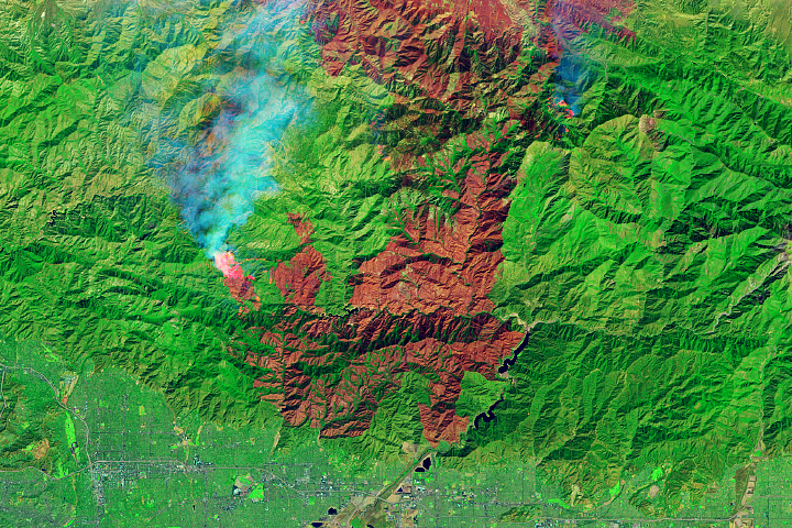
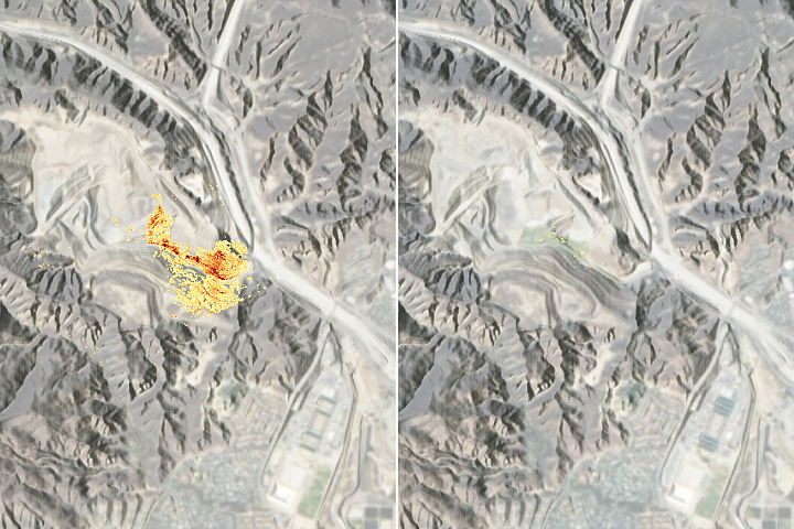
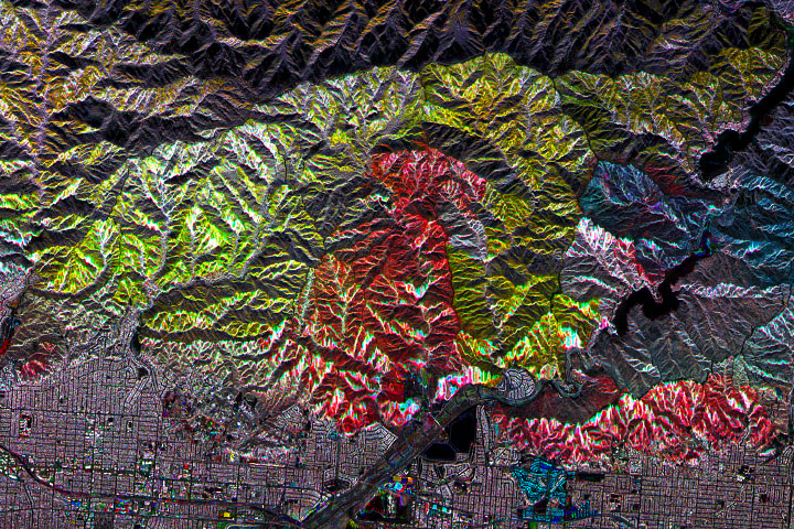
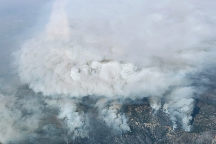
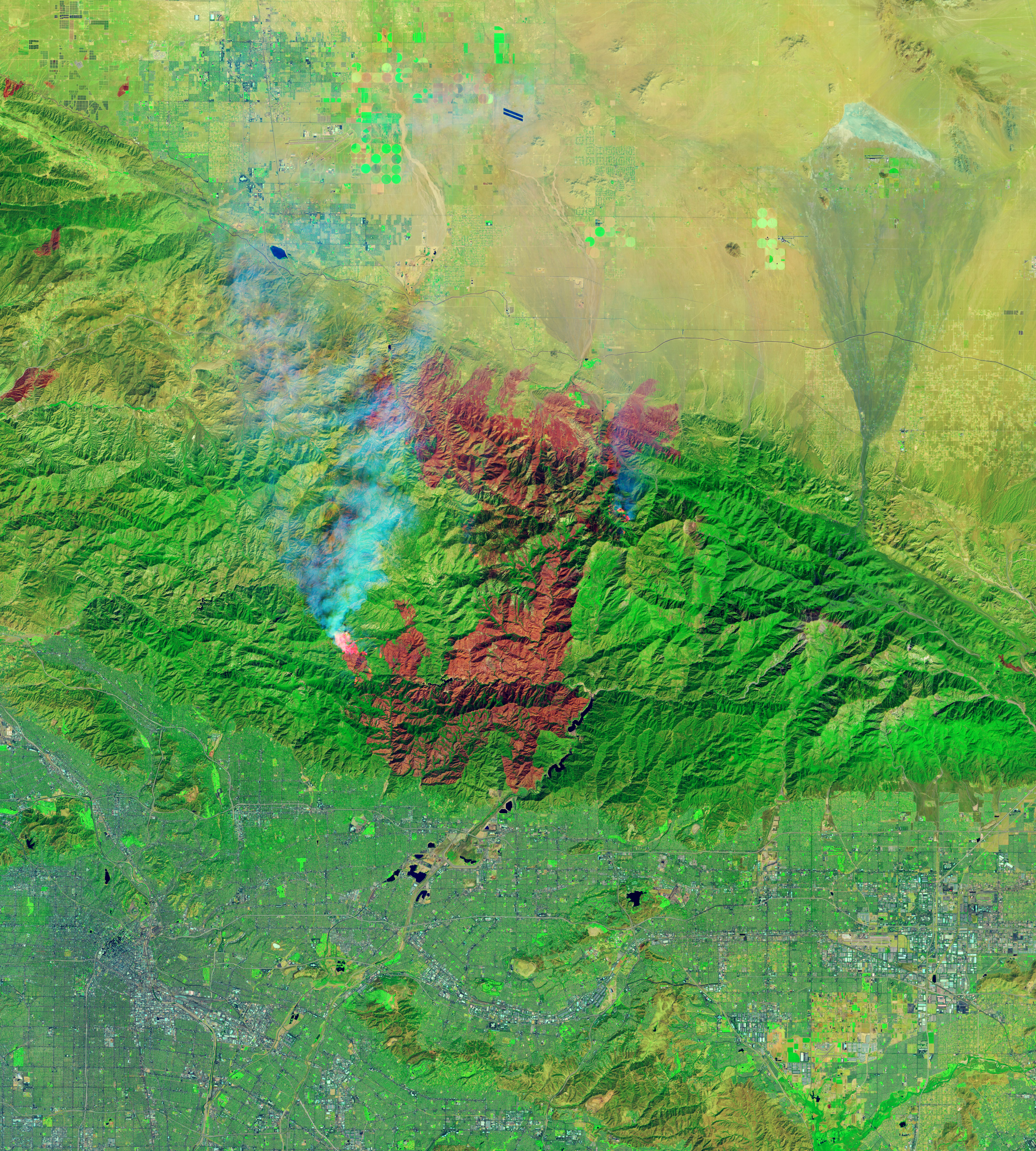
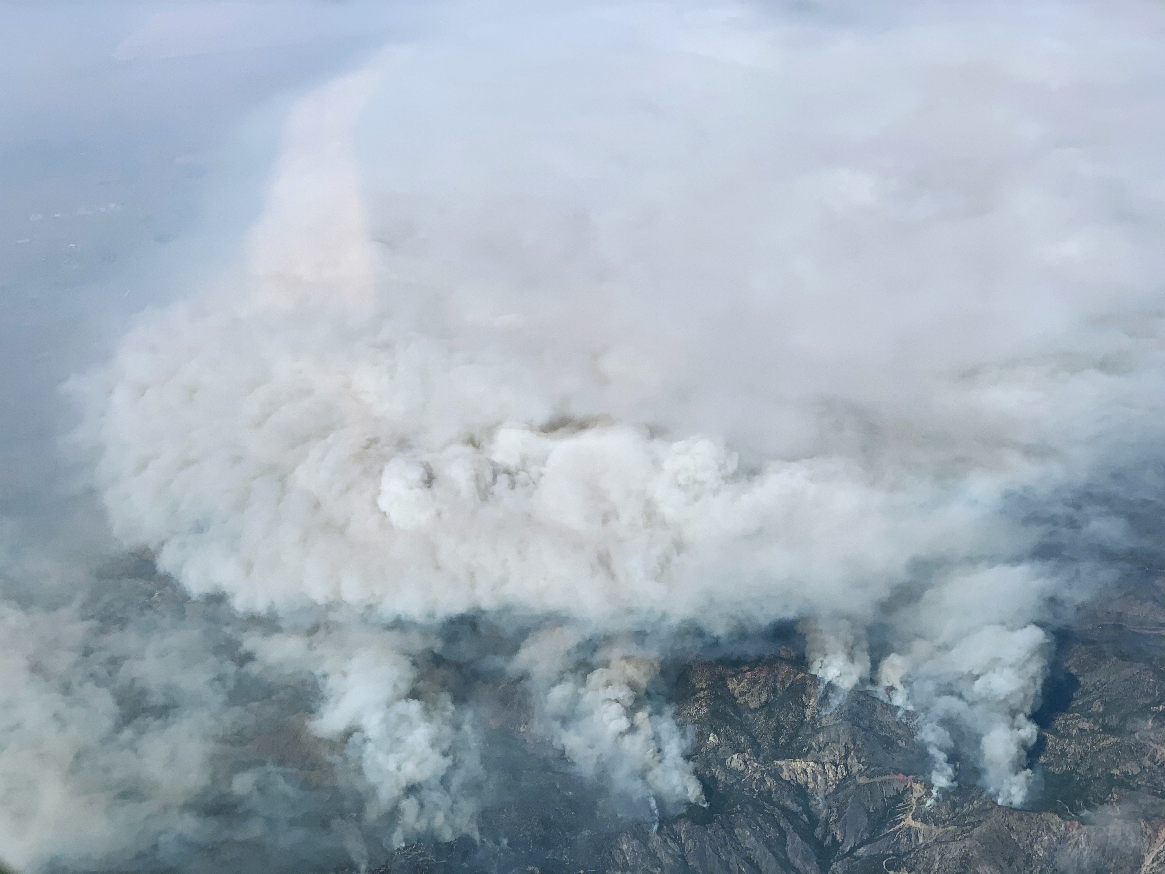
Bobcat Fire Scorches Southern California
Published September 23, 2020
The fire is among the largest Los Angeles County has ever faced.
Related images:
.jpg)
720 x 600
JPEG
2773 x 3081
4 MB - JPEG
4032 x 3024
5 MB - JPEG