


What is the atmospheric thermodynamic reason for dry weather vs. stormy weather? Well there are multiple factors but arguably the most important is called a "cap" or "capping inversion."

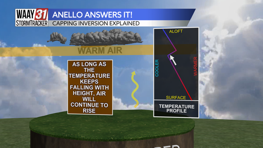
In a normal temperature profile, the warmest air is at the surface, or by the ground. This is because this is where all the cars, people, and factories that emit heat are.
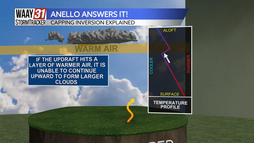
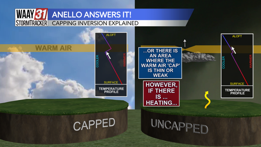
As we head higher into the atmosphere, that air becomes colder. However, if there is an inversion, or a Cap, there is dense sector of warm air in the upper atmosphere. This acts as a lid and prevents the rising air from the surface from rising any further.
As a result, we could see a cloudy day, but we won't see that air, or the moisture it carries with it, get high enough in the atmosphere to create storms.
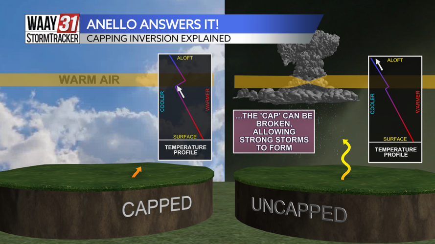
In an uncapped environment, that sector of warm air very thin. This means that the rising air from the surface can push through the warm sector and reach into the upper atmosphere. This allows for the development of large storm clouds that bring rain, thunder, and plenty of lightning.
Got a weather question you want answered? Email ganello@waaytv.com!
Find more episodes of "Anello Answers It!" here.


