Share on Facebook
 Share on X
 Share by Email
 Share on Google Classroom
Lakes are bodies of water surrounded by land, typically characterized by an accumulation of surface water runoff and groundwater at a low point on the landscape. Canada has as many as 2 million lakes, which accounts for 14% of the world’s lakes. Some of the best-known lakes in Canada are the Great Lakes: Lake Superior, Lake Ontario, Lake Huron, and Lake Erie. Lake Superior, with a surface area of 82,100 km2, is also the largest lake in Canada.

Description
The hydrologic cycle supplies the world's landmasses with water as precipitation. In areas where precipitation is neither retained as ice nor evaporated, excess water must find its way back to the sea via surface runoff, rivers and groundwater percolation. Where these flows are intercepted by a naturally occurring impervious basin or depression, a lake may result.
A lake represents a short-term dynamic balance and a long-term evolution. A constant water level is maintained only if inflows from precipitation, runoff and groundwater percolation balance losses from outflow, evaporation or groundwater movement. Over geological time, lakes are transient; inflows carry dissolved and suspended material washed from the surrounding high ground, and biological productivity adds organic material to the accumulating sediments. These sediments gradually fill the basin. Human activities in a lake's drainage basin can accelerate the aging and infilling processes through increased erosion that accompanies agricultural and urban developments and through the addition of biologically active materials or nutrients.
See also Largest Lakes in Canada.
Lake Formation Processes
Many geological processes can result in the formation of a lake. Six of Canada's most important ones are glacial, tectonic, coastal, river, volcanic, and dissolution processes.
Glacial
Movements of ice sheets and valley glaciers in past ice ages have scoured basins in the underlying terrain. Glacial deposits (e.g., moraines, eskers, drumlins) may create favourable sites for lakes and ponds. Most Canadian lakes are of glacial origin.

Tectonic
Movements of the Earth's crust, i.e., folding and faulting, can create basins later filled by lakes. Glacial and tectonic processes together resulted in the formation of Lake Superior.
Coastal
Waves contribute to erosion and generate coastal currents, which move sediments along the shore to zones of relative calm. The sandbars thus formed may block the entrance to a bay, forming a lagoon. If freshwater drains into the lagoon, a coastal lake, separated from the sea by a narrow barrier, may result. Many small lakes so formed occur along the Atlantic coast of Nova Scotia, and several good examples occur within Lake Ontario, e.g., Hamilton Harbour.
River
River meanders can be separated from the main flow in floodplains and become oxbow lakes or sloughs. Deposition of sediments across the mouths of tributaries can flood the upstream tributary valley. At river mouths, where a delta is formed, a combination of river and coastal processes can form shallow deltaic lakes.

Volcanic
Centres of volcanic cones may collapse into craters, forming crater lakes, often very deep in relation to their surface area. Lava flows may dam rivers to form lakes.
Dissolution
Relatively soluble rock may be slowly eaten away by percolating groundwater, creating caverns which may collapse into water-filled depressions or solution lakes. This process occurs most frequently in limestone or gypsum regions. A somewhat analogous process occurs in the Arctic when collected surface water melts underlying permafrost, forming a thaw lake.

Did you know?
One of the most unique lakes in Canada is the Manicouagan Reservoir. This annular lake was formed when water filled the crater left behind by a meteorite impact in central Quebec 200 million years ago.

Distribution of Lakes in Canada
Recent surveys suggest there may be as many as 2 million lakes in Canada. About 7.6% of Canada's nearly 10 million km2 is covered by freshwater; these lakes and rivers contain enough water to flood the entire country to a depth of over 2 m. Canada has nearly 14% of the world's lakes, with surface areas over 500 km2. Although Canada stores a disproportionate share of the world's surface freshwater, the amount available for use depends more on the volume supplied annually than on that stored over many years. Therefore, despite an apparent abundance, freshwater resources must be managed carefully.
Surface geology and climate govern the nature and distribution of lakes. It is convenient to describe lakes in relation to the physiographic regions of Canada.

Lakes in the Canadian Shield
Many lakes are distributed through a 1,000 km swath of land surrounding Hudson Bay, the Canadian Shield. Nearly all are of glacial origin. Thin soils and high resistance of the rocks to weathering tend to make the lakes clear, biologically unproductive and relatively long-lived because of slow sedimentation. The Shield is dome-shaped in cross-section, dipping to contact the softer sedimentary rocks of the Hudson Bay Lowlands and the Western Interior Lowlands. The lowlands along the southwest shore of Hudson Bay have only recently emerged from the sea as the land rebounds from the last glaciation.
This region of poor, disorganized drainage is carpeted with muskeg and peat bogs. Within the peatlands are many small, shallow lakes and ponds with a teardrop shape aligned to the prevailing winds, resulting from wave action on the fragile shorelines. Ancient beach ridges define long, narrow, shore-parallel lakes and ponds near the coast. Old river channels, abandoned as the land rises, are frequently occupied by lakes in this region.
Lakes in the Western Interior Lowlands
The line of contact between the Shield and the Western Interior Lowlands is marked by a band containing Canada's largest lakes, ranging from Great Bear Lake, NWT, to the Great Lakes, Ont. Glaciers pouring off the Shield and carrying with them hard granitic debris gouged deeply into the thin edge of the softer sedimentary rocks before spreading over the lowlands. Glacial deposition of till, rather than extensive scouring, marks the effect of glaciers on the plains. Unlike Shield lakes, prairie lakes are formed in a thick overburden of clay, till and soil. Lakes in the Western Interior Lowlands tend to be shallower, more rapidly filled by sediments, and more biologically productive than Shield lakes.
Annual rainfall decreases, and evaporation increases from northeast to southwest; the corresponding trend in lake distribution is for fewer, sometimes seasonally transient lakes, carrying higher concentrations of dissolved materials. In the dry southwest, numerous alkali lakes and ponds occur in which concentrations of dissolved materials reach saturation and evaporite crystals, usually sodium sulphate, precipitate out.
Glacial deposition in the southwest has left the ground pocked with small depressions, which fill to become ponds or sloughs in spring, often drying up by late summer. Although the total water volume of these ponds is small compared to well-established lakes in other places, they are essential to agriculture and waterfowl habitat. In the Far North, parkland and forest yield to the boreal forest proper, with extensive areas of muskeg and bog lakes.
Lakes in Western Canada
Lakes in the rugged terrain west of the Great Plains are relatively sparse compared with those of eastern Canada (covering less than 2% of surface area), but they are extremely varied. Lakes in western Canada are mainly of glacial origin: large lakes in BC and the YT are generally confined to deep, glaciated valleys; smaller scour lakes are found on upland plateaus. Tectonic processes associated with mountain building provide other natural basins.
The Cariboo region (Southern Interior Plateau) of BC, in the rain shadow of the Coast Range, is relatively arid and contains alkali ponds and lakes. Some lakes occupy the heads of ancient fjords near the coast. Powell Lake, near Vancouver, was formed when isostatic rebound (the tendency for land to rise once the heavy ice cover melts) isolated a fjord from the sea. Although this occurred thousands of years ago, the lake's bottom water is still salty, a fossil seawater.
Lakes in the Atlantic Provinces
The Atlantic provinces lie in a region of ancient mountains, a northern extension of the Appalachians. This land was also heavily glaciated. The many lakes in areas underlain by hard igneous or metamorphosed rocks closely resemble the lakes of the Shield. More permeable sedimentary rocks underlie eastern NB, northwestern NS and PEI; hence, fewer lakes occur in these areas. Many small coastal lakes occur in NS.
Lakes in the St. Lawrence Lowlands and Lower Great Lakes Region
The St Lawrence Lowlands and lower Great Lakes region contain some of Canada's richest farmland, but small- and medium-sized lakes are rare compared to the scoured region of the Shield. However, this region is adjacent to the Great Lakes, which together constitute the largest body of fresh water on Earth. Lakes Superior and Huron lie across the contact between Shield rocks and the more recent sedimentary rocks. Sedimentary rocks underlie Lakes Michigan, Erie and Ontario with thick overburdens of glacial deposits. The geology of the drainage basins has affected the primordial character of each lake and has determined the settlement patterns, which in turn have had a considerable impact on Lakes Erie and Ontario.

Biological Properties
Lakes are ecosystems: biological energy flows through a food chain, and spent organic matter is recycled into materials again available to living organisms. The first and most important biological process found in lakes, primary productivity, is photosynthesis. During photosynthesis, nutrients are combined into organic matter and energy through the energy of sunlight and the action of chlorophyll contained in plant cells.
Most lake plants are single-celled microscopic algae (phytoplankton), which are suspended in the water and move with it. In abundant quantities, they may colour the water, rendering it turbid. A host of tiny zooplankton graze on the phytoplankton and, in turn, are eaten by fish. Bacteria decompose dead material into constituents available for new cycles of life. Carbon, hydrogen and oxygen are usually freely available in sunlit surface waters. Usable forms of nitrogen and phosphorus may be scarce, limiting photosynthesis. Inflows and local runoff may supply nutrients; their distribution within a lake is controlled by physical processes.
Physical Properties
Three sources of energy govern water movements in lakes: the flow of water from inlet to outflow, the stirring action of wind (both mechanical sources), and heat energy (gained in spring and summer and lost in fall and winter). These processes together impact many features of lakes, including any kind of stratification present.
Water Flow
The longest time scales of motion, having perhaps a yearly cycle, are those associated with the flow of water through a lake from inlet to outlet (a hydraulic component of flow). Outflow removes dissolved and suspended materials along with the water.
Since lakes vary widely in size and rate of outflow, it is useful to define a flushing time as the lake's volume divided by the average outflow rate (i.e., the time required to drain the lake at the mean outflow rate). Permanent lakes with flushing times much less than a year are quite rare, and their behaviour is strongly marked by vigorous flow and biological productivity usually being depressed. At the other extreme, lakes with flushing times greater than ten years are considered sensitive to external changes; recovery from a polluted state requires at least one flushing time.
Wind
Superimposed on the inflow-outflow motion are movements driven by wind. Wind-driven motions, mechanically the most important, include surface waves, turbulent mixing and systems of currents circulating the lake. These motions distribute dissolved and suspended materials through the lake.
Heat
In addition to the motions of water flow and wind, the convection caused by surface cooling or heating of lakes has a very significant effect.
Lakes gain heat from solar radiation and lose heat as water evaporates from the surface. They may also gain or lose heat directly from the atmosphere. Except for solar radiation, these fluxes are absorbed or emitted in the top few centimetres of the water column. Solar radiation, which powers photosynthesis in addition to heating the water, may penetrate effectively to a depth of 30 m in a very clear lake or may be absorbed in the top metre of a lake made turbid by suspended sediments or an abundance of plankton. A kilogram of water must absorb or lose 4,200 joules of heat to raise or lower its temperature by 1°C. This is one of the largest "specific heats" of all substances. Compared with the land, lakes can store and release huge amounts of heat; therefore, large lakes may moderate the climate near their shores. Stone fruits can be grown on the Niagara Peninsula because it is protected from severe winter weather by the open waters of Lake Ontario. Areas around these great lakes may also experience slightly cooler weather when it is very hot in the summer. With water bodies the size of oceans, this effect results in the milder coastal temperatures experienced in much of the Atlantic provinces and British Columbia compared to the more extreme temperatures of Central Canada, where certain locations may experience temperatures as high as 40°C in the summer and – 40°C in the winter.
Water also changes density depending on its temperature. Fresh water is most dense not at freezing point (0°C) but at 4°C. As water is warmed above or cooled below 4°C, its density decreases (it expands). If the heat flux increases the surface density (fall cooling or early spring warming), surface water tends to sink and mixing by convection occurs. If the heat flux decreases the surface density (winter cooling just before freeze-up, spring and summer warming), the lighter surface water tends to float on the heavier underlying water.
Stratification
Wind mixing may not be strong enough to overcome this extra stability, particularly in summer, and a layered distribution of warm and cool water can persist through the summer in deep lakes. These lakes are said to be thermally stratified, and it is usually possible to define three layers: a warm, actively wind-stirred upper layer called the epilimnion; a cool, relatively homogeneous bottom layer called the hypolimnion; and a transitional layer called the thermocline between the warm and cool layers.
Stratification strongly affects all other physical, biological and biochemical processes. It influences the horizontal distribution of nutrients and the speed with which nutrients trapped in the hypolimnion and in bottom sediments are made available to algae in the surface waters. Furthermore, inflows and outflows often occur at shallow depths within the epilimnion. If the inflowing water is of equal or lesser density than the surface water of the receiving lake, the hydraulic flow and attendant flushing is confined to the epilimnion. This restriction may slow the effective flushing of a contaminant from a lake since much of it will be stored in the sheltered hypolimnion.
Seasonal thermal stratification has other important consequences. Diversity of habitat encourages diversity of living organisms; therefore, stratified lakes may permit the coexistence of warm-water fish (e.g., bass) and cool-water fish (e.g., trout). Diversity may be limited by the interaction of stratification with primary productivity and bacterial decomposition, which may be influenced by human activities.
Human Impacts
Human activity around lakes can have a very large impact on the state of lakes, from their perceived aesthetic qualities to their biodiversity and even their depth.
Lake Eutrophication
Lake eutrophication is one of the most common severe problems lakes face in Canada due to human activity. Overfertilization by sewage or agricultural runoff into the lake may lead to increased algal growth, with a corresponding rise in dead organic material in the cool waters of the hypolimnion. This results in oxygen depletion, caused by increased bacterial decomposition, and may lead to the loss of cool-water fish species. Through this process, a once deep, cool, clear lake filled with fish (oligotrophic lakes) may become shallow, warm, turbid, and devoid of vertebrate life. If the system has been pushed far enough, recovery may become impossible, even with greatly reduced external loading of nutrients. Also, poor forestry practices (e.g., extensive clear-cutting in inappropriate areas) can have similar effects because increased runoff carries soil nutrients into nearby lakes. Logging and settlement in the Lakes Ontario and Erie basins are thought to have modified these lakes considerably.
Toxins and Acid Rain
Overenrichment (eutrophication) is not the only problem faced in lake management. Many compounds used in agriculture or industry are dangerous toxins; the more insidious have chemical affinities to natural organic material and enter the food chain, becoming increasingly concentrated (see hazardous wastes, water pollution). Another serious problem arising from human activities is acid rain, which results from burning fossil fuels. The region's surface geology strongly governs the effects of the fallout on lakes. Shield lakes are vulnerable to these effects, which may include a complete loss of fish. Lakes in limestone-rich areas are less vulnerable because the dissolution of limestone neutralizes acidity.
Lakes surrounded by roads can also experience salinification due to road salt runoff. Changes in salinity can impact which species of plants and animals can thrive in and around the lake, as well as change the physical properties and cycles of the lake itself.
Biodiversity Declines and Invasive Species
The decline of some native species can have a negative impact on the lakes and wetlands they inhabit. Many species, like snapping turtles, help maintain healthy bodies of water by eating a lot of the organic material which ends up in the lake, thus assisting in healthy nutrient cycling. The declining numbers of native turtle species are having a profound negative effect on the freshwater ecology of many Canadian lakes. Proper conservation practices of these species are a crucial element of freshwater management.

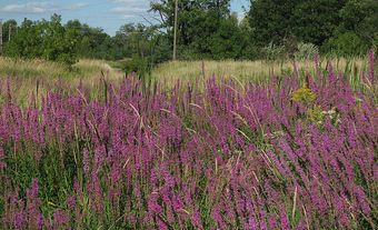
Simultaneously, the introduction of certain invasive species, such as Phragmites australis and the Asian carp, can cause a decline in the health of bodies of water. Phragmites australis, a tall cattail-like plant often used decoratively in gardens, is a highly invasive plant which is very difficult to remove once it spreads to the wild. Highly competitive, this species crowds out native and beneficial plants along shorelines, makes shorelines less accessible for people, and creates a shoreline habitat that is incompatible with many native species of animals. Similarly, Asian carp, another highly invasive species, roots out and eats a lot of native vegetation, causes increases in water turbidity due to its feeding and spawning habits, and out-competes many native fish. Other notable invasive species that significantly impact the health of Canadian lakes are zebra mussels, quagga mussels, sea lampreys, and purple loosestrife.
See also Invasive Species in Canada: Plants and Invasive Species in Canada: Animals.

Wetland Destruction
Various industries directly damage lakes by destroying bodies of water within their hydrological basin. Some notable examples are the destruction of peatlands [1] and the filling in of wetlands and floodplains for construction. Given lakes often receive water from many smaller bodies of water, like wetlands and rivers, the destruction, alteration, or contamination of these can have unforeseen and sometimes difficult-to-predict impacts on the lakes within the same drainage basin.
Reservoirs
In Canada, many lakes have been created by damming rivers for reservoirs for hydroelectric developments, sources of water for irrigation and domestic use, and for flood control. Reservoir design and management draw on all aspects of lake science. For example, the large fluctuations in water level accompanying reservoir operation can cause accelerated shore erosion and potentially harm fish spawning in shallow water.