
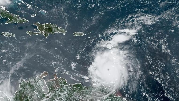


Hurricane Beryl, a record-breaking Category 4 storm, is continuing to strengthen Monday as it barrels towards the Caribbean, producing catastrophic winds and life-threatening storm surge.
The National Hurricane Center in Miami said Beryl had winds of up to 150 mph, making it the first hurricane to ever reach Cat 4 strength in June. The core of the storm was approaching Carriacou Island, Grenada, and the Grenadine Islands, where residents have been warned to shelter in place.
NHC forecasters say the storm is expected to continue moving west across the Caribbean over the next few days. But where the storm will head after is the question of the minds of many residents along the U.S. Gulf Coast.
Though NHC forecasters say there is still some uncertainty to the strength and track of Beryl five days from now, a strong ridge of high pressure over the south and the Gulf of Mexico is likely to keep the storm south of Louisiana.
Whether Hurricane Beryl continues to move west into the Mexico depends on how strong that ridge remains, forecasters say.

Beryl's current track and forecast
Beryl's eyewall was over the southern Windward Islands as of 11 a.m. CST on Monday, battering parts of the area which aren't used to seeing intense hurricanes.
Life-threatening winds and storm surge were expected to reach Carriacou Island, Grenada, and the Grenadine Islands in the following hours.
Forecasters say the storm will likely remain a strong, major hurricane as it moves further west towards Jamaica, where a hurricane watch has already been issued.
From there, Beryl will approach the northwest Caribbean and and is likely to weaken some.
NHC forecasts have the storm moving towards the Yucatan Peninsula late this week, though the storm's strength and how far south it remains depends on how strong the ridge of high pressure sitting over the south U.S. stays.
A helpful heat dome?
The brutal heat Louisiana has been experiencing over the past few weeks is thanks to the same ridge of high pressure that is keeping Beryl south of the Gulf of Coast.
The high pressure ridge, often referred to as a heat dome, is what has been raising temperatures across the South and skyrocketing heat indices.
As of Monday, all of Louisiana was under a heat advisory, and areas in Acadiana, Baton Rouge and New Orleans were under excessive heat warnings.
Even with the presence of the heat dome over the state, forecasters still can't rule out a turn towards the Gulf Coast, so Louisiana residents should continue to stay up to date with the latest hurricane advisories from the NHC.