
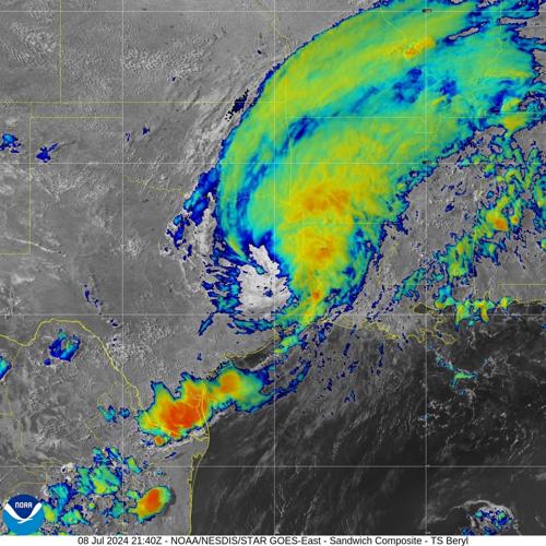


Southeastern Louisiana will see its chance of rain increase significantly on Tuesday, as the trailing moisture of a retreating and weakening Tropical Storm Beryl drapes across the coast after the storm cut a destructive path across eastern Texas and western Louisiana.
“A narrow trowel of deep tropical moisture extending southwestward from the remnants of Beryl will move into the forecast area late tonight into tomorrow morning,” said a 3:45 p.m. Monday forecast discussion message issued by the Slidell office of the National Weather Service.
The primary concern for Tuesday, the message said, "will be the potential for storms with high rainfall rates of 2 to 3 inches per hour to train over the same locations and cause some localized flooding issues. Otherwise, the increased rainfall and cloud cover will help to break the heat the region has experienced the past few days with highs only warming into the upper 80s and lower 90s and heat index values of 100 to 105.”

Graphic showing Tropical Storm Beryl's flash flood potential through Thursday morning. (National Hurricane Center)
The Weather Service predicts a 15% chance of flash flooding in areas south of Lake Pontchartrain through 7 a.m. Thursday, with a 5 percent chance north of the lake, including in Baton Rouge.
A coastal flood advisory remains in effect for southeastern Louisiana, including Terrebonne, Lafourche, Jefferson and Plaquemines parishes, until 3 p.m. Tuesday, with minor coastal flooding of 1 to 3 feet above ground level expected during high tide.
That moisture will stay draped across the coast from Wednesday through Friday, with drier conditions to the north, forecasters said.
"Some of the rainfall could be locally heavy at times, and this could lead to some localized street flooding issues. Temperatures will also remain somewhat cooler with highs in the upper 80s and lower 90s and heat index values rising into the 100 to 105 range through the end of the workweek," the message said.
Expect a more typical summer pattern over the weekend, with scattered showers, temperatures reaching the lower 90s, and heat index values of around 105 degrees, the message said.